Rhinos In Kansas?
About 30 years ago I decided my favorite animal was the white rhino. Whenever we went on a family trip, our Children – Bevin and Jack – would scour any gift shop or gas station we stopped at for rhino statues or memorabilia. Because of this quest I have a pretty good collection of rhinos on my desk. Plastic, porcelain, metal – even crystal – I have about 20 of them.
After about 20 years the thrill of the hunt diminished and I had not added to my collection in quite a while. Little did I expect to catch Rhino Fever again in of all places Marion, Kansas. But, that’s what happened, as you shall see…
Rain Again!
Humid Sub-Tropical
In doing research for a movie I am making for my YouTube Channel, I was amazed to discover that the part of Kansas I reside in (South Central) has climate referred to as Humid Subtropical. I’ve been living here over 30 years and it never struck me that way until I read that. While people can get it in their minds that Kansas is dry and dusty, South Central Kansas – at least – is not. In retrospect, I realized it rains here considerably more than I had assumed. The real shocker for me is that July -the middle of Summer- is the month with the highest rainfall.
Anyway, the picture above was taken to help you with that Kansas meteorological insight. As I thought about it, that’s why the grass (think wheat – the tall grass) grows so well here.
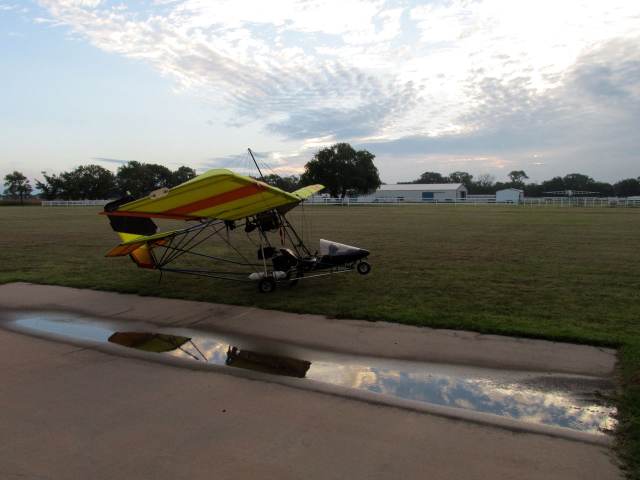
With regard to Blue Sky Ranch & Aerodrome I need to point out that the original owner – Bill Selby – did a masterful job constructing the airstrip. Even when there is water standing in the drain at the foot of our hangar, the airfield is never wet or soggy. He had gravel laid down and then “crowned” it with dirt topped off with a particularly resilient grass mixture. There is never mud or puddles on the strip.
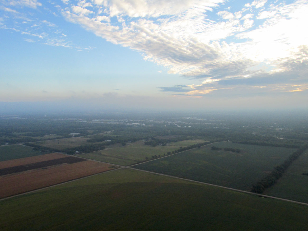
Sunrise Over Derby, Kansas
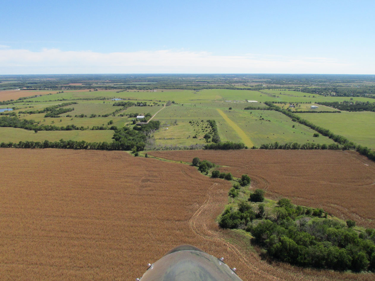
I was able to get airborne at sunrise. Marion, Kansas is North Northeast of Blue Sky so I would not have the sun directly in my face like it was on my Sky Safari to Severy, Kansas.
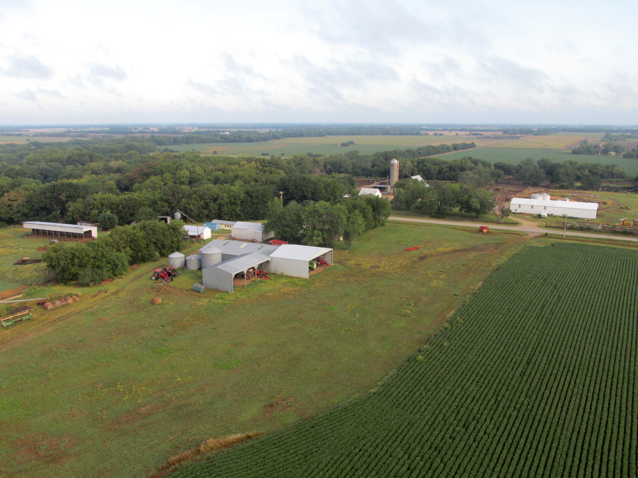
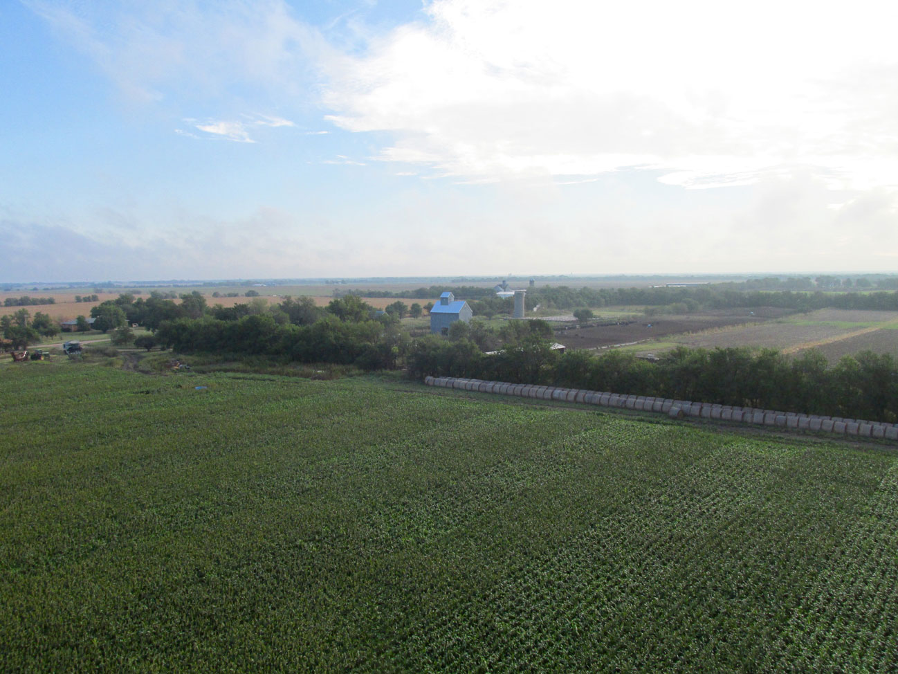
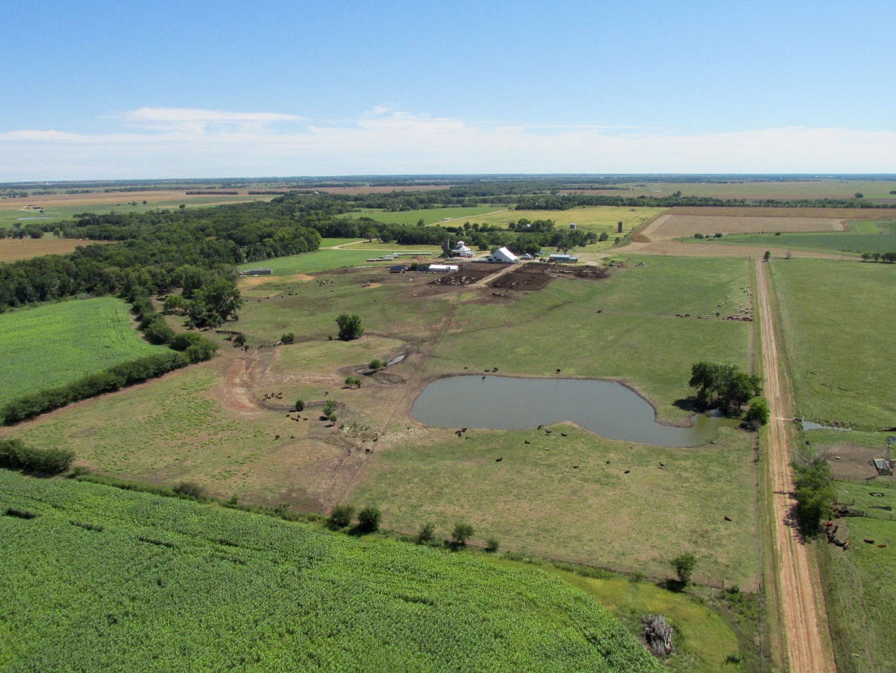
After crossing Highway 54 / Kellogg Ave., things got rural fast. This attractive farm caught my eye.
Nap Of The Earth
I was flying low because the wind was out of the North Northeast – the exact direction I was traveling. It wasn’t very strong but it would have slowed my progress enough to be a problem. Regardless, that morning I followed the well-tested “Sky Surfer Flight Protocol” – out early in the morning under the wind – return to base “riding the wave”.
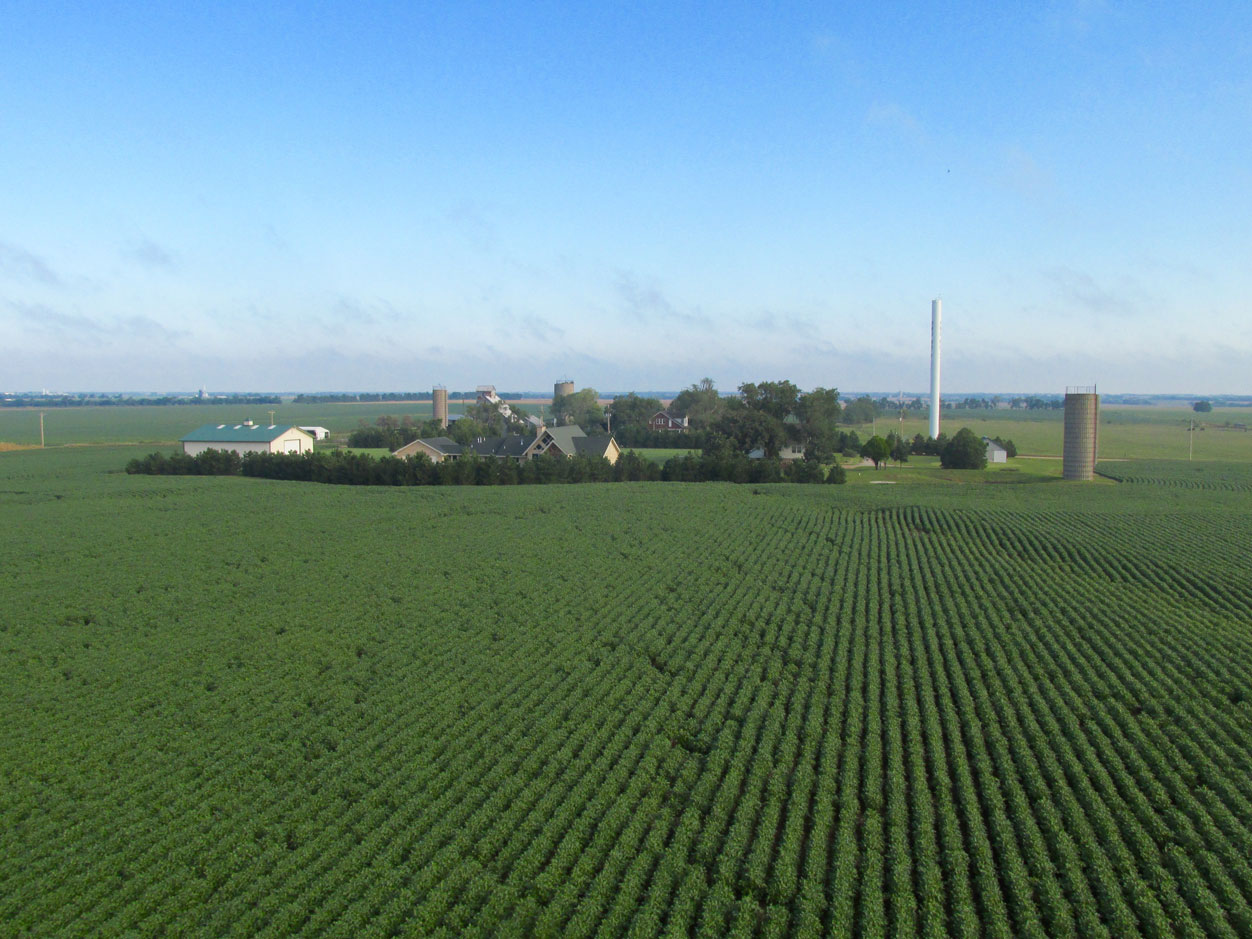
Another attractive group of farm homes a few miles North Northeast of Wichita. This was shot at about 30′ AGL looking North.
About a section or two past the previous shot I saw the old fashioned angular barn just past the tree row.
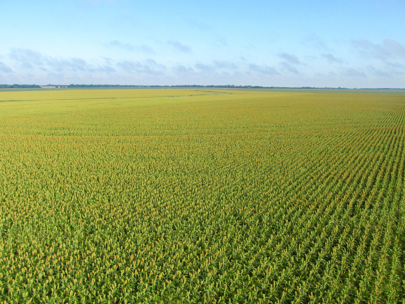
Then appeared one of my favorite sights this time of year – a beautiful field of milo!
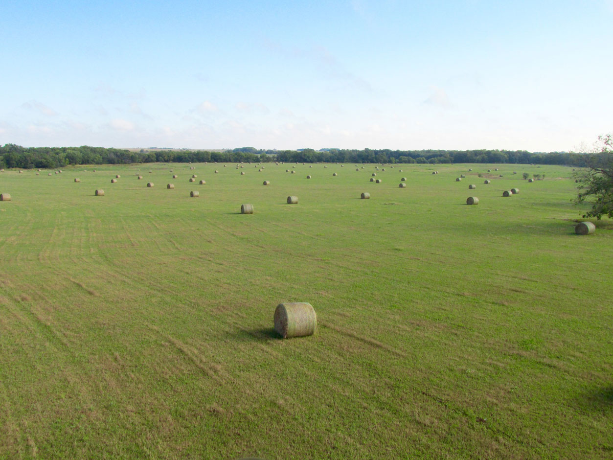
On the other hand, it is hard to be more pleasing to the eye than a hay field covered with bales. I can’t make up my mind which I like better… (Do I have to like one better?)
The point of this shot is not the flora but the fauna. Look closely near the center of the picture and you will see two white tail deer cutting a path away from the noise of my Big Yellow Bird.
Water Ho!
Out on the ocean, the call is “Land Ho!” but out on The Great Plains often the “landmark” is water. For this Safari, my path took me directly over Marion County Lake and Park. The park is well known for Bird Watching and Fishing. You can catch Channel Catfish, Flathead Catfish, Black Bass, Walleye or Saugeye, Wipers (White Bass/Striped Bass Hybrid) and Crappie in this 153 acre lake.
Since I was still hugging the ground to stay under the headwind, after I took the picture seen below, I cut to the left (West) around the campgrounds. Marion, Kansas and The Marion County Airport are only a mile or so beyond this point.
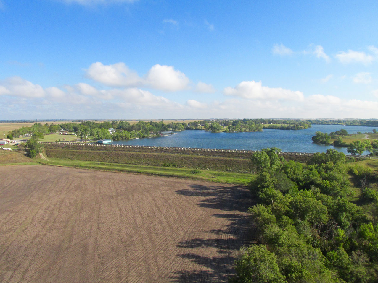
Marion County Lake and Park with the dam that formed the lake in the fore.
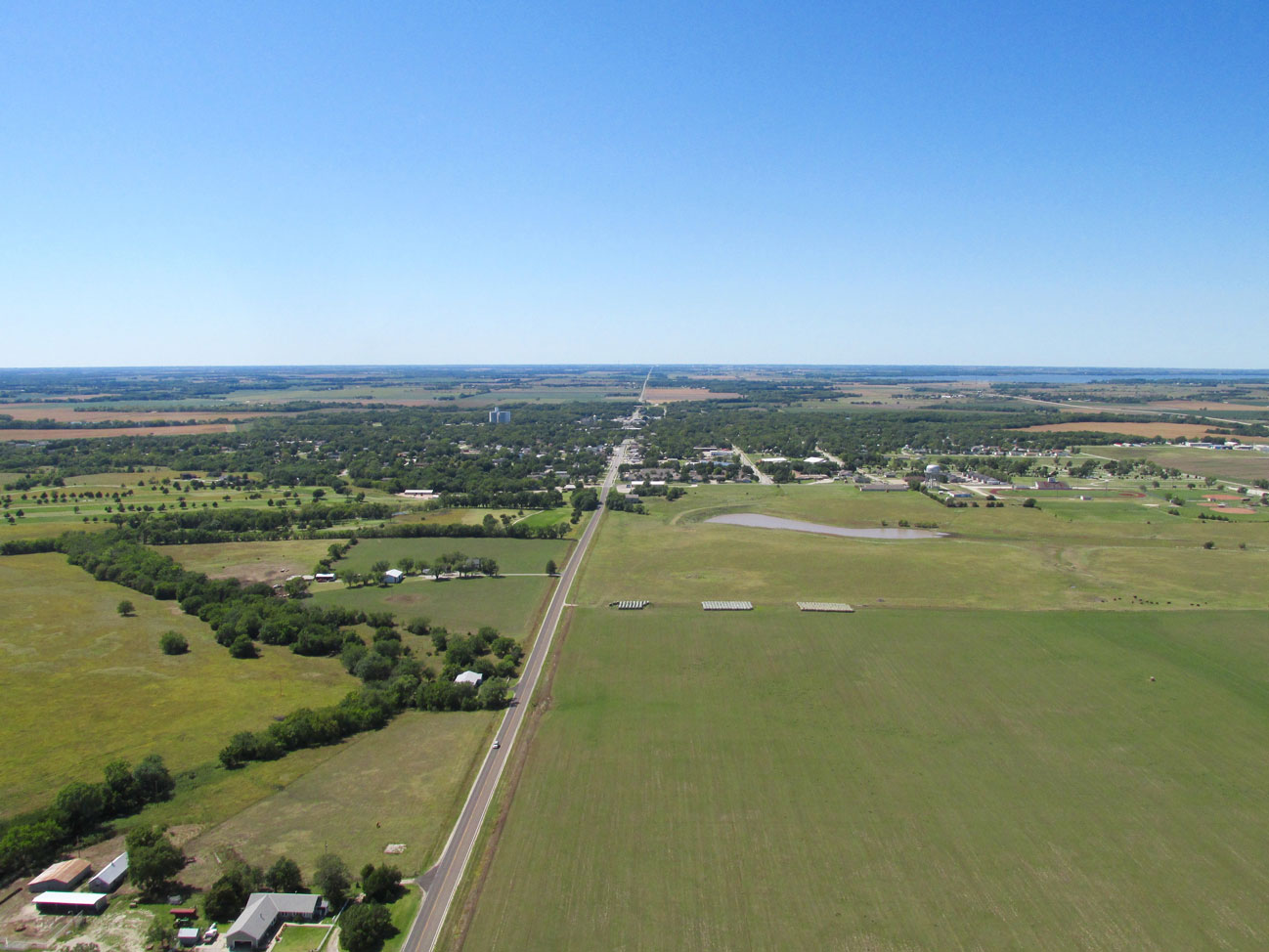
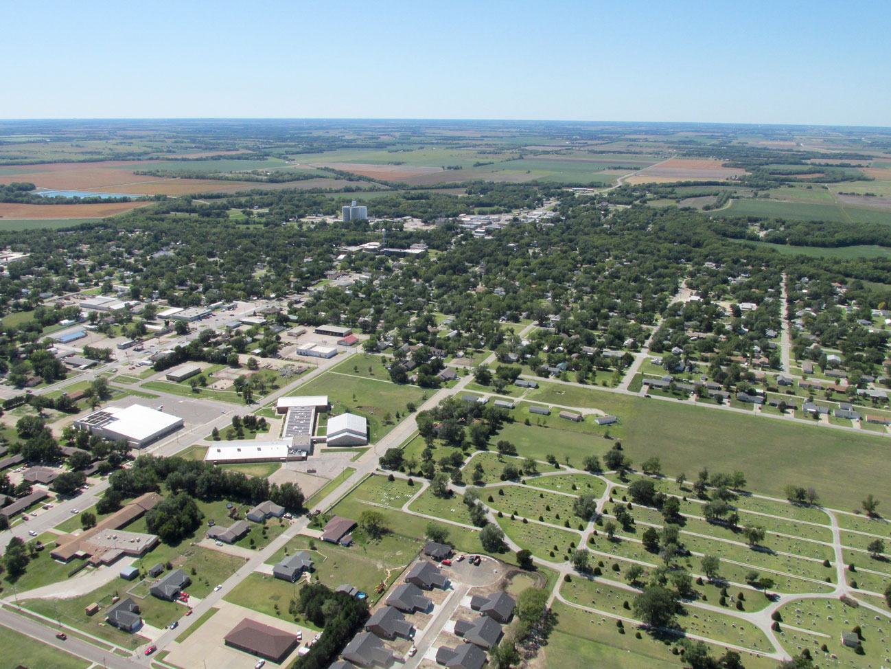
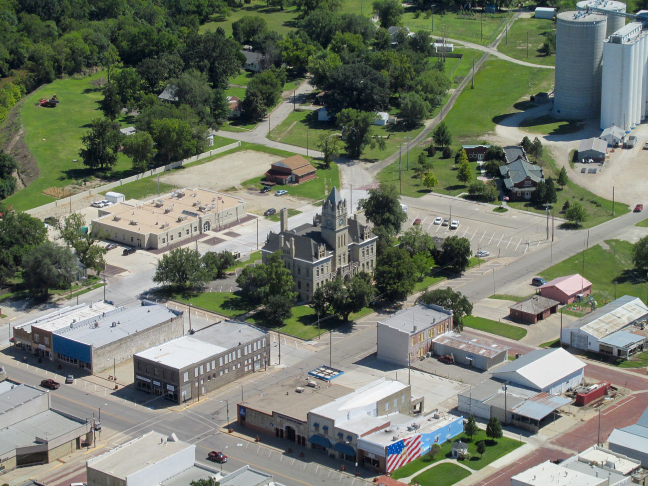
Right after swinging around the Marion Park/Lake, I took this shot of Marion, Kansas from about 500′ AGL looking Northwest.
After taking the picture of Marion, I panned the cam about 30° right to show The Marion County Airport. It is 1.25 miles Southeast of the edge of town.
I also took a telephoto of the airport. I like each shot for different reasons so here you go…
Marion County Airport
In June of 2013, I made one of my longest Sky Safaris to The National Biplane Fly-In at Freeman Field of Junction City, Kansas. Part of that plan was to land at Marion Airport for gas. That was when I had the first opportunity to use the Baxter Flight Center and had the providential meeting with Dick McClinden and his wife Patty. I say providential because although Dick is an airport volunteer and carries a key to start up the gas pump for aviators passing through, that morning, he and Patty were on their way out of town and just happened to be driving by the airport. If the timing hadn’t been so good, I would have had to wait an hour or more to wait for one of the other volunteer operators who live in and around town to drive out and fuel me up.
This is one of the nicest airfields on The Great Plains and is made better yet by the Baxter Flight Center that was donated by Flying Farmer Pearl Baxter in memory of her husband George.
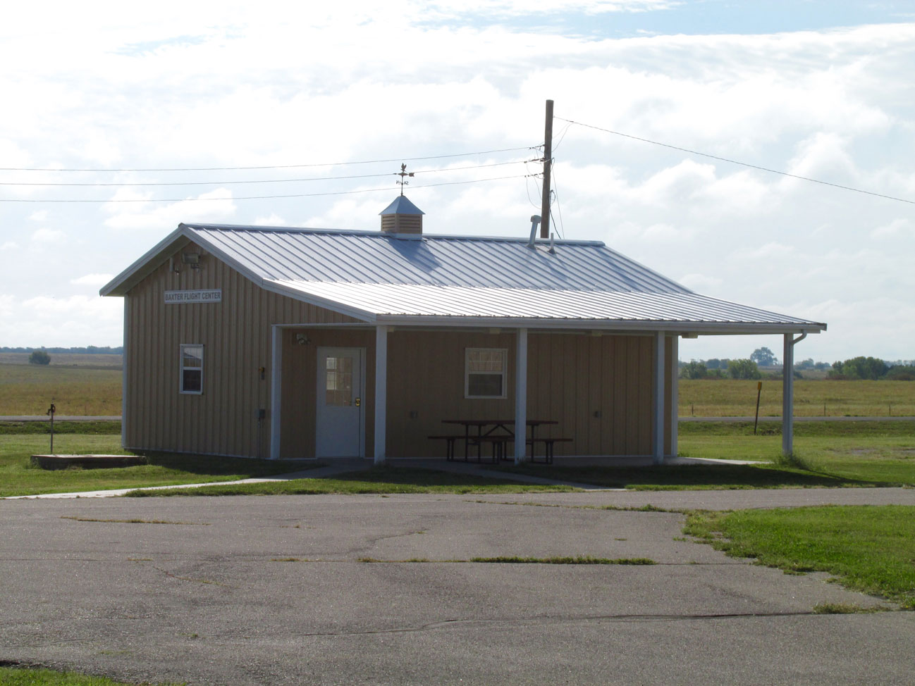
The Baxter Flight Center at Marion County Airport
There’s Tie Downs And There’s Tie Downs
As you can see in the photo below (with the windsock stretched out pretty good), the wind was blowing with vigor after I landed. Whenever possible I do not leave the plane out in the open. A row of hangars at Marion provided the perfect prescription for The Sky Surfer’s needs. By putting the MXL behind the hangars, the plane was protected from the majority of the wind so that the control surfaces wouldn’t be flipped around in the breeze. I carry my own stakes and tie down straps so after about 15 minutes I had the ship battened down and started the mile and a quarter walk into town.
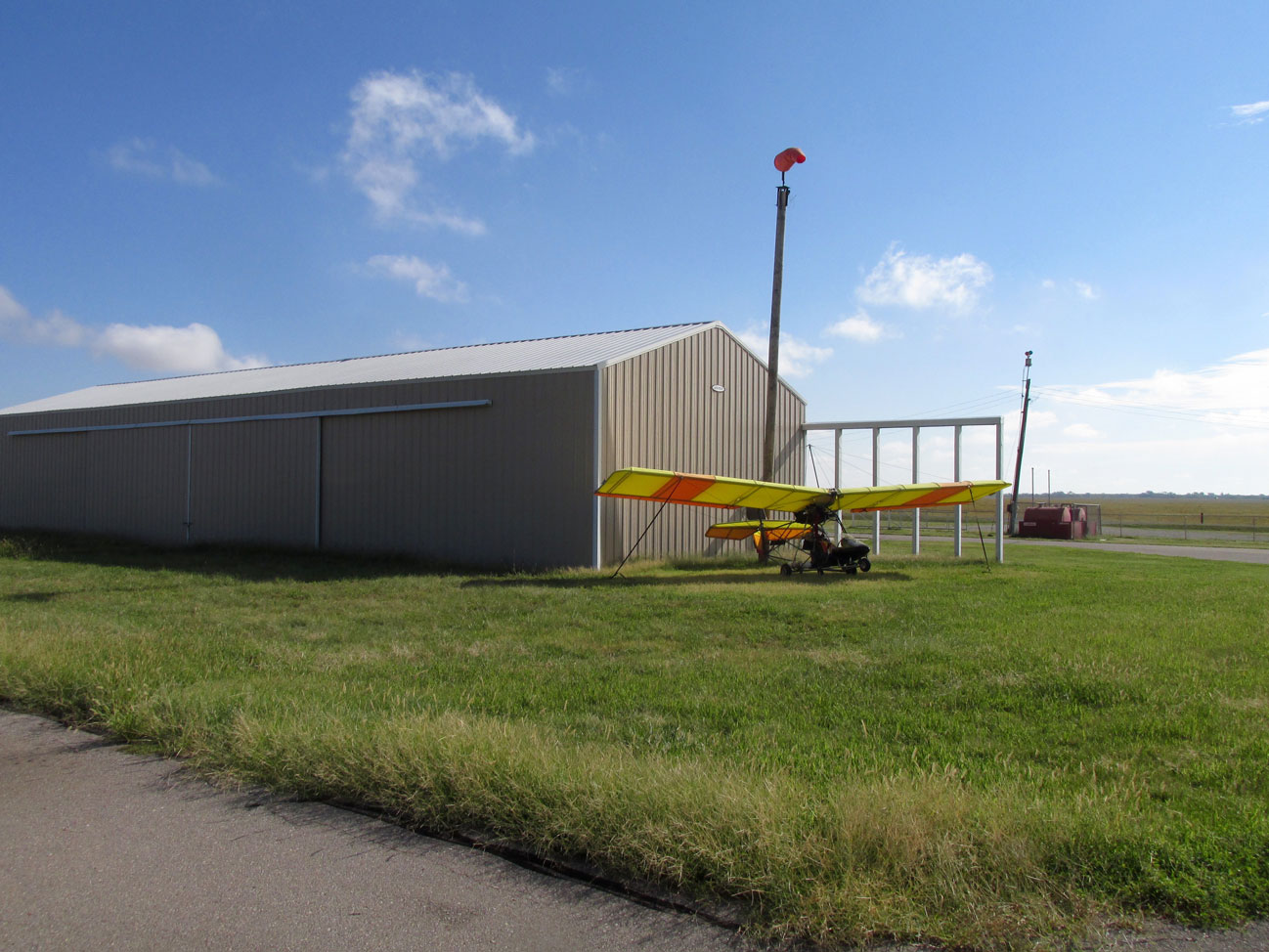
After fixing it tightly to the ground, I left for town with a reasonable expectation the Quicksilver would be there when I returned.
As I walked across the airport property toward town, I turned back Southeast for this shot of Baxter Center and the hangars…
…and then 180° back Northwest toward town so you could see my scenario. The fence ahead is typical of that found around small airports. The Sky Surfer has become adept at surmounting them without ripping his pants or shirt.
Welcome!
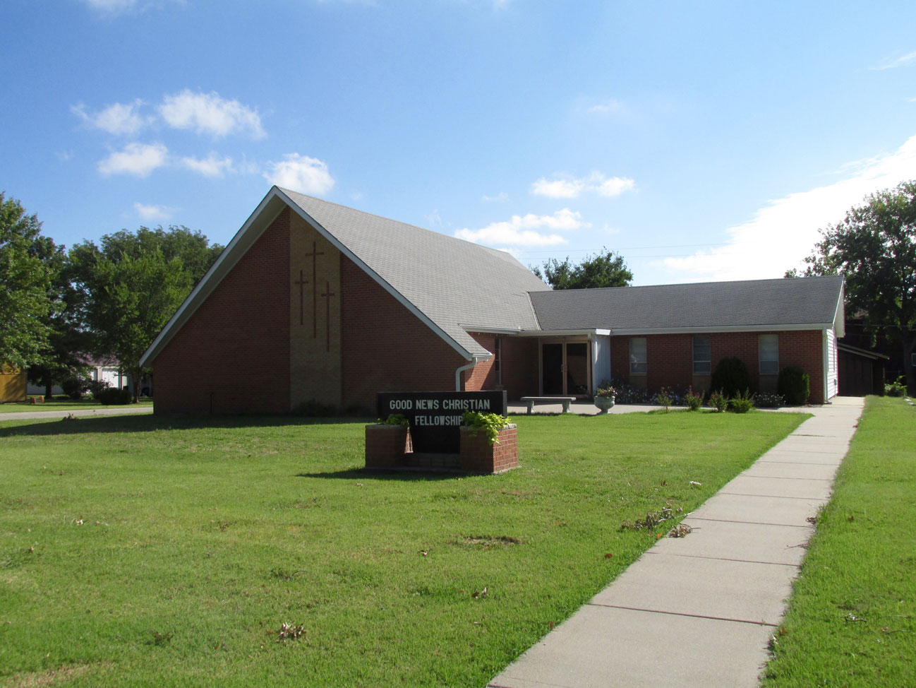
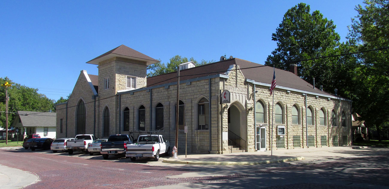
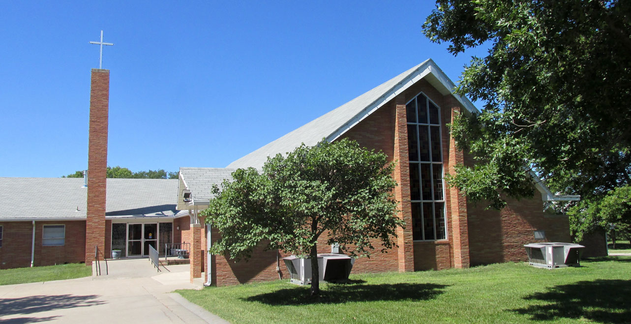
About the first thing I saw when entering Marion after crossing the field you see above was the Church shown below. What we call “The Gospel” is actually an Olde English word meaning “Good Story” translated today as “Good News” and that is the name of this Church. The Gospel is still The Best Story and The Best News on Earth.
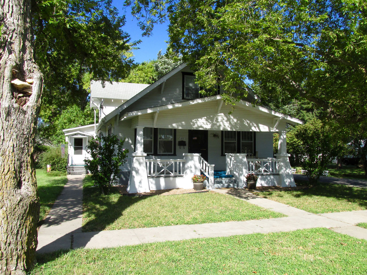
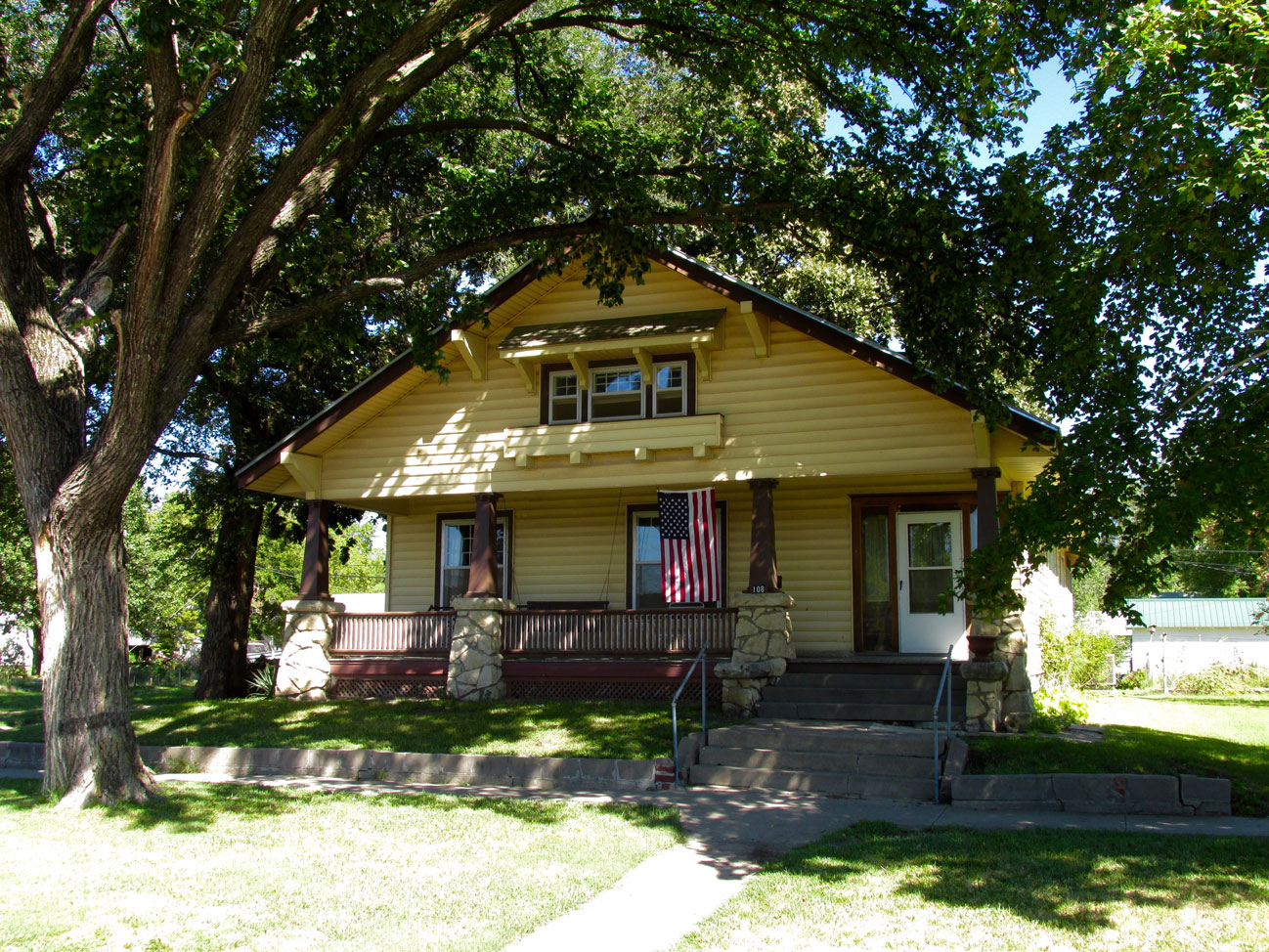
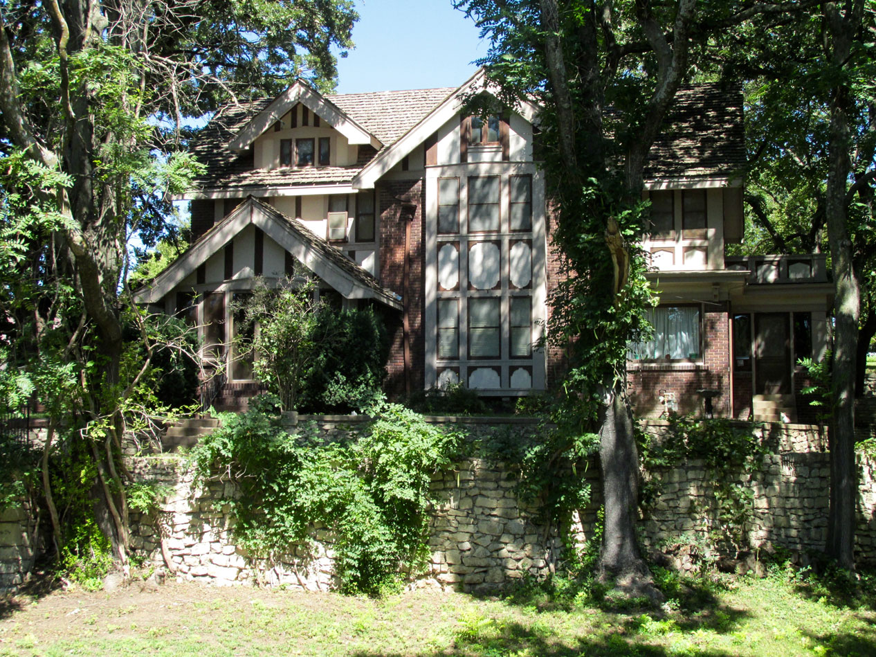
Architecture That Speaks
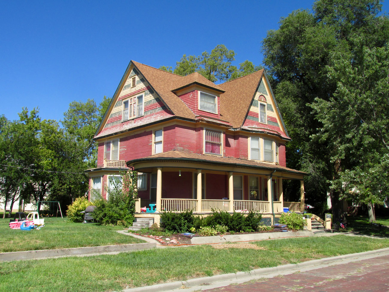
Among so many of the things I like about my Sky Safari Adventures is witnessing the delightful architecture present in these small towns I visit. To me a town’s notable architecture is not limited to the classic stone and brick public and business edifices but definitely includes the homes.
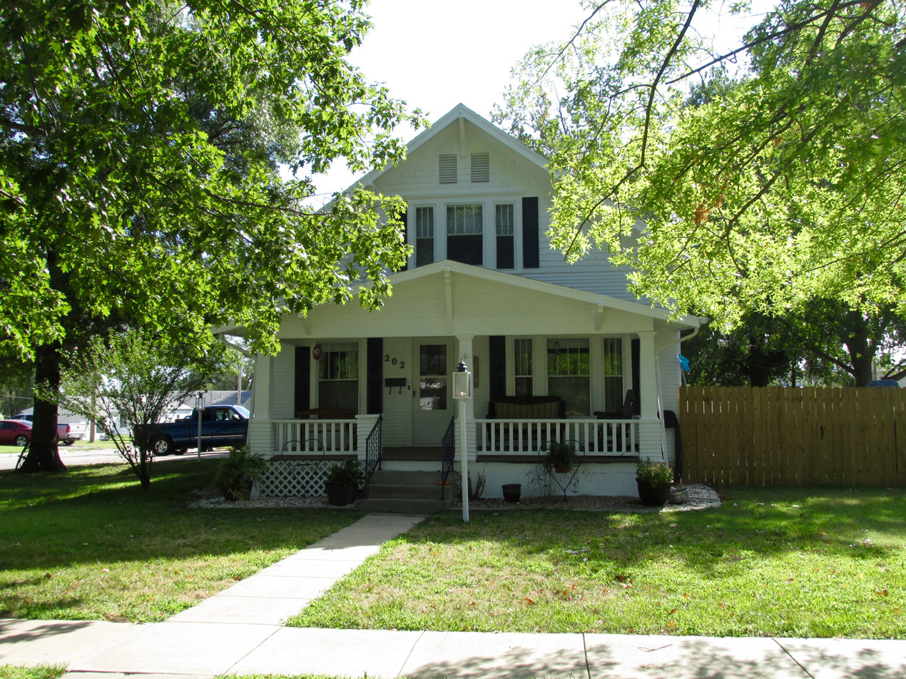
An attractive two story with a porch.
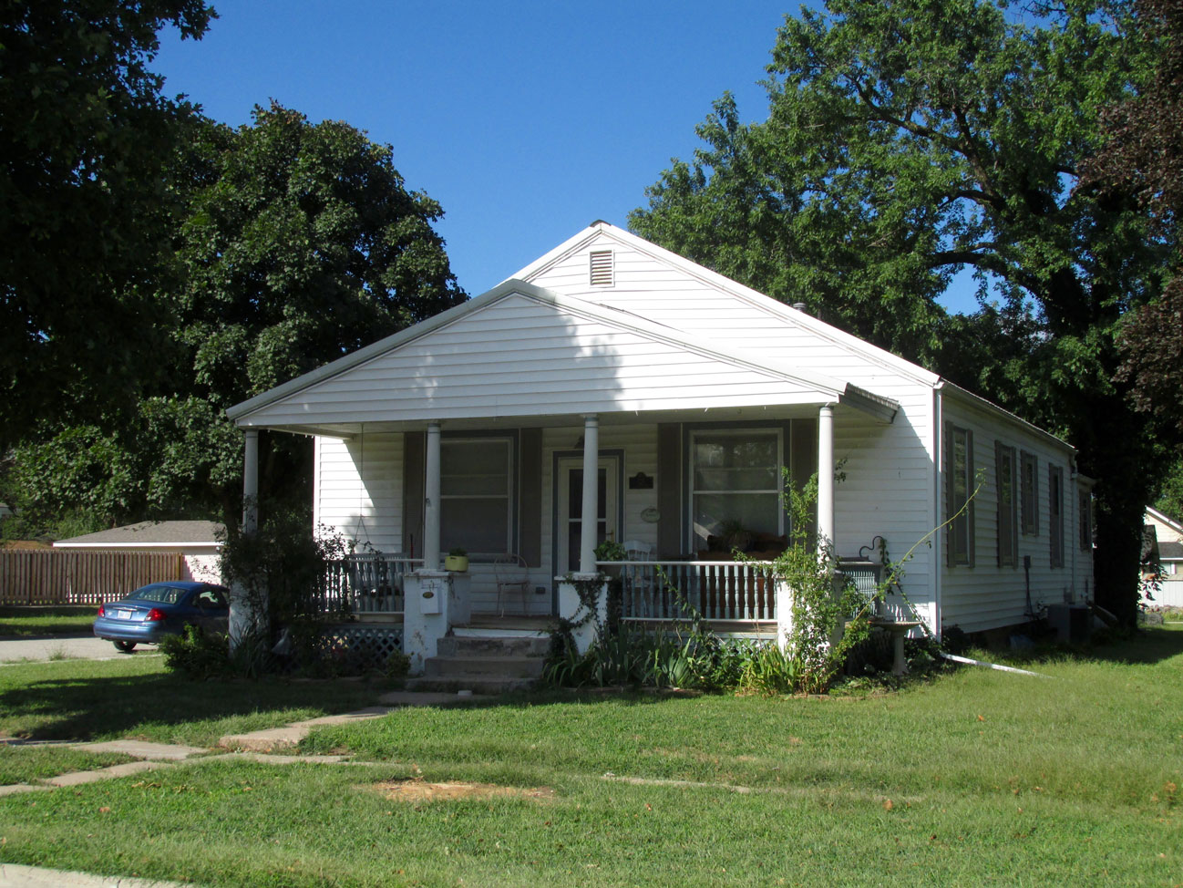
As usual I will be featuring homes and buildings that caught my eye as I randomly, roamed the streets of Marion. In doing this, I would like to caution my readers that the pictures I take are by no means an exhaustive study of Marion (or by extension any town I visit). Rather, they are what I saw during a couple of hours strolling about. I’m sure there are houses and buildings deserving attention I missed in Marion. Sorry, but that is the way it went that sunny, Saturday morning…
I like these curved roof lines. They remind me of The Hobbit by Tolkien.
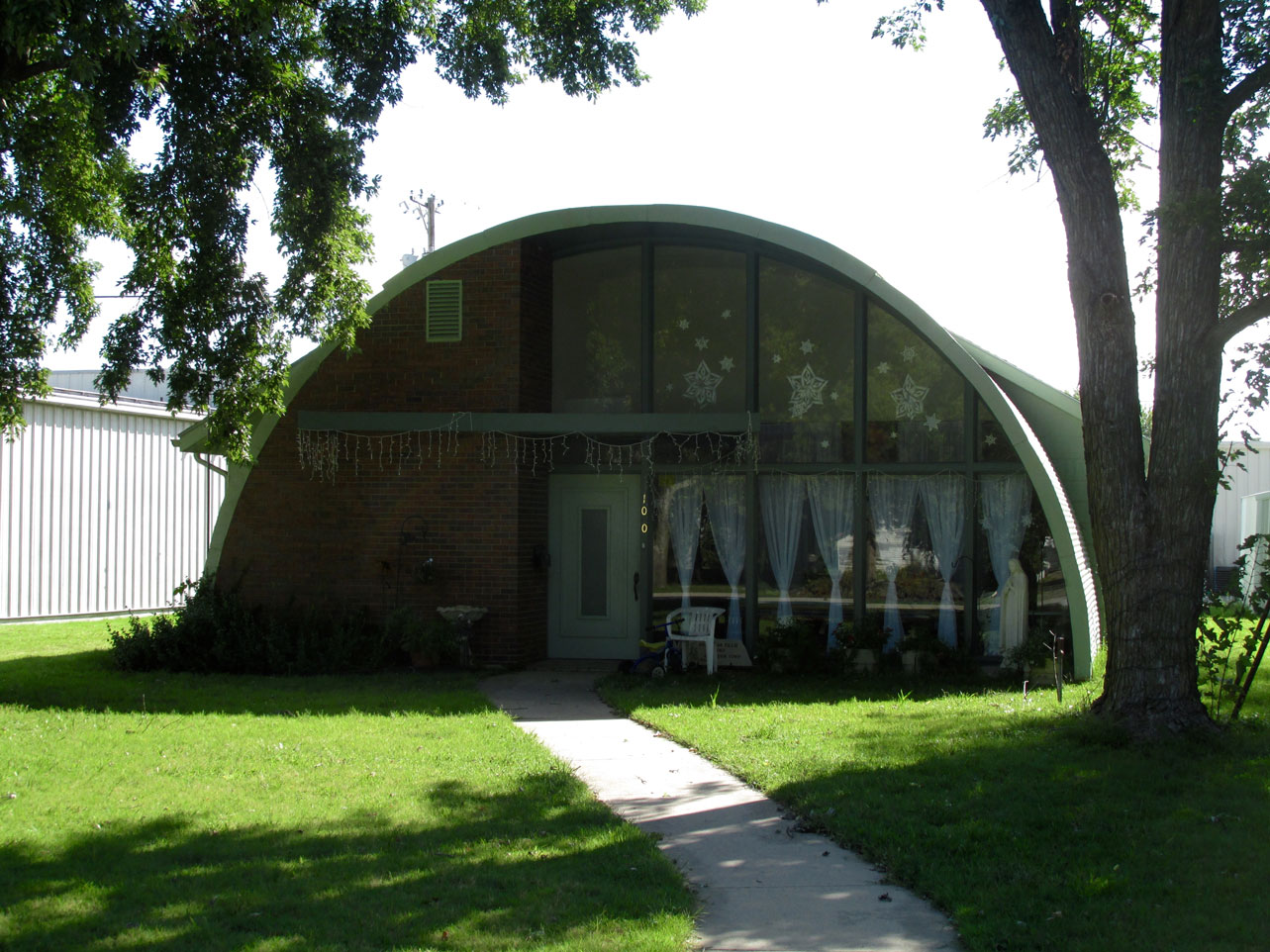
This is brilliant. A quonset hut turned into a house.
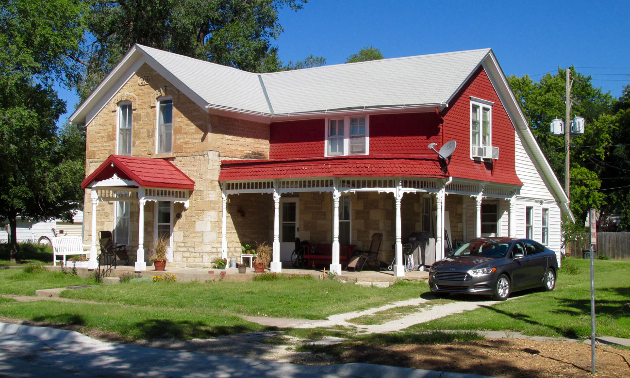
A nice touch on this house are the truncated pyramids holding the porch columns.
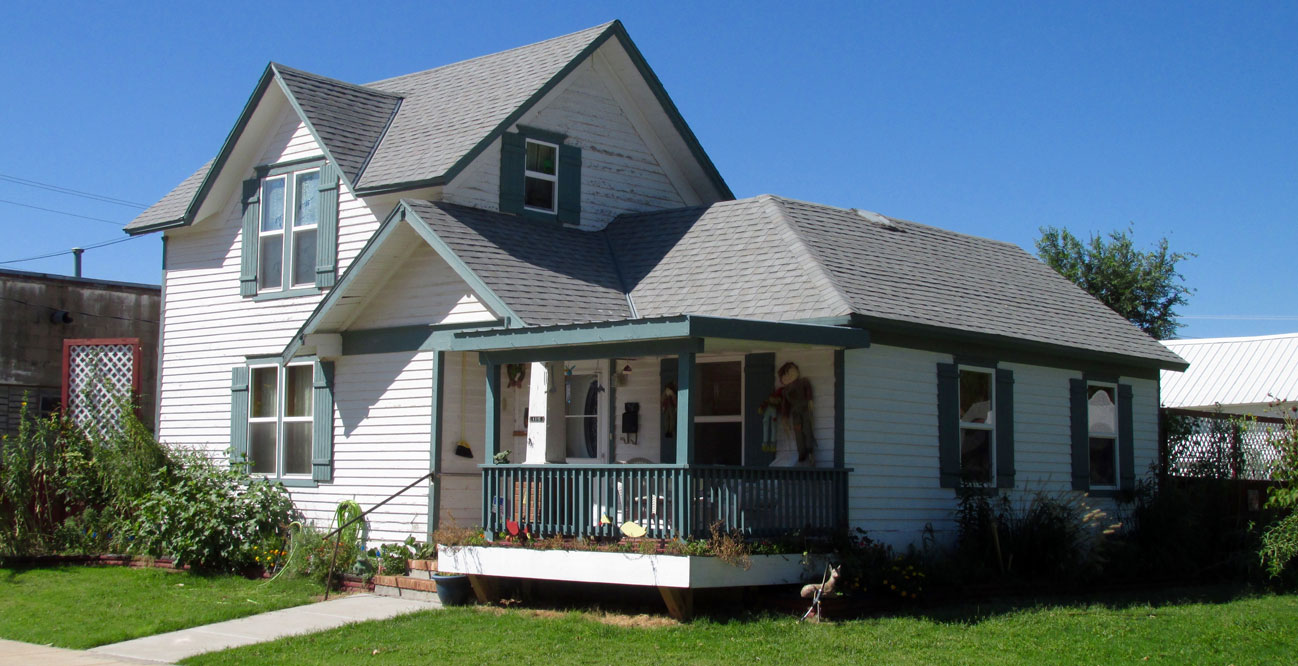
A porch with a swing
Mom & Dad’s
As I came to the end of a residential street and turned the corner I found myself in the parking lot of Mom & Dad’s Cafe.
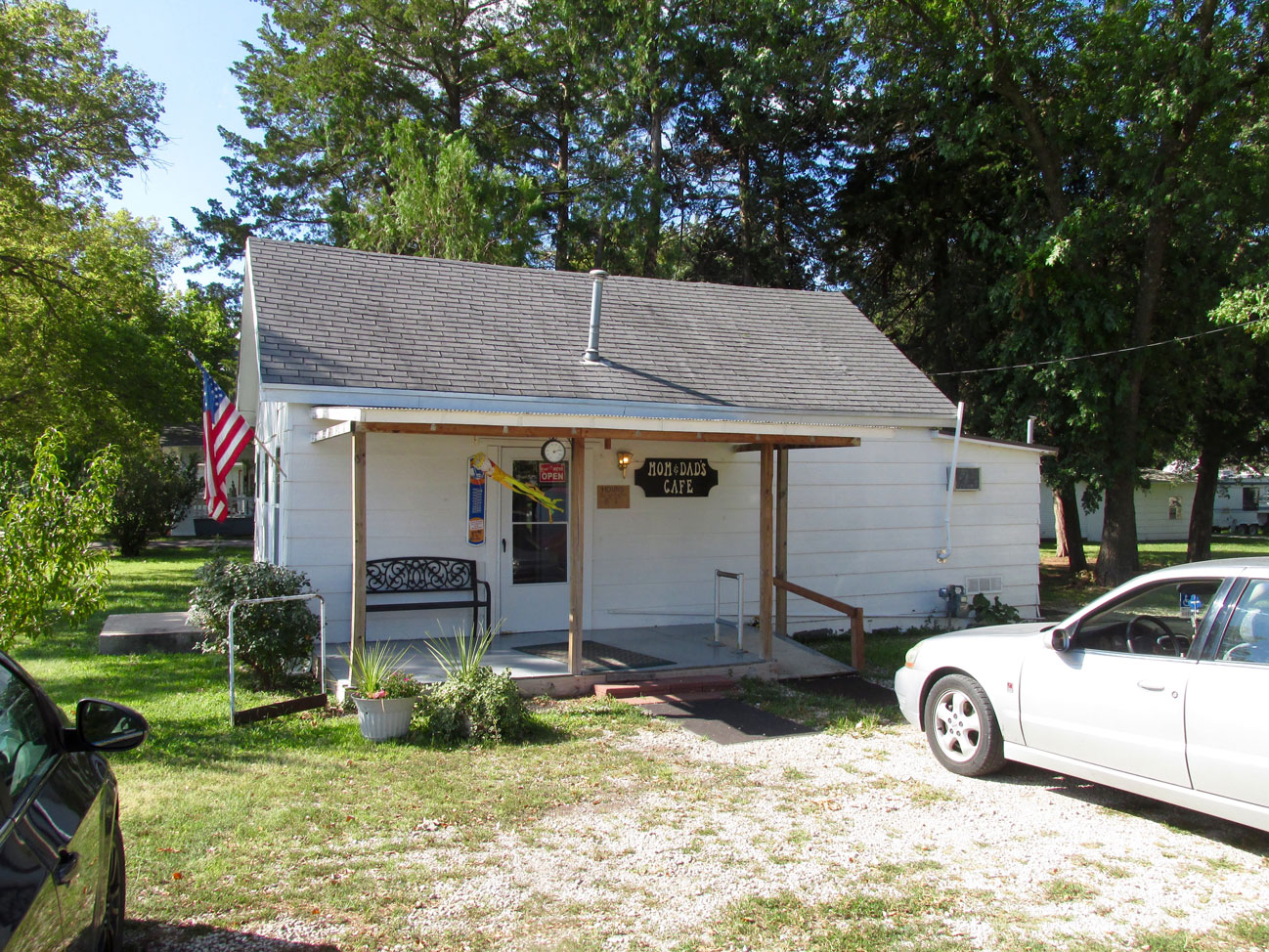
Mom & Dad’s Cafe. In addition to a great breakfast inside, there is a bench out front to rest upon.
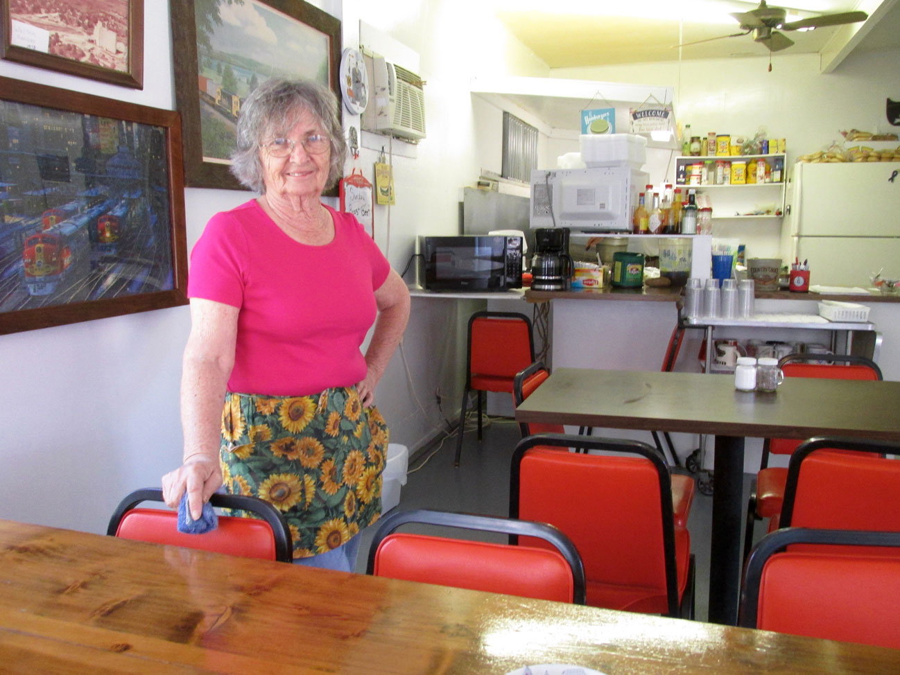
Waitress Iona Dietrich greeted me upon my entrance.
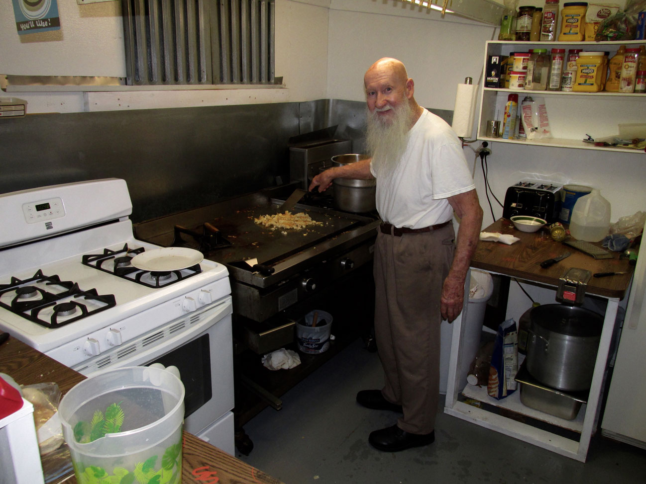
Working the grill was “Dad” Reign Anduss
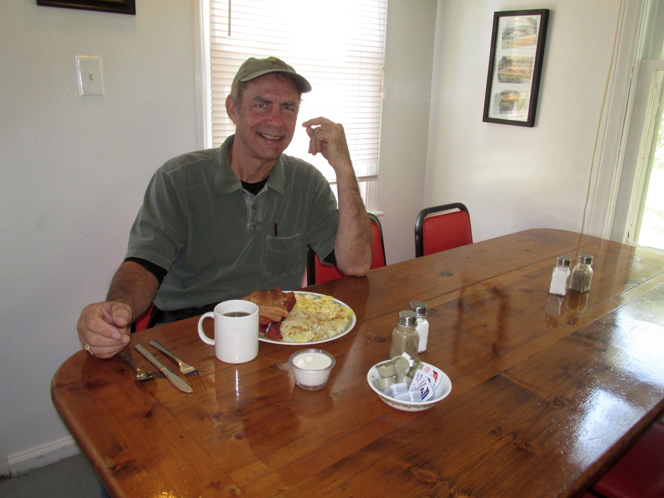
The Sky Surfer chows down
The Show Must Go On
It would be natural to assume (as I did) that Iona is the “Mom” of Mom & Dad’s Diner but that is not the case. Iona confided to me that Reign’s Dear Wife Marlene had recently passed on and being she was a friend of the couple, she had stepped in as waitress. This loving gesture was obviously of great help and support to Reign.
After finishing my hearty “farm breakfast”, I stepped out into the sunshine of the day to see what more I could find of Marion.
Down The Hill
From Mom & Dad’s Diner to “Main Street” Marion is a downhill stroll. Even though I thankfully wore long underwear for the cool morning flight, after emerging from The Diner, the temperature was rising. Later I ducked into a the men’s room of a gas station, removed said long johns and stuffed them in my carry pack. Layering, right?
On the way down the hill the first interesting sight I encountered was was T.C.’s What Not Shop. It is an antique store and is spread out over a large area. Because of this I don’t think I did it justice with my photo but, you get the idea anyway.
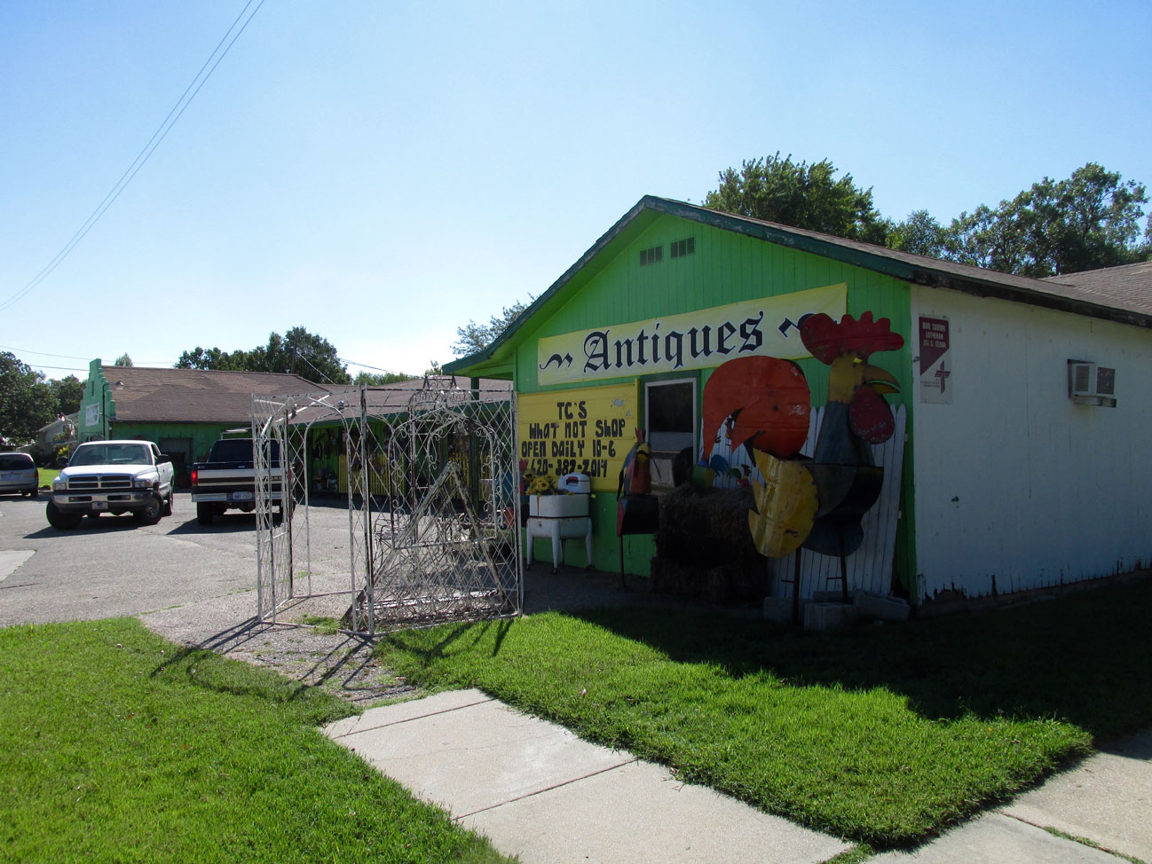
T.C.’s What Not Shop – 901 E Main Street
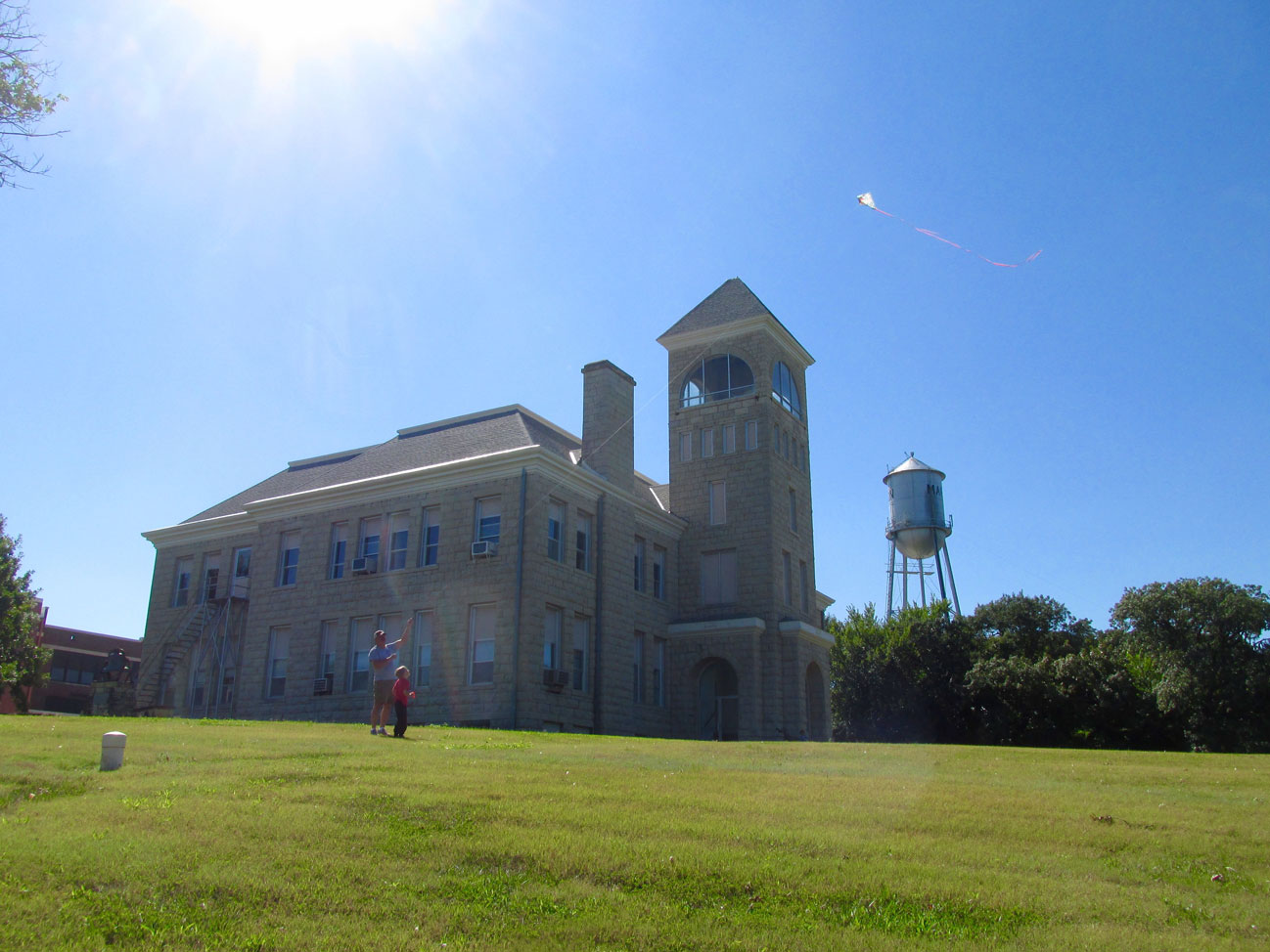
Now heading down the Main Street hill, I quickly snapped this scene of Dad and Son flying a kite on the Marion High School grounds. One of the town water towers is in the background.
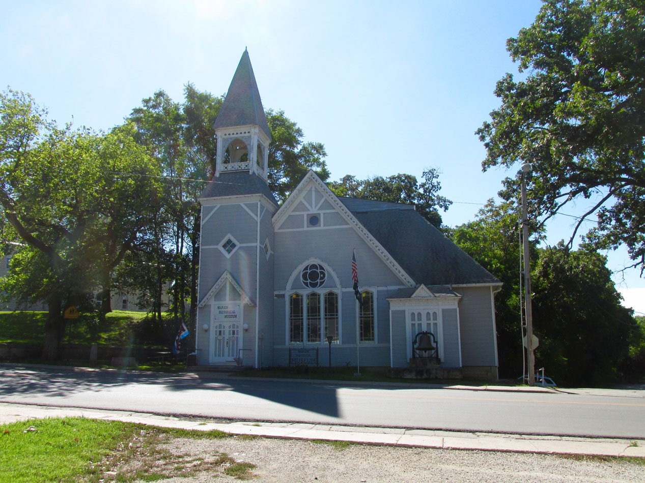
Marion’s Historical Society building is at the East entrance of the downtown business sector
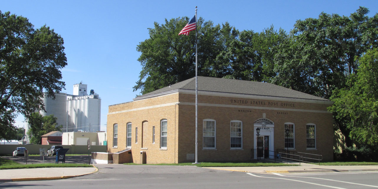
The Marion Post Office with the Grain Co-Op in the background
First Sighting!
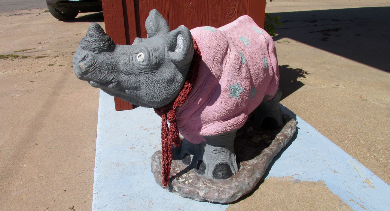
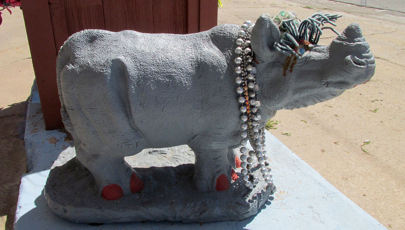
Below you see the small Rhino herd that kicked off my hunt. At first, I thought they were peculiar only to that business establishment but definitely worthy of photo capture. Later when I saw a third Rhino, I knew something was going on and peeled my eyes seeking more.
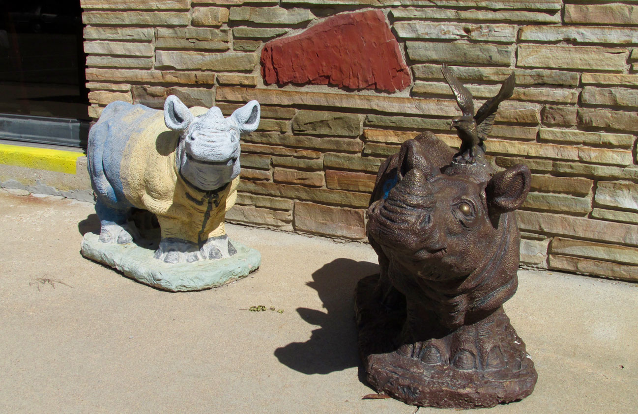
Two “Petes” dressed for any occasion
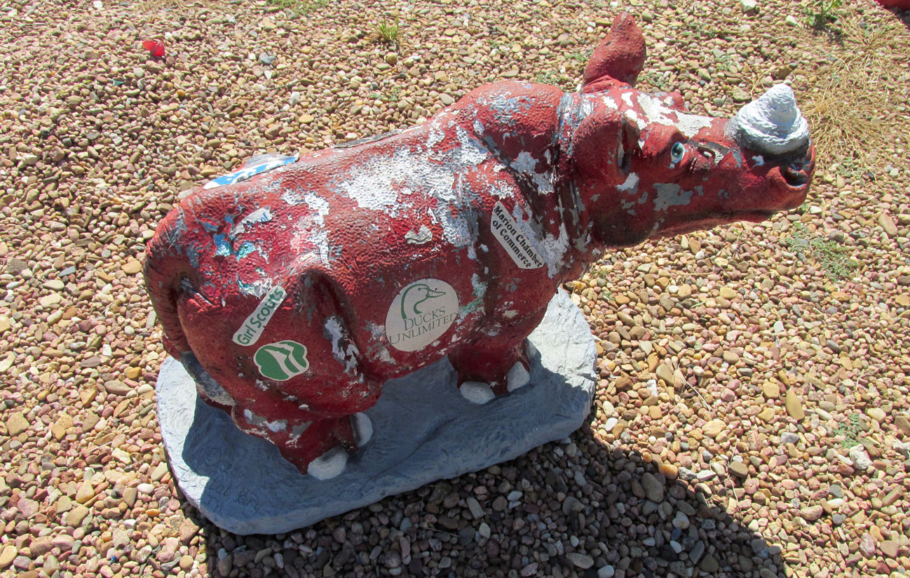
Marion – The Rhino Capital Of Kansas
The Marion Rhino identity is an outgrowth of the annual Chingawassa Days Celebration. Chingawassa was an Osage Indian Chief who’s name meant “Handsome Bird”. He is noted for having been a signatory to a number of treaties with the U.S. Government. The celebration also has connection with a now defunct railroad line that was only four miles long with its destination being a dance hall.
The event was begun in 1997. A particularly enthusiastic member of the steering committee was a man named Pete Peterson. Pete had a love of the Rhinoceros. Unfortunately, Pete also suffered from a debilitating disease that eventually took his life. In honor of Pete, “Pete The Rhino” was made official mascot of the event and incorporated into its logo. Since then new “Petes” are introduced to the community at the yearly festival. As this story continues you will see all the Petes I “bagged” on my Safari.
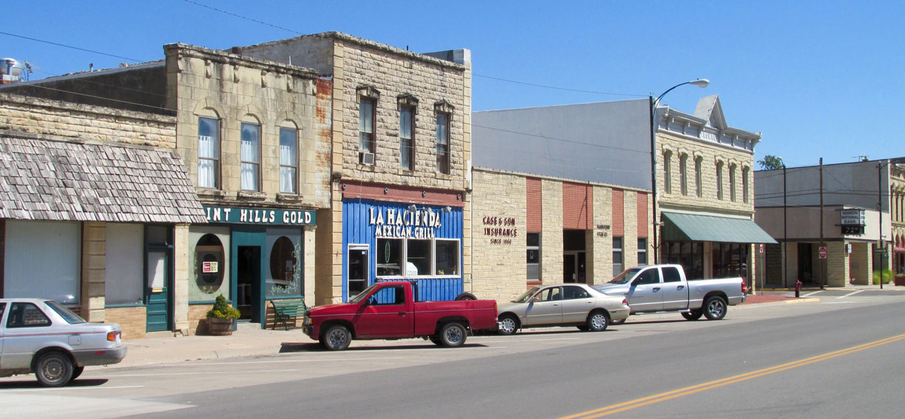
Main Street
Marion has a very attractive Main Street that heralds its dedication to preserving a storied past while keeping in step with the times. Marion was started in 1860 when a group of families in covered wagons came to the site on the recommendation of surveyors who proclaimed the high quality of the land there. In 1862, Marion was established as Marion Centre, named by the fact that it was in the center of Marion County. I suspect they also had an eye on becoming the County Seat which did occur and it continues to be such to this day.
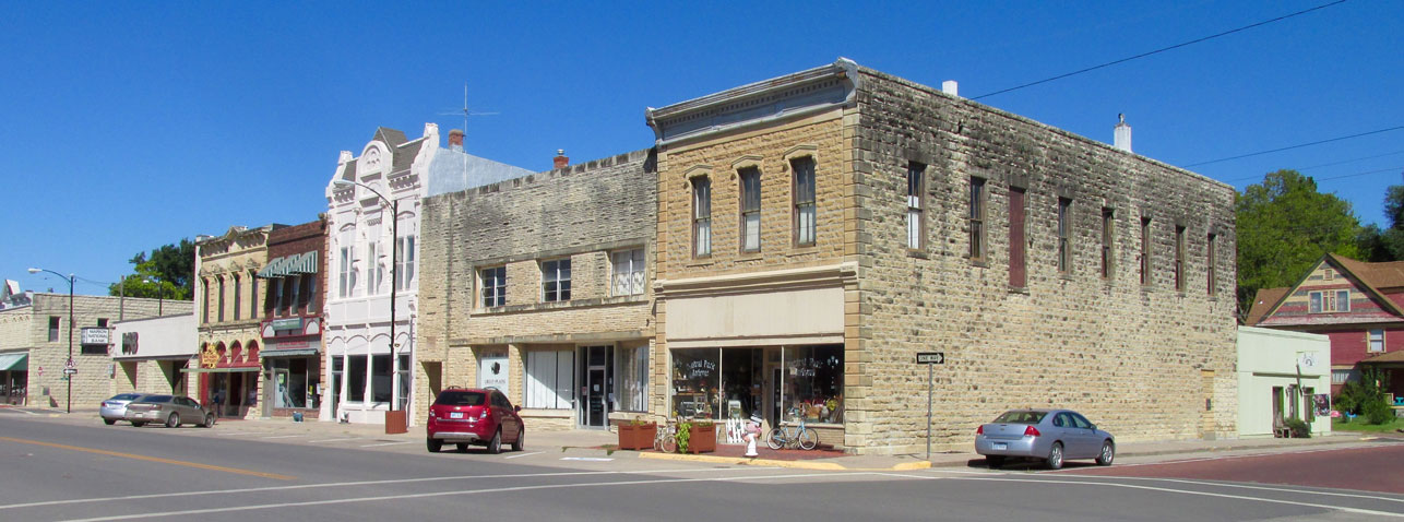
Stone and brick. Monuments to Mercantilism and Solidity. Also very pleasing to the eye unlike the faceless, sterile metal and glass boxes of our age…
A block on the North Side of Main Street.
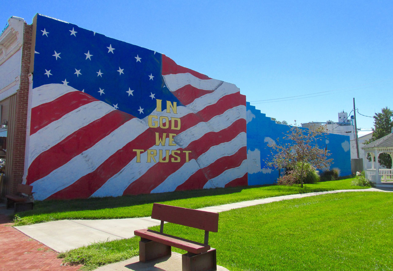
This is called “Liberty Park”. Love of God – Love of Country
This was the “Third Pete” I alluded to earlier that suggested to me the first two were not “a duo singularity”. He is honored with a raised platform.
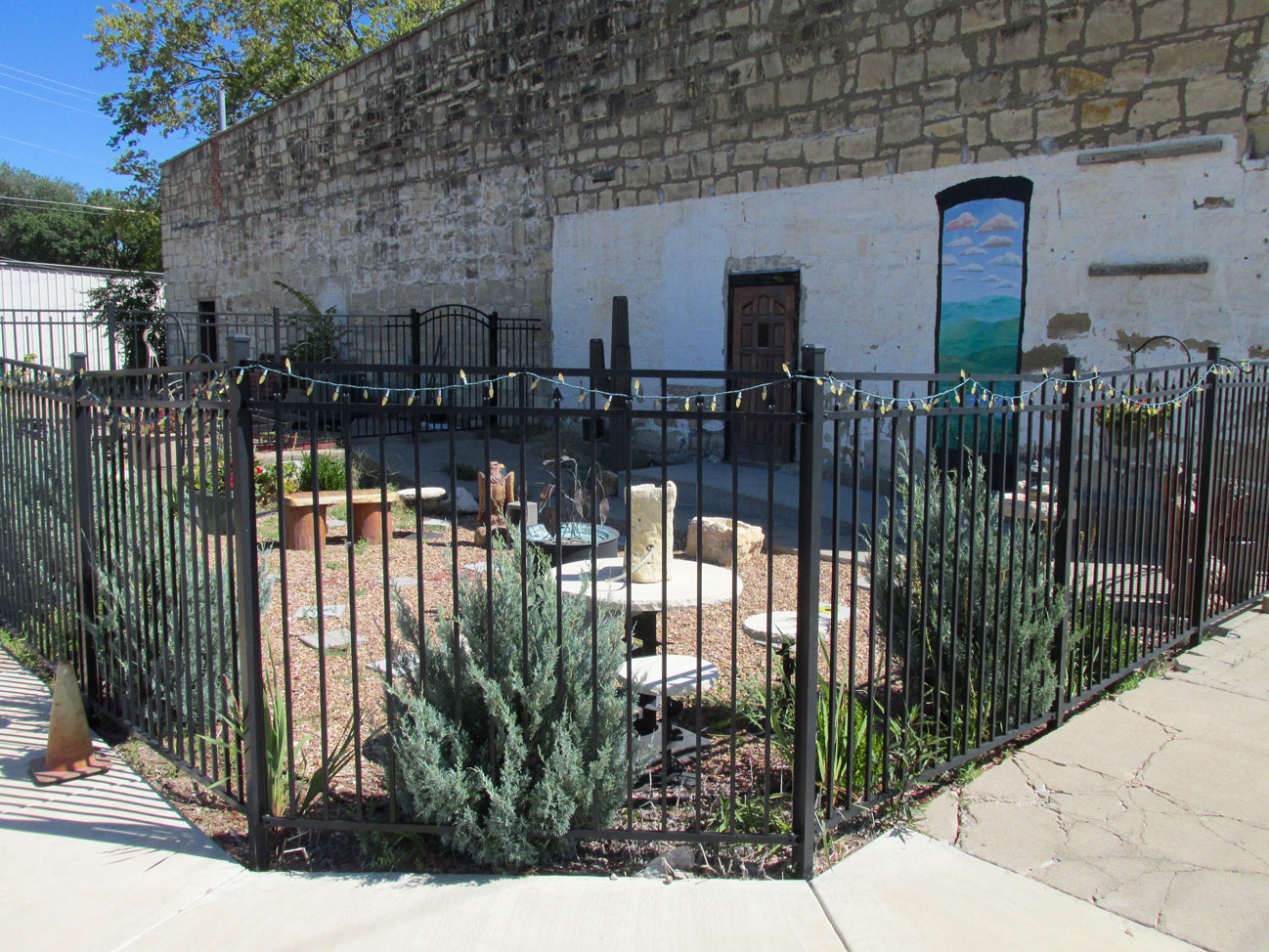
I found this attractive stone garden at the corner of 1st and Main.
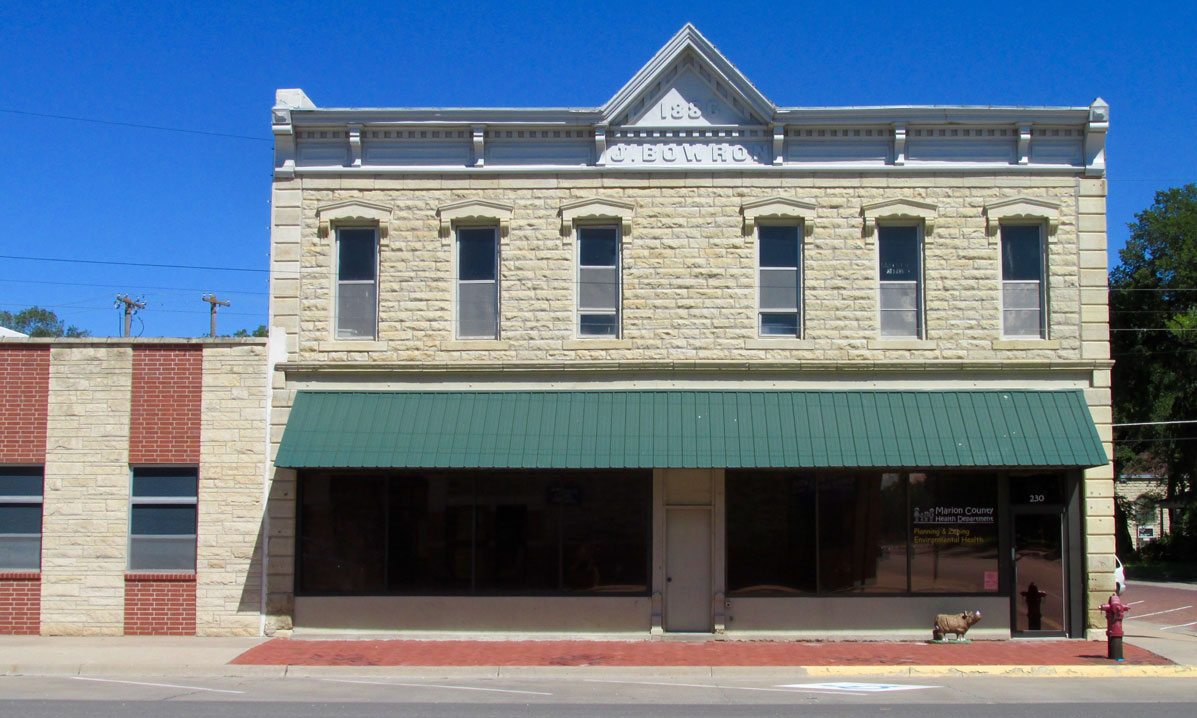
Built in 1886, the J. Bowron Building houses the County Health Department.
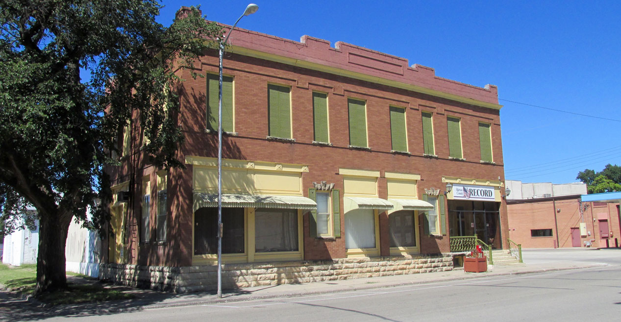
The Marion County Record has been publishing since 1869. That makes it famous for being established 100 years before the year The Sky Surfer graduated from High School :)
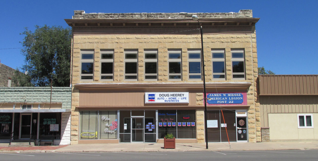
This solid structure features stone with new, modern windows housing the American Legion Post 22 and Doug’s Insurance company.
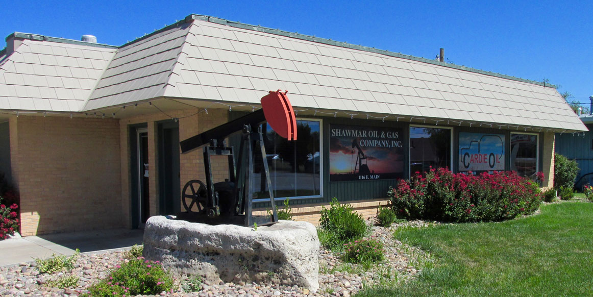
Pumpjack – The Farmer’s Friend. Incorporating the little “jack” into a garden makes this the neatest entry for an oil company business I have seen.
The Cottonwood
Marion is enclosed on the West side by the Cottonwood River (at least one of its many branches). I walked out on the bridge that crosses it to get these pictures.
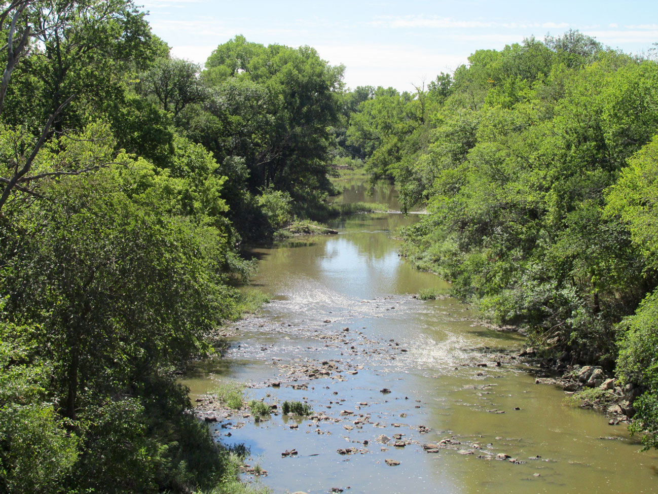
This is the view of The Cottonwood River looking South from the bridge…
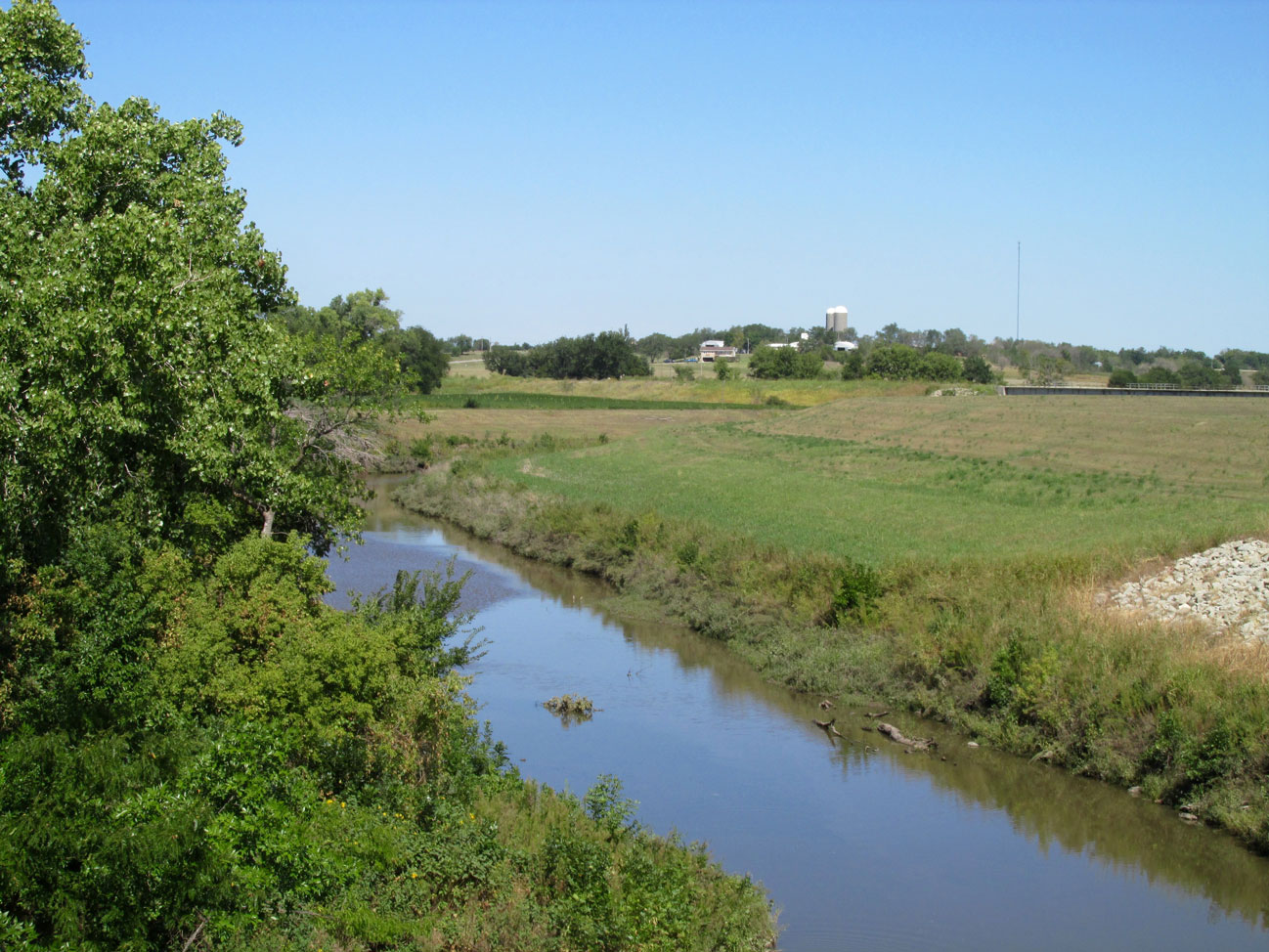
…and this is how it looks to the North with the picturesque farm at the horizon.
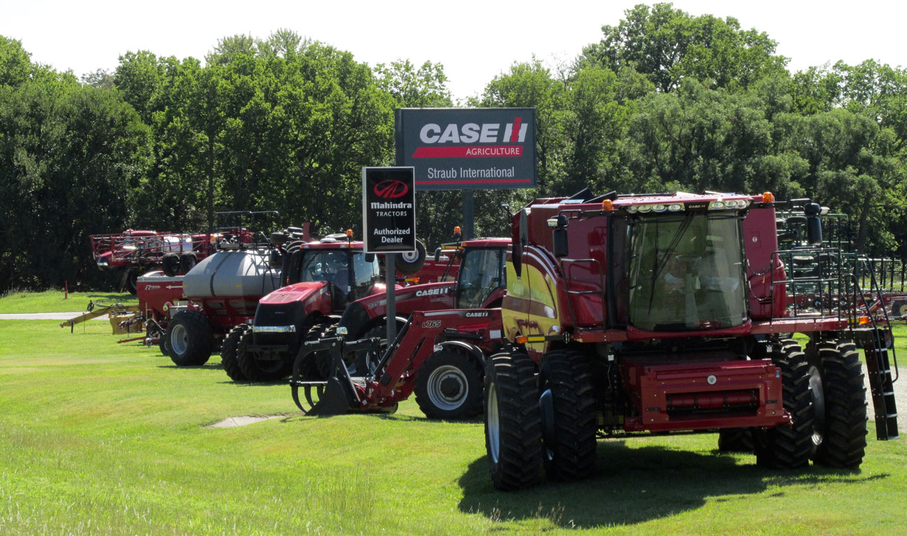
Prairie Leviathans
Just East of the Cottonwood Bridge is a high tech vendor, the type of which, helps keep Kansas The Breadbasket of The World. Of constant wonder to me are the HUGE machines American Farmers use to grow crops. From the air I get to watch them ply their trade but it is not until they are approached at ground level that their awesome size is revealed. This Case dealership is at the West end of Main Street near the bridge over the Cottonwood.
A telephoto shot showing part of the display on Main Street.
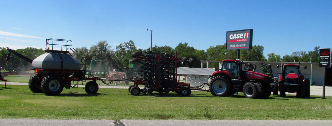
I had never seen a three part rig like this monster before. You need some wide open space to put something like this to work…
The Payoff
Whether a result of the big machines or a small garden it is the produce that makes the point. As I returned from the West end of town down Main Street I met Francis Jirak and his Grand Daughter Felicity Gear – she sporting a Wildcat t-shirt. Francis has been farming at nearby Tampa, Kansas for Fifty Years. They had set up on that beautiful morning to sell their watermelons and corn. Watermelon and corn-on-the-cob are two of God’s Greatest Gifts To Mankind. My Wife can testify as to the prodigious amount of watermelon I eat each season. I love corn just as much. I say this to give you some measure of my disappointment at not being able to take some with me. Unfortunately there is absolutely no space – none – for carrying a watermelon with me on my Ultralight. For a fleeting moment I considered stuffing a half dozen ears of corn in my shirt but as I still had an hour or so to walk the town, I sadly discarded that notion.
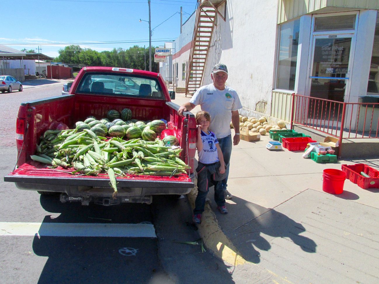
Francis Jirak and Felicity Gear
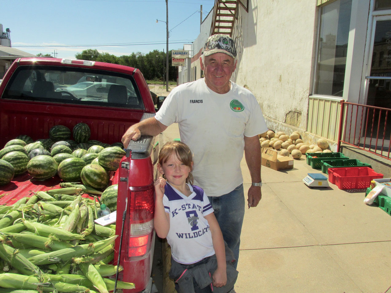
A Francis and Felicity Closeup Shot
Back Through Town
At this point in the journey, I decided to branch off Main Street into the neighborhood to see what I would see. It was not an orderly process. Sometimes I was on the Main Drag and other times among the residences. I’ll just show it as best I can.
The Best Movies Are The Ones You Create In Real Life
I wish I had a better picture of the next scene but I snapped it quickly from afar to avoid having my subjects see me. If I had come closer for a better shot it would have jerked the Star Warriors out of the space-time continuum and caused irreparable harm to their Space Opera Fantasy. Watching them brought back indelible, charming memories of my Son Jack and his Buddies viewed through our kitchen window playing the same games in our back yard some years prior.
It is a far better thing for youngsters to be outside interacting and playing – occasionally getting a scraped knee – than sitting inside watching TV or playing video games in an artificially controlled climate. “Real Reality” trumps “Virtual Reality” every time. I’m glad I had the opportunity to grow up in Real Reality and that My Children did, too.
Tube Time
For most of the time as my children grew up I based my advertising and video business in a home office. So, when Summer came around each year, the kids would be with me while their Mother worked downtown at her office. If you did not know it, The Sky Surfer has been enamored of computers, video cameras and a variety of “high tech” devices as long as he can remember. But, even in the 1980’s, it was becoming apparent that computers, the burgeoning Internet (“Bulletin Boards” were the early “social media”) and video games could become habit forming and potentially deleterious to a healthy life. Exposure to them needs to be controlled.
As such, when our Children were growing up they were limited to 1 hour of “Tube Time” during the “play time” of the day. (Note to younger people: before flat screens, video devices used to be big, bulky cathode ray tube devices. Hence the term “Tube”). I wanted them outside playing or inside playing games or, at least, reading – doing things – rather than watching others do things. Even though this mandate was met with great resistance at the time, it was without doubt beneficial. Both profited from the strategy as is evident in the vibrancy of their successful adult lives.
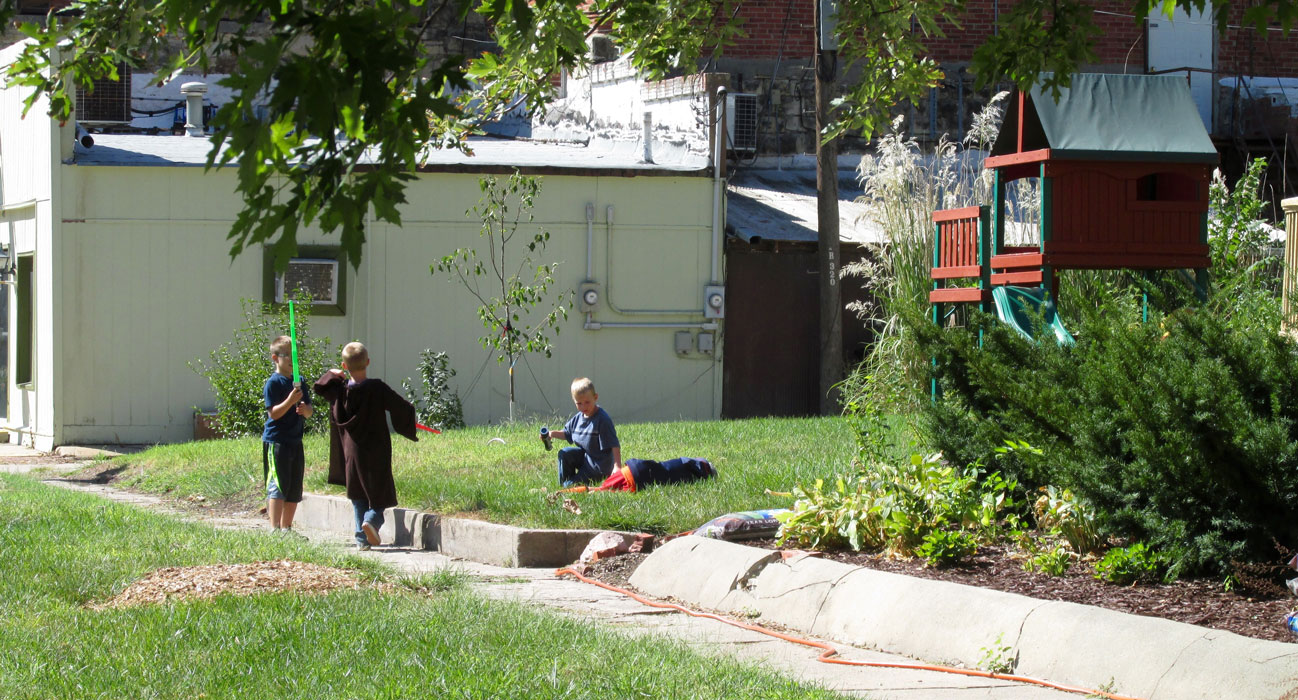
Star Warriors complete with Light Sabers battle in the back streets of Marion
Elgin House Hotel
On the National Register of Historic Places is The Elgin House. Completed in 1886 after a public stock offering, the hotel was quite elegant and featuring amenities generally only found in much larger cities. You can learn more about it at this link HERE. It has been renovated and is very impressive.
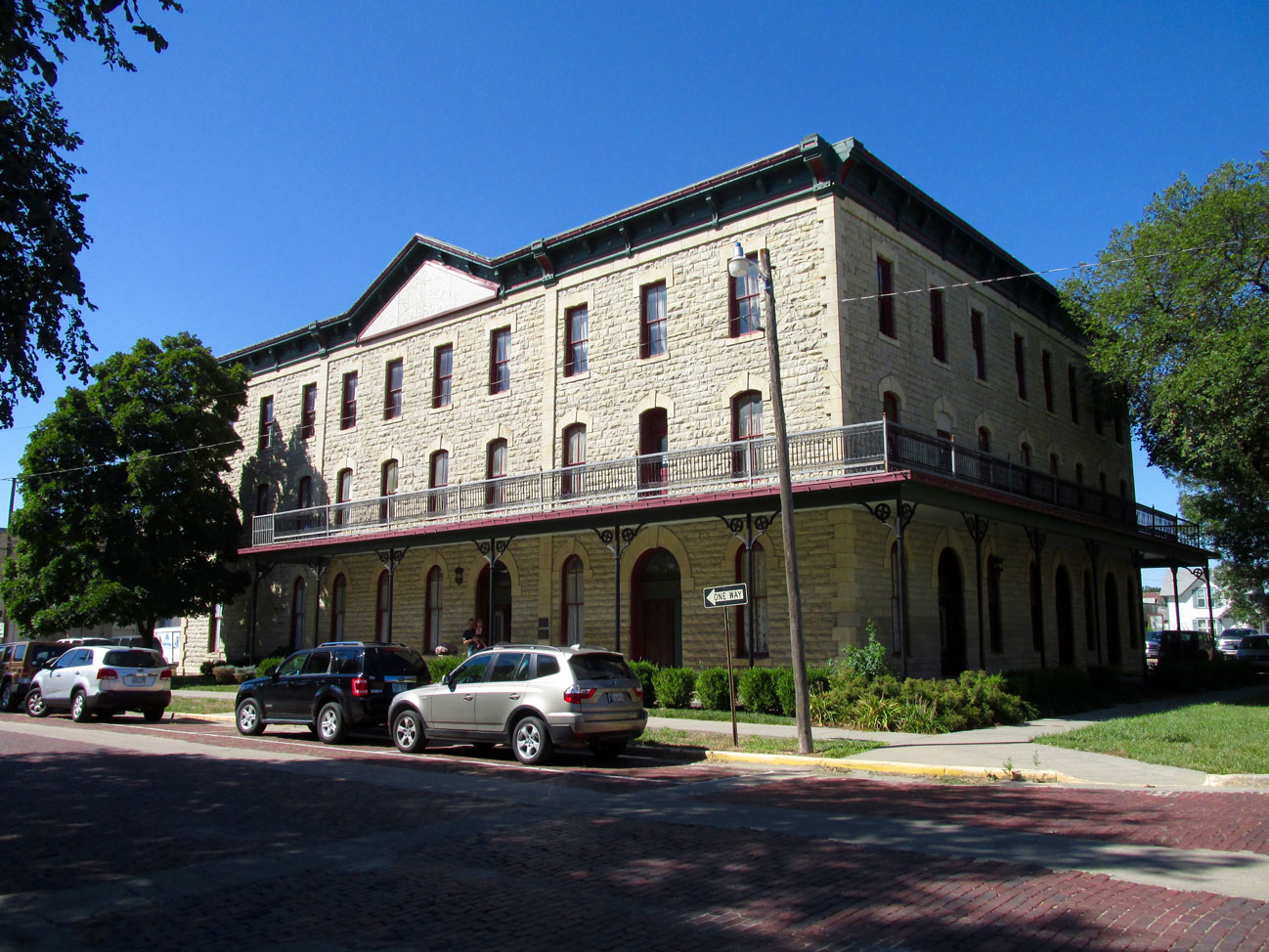
The Elgin
Another Fine Stone Building
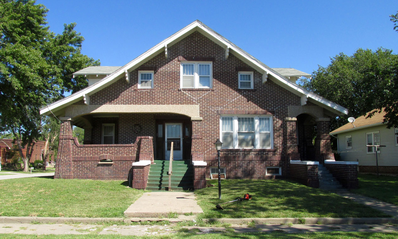
Let’s Check Out The Neighborhood
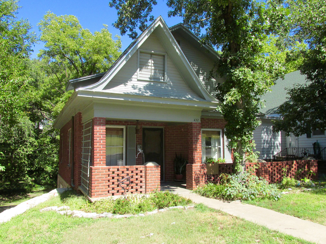
Even though a bit faded, this house has great appeal.
1879 was when this home originated
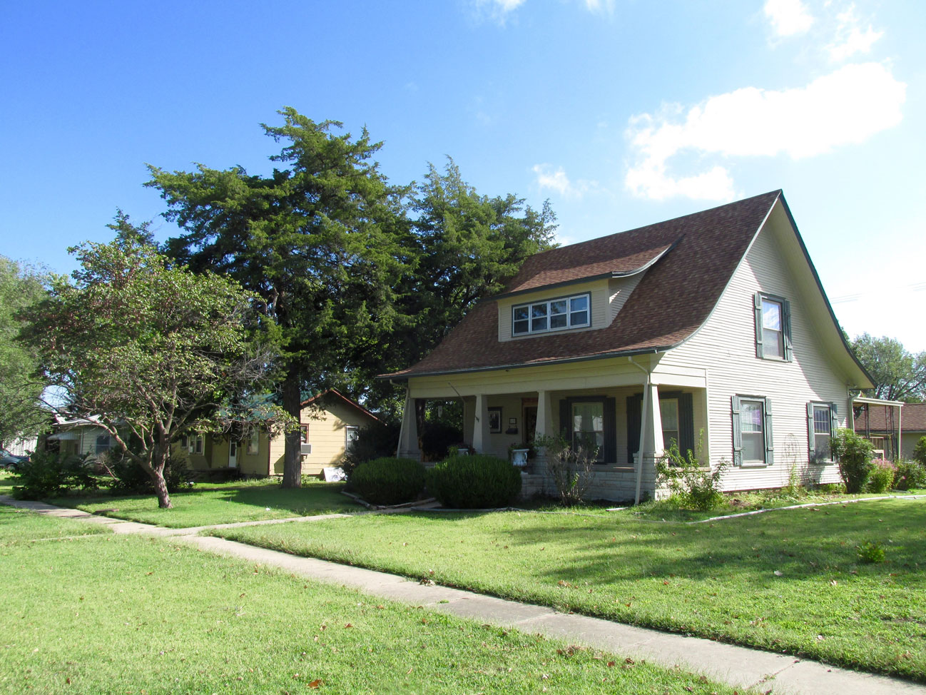
Nice lines on this one
Stone stanchions, covering trees, pillars, a porch – this one has character to spare.
I walked by this well-kept older brick house. Apparently the owner was taking a break from trimming the lawn…
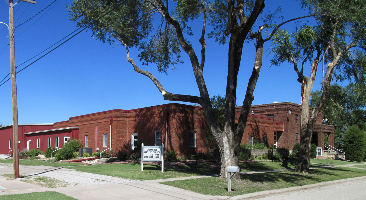
Emmanuel Baptist Church at 229 Walnut Street
Back On Main Street
As I wandered toward anything that caught my attention I crossed Main Street a few times. Toward the West end of the business sector I saw some folks sitting out front of “Down on the Corner”, a nice gift store at 162 W. Main. Since it was closed at the time, I figured the folks were waiting for it to open. I walked over and introduced myself to Don and Betty Stemzel to ask what they knew about the Rhinos. I figured they would know because “Down” has two of them out front. Don and Betty were very familiar with the Rhinos and gave me pretty much the whole rundown that I gave about the festival earlier. After taking the picture below, the store owner showed up, I bid adieu and bagged two more Rhinos…
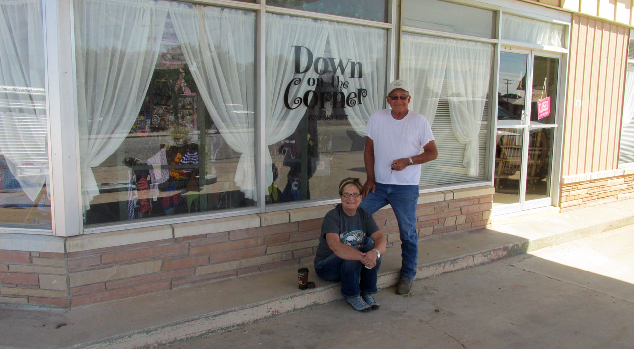
Don & Betty in front of “Down on the Corner”
“Pinkie” is the store’s first Rhino…
…and “Glamour Girl” is the second.
The Marion County Seat
As I walked along Main Street I could see the Marion County Courthouse spire above the buildings. I headed that way to get a picture. As are so many County Courthouses in Kansas and Oklahoma, it is an impressive stone building. In this case reminiscent of Westminster in London.
Trees Are Great, But…
I’m all for trees (Johnny Appleseed and all…) and my Wife Debra and I have planted many around our home. Sometimes, though, they obscure that which is meant to be seen. Such is the case with the Marion Courthouse – particularly the fairly recent Arbor addition blocking the building entrance. On top of that, in the scene below there are some unsightly electric lines cutting across. There was no way to get a good shot of the front of this fine building.
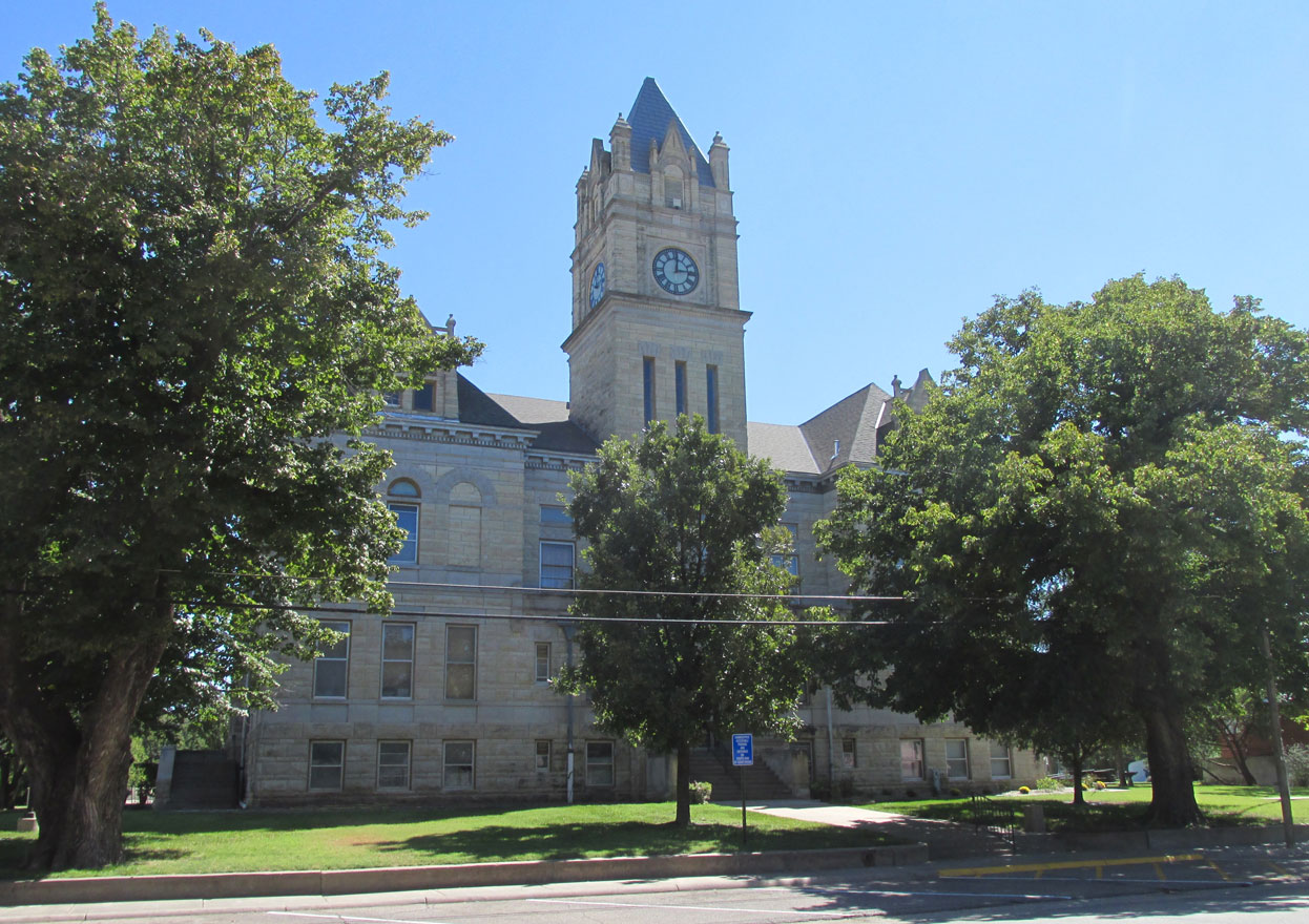
The Marion County Courthouse (with wires)
So, I tried another angle. Although not the front door, this looks much better.
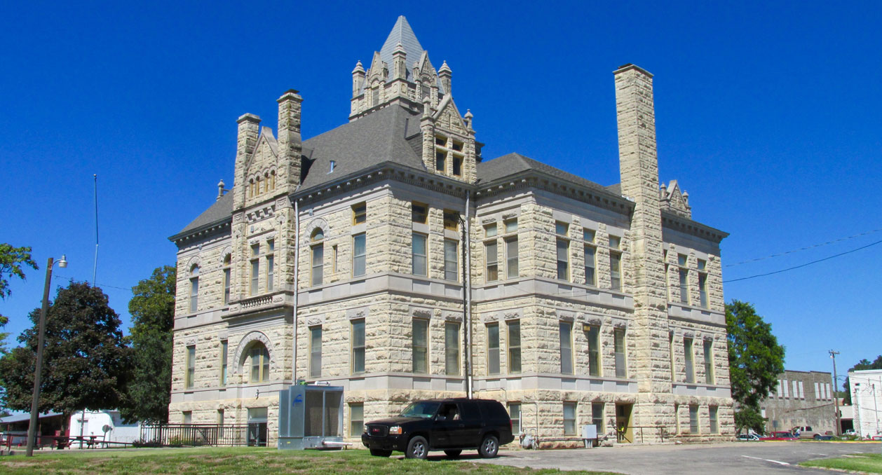
The Courthouse as seen from the Southeast – a marvelous example of the stonemason’s craft.
Added Bonus
My desire to get a better angle on The Courthouse revealed another Marion Architectural Treasure – The Marion Depot. Formerly the Santa Fe Railroad Station, in 1999 it was re-purposed to be the City Library. This was an excellent way to draw attention to the town’s Railroad Heritage while providing a larger, separate location for the library which had been housed in the city building. I have included an “isolation shot” so you can see the Depot by itself and then a wider photo so you can see it in context next to the Co-Op.
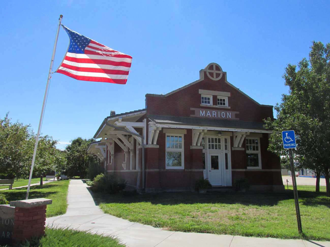
The Marion Depot
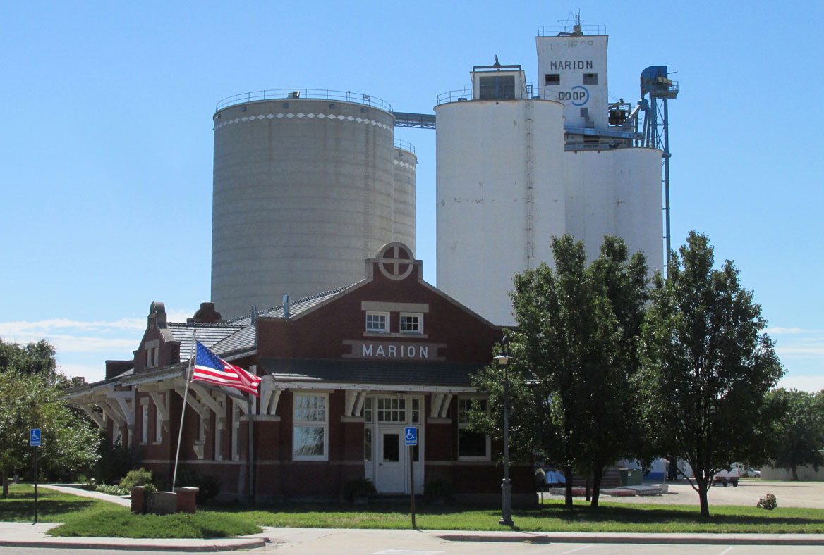
The Marion Depot overshadowed by “a cathedral of the plains” – The Marion Co-Op
Central Park
Next to what I assume is another branch of the Cottonwood River is Central Park. There were teens and middle schoolers there and some young Mothers with babies. It is a pleasant place to spend an afternoon on a lazy Summer day.
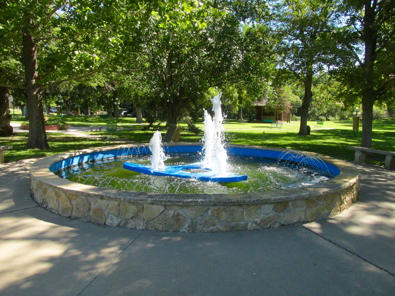
The water sculpture at Central Park
A Dedicated Rhino
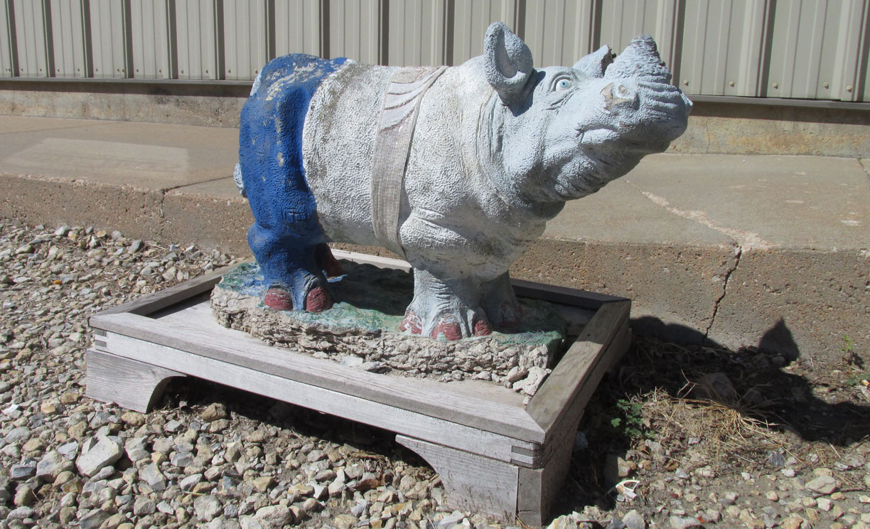
The park also hosts the most lifelike of all the Rhinos I saw. He has his own sand box.
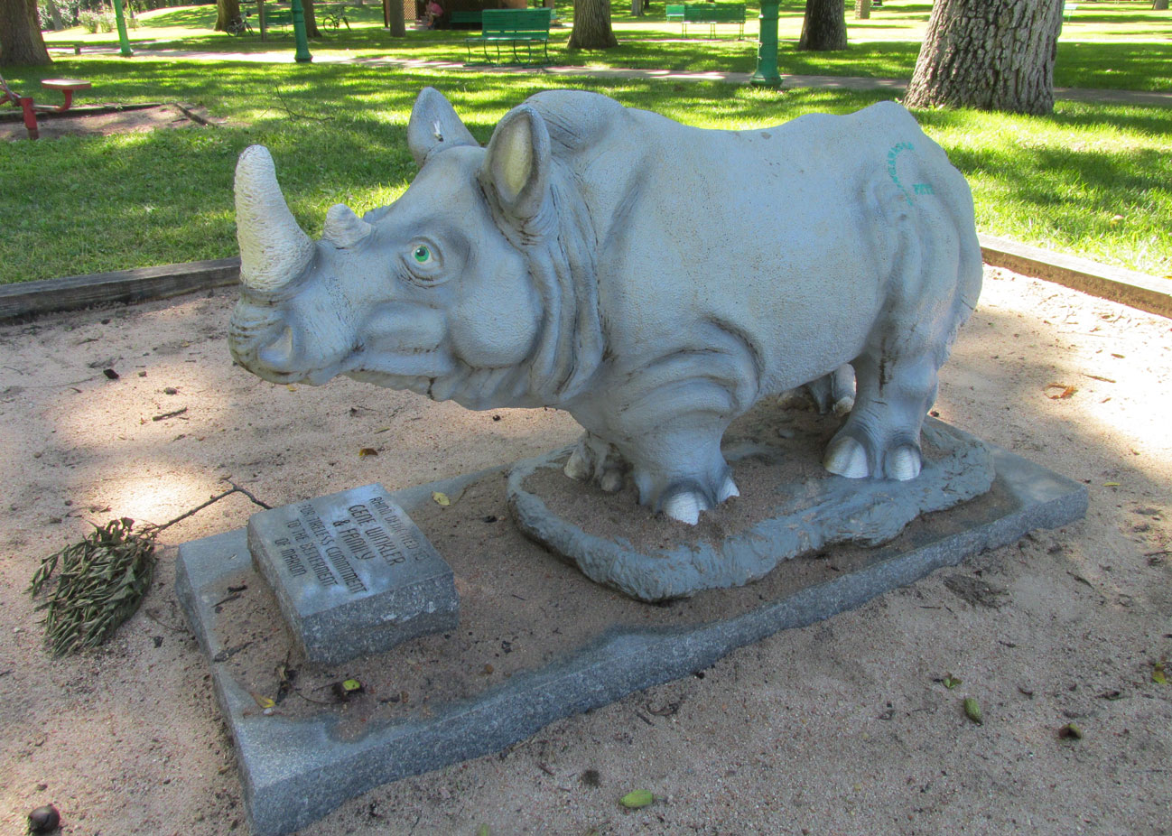
The Gene Winkler & Family Tribute Rhino of Central Park
Across from the park set above the creek overflow was this very interesting house.
And then across the creek from it is this brick house with a curved roof line.
Heading Out Of Town
It was time to trek back to the airport. I still had to get some gas for the trip home. On the way I spied yet two more Rhinos!
“Red” seems to have been a collaborative effort
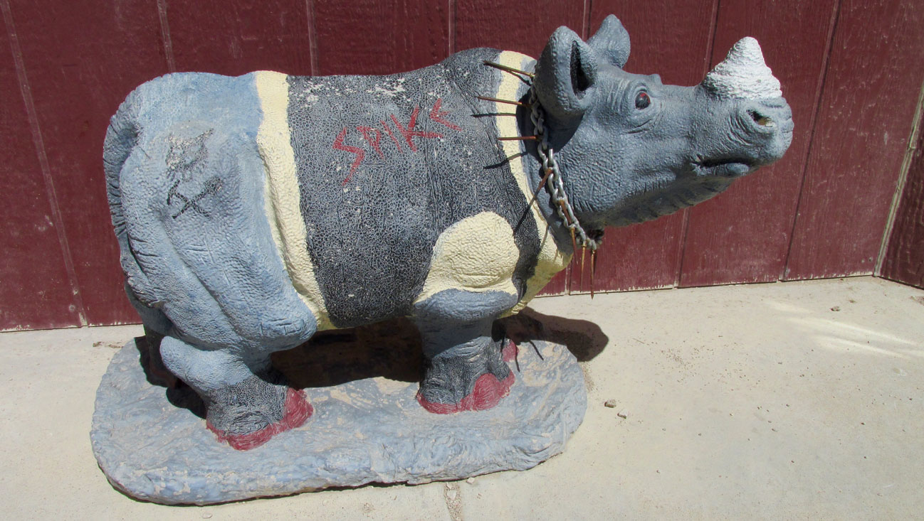
My last Rhino, “Spike”, was the only one I saw that sported a name.
I’d Walk A Mile…
I took a different path back to the airport and a way down one of the streets I saw an interesting church a few blocks over. I decided this would be my only chance to take a picture of it so I detoured and grabbed the shot.
A Pleasant Obstacle
When I walk around in an unfamiliar town, as I do for these stories, I generally have a “feel” for where the airport is. I don’t have a map but I have a good, general idea in which direction to head back to my plane. Because I purposely took a slightly different route back from the way I came in that morning, I came to find myself inside The Marion Country Club Golf Course. From the angle I entered, I thought it was another park. The picture below was taken at the moment I discovered it was a golf course. The airport is almost directly over the ridge in the middle of the shot.
By the time I discovered my predicament I was a bit tired and did not want to walk all the way around it. Also, about 15 minutes earlier I had called one of the volunteers to request he come out to the airport to turn on the gas. I didn’t want to keep him waiting. So, I wandered through the attractive 9 hole course and exited on the Southeast side. While walking I passed two different groups on the links. I was the only one hoofing it. They were all using carts.
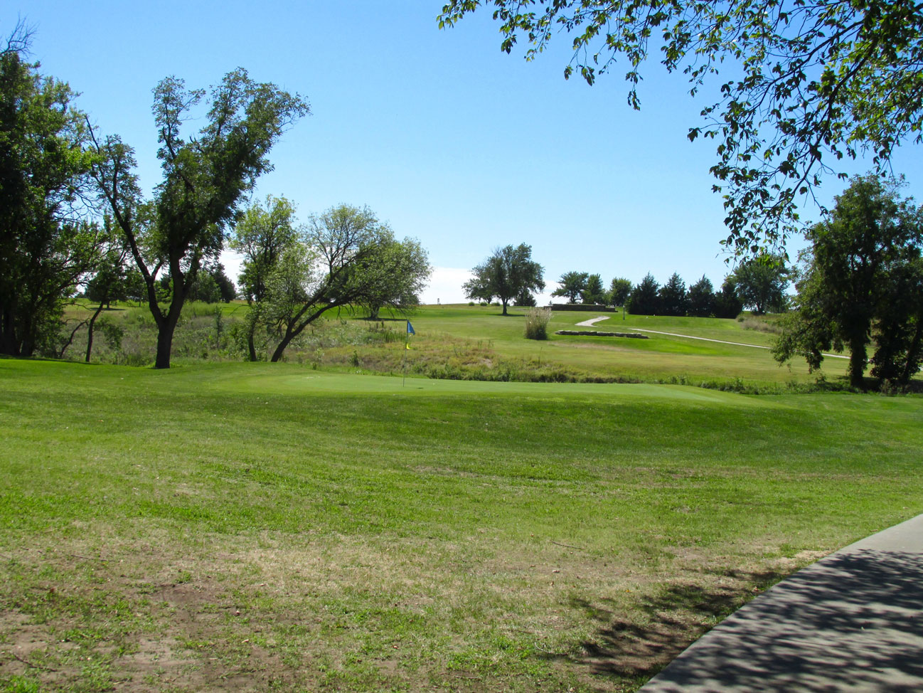
Marion Country Club Golf Course looking Southeast
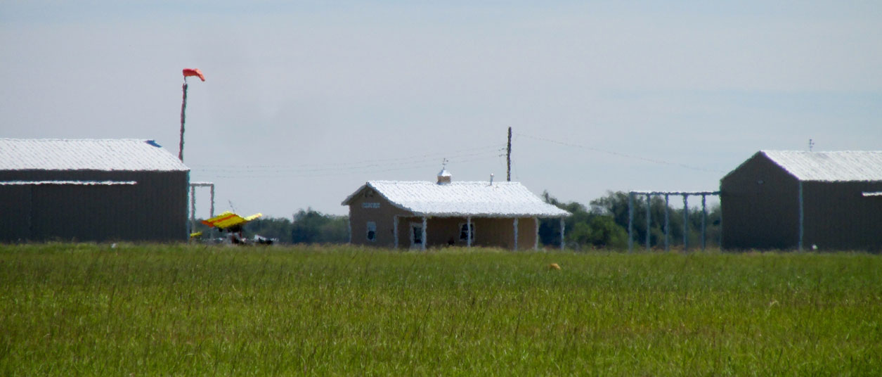
This telephoto of my plane and the airport building gives you an idea of the heat of the day and the Northeast wind.
Volunteers Make It Happen
Marion uses a system that I have experienced in a few towns. When you need gas at the airport, a phone number is supplied and one of the pilots will come out to the airport and unlock the pump for you. This day it was Jim Braden who does aircraft mechanical work at the field. I am very appreciative of Jim. He and I had a good discussion about aviation while I pumped 5 gallons into the tank. When it was all said and done, I can’t remember why, but I couldn’t make the payment. Either Jim had no change or their credit card machine wasn’t working or something so Jim told me to just call Cardie Oil when I got back to Wichita and I could send a check to them. If you remember earlier in the story, I featured a shot of Cardie with the baby pump jack out front.
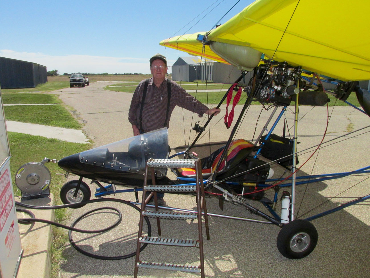
Jim Braden and my Heavy Iron
TCB Before Catchin’ The Wave
Usually I take all the aerial photos of the towns I visit upon arrival. That way if on the way home the weather changes for the worse or the lighting conditions have deteriorated while I am walking around, I will have some good pix. The Marion Adventure did not allow this as I was “bumping’ easy” (nearing empty on the gas) upon arrival. I wasn’t concerned about the aerials, though, because the report the day before for a clear sky looked to be golden – and it was. So, upon exiting the airport airspace, I endeavored to circumnavigate Marion and get as many choice shots as I could. That’s what you’ll see now.
(BTW, TCB is an Elvis line meaning “Takin’ Care of Business”. He had many diamond pins and gold necklaces made sporting “TCB” that he would hand out to special friends.)
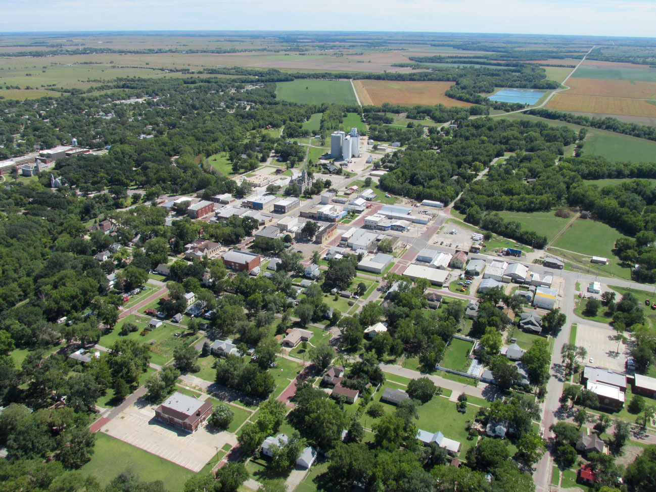
Marion, Kansas from 600′ AGL looking West
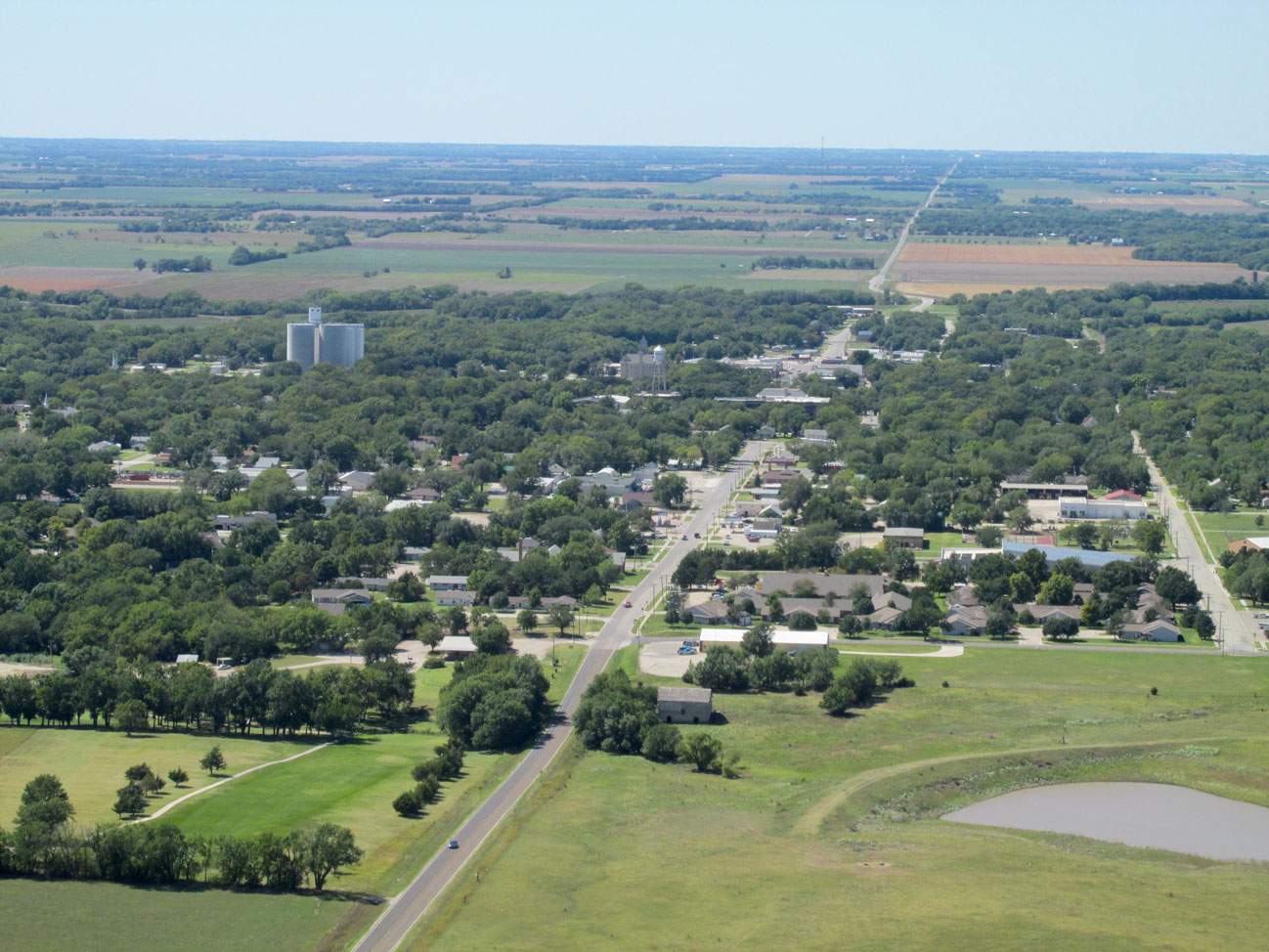
Same as above with telephoto lens
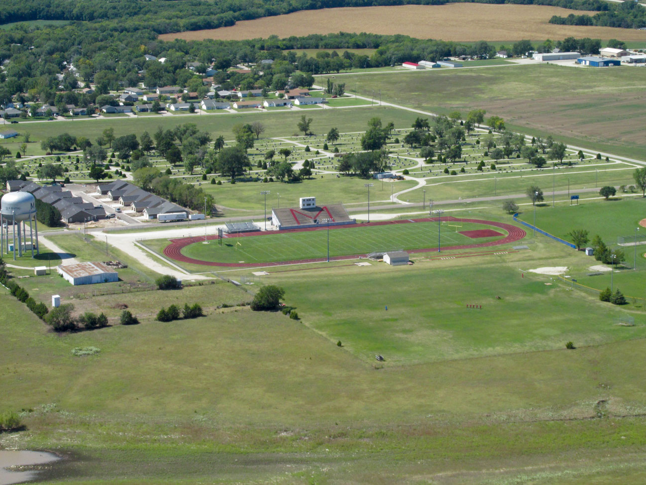
Marion’s Football Field with the Marion City Cemetery behind it. This is looking Southwest from about 600′ AGL.
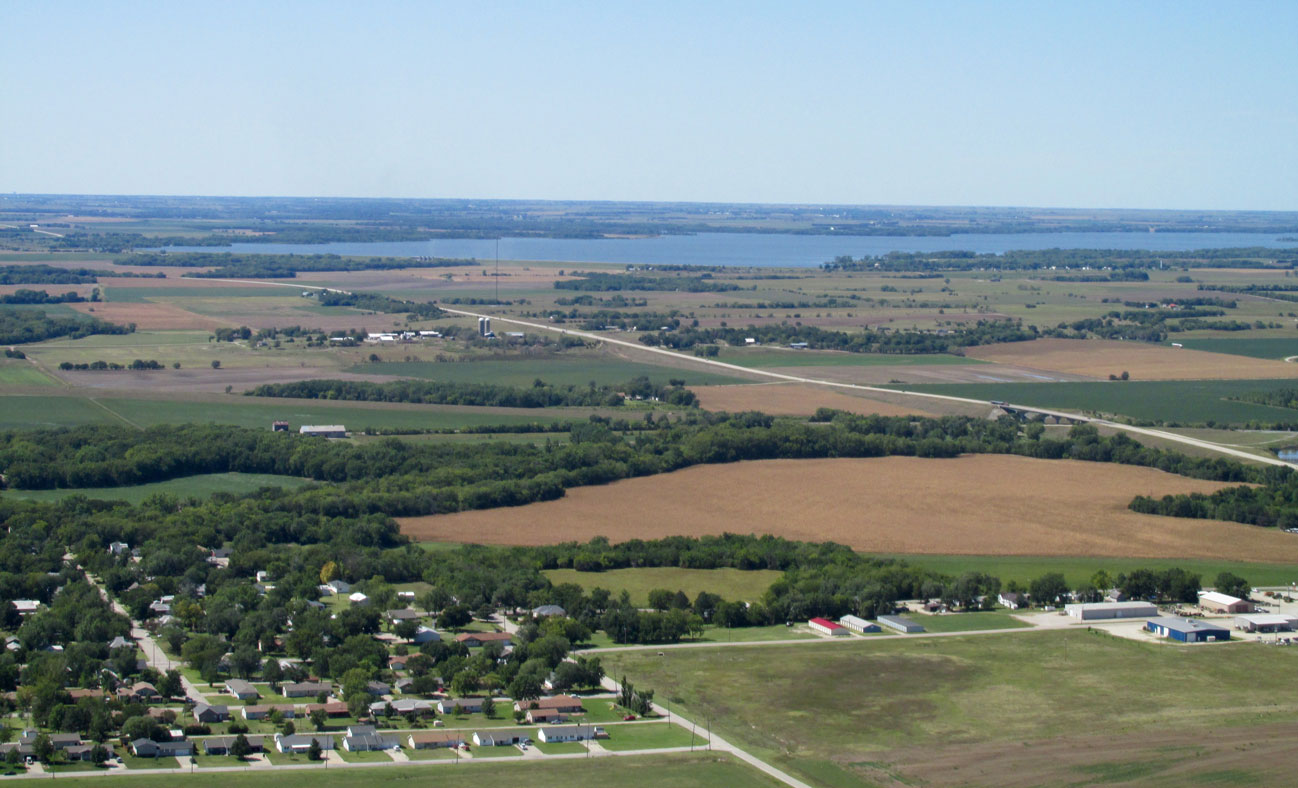
Marion Lake is 4.5 miles Northwest of town. This was taken at 800′ AGL looking West Northwest.
A wide shot of Marion looking Southeast from 800′ AGL
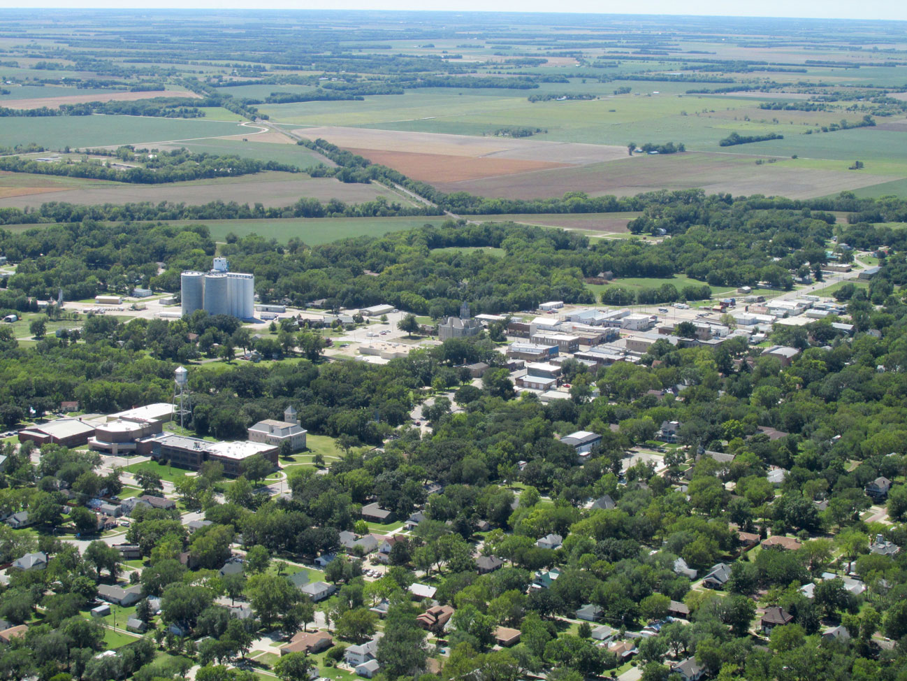
A telephoto from the same location as above. Among other highlights, in this you can see the downtown area I just traversed. Also, The High School building where The Father and Son were flying the kite. Seeing this now I wish I had walked to the Co-Op but I just can’t get everything…
While scaling the heights I realized Mom and Dad’s Restaurant was below. See if you can pick it out!
I am now on the Northwest edge of town looking Southeast from 800′ AGL
Suddenly I saw the opportunity to photograph the front of The County Hall without trees obstructing. I “went telephoto” and here you have it.
Back To The Country
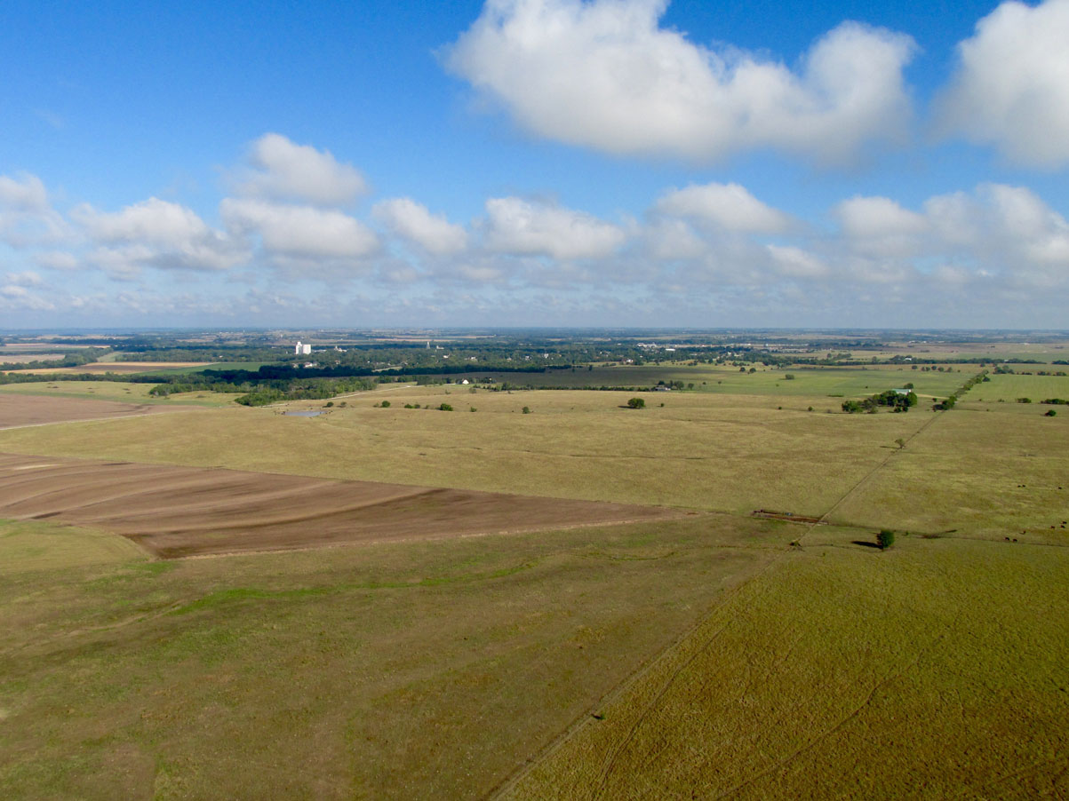
It was time to leave city life and head back to the country. Both have their appeal and I do my best to capture that of each. Here’s what I saw on the way back.
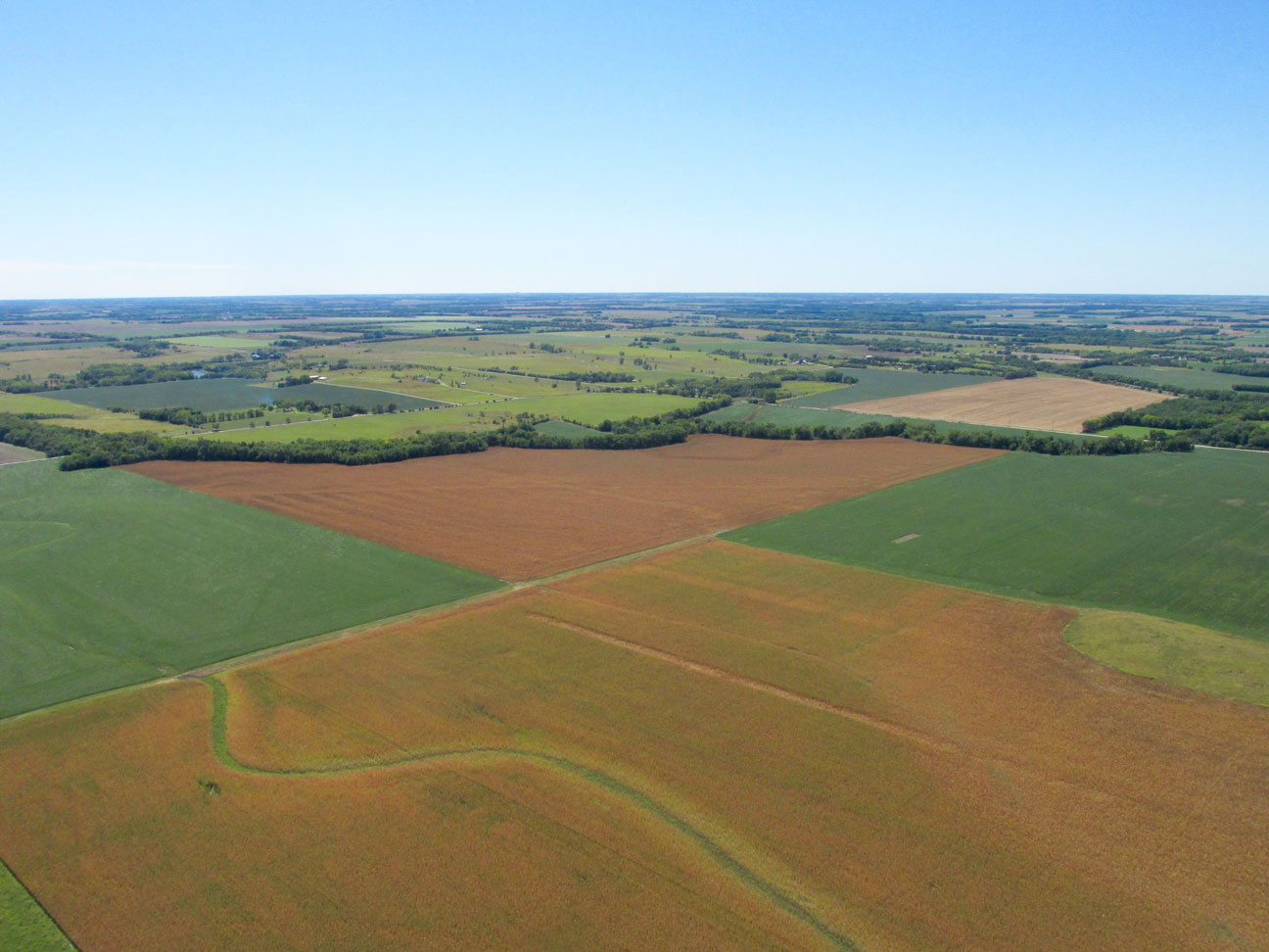
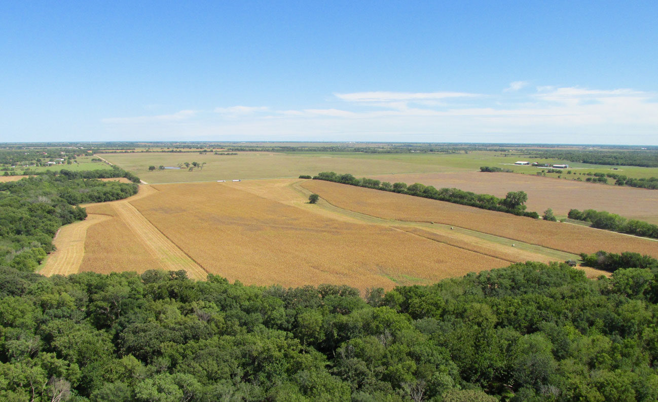
Beautiful Earth Tones on the Great Wide Open!
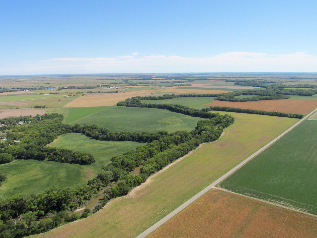
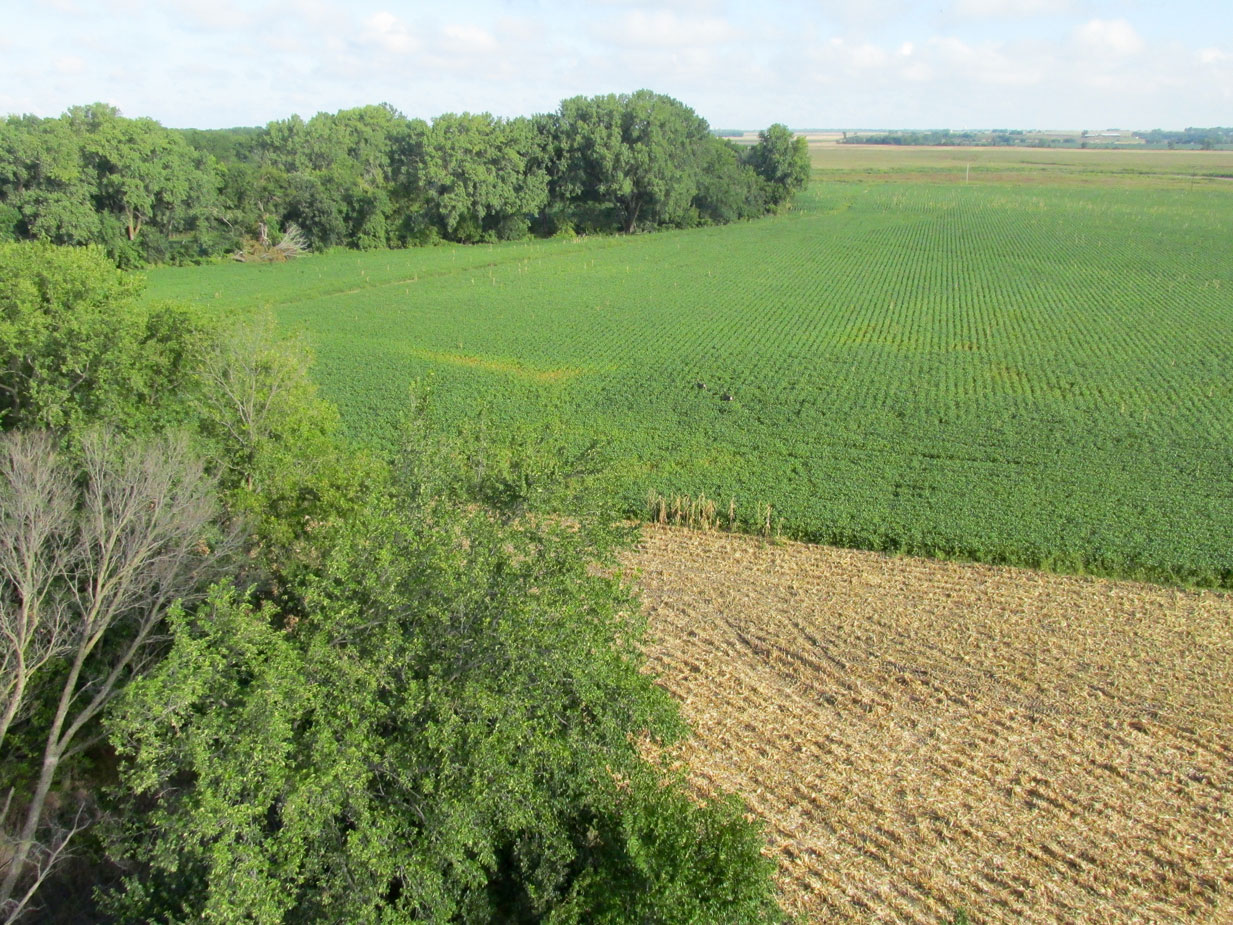
Interesting patterns of creeks and trees interwoven among crops of tan, green and gold.
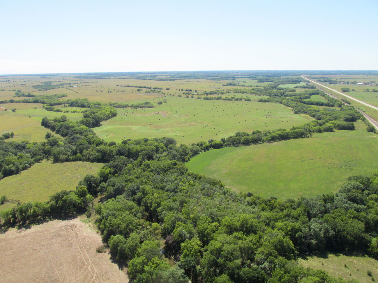
A sight that always brings a smile to my face are fields covered with big, round hay bales.
I am thinking this is a dairy operation. I always swing wide around dairy cattle as they are finicky.
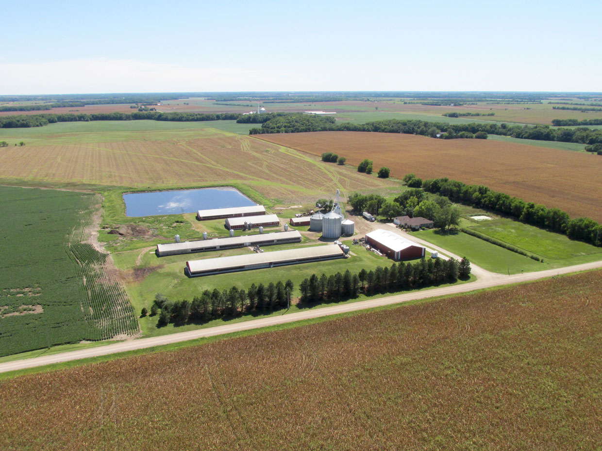
I believe this is a big hog farm.
I have yet to figure out what crop this is being harvested. Beans? It sure has a nice look to it.
I was concerned about fuel on the trip back so I did not detour over to get a closer look at Potwin, Kansas. This is from 300′ AGL looking East.
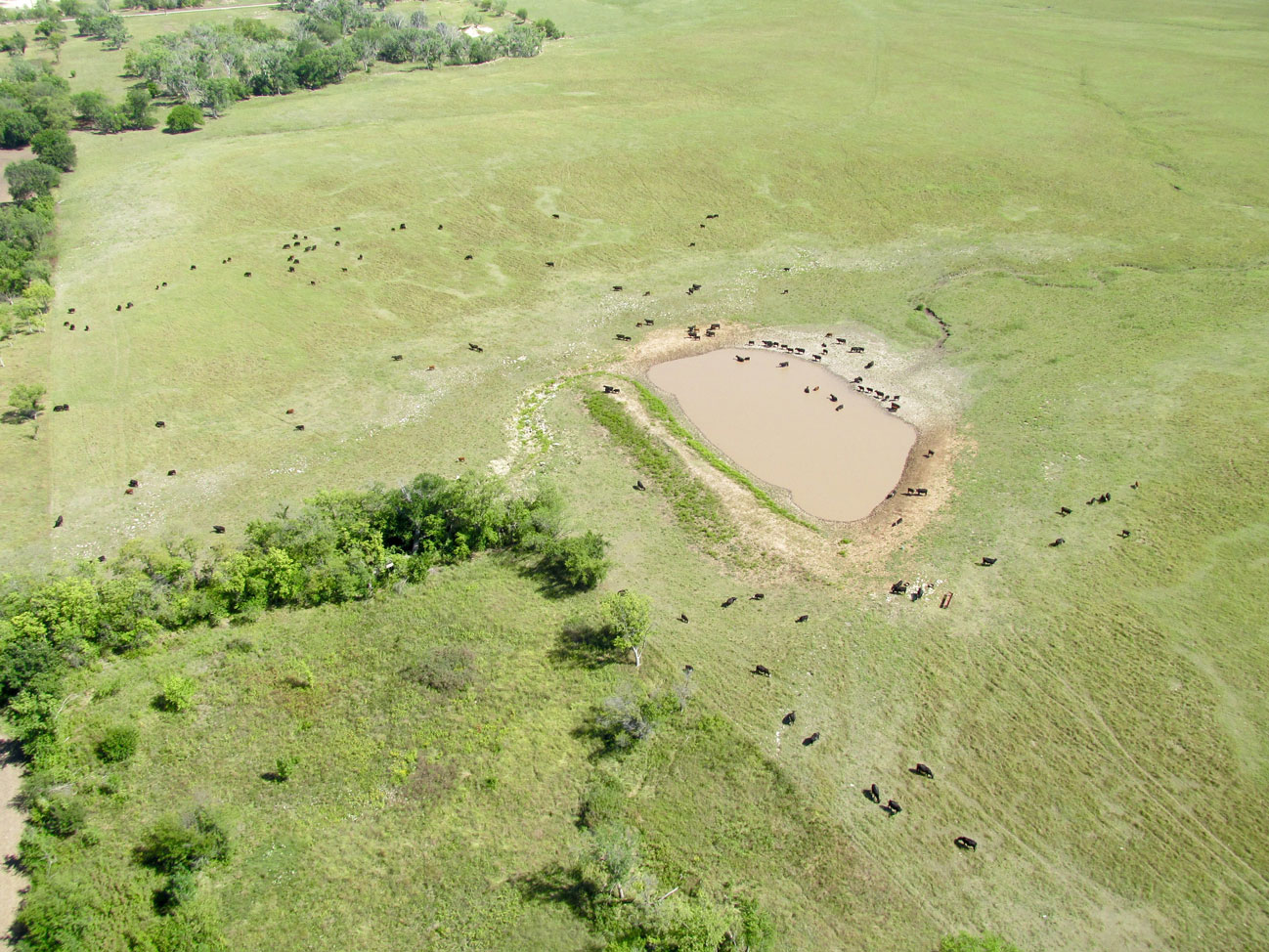
From 800′ AGL, these cattle looked like fleas on blanket to me.
On the road at the North end of this field you can see two grain trucks…
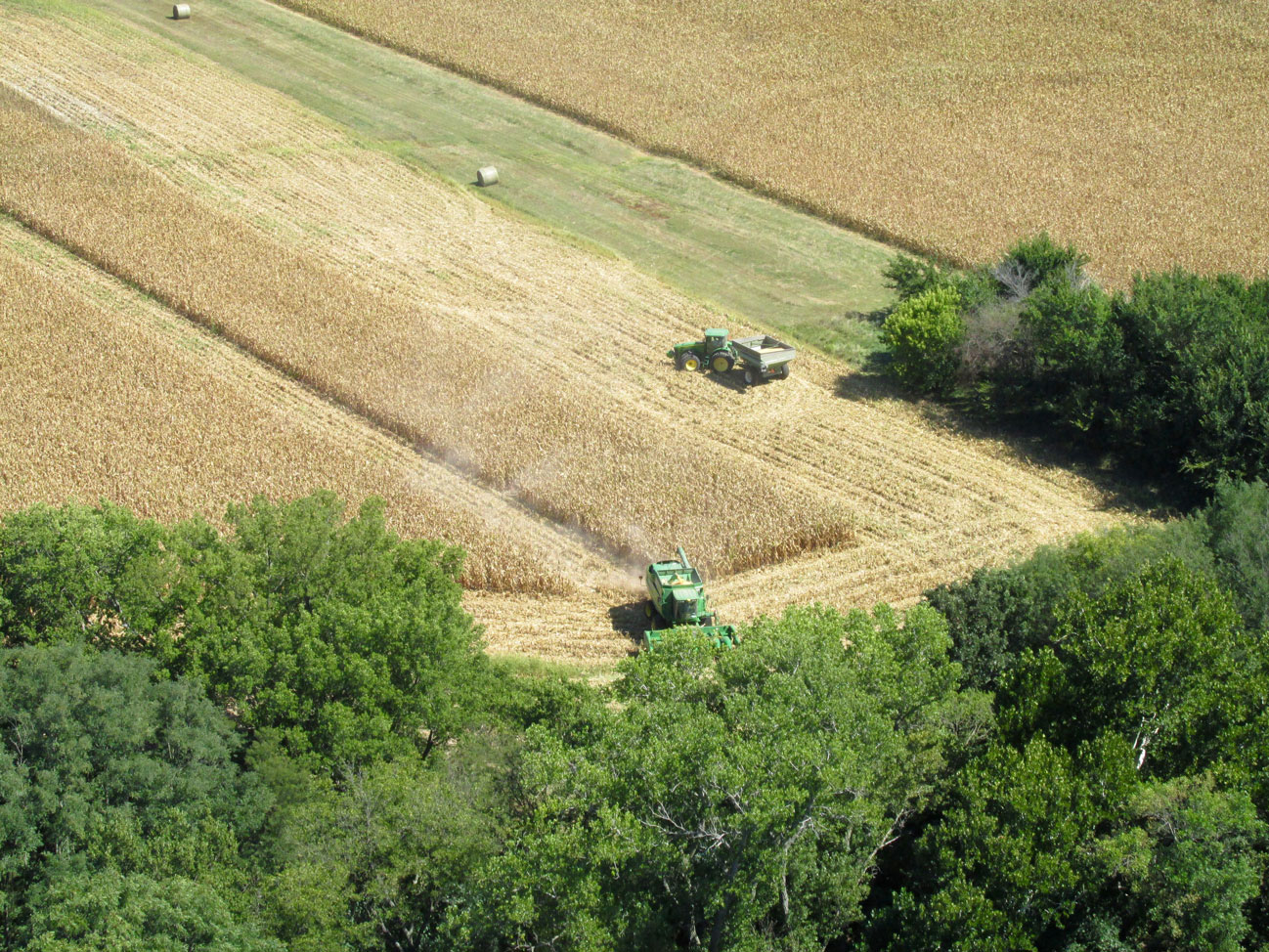
…waiting to be filled up by these guys.
The sun reflected just as I hit the shutter button.
I post at least one “GlennView Shot” a Safari. In this one, just ahead is a private grass airstrip I happened over.
Today’s Yellow Brick Road (Hwy 254) meandering into Wichita, Kansas in the distance. From 600′ AGL looking West.
Over yonder is Santa Fe Lake from 300′ AGL looking West. Adjacent to it is an airfield there where my Buddy Steve Cannaby lives. He is featured in a story HERE.
No caption required
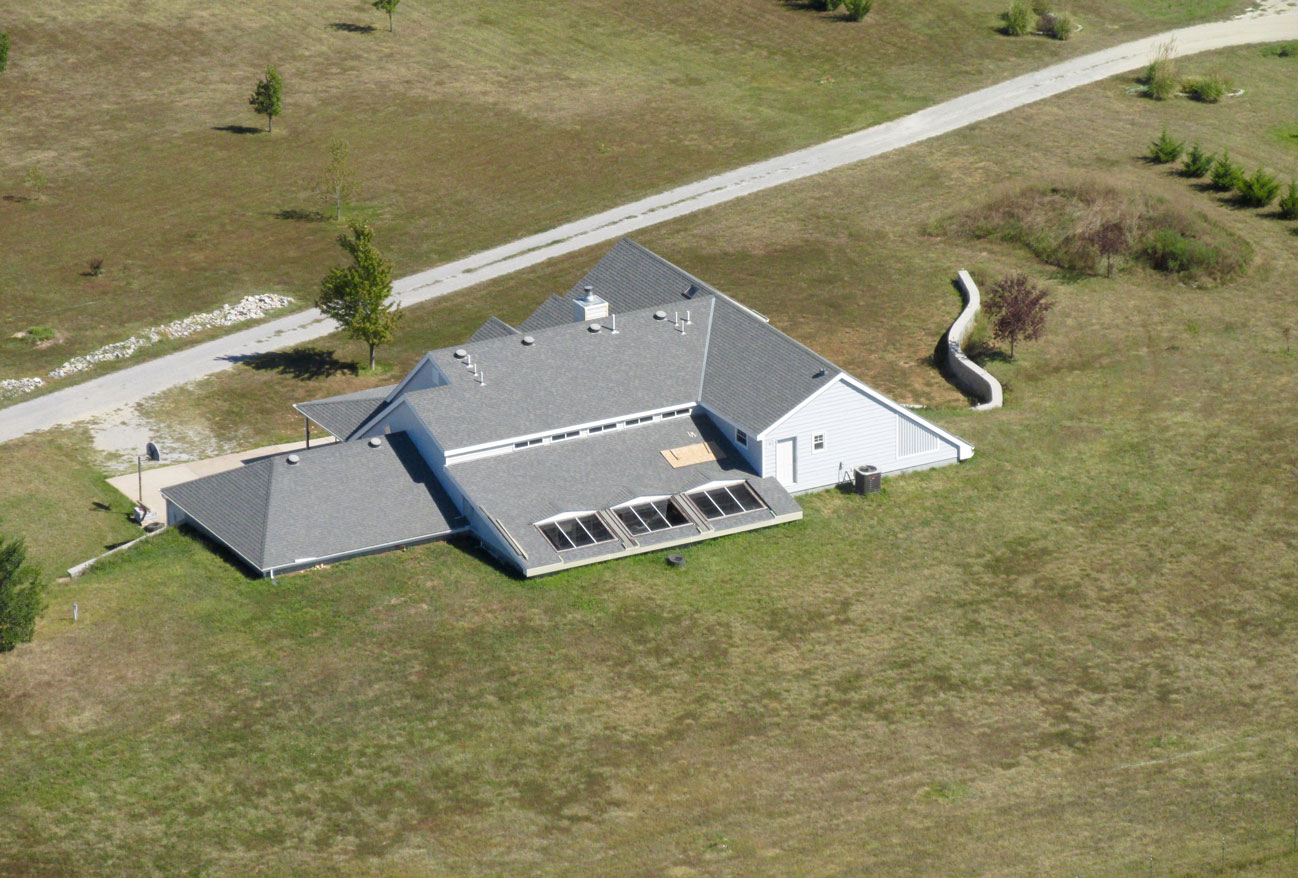
A Semi-Earth Sheltered Home
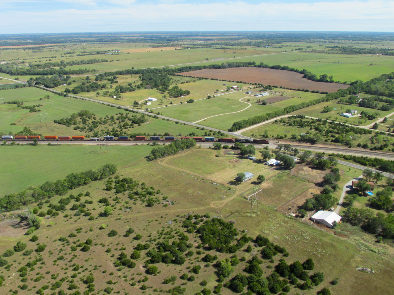
I decided this colorful train heading into Rose Hill, Kansas deserved representation in this story.
Butler Airpark
In the near future, Butler Airpark will figure large in the lives of The Sky Surfer and his Wahine Debra. That will be the subject of different story. On the return from Marion, though, I detoured over it to see if my Buddy Chuck Gantzer might be out and about. If he was I planned to land and say Hi!
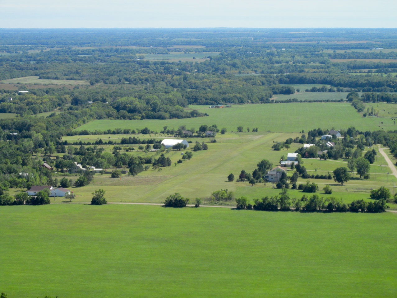
Butler Airpark from 600′ AGL looking South from about 2 miles away.
Chuck lives in the huge Quonset Hut Hangar-Home you can see toward the center of the shot above. I made a pass around the pattern. Chuck came out and waved. That confirmed he was home so I landed. Chuck is an avid flyer and owns a Pietenpol homebuilt airplane he made himself. He actually handmade the propeller! Chuck also produced many movies about the Piet of which he sold a lot over the years. He has an excellent “rep” in the Pietenpol community.
In addition, he has designed his hangar home to be “off the grid” complete with solar power electricity and heating. When completed, it might be a subject for one of The Sky Surfer’s documentaries…
Neighbor Jim Smith, who owns an RV-6 he built, happened along so I regaled them both about my Marion journey before flying back to Blue Sky Aerodrome.
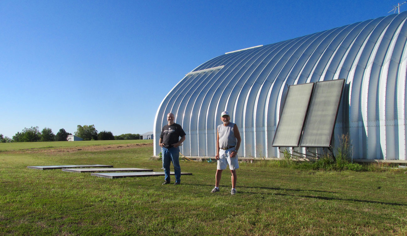
Chuck Gantzer and Jim Smith
Sometimes You Don’t Know What You’re Looking At
The final leg of my journey was from Butler Airpark to Blue Sky Aerodrome. This path took me across the South end of Rose Hill, Kansas. I have taken so many pictures of Rose Hill over the course of doing The Flite Blog™, I decided to give the town a rest. But, that isn’t to say my roving eye was not scanning horizon to horizon for other targets of opportunity. Due West of Rose Hill is Cook Airfield. It is a burgeoning Residential Airstrip similar to Butler Airpark and many others. Since the atmosphere was relatively clear, I decided to try a “compression shot” incorporating both Cook and the Wichita Skyline. Since I was moving right to left at a blistering 50 miles per hour, there would be a short window of opportunity to line them up and take the shot. I snapped off a few while “in the zone” and have included the best of the three I took. Actually, it is not the best shot but the picture you will see below contained an element I only noticed while reviewing my photo cache for this story.
HINT: Cook Field is home to Air Capital Drop Zone – a sky diving club. They fly on weekends and afternoons. Many times I have landed at Cook to watch them descend. Look closely and you will see evidence of The Club in action.
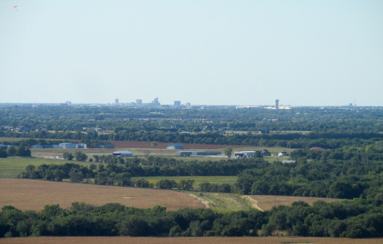
Cook Airfield in the foreground with Wichita at the horizon. I am at 400′ AGL looking Northwest.
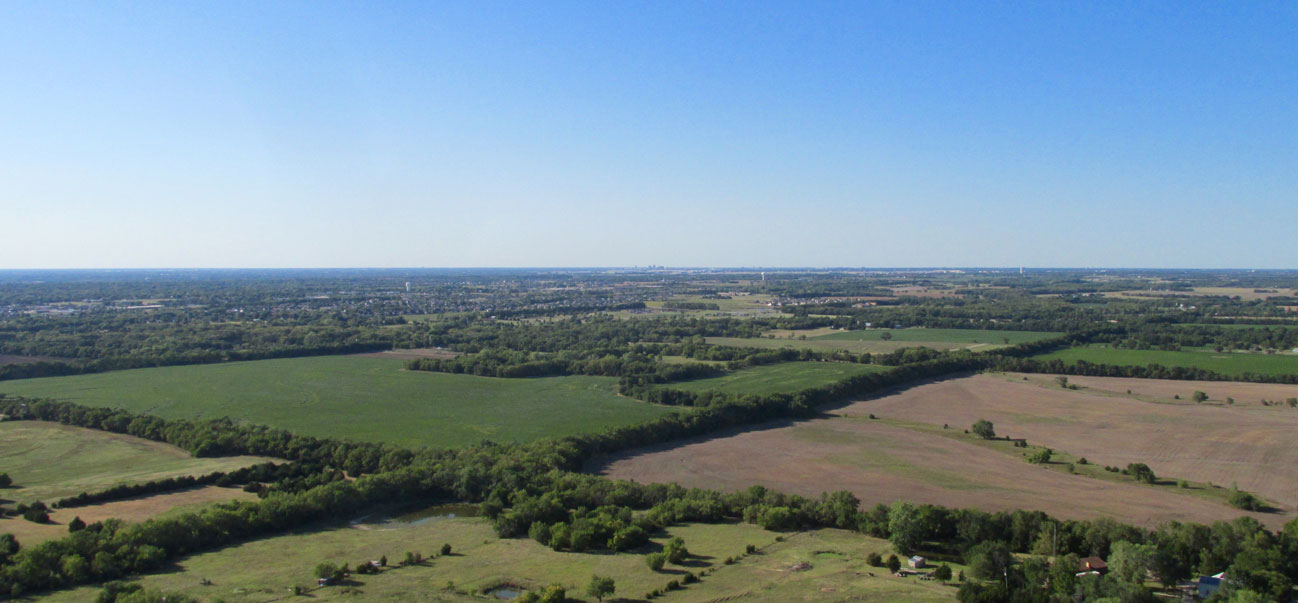
A a mile or two later I shot this panoramic featuring lush crop land, Derby, Kansas at mid and Wichita’s skyline at the horizon.
Another Changeup
Since I have taken innumerable aerial photos of Blue Sky Aerodrome (formerly named Selby Aerodrome in earlier reports), I decided to give it a rest, too, and finish on another item of note under The Surfer’s wake. I present Round Barn Ranch. The first time I flew from Selby Aerodrome after buying my Quicksilver, I noticed this edifice. Upon researching, I discovered this design was once quite common for dairy farms. Now an anachronism, the owners have restored it for use as a venue for weddings and other events. On this day it looked to me like a family reunion.
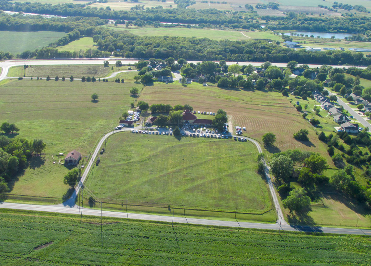
Round Barn Ranch of Derby, Kansas
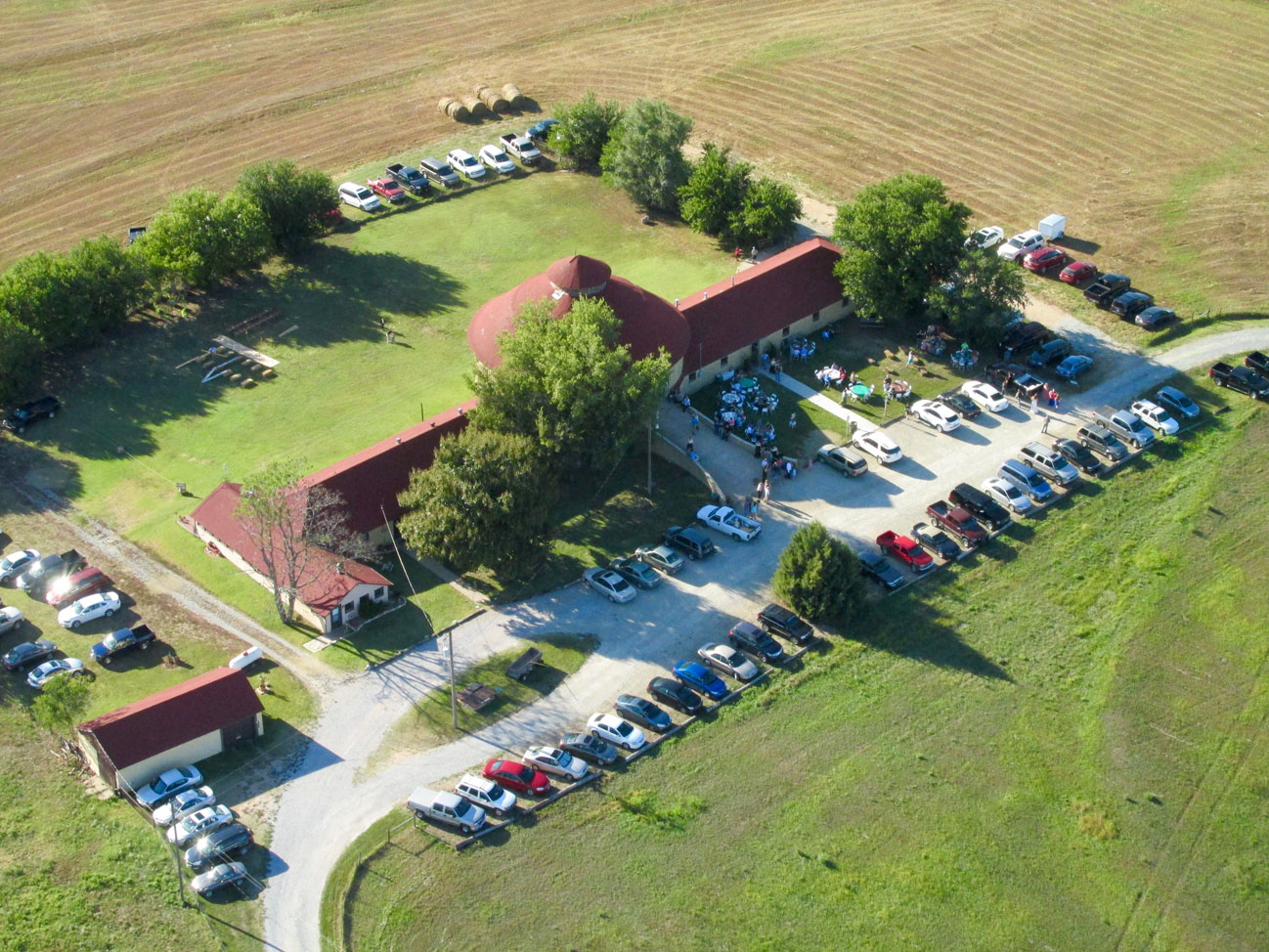
With picnic tables out front, the makings of a family reunion are in progress below.
A Safari Of Safaris
So how did the impromptu Rhino Hunt end? Out of 60+ Rhinos in town and I bagged eight. I got my quota, had a wonderful visit to Another Jewel of The Plains and was able to meet some of The People who call it home. That was the Sky Safari to Marion – The Rhino Capital of Kansas!
Blue Skies & Tailwinds!™
Brian FitzGerald – The Sky Surfer – Wichita
Great Safari once again!
I have to wonder where the other 52 Rinos are hiding.
Thanks, Marlon! It seems to me there is a map of all the Rhinos available but I can’t remember where to get it. At least I know where you can see pictures of all the Rhinos.
Here: http://www.marionks.com/rhinopics.php
I hope you have been getting some flying in. I have been grounded from bad weather for a while. During that time I have been working on a new POV movie called “Mustang Valley”. It will be done soon. I think you will like it.
Blue Skies & Tailwinds!™
Brian