Static Front
In the days around 27 July 2013, Central Kansas was under a static front. While not a “front” per se, it is a term my Dad used to describe weather that was not moving. Winds were mild and out of the North – conditions which had brought welcome rain.
Conditions such as these allow for flying to destinations other than South during The Flying Season. I save the destinations South for days when our prevailing South Wind is in force. I looked on my planning map and my attention was drawn to Yates Center, Kansas. I had never been there before and it looked interesting.
Yates Center, Kansas – Woodson County Seat, a Place of “Living Waters” and Home of Entrepreneurs and Great Fliers
Although I had already printed the AirNav.com page of Yates Center airport data, since I was sitting at my workstation, I decided to look it up on the computer. I wanted to get the telephone number for the Airport Manager. Strangely enough, this time I could not find the listing so I got up and pulled the printed one from my collection. I called City Hall and they told me the airport had been de-commissioned but that I could call the man leasing the property to raise hay – Charlie Davis. If he didn’t mind, I could land there. I got Charlie on the phone and he was very enthusiastic. He said he would give me a ride to town when I arrived and offered his phone number. I thanked him for that generosity but told him I could be up there quite early and would not bother him on arrival but rather look for him later that morning. I prepared to fly to Yates Center the next day. I was determined to be “wheels up” before sunrise…

The Quicksilver highlighted by a colorful daybreak.
I had fueled up and pre-flighted the plane the evening before so all I had to do was roll it out and start it up. This is the first flight all season that I was actually airborne before sunup.

Proof!
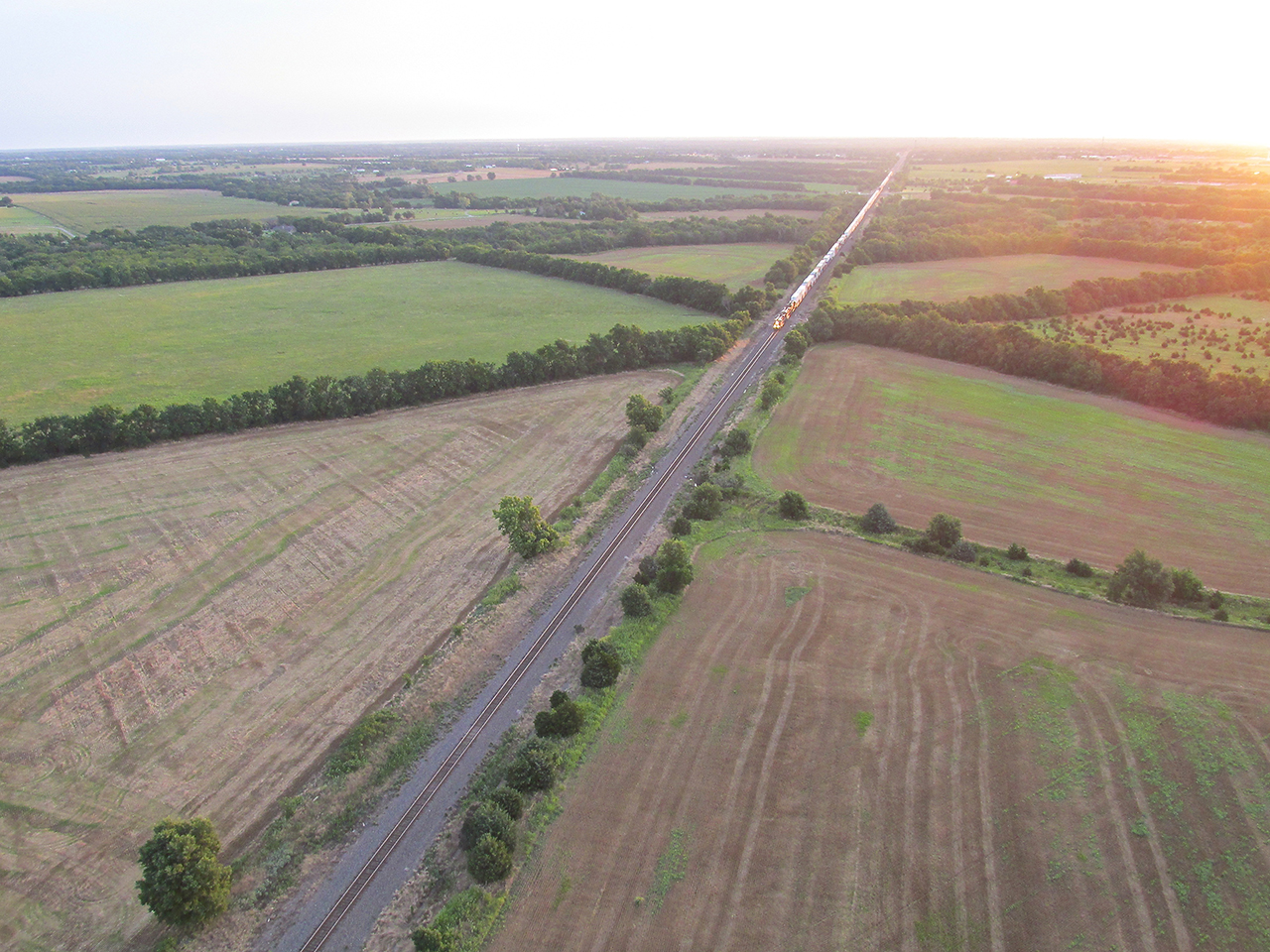
A train heading West through Rose Hill, Kansas. Note the headlights on the train. It was much darker to the eye than this photo portrays as the camera enhanced the light to a significant degree.
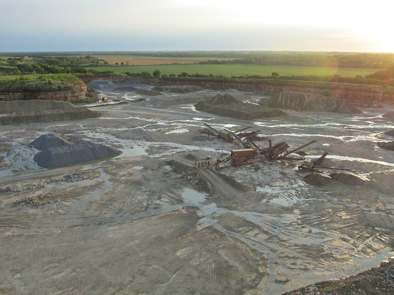
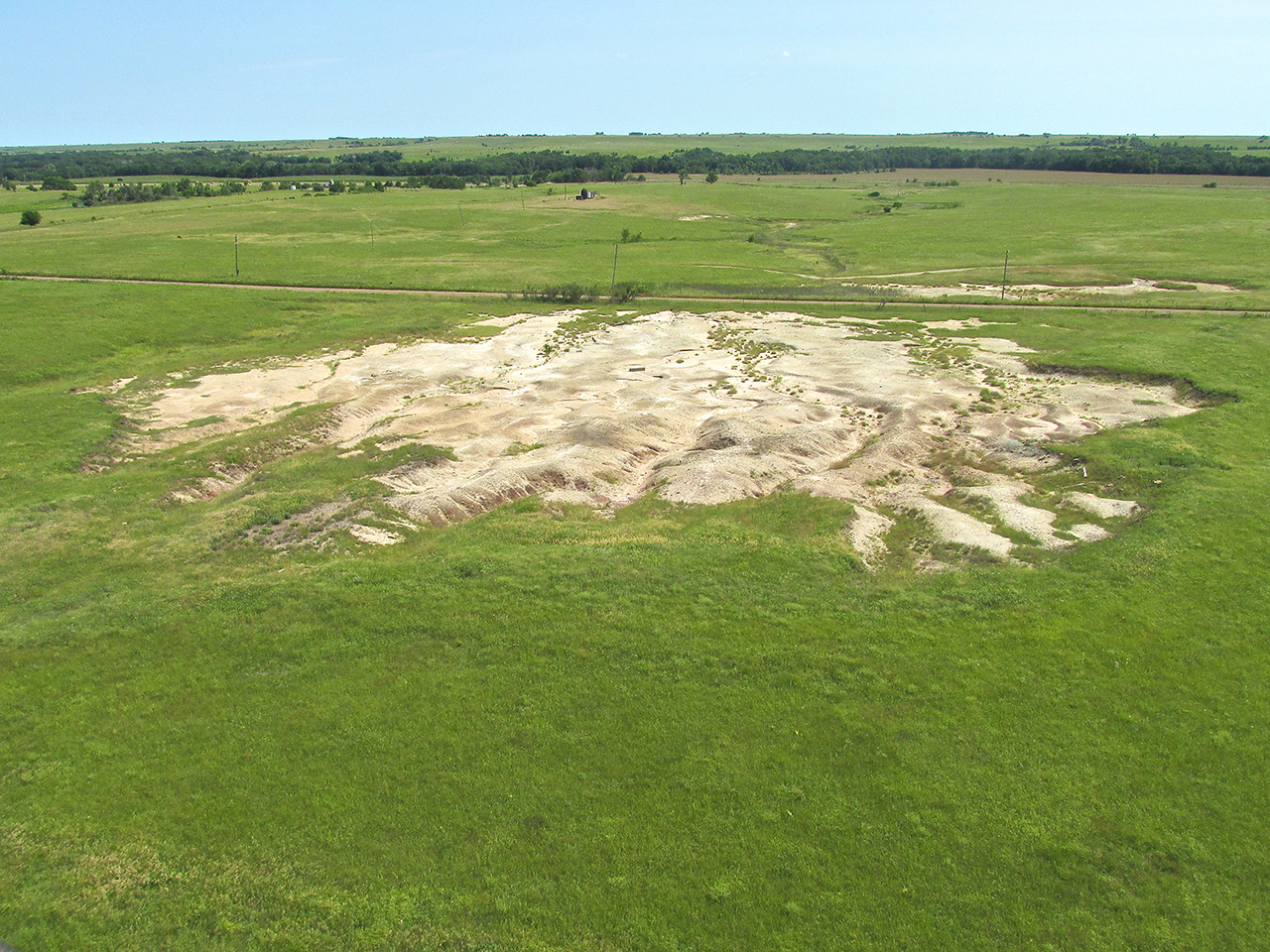
This is Southwest Butler Quarry. The incredible volume of rain we have been experiencing this Summer is evident.
Having flown over this quarry for years I am constantly amazed how much gravel they continue to pull out of it.

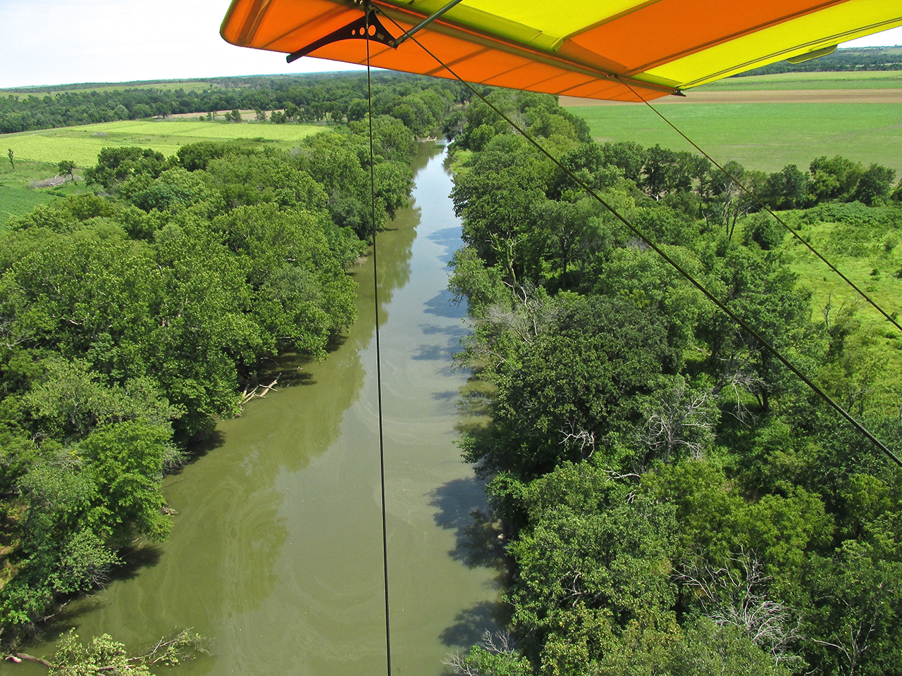
Many times on the way to Beaumont, Kansas I fly to the North of this lake. Today I was surprised to see it directly on my path as I topped a ridge. I was barely able to snap this shot in time. I was flying down the dam to the left.
The Flint Hills
In a previous story I had shown off my new dark tinted goggles bought for use when flying directly into the sun. Since this flight to Yates Center was also at sunrise and flying directly into it, I put the batman buggies to work again. But, it was on this morning I found their “failure mode”. For me, sunglasses of any type (and that’s what these are) only function in a “high contrast visual environment”. Wearing them in “flat” lighting (no highlights) like what happens on an overcast day, just makes everything harder to see. In photographic terms, it is equivalent to putting Neutral Density Filters over your eyes. You lose a few F Stops. It is like driving a car with deep tinted glass at night. It just doesn’t work for me.
I switched them with the clear goggles I also had brought. Suffice to say, it is no mean trick to do this in a 40 mph wind with no place to put anything down…
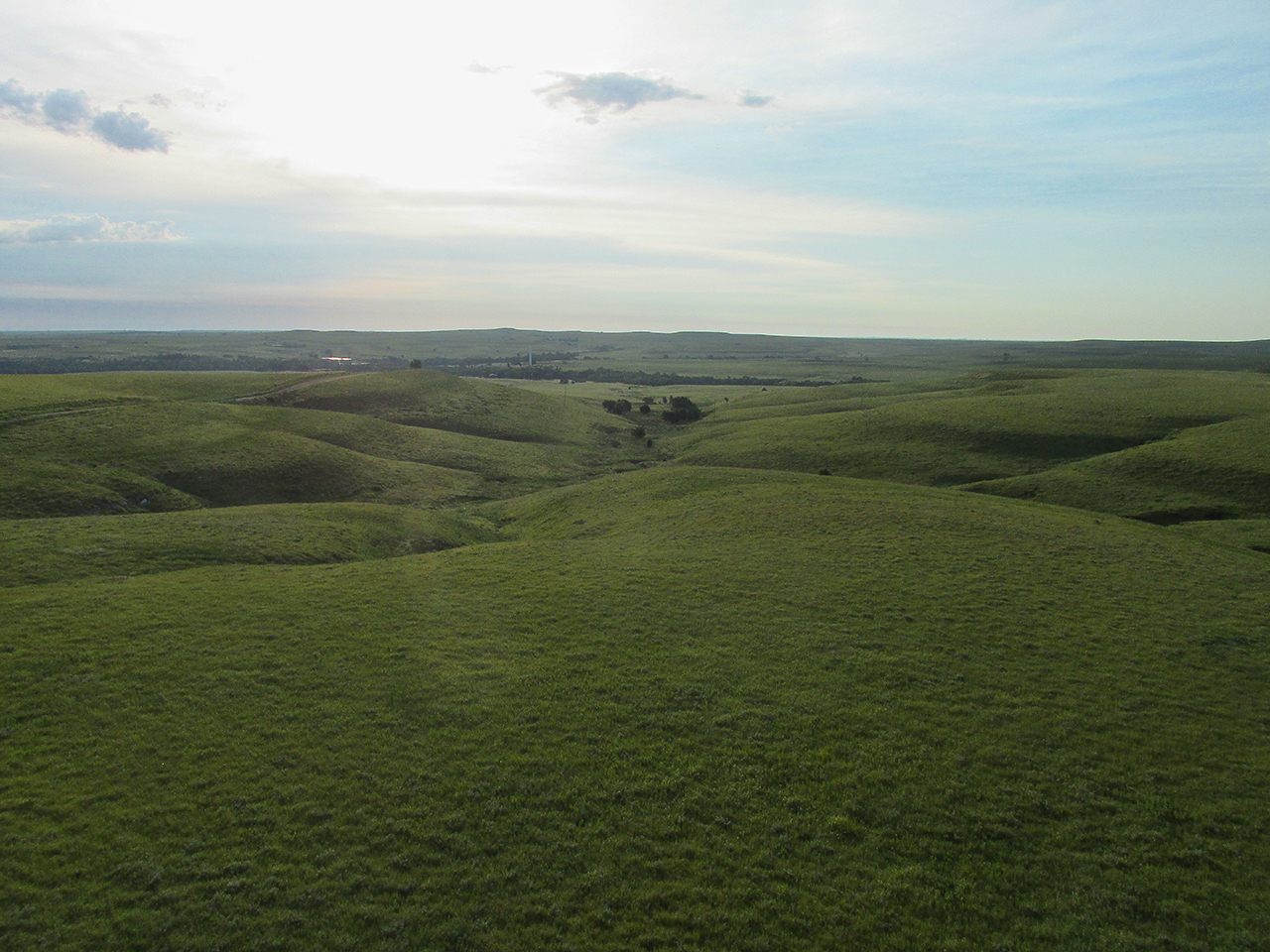
This looks like the official entry point to The Flint Hills!
This is looking North from 200′ AGL. In the distance, ominous clouds are moving in.
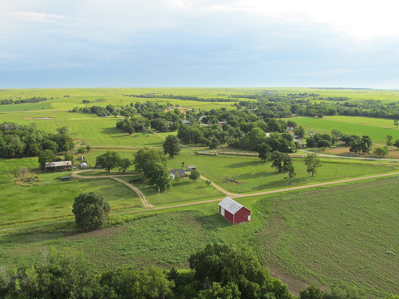
The next two photos are Neal, Kansas. It lies on Highway 54 about 19 miles from Yates Center.
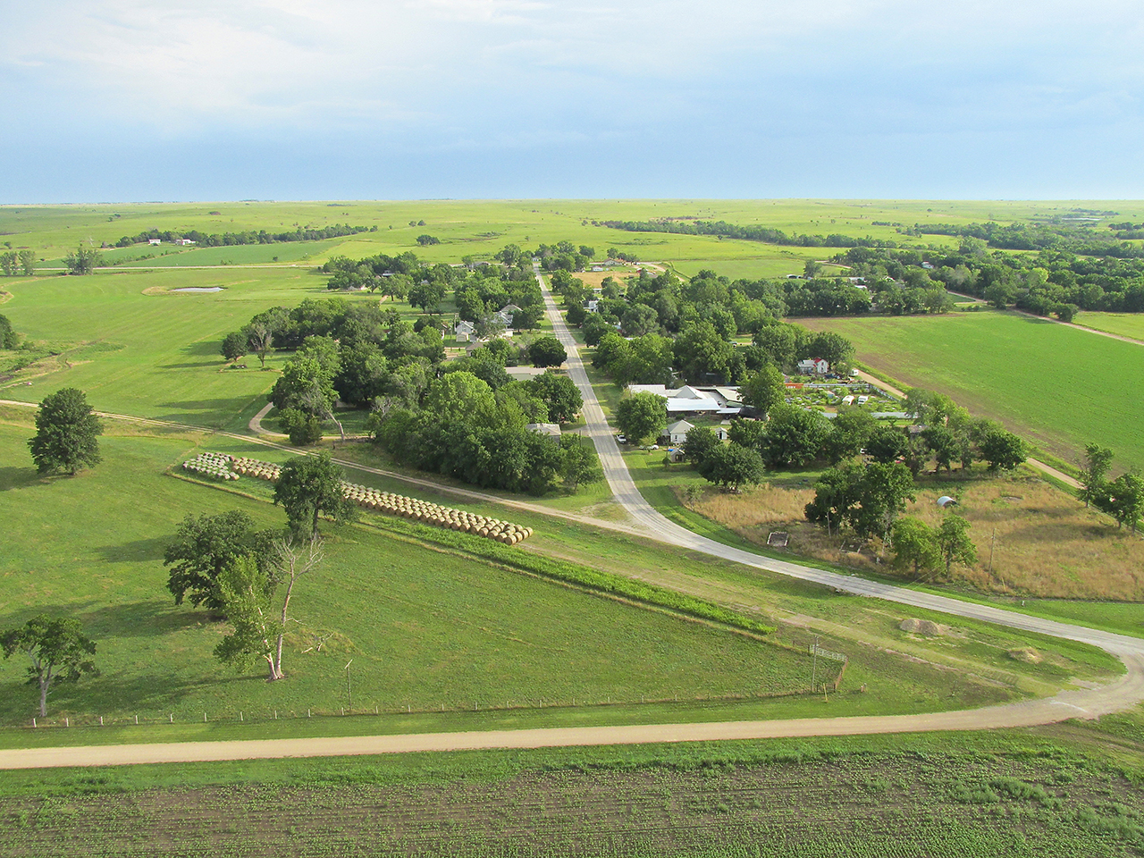
Break Time
I decided to take a break and pull off the road for a minute. This area is like one big landing strip. As you can see in the picture above, hay is prevalent here. A mown hay field is as good as it gets for a landing field. I saw one below on a hill next to some power lines. I settled down on it and quickly came to a stop.
The sky ahead was becoming dark but I saw no lightning.
After looking at the map and taking stock of the weather I started the motor again. Before buckling in I ran Northwest of my MXL and snapped this shot. I was only 5 miles from Yates Center.
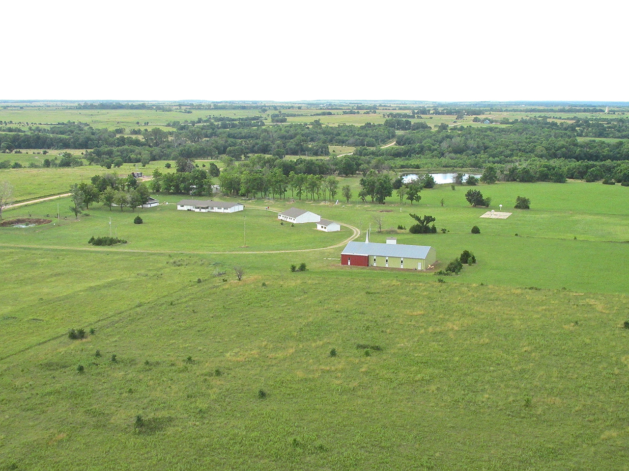
Just outside of Yates Center I saw this place I take to be a Christian Retreat.
Yates Center, Kansas
Just before landing on the hay field and until a good while after I later landed at Yates Center, the wind had built up to about 15-20 mph. It was not a serious impediment but after surveying the sky I decided I needed to get on the ground at Yates Center in due time in case it started raining. The clouds shown in the two pictures taken at the hay field revealed the definite potential for a storm.
I was down low enough (30′ AGL) that I couldn’t see in the distance very far in any direction. Shortly I noticed Highway 54 off to my right (South). It passes through Yates Center so when I saw some houses ahead I decided I was at the outskirts of town. I climbed to get some altitude and a better lookout point. My assumption proved correct.
Grand Tour
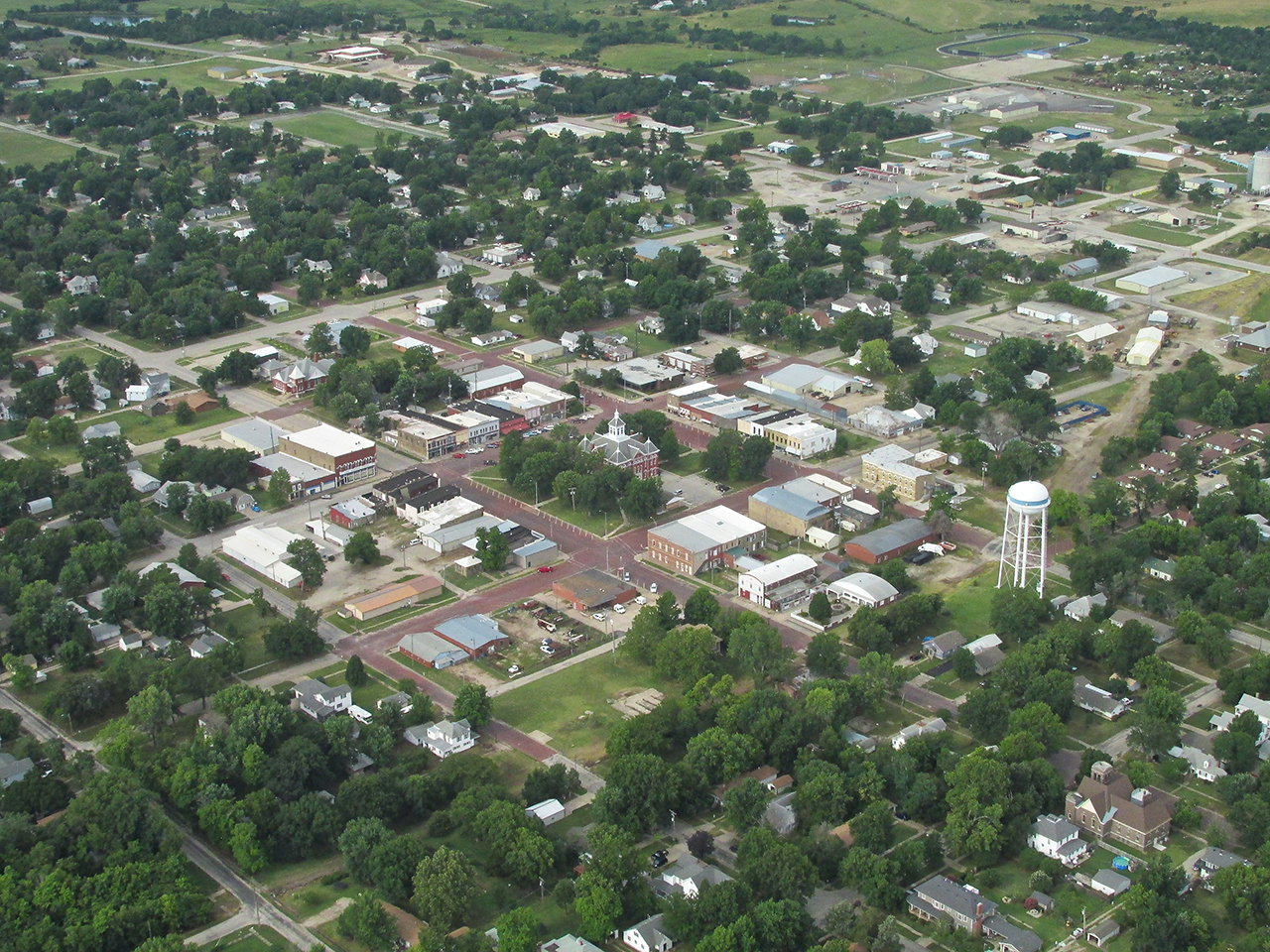
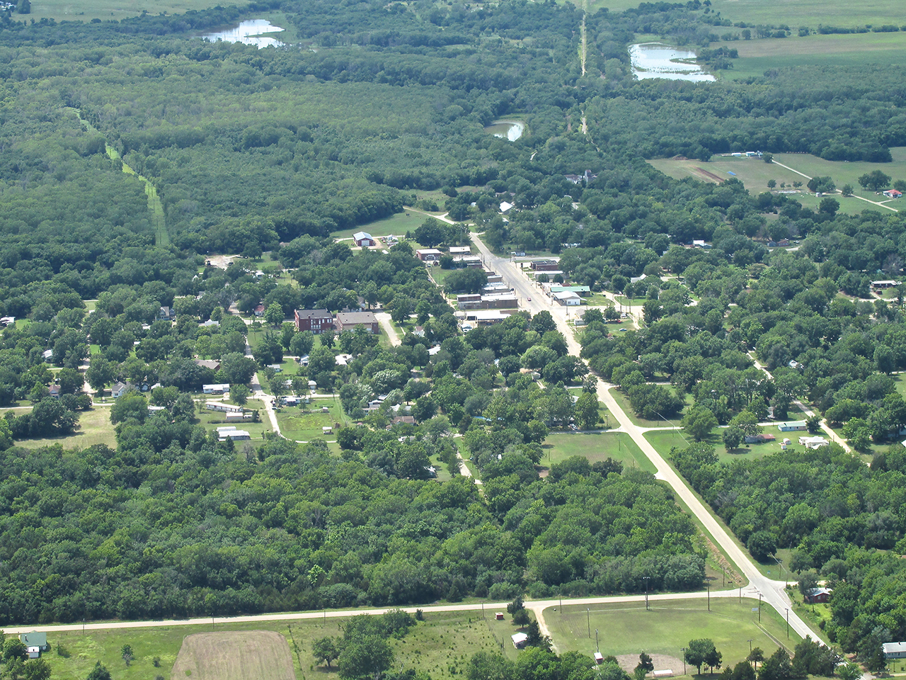
Even though the shortest distance to the airport would have been a hard right, I instead went left in order to circumnavigate the town to the North and East before landing. My general rule is to get the aerial photos of the town I am visiting on arrival. I think they are of great importance to the story and want to make sure I get them while I can. Then, if after touring the town, I need to get another aerial of an important discovery, I can get that shot on the egress. The following is Yates Center from the air.
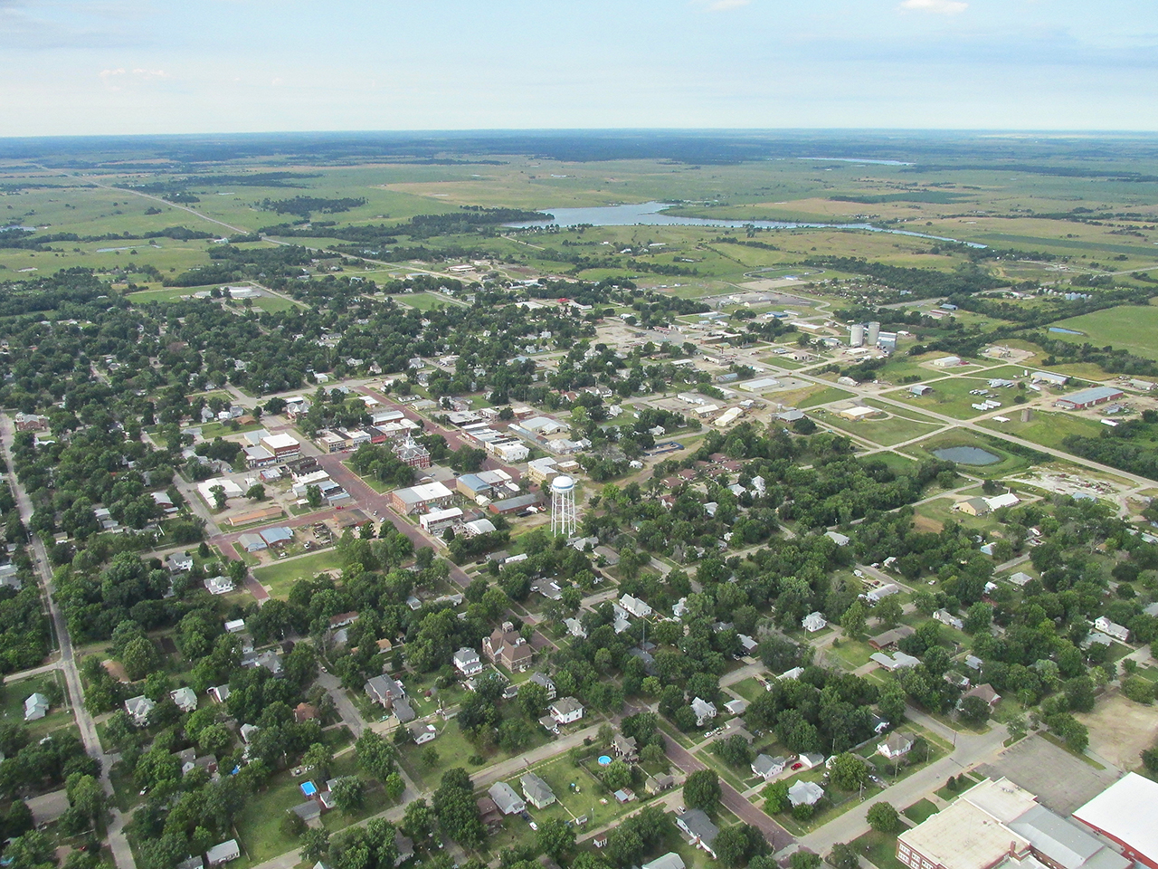
Yates Center, Kansas from 1,000′ AGL looking Southwest.
Yates Center – Town Center
The Center of Town at Yates Center is of great historical interest. In 1875, a man named Abner Yates owned the land around these parts. After The Civil War, Abner had journeyed to Kansas to buy land. He found and bought the only land in the area with what they called “Living Water” (I love that term! Read John Chapter 4). “Living Water” meant natural spring water that did not have to be obtained by digging a well. Yates’ property also happened to be near the geological center of The County. A County Seat was of great importance politically and economically and Woodson County was having no small amount of trouble deciding where it would be. The contenders were Neosho Falls, Kalida and Defiance with Abner Yates entering a bid with an empty square of land with nothing built upon it. At the election held to determine where The Seat would be, Boosters for the town of Defiance cried out that Abner Yates property should be disallowed because having the only free running water it would be far too expensive for the citizens to buy. Abner Yates, though, closed the deal with a brilliant ploy when he loudly declared The County could have the land it needed FREE!
In the photos below you can see the square in the middle of town with the Courthouse right in the Center. Note the attractive red brick boulevards.
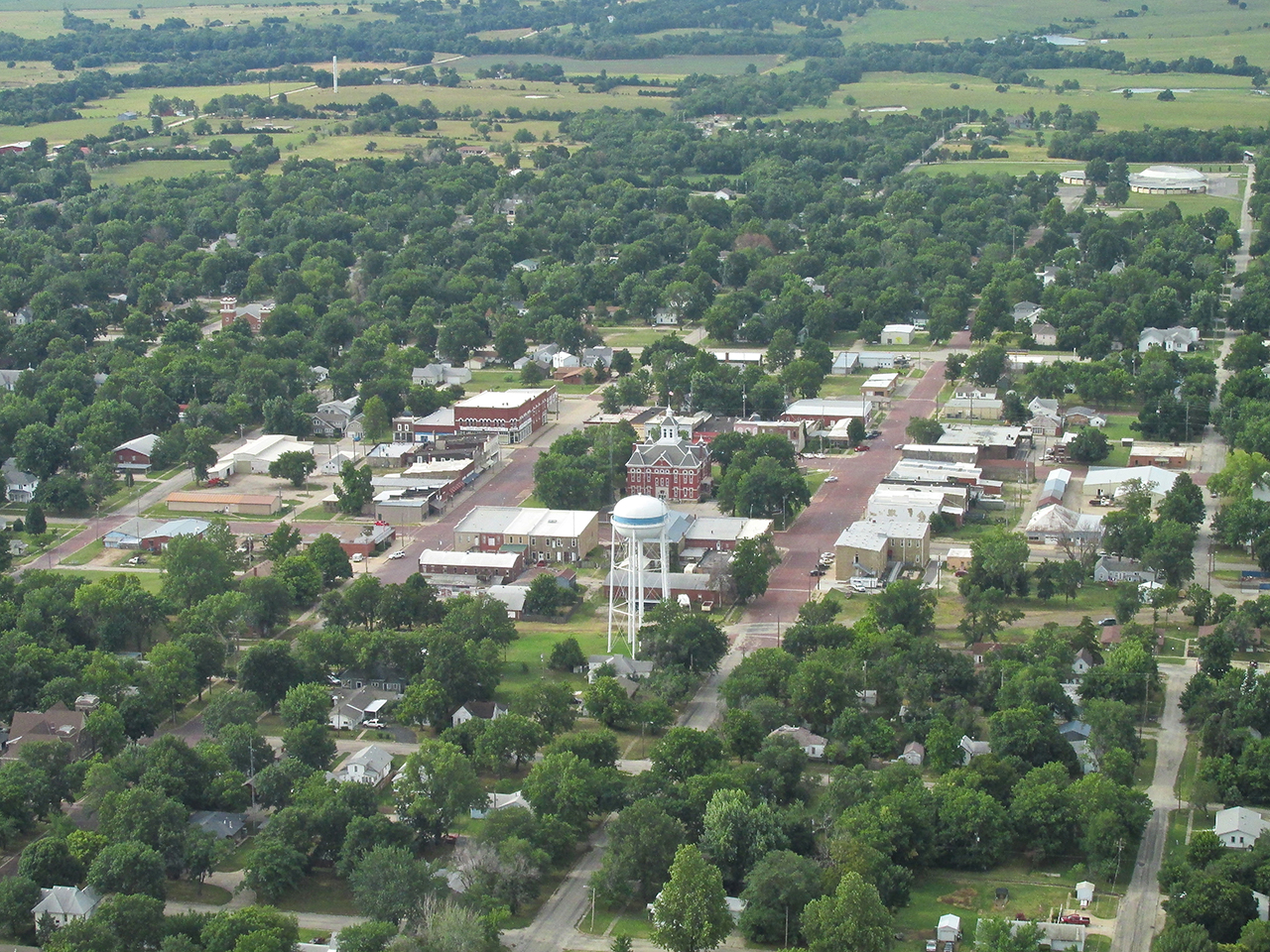
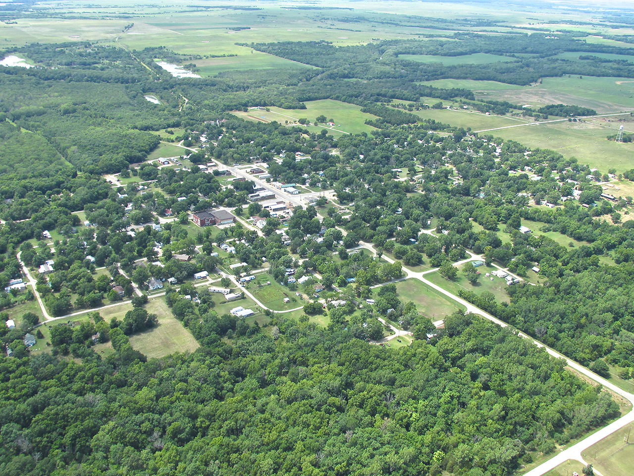
Yates Center from 1000′ AGL looking South Southeast
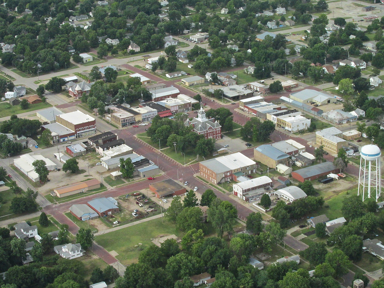
Yates Center from 1,000′ AGL looking Southwest.
A wider shot again from 1,000′ AGL looking Southwest.
Living Waters
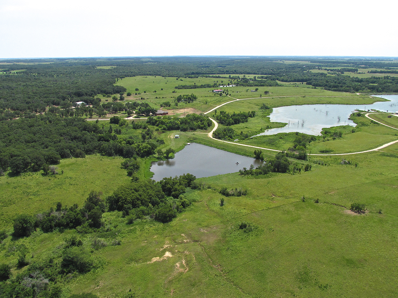
After encircling the town I took the picture below of the two lakes that are Southwest of Yates Center. I am guessing at least one of these is the source of water previously discussed.
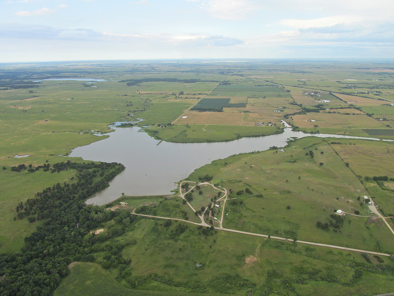
After taking the picture of the lakes I swung a 180 back Northeast to get this final view of the town from 1200′ AGL.
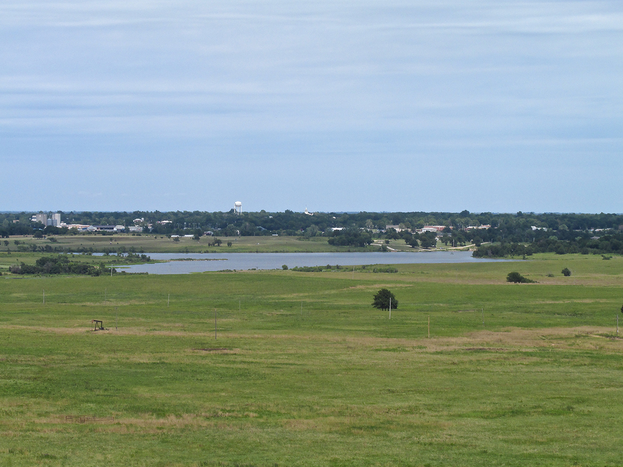
Turning again, now pointing due South from over the Yates Center Reservoir, we see the airport directly in the center of the shot – Looking right down the barrel.
Photo Ops Galore
Believe me, folks, I shoot way more pictures than I put in these reports. Great stuff continually jumps out at me.
While in the landing pattern on downwind just before turning base, ahead of me I saw a charming sight (Hey. Cut me some slack. I’m from Suburbia). I have seen scenes like this from the ground a few times from afar but never from the air. The thing is that while maturing, cattle get to know the rancher well and know when he is bringing some food out to them. It reminds me of my dogs following me when they think I have a treat. In similar manner, cattle will follow a ranch truck across the field.
Concentration Required
Under pressure to get on the ground due to the oncoming bad weather, I didn’t want to go around more than once to capture this scene. Also, like all these shots – it was only going to happen ONCE. In addition, I was concerned so as not to spook the beeves and had to ease in more power in order to extend my downwind leg at higher altitude. So, all in a flash I whip the cam out of its holster at the same time adjusting the throttle and working the stick and rudder. We’re talkin’ a “trick shot” similar to shooting watermelons with a six-gun from the back of a galloping horse. I was able to get two rounds off . Below is the best of the two. 15 seconds later I was on the ground.
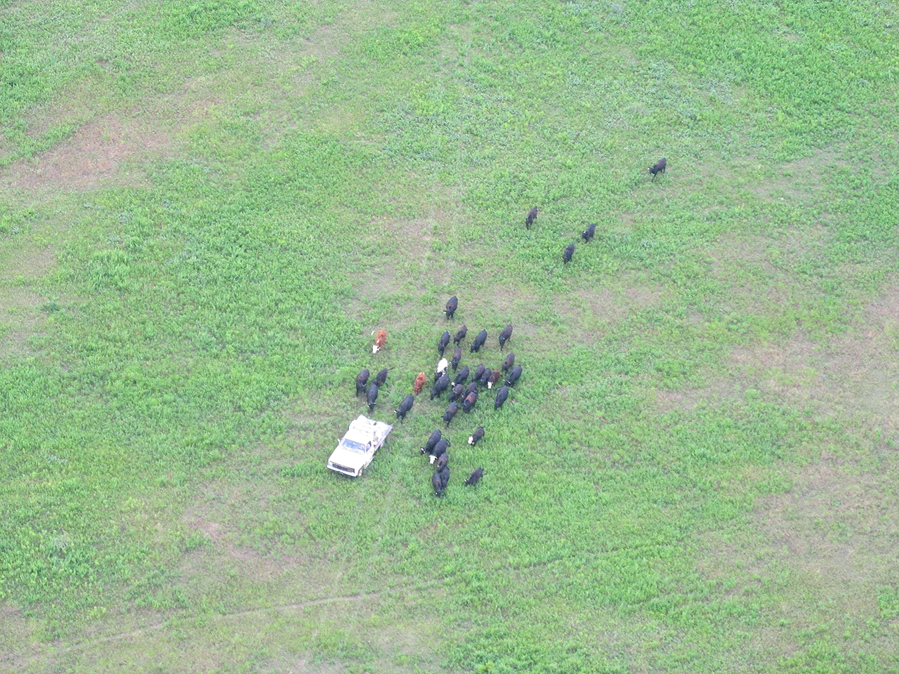
In the distance, beyond the tail of my Quicksilver, you can see one of the cattle that was following the pickup in the previous photo.
Boy Scout Time
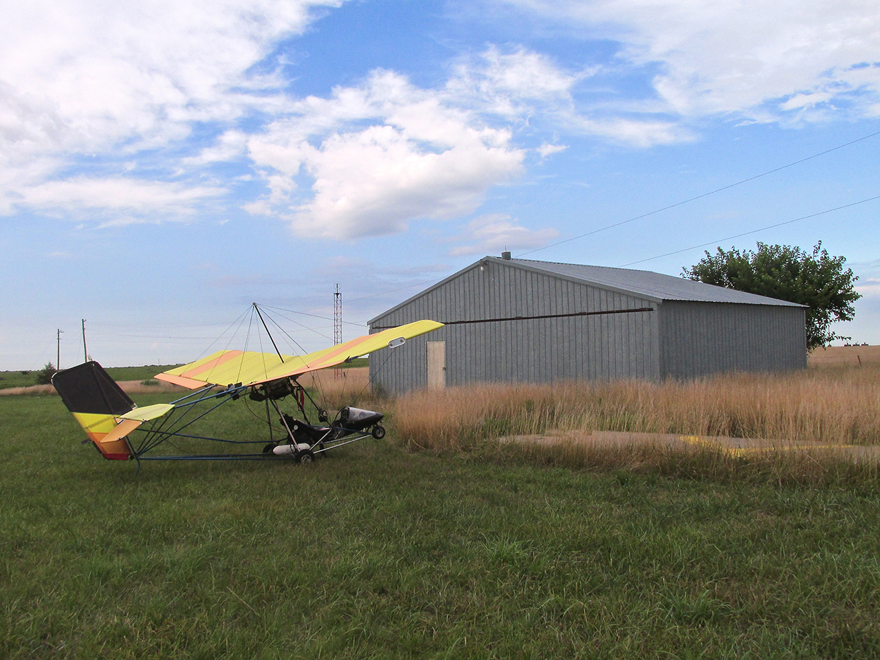
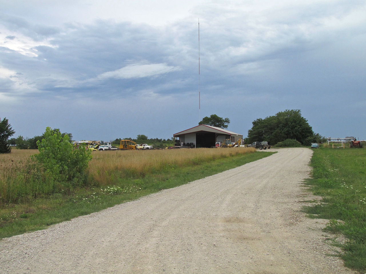
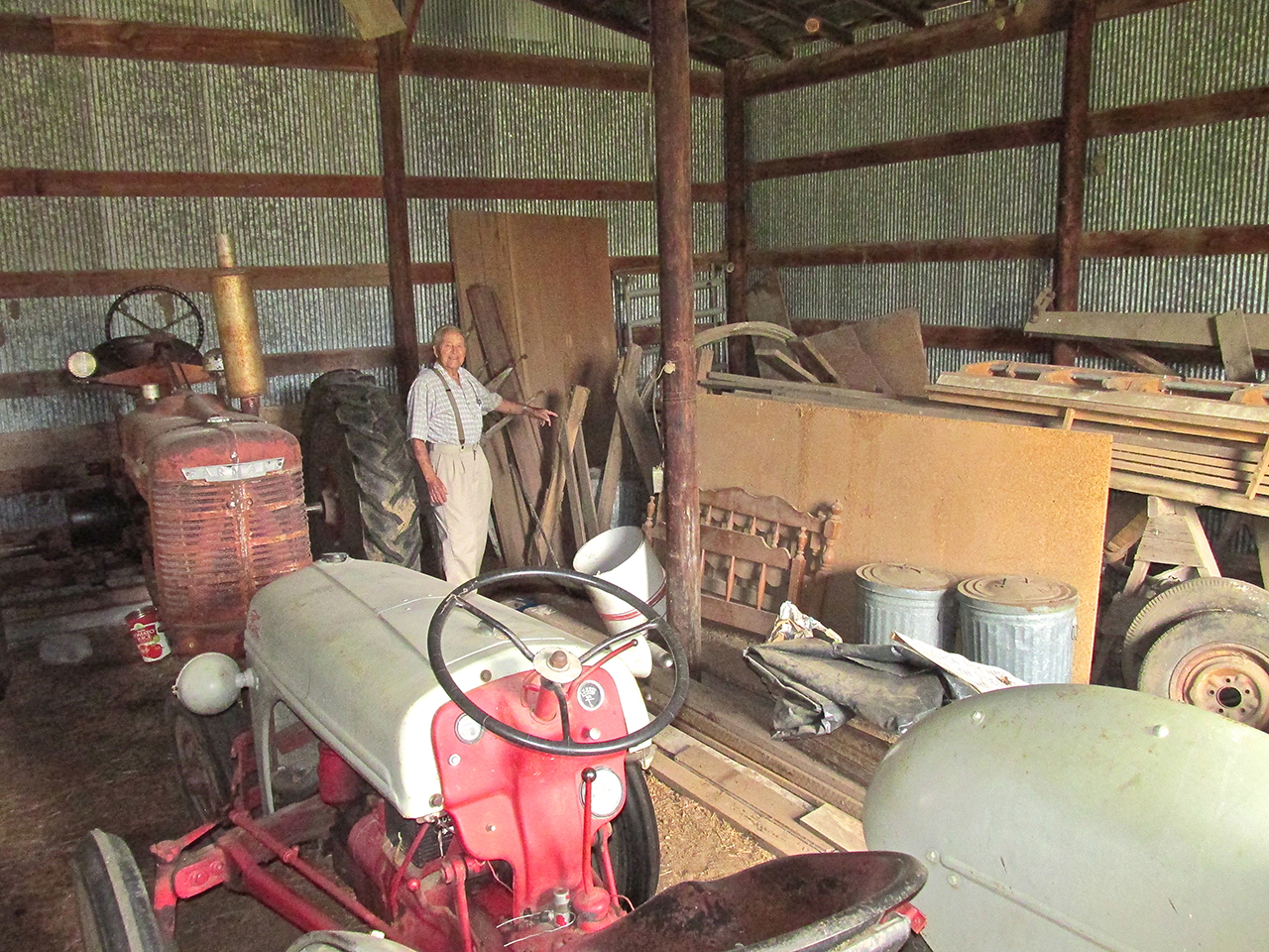
Among many things I learned as a Boy Scout was to use available resources. Upon landing at the field, even though it was “technically” no longer an airfield, I was happy to see a hangar. With the potential of a storm coming through the area at any moment it was imperative that I secure the plane as best as I could. I had looked around near the hangar to see if there were any tie down anchors in the ground and found none. In the event of that, I always carry stakes, straps and a hammer in a backpack behind the seat. The “available resource” alluded to earlier was the hangar. I pulled the plane up close to the wall on the downwind side of the hangar to use it as a shield. Now, with the “wind shadow” and the tie downs I was comfortable leaving the airplane even if it should get a little stormy. I covered the aircraft instruments with a piece of plastic I found.
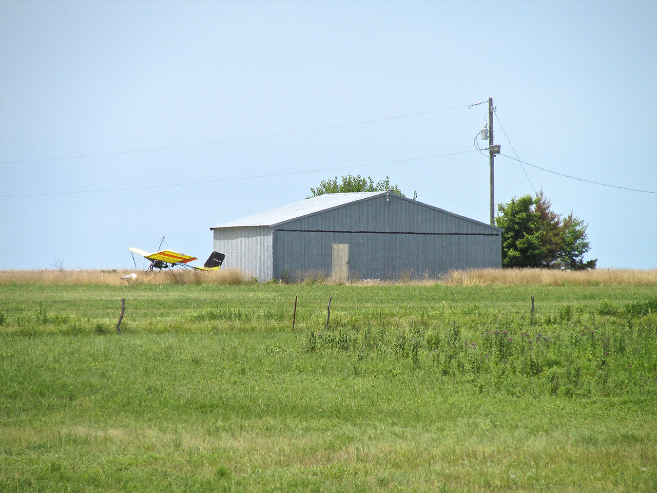
The grass next to the hangar was tall but it was the best place to tie down.
I was checking the time (I use my cell phone as a clock) to decide if it was too early to call Charlie or not. It was about 9:15 am so I thought I would call him. Just as I looked up from my cell phone I saw a pickup bounding down the road to the airfield entrance. I figured it had to be Charlie Davis…

…it was!
Charlie’s Son had seen me flying over the Yates Center while I was taking pictures and called his Dad to say, “I think your guy is here”. Charlie said he jumped in the pickup and headed my way.
Charley Davis
Charley Davis – Yates Center, Kansas
Sometimes when I call a town I have decided to fly to, it takes a lot of explaining as to what I am doing – photography, exploration, etc. From the moment I first talked to Charley Davis, though, I could tell he understood my mission immediately and completely. I think that is why he is a successful entrepreneur. He has the ability to size up a situation quickly.
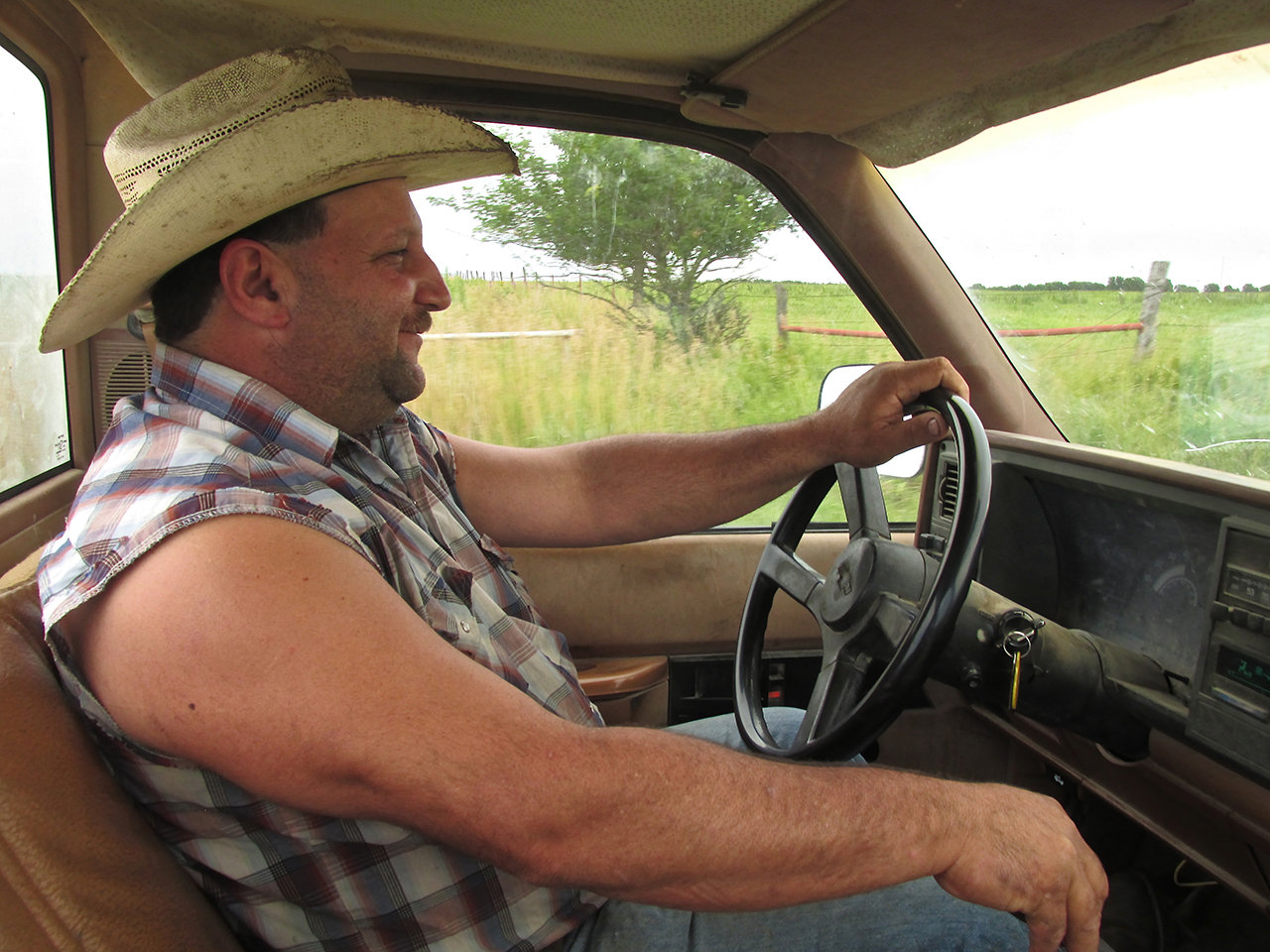
Charley was determined that I should not walk into town. I appreciated that fact and jumped in the cab.
Charley said he had some work to do but would drop me off at the Town Square and be back in about an hour or so for lunch. I had asked him about his mechanic shop so I could get a photo of it. It was on the way to my drop off point so we swung by it first. True to the natural flair Charley seems to have for business this enterprise is named “The Greasy Wrench”. They fix machines big and small.
The Greasy Wrench – (620) 625-2124
1408 118th Rd, Yates Center, KS 66783
The Center
Charley dropped me off in front of the restaurant he and his Wife Michelle own. I’ll show it later. Moving quickly before it might rain I walked around The Center of town. One of the first buildings to catch my attention was the Woodson Hotel. In the process of being renovated as a Senior Living Center, The Woodson, originally built in 1887 is quite handsome.
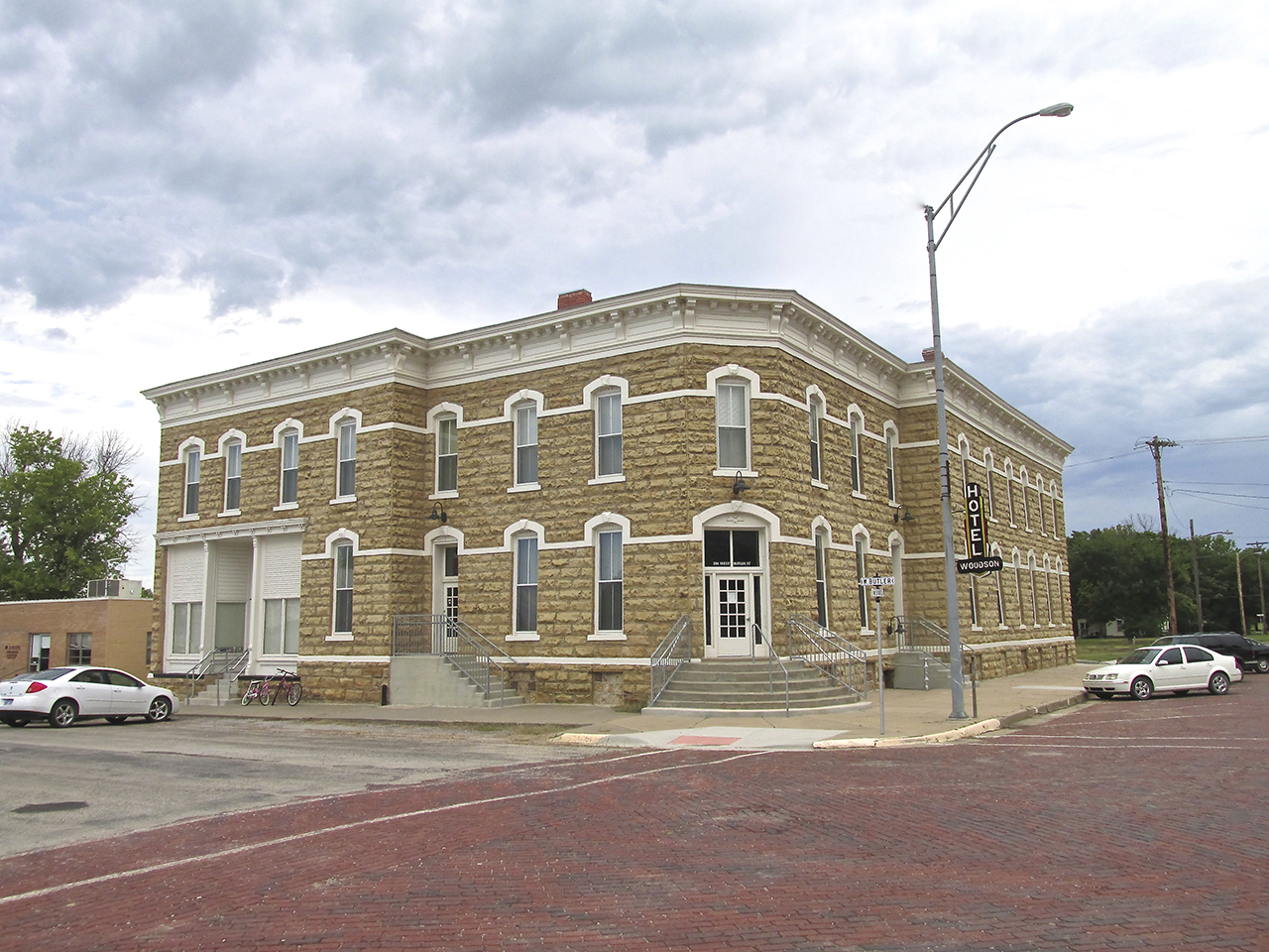
The Woodson Hotel
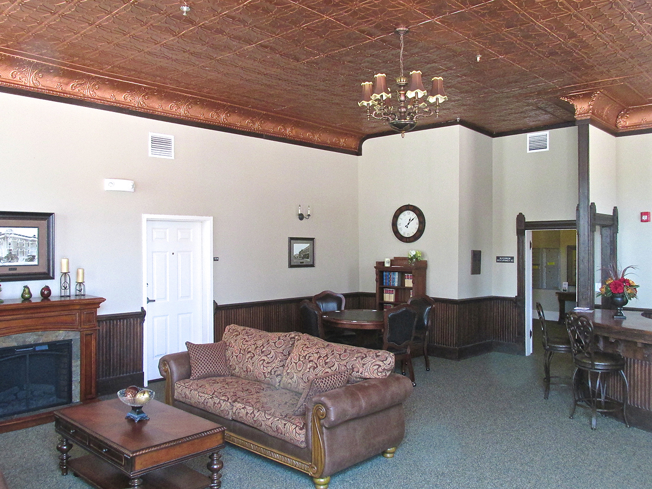
The lobby of The Woodson Hotel
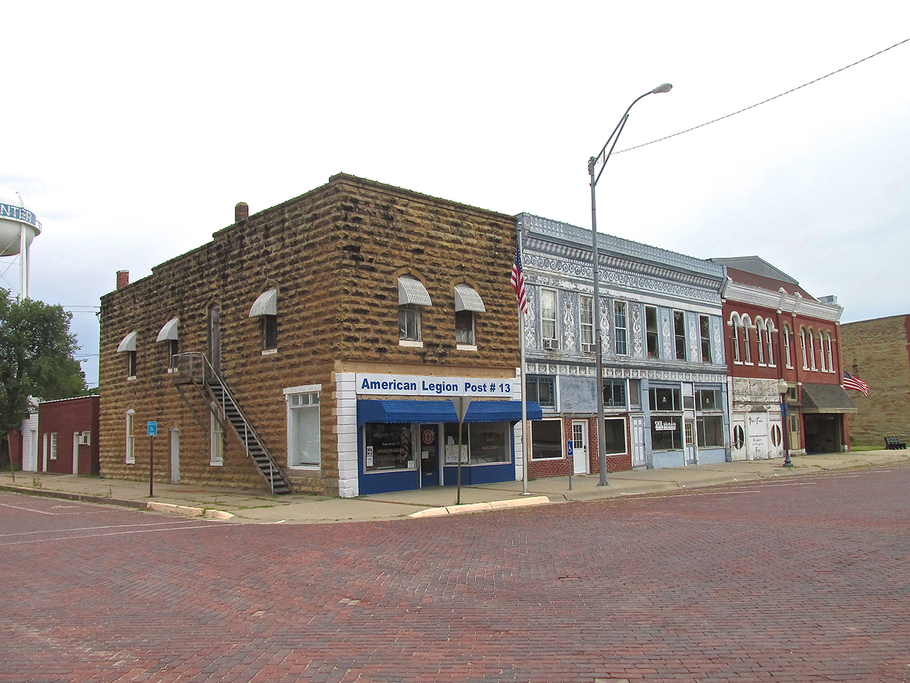
On West Butler Street, made of my “always-favorite” brick, we see buildings of stone and filigreed facade.
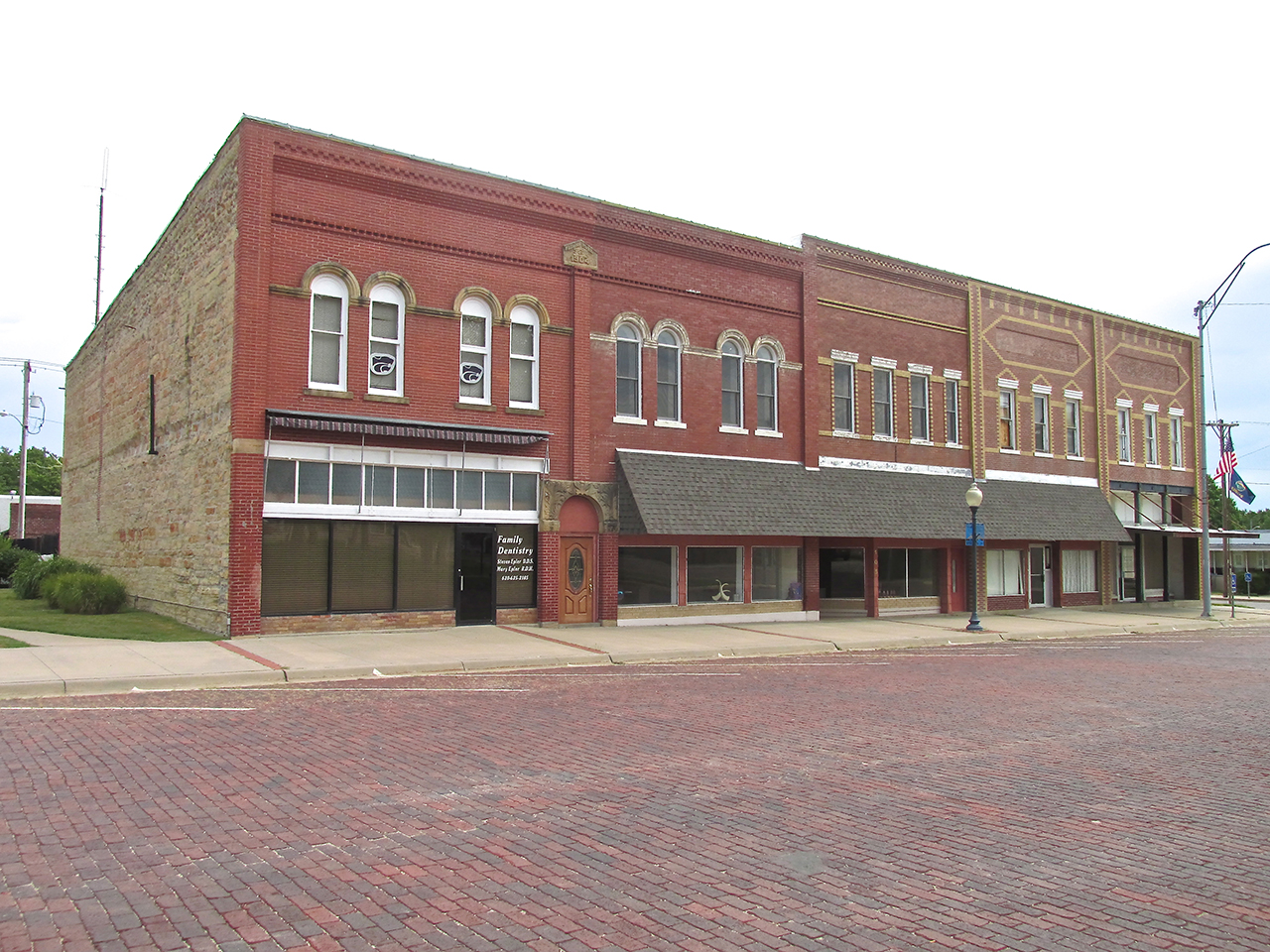
A little farther East on the same street we see these fine structures.
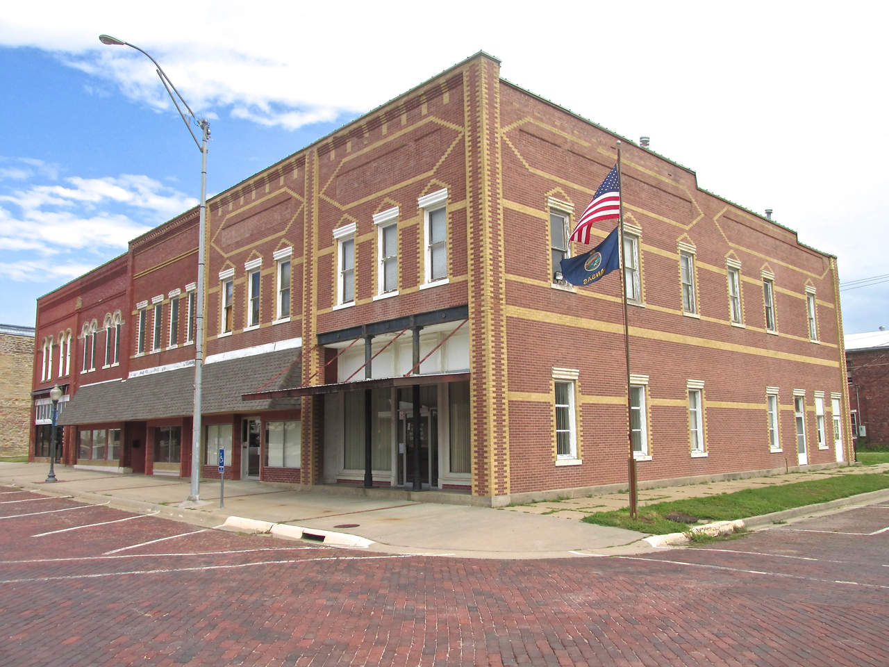
At the corner of West Butler is the Board of Education building. The brickwork of it was so attractive it deserved its own shot.
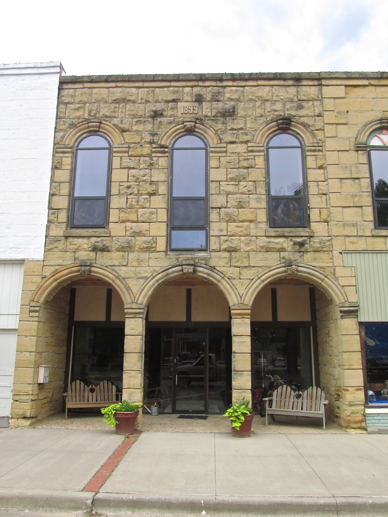
A stone building from 1899
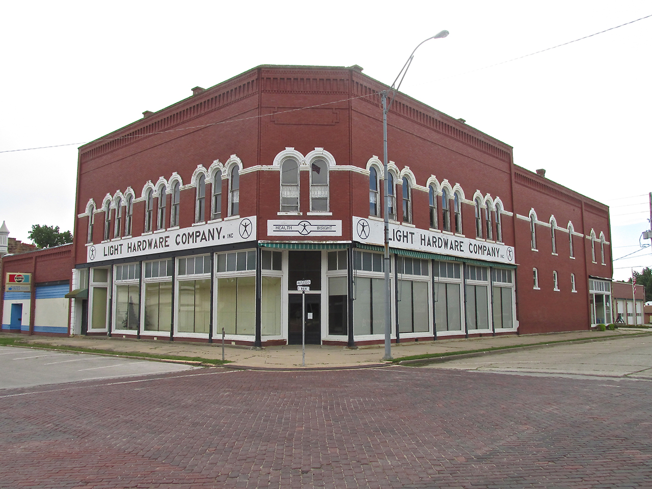
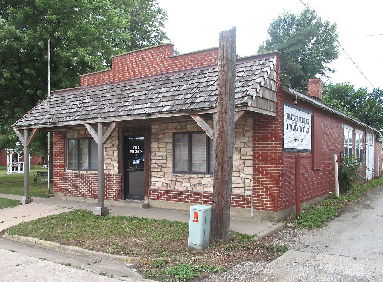
Health Insight is at the corner of Main and Rutledge.
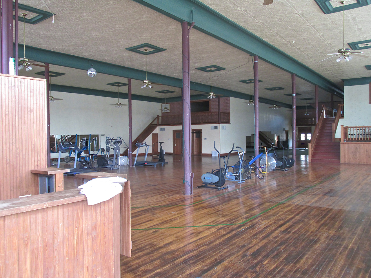
Health Insight
The County Seat
As I explained in my short history of Yates Center, it is The County Seat. We have seen the Center of Yates Center from the air. Now I will show it from eye level.

Woodson County Courthouse

I found this inscription next to the front door of The Courthouse.
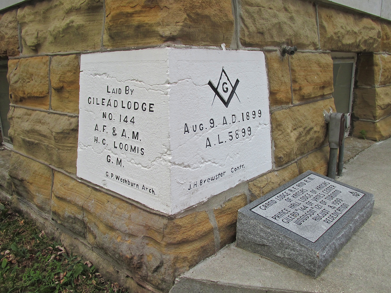
The Courthouse Cornerstone
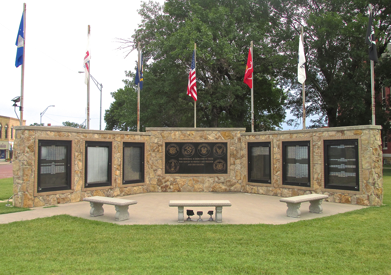
Yates Center has a fine tribute to the Guardians of our Freedom at the Southwest Corner of the Town Square.
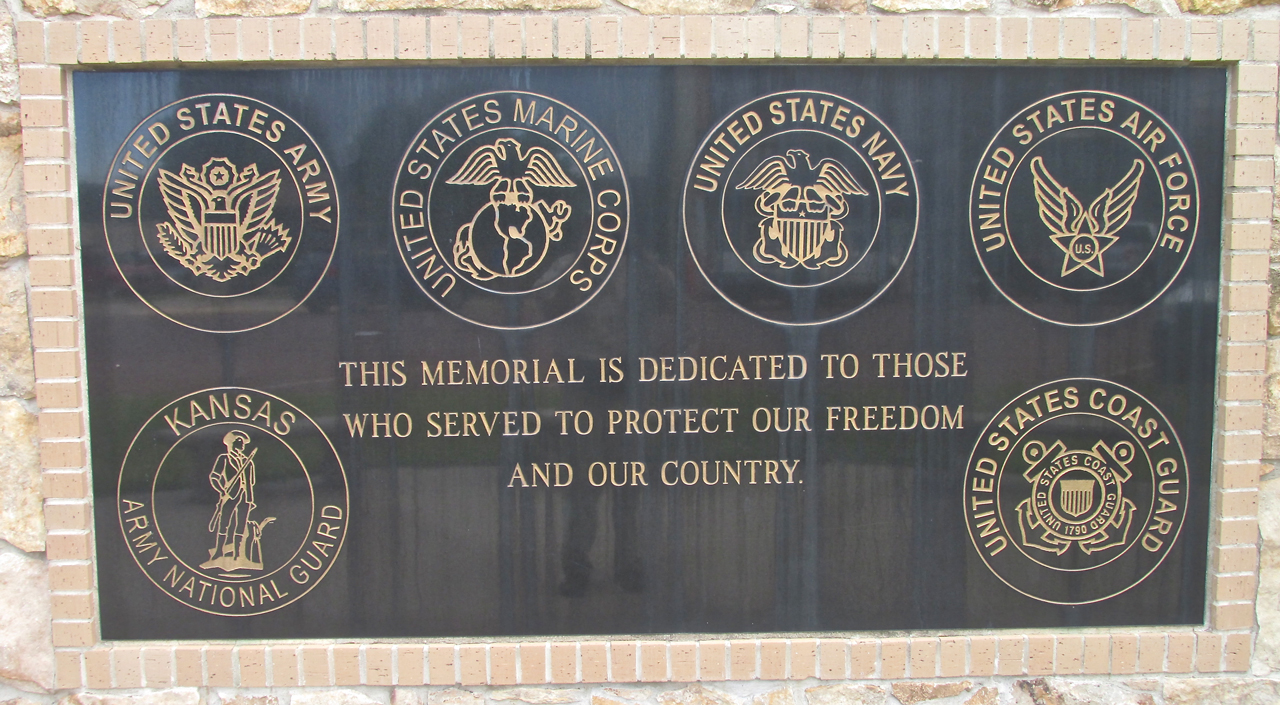
The Center Plaque
Prairie Renaissance
In the title of this story I use the phrase “Prairie Renaissance”. In America, as in most of the world, the trend of humanity has been inexorably from single family rural homes to villages to towns to cities to mega-cities. During this “progressive movement”, for the most part, mankind has turned its collective back on “the small town”. This ethos has promoted the idea that “Small Town is Small Time” and that nothing of importance happens outside “The Big City”.
To thoughtful observers, though, the promise of “Big City Life” has not panned out. Particularly with increasing worldwide communication and transportation, the putative superiority of City Life to Rural Life has proven to be a mirage. More important than ever to people attentive to matters of Family, Faith and Freedom is the elusive concept “Quality of Life”. Alienation is a constant in The Big City.
While Small Town Life is not perfect, I do believe it is more natural to human beings. More than we like to acknowledge, humans benefit from a close relationship to God’s Creation – His Countryside and His Creatures. Zoos and Parks are nice but a pale comparison to the “real” outdoors. In a Small Town, the outdoors is but a short walk or bike ride from one’s house.
In Yates Center, like many of the small towns I visit, I could see revitalization. People are beginning to believe again. With new eyes they are seeing the value that had previously been hidden right in front their faces. The town square of Yates Center is emblematic of this new outlook and is on the rebound.
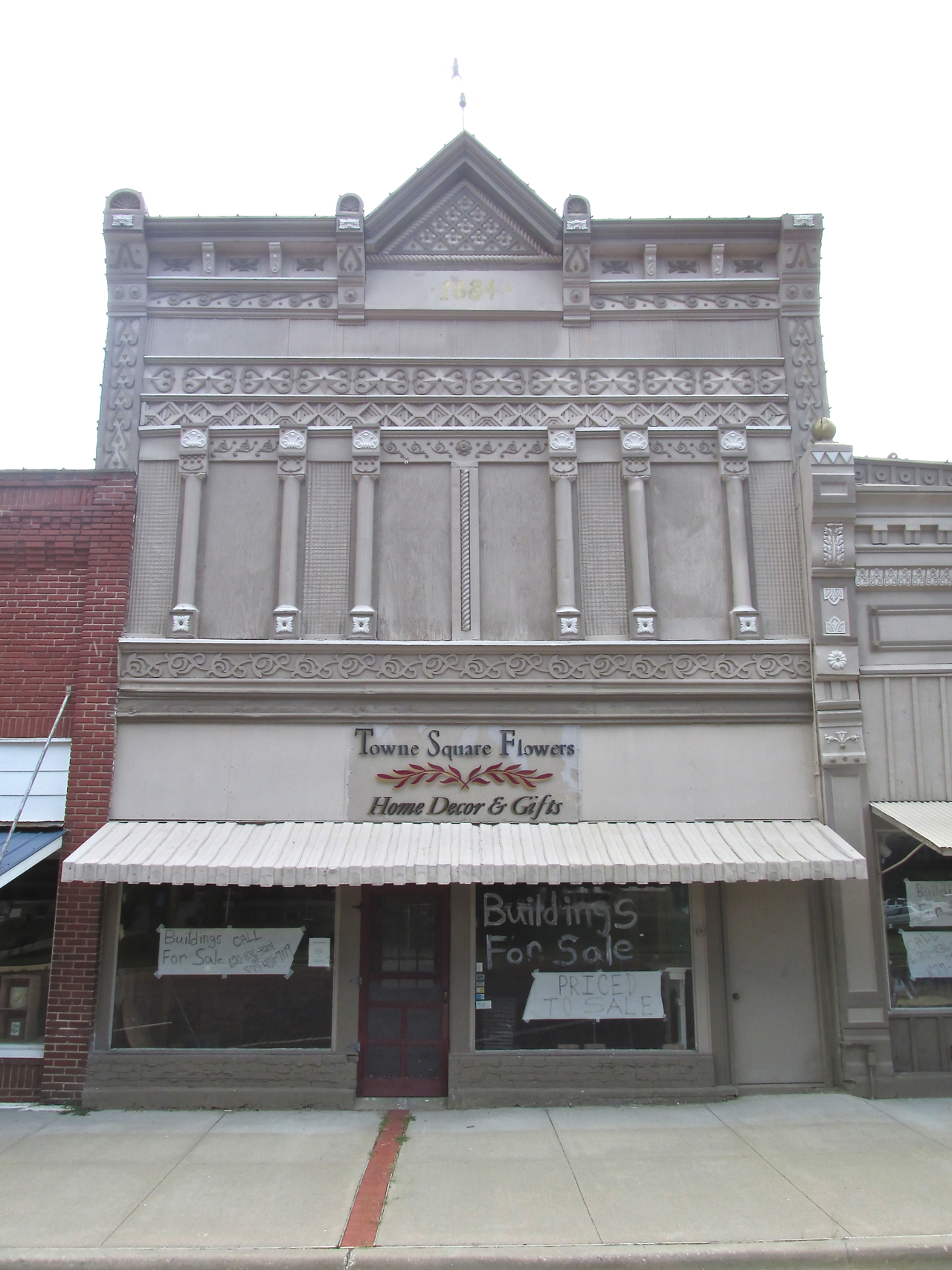
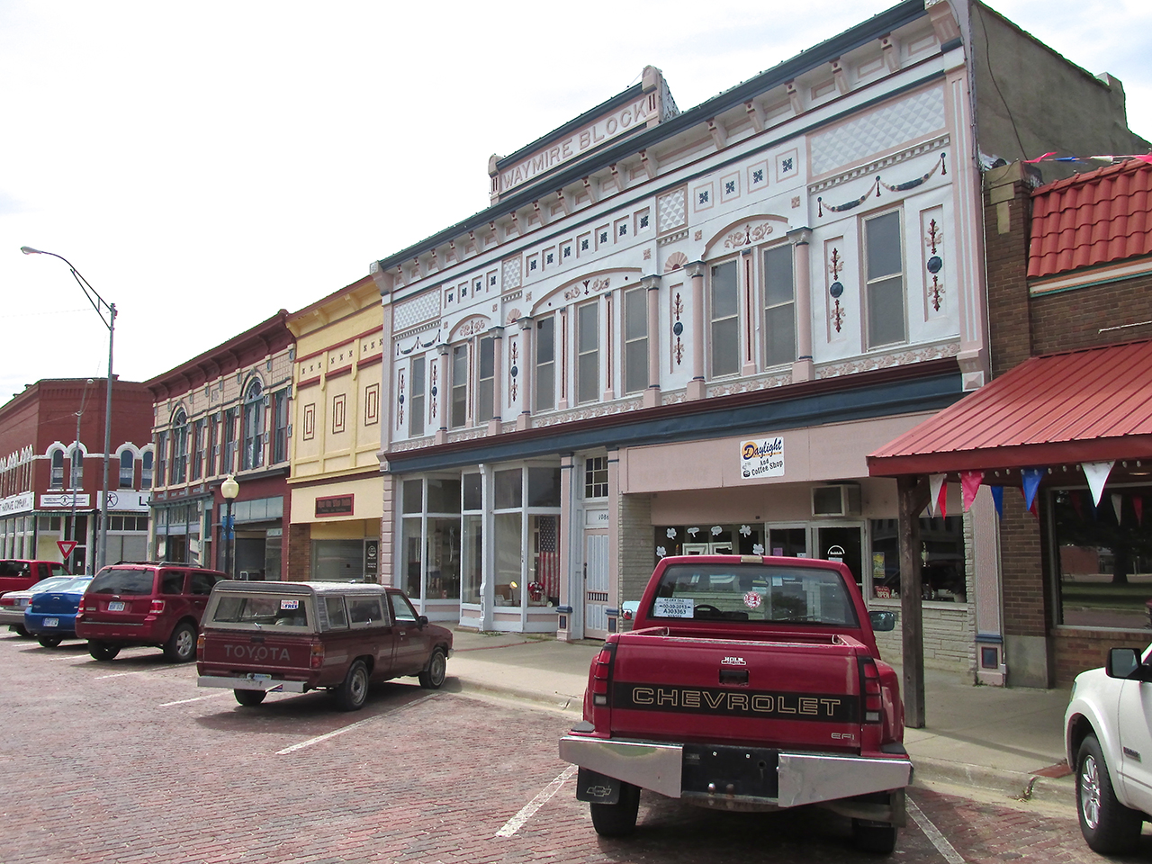
On the East Side of Main Street is this incredibly ornate building built in 1884.
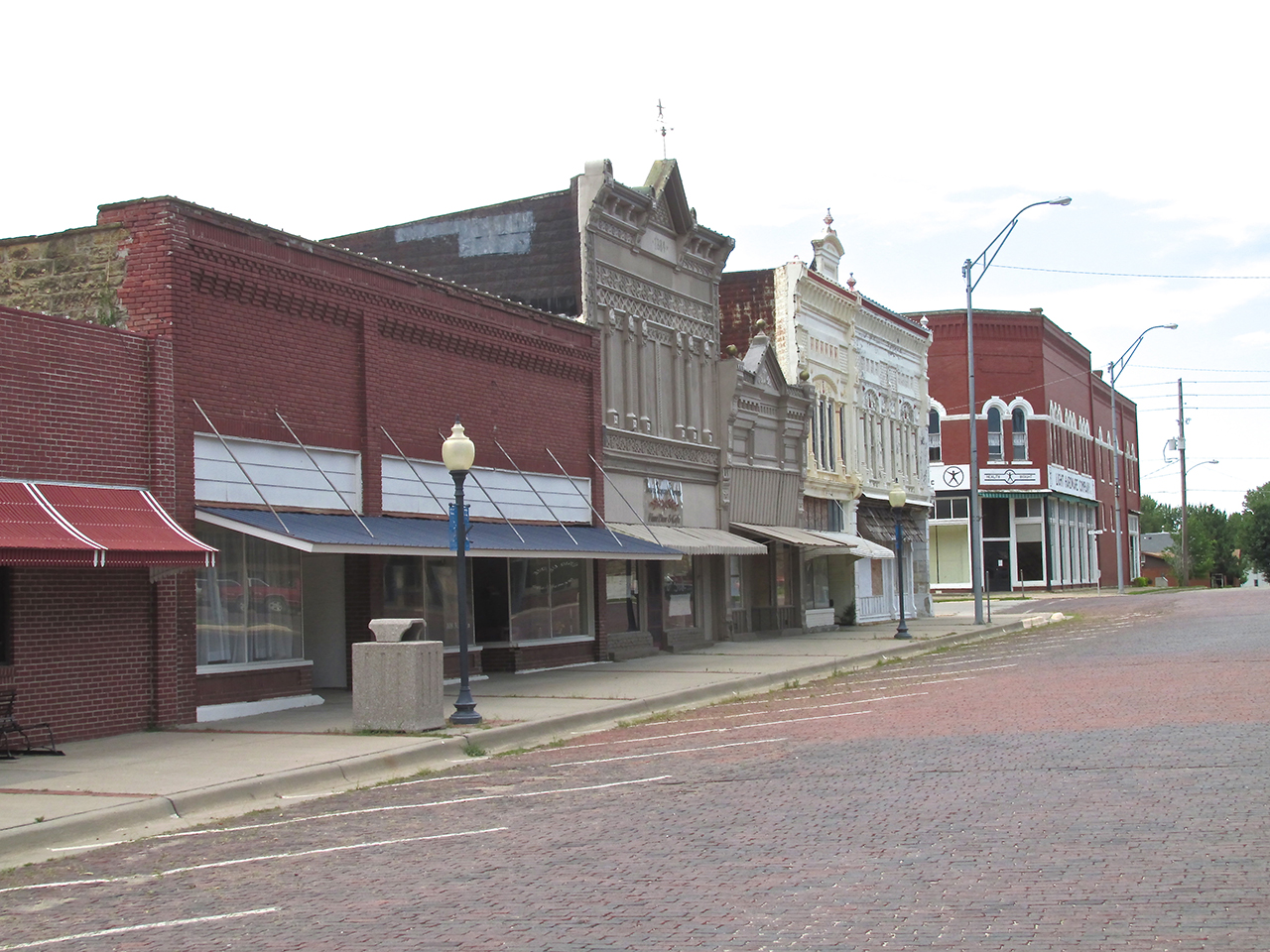
More of the buildings on Main Street.

On the West Side of Town Square is State Street. More of these buildings are now occupied.
The Outer Ring
After taking the pictures above of the buildings in and adjacent to the Town Square, I ranged out a bit to see what I would see.
Time To Eat
I had been walking around town for about an hour and a half and recalled Charley saying he would be back around lunch time. It was too early for lunch but it had started to rain so I walked back to the restaurant. Charley was still on the job so I sat down for a hearty breakfast while I waited for him.
The Renaissance is in full swing on the North Side of Rutledge Street which faces the Courthouse. This is the block just East of Charley and Michelle’s restaurant.
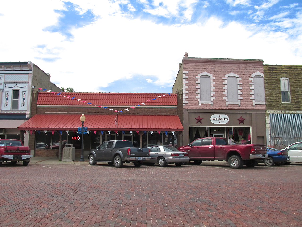
And here in the center of Rutledge Street are two of Charley’s enterprises: The Feed Bunk Restaurant and Down Home Gifts. Son Lance works with Mom in the restaurant

Before heading into the restaurant I stuck my head in The Gift Shop to say Hi.

Rylie Albert was “hard at it”.
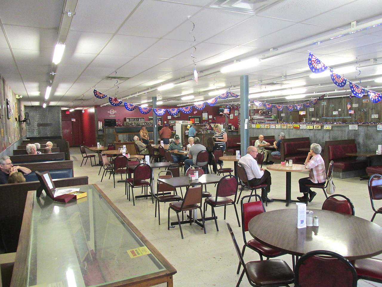
Next door in the restaurant, business was starting to pick up as lunch time approached.
Jessica Rossillon was my waitress at The Feed Bunk and also handled the check out. Earlier I had met her Grandmother when buying the newspaper (I was remiss for not writing her name down). Grandma was proud that Jessica was involved in Softball, Volleyball and 4H. I asked Jessica what animals she tended in 4H and she said, “lambs, goats and pigs”.

Jessica Rossillon of Yates Center
Famous Aviator In Town
While eating my breakfast and reading the local paper, I overheard a conversation in the next booth. A man, whom I would later learn to be Harry Theobald, got my attention as he talked to his friend about one of The Most Famous Fliers of Kansas. I know a bit about this aviator and can think of no better flier in Kansas – maybe the entire world.
After finishing breakfast, Harry and I sat on a bench in front of The Feed Bunk discussing his hometown (Yates) and his lifetime residence there. Charley had finally finished the job he was working and walked up to us. Of course he knew Harry. Charley said he was hungry and invited both of us in. Harry said, “Thanks” but he had just eaten and had to go. I also thanked Charley and said I, too, had already eaten but would sit with him.
Suddenly, out of the blue, Harry asked if I would be interested in meeting the famous flier AND his brother. Wow! What an excellent addition to an already interesting Yates Center story. I looked at Charley and his demeanor indicated “No Contest”. He said, “I’ll see you when you get back”. Harry and I piled into his pickup and set off.
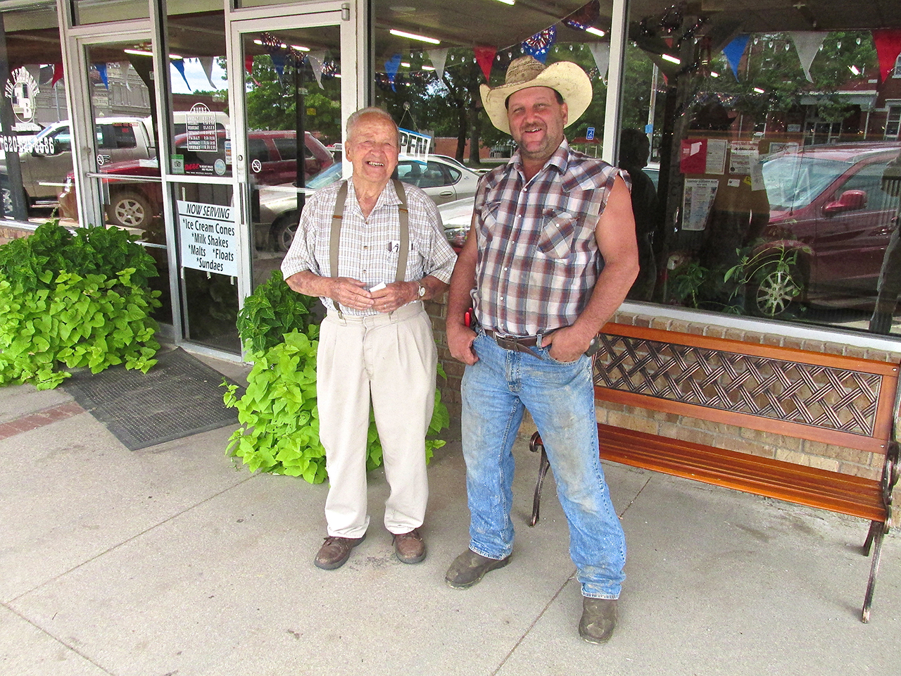
Harry Theobald & Charley Davis
Slight Detour
While we were conversing I learned that Harry was over 90 years old. I also discovered he was an aviator and had owned a Cessna at one time. He mentioned his sadness at the loss of his Dear Wife a year ago. Regardless of that, his general demeanor was cheerful and he was interested to discuss many things. He told me they had lived in the same house for 64 years and asked if I wanted to see it. “Of course!” I responded. We made two turns and were there in less than a minute. Harry was about to drive by when I prevailed upon him to stand in front of it for a photo.
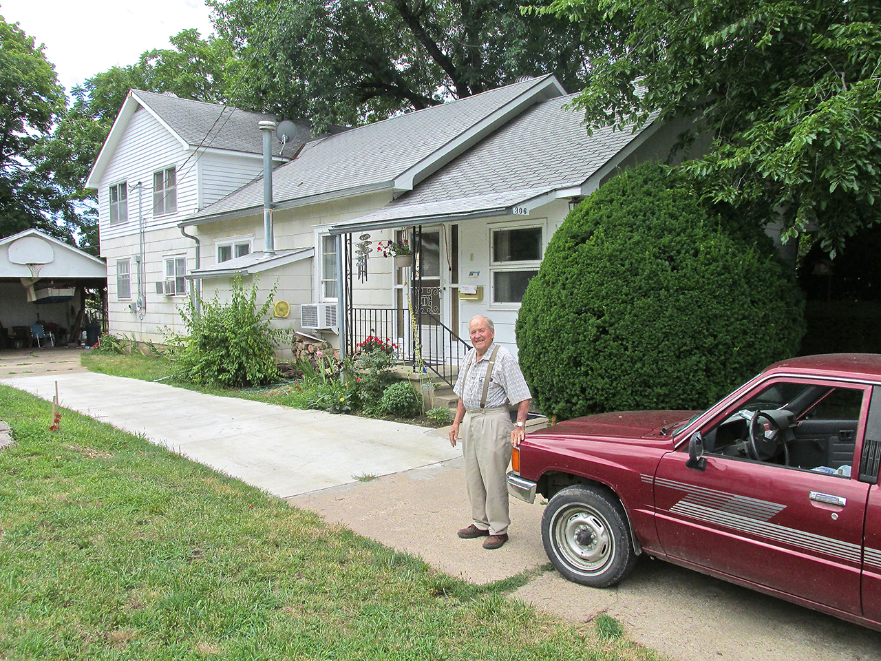
Harry Theobald and home of 64 years. While standing there he noted that Charley Davis had laid the new section of concrete in his driveway.
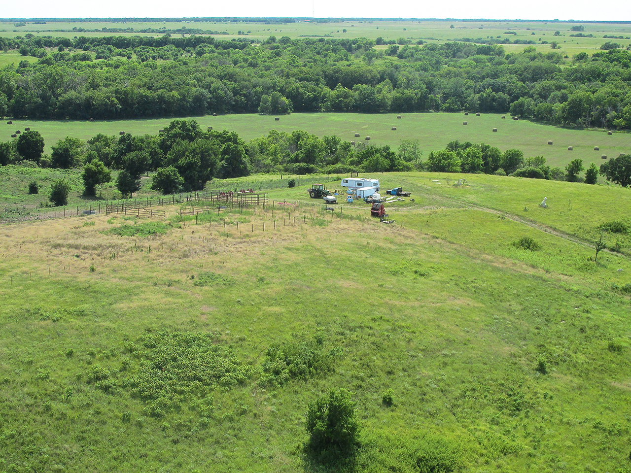
The Farmstead
After looking at Harry’s house we had to drive out of town a short way to his property. Harry was born on a farm adjacent to this piece of land. On it, in 1960, he had built the shed seen below. His Daughter Cynthia Blisard had painted the marvelous art that adorns the door. Like most people out in the country, Harry has strong feelings for The United States of America.
Harry beckoned me over as he opened the door to the shed. He said the Famous Flying Brothers were staying inside. He motioned for me to be quiet as they were probably sleeping.
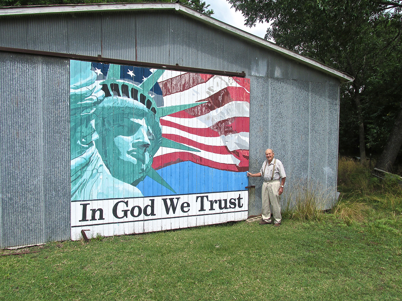
Cynthia Blisard’s Magnificent Mural
Once inside Harry gestured to the place the two aviators had chosen for their nap.
Flying As An Artform
For those of us smitten by The Flying Bug, there are a variety of ways it plays out. I happen to enjoy the minimalistic method of motorized flight known as Ultralight Flying. Others like to fly high powered speedsters and aerobatic planes. Helicopters, Gyrocopters, Powered Parachutes and many more are also included among the choices. Of a more “purist” bent are the Sail-planers. They choose to remain aloft in the manner of the great soaring birds of prey – without motors – by delicately maneuvering to take advantage of the lift differential presented by temperature variations in the atmosphere. Called “thermals”, these invisible “heat funnels” emanating from the Earth’s surface have the power to levitate heavier-than-air objects built to function in a prescribed manner.
Like it or not, all man-made air machines are poor imitations of one of God’s Most Elegant Creations – The Bird. Pilots who fly at the low end of the speed curve such as Sail-planers, Parachuters and Ultralight Flyers, come to have a more enhanced “feel for the air” not discerned by pilots flying high powered, fast movers. For me, the more I experience the myriad variations present in the invisible medium of air, the greater appreciation I have for Birds and Butterflies maneuvering through it.
One unexpected “soaring champion” I have been fortunate to observe in my back yard for many Summers now is the Purple Martin. I say unexpected because even though they do not have the long, high aspect wings typical of most soaring birds, Purple Martins perform marvelously in minimal wind staying aloft for long periods with nary a flap of their wings.
The Turkey Vulture
By far, though, the best flyer I have seen in my time studying such matters is the Kansas Turkey Vulture. I am aware that these birds are found throughout North and South America but when they fly around here I claim them for Kansas. They appear here in the Summer, but that being said, not all the time or everywhere. I wouldn’t say they are rare but it is a notable flight when I see one soaring in proximity to me. In those opportunities I have to watch them negotiate the atmosphere, I marvel at their complete mastery of this environment. While I may be furiously working the stick and rudder to stay upright in a turbulent situation, I look over and the Turkey Vulture might move – at most – a “finger feather”. They are the Kings of The Air and Harry Theobald had provided me the coveted opportunity to see two young princes maturing in his shed.
Harry approaches cautiously.
Layin’ Low
Not apparent in these pictures is that it was fairly dark in the barn. We were stepping gingerly so as to not trip on boards and tools on the ground. I had to turn on the flash of my camera to light everything up. As we approached the corner where Harry thought they would be found, suddenly there was a “skittering” sound accompanied by fuzzy, white things dashing through the shadows. Harry pointed and says, “I think they are next to the wall”. I traded places with him. I peered into the dark but could see very little. I decided to try some “blind shots” with the flash in the dark to see if I could get pictures of the brothers. Below is the result.
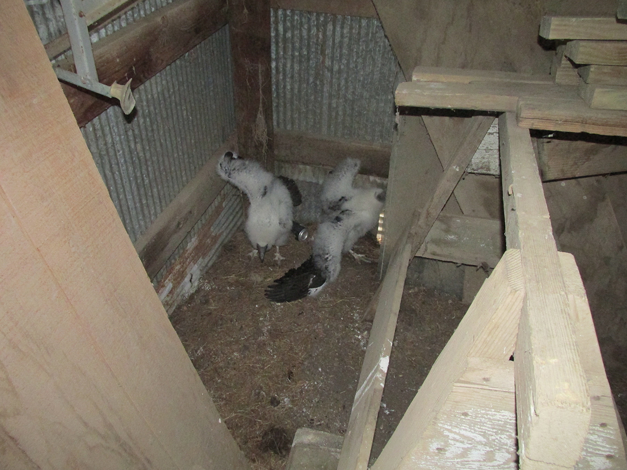
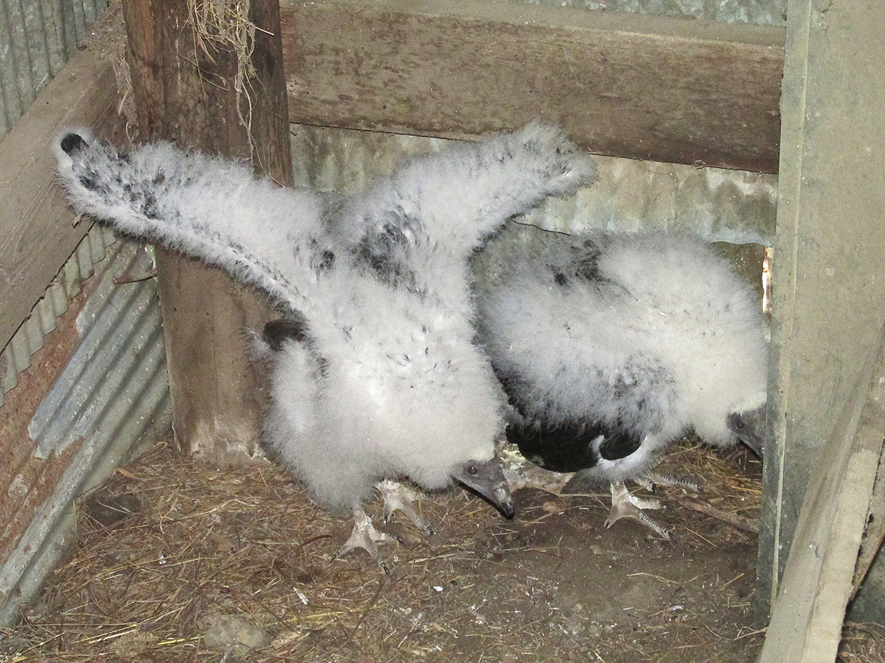
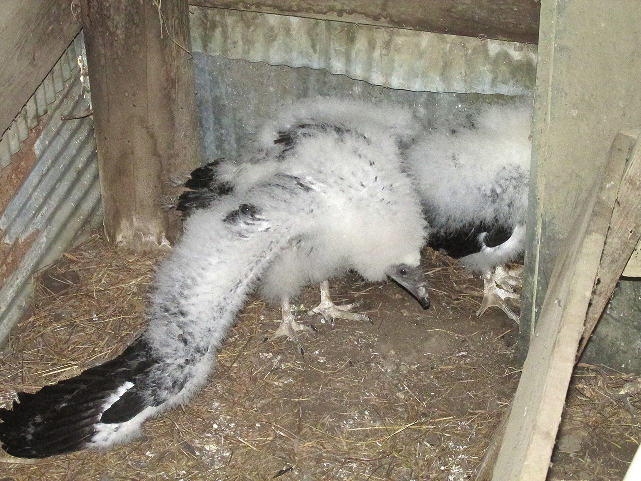
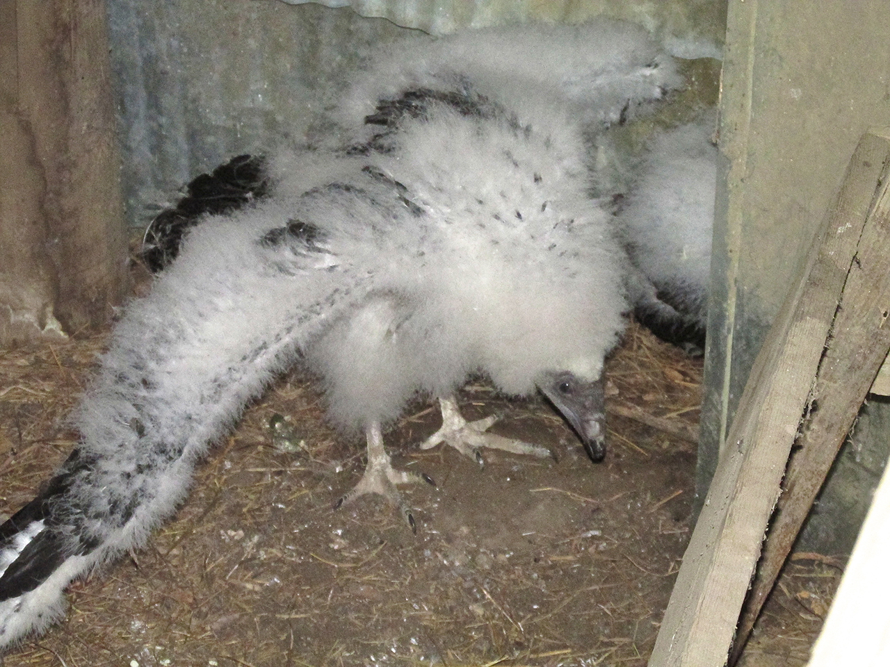
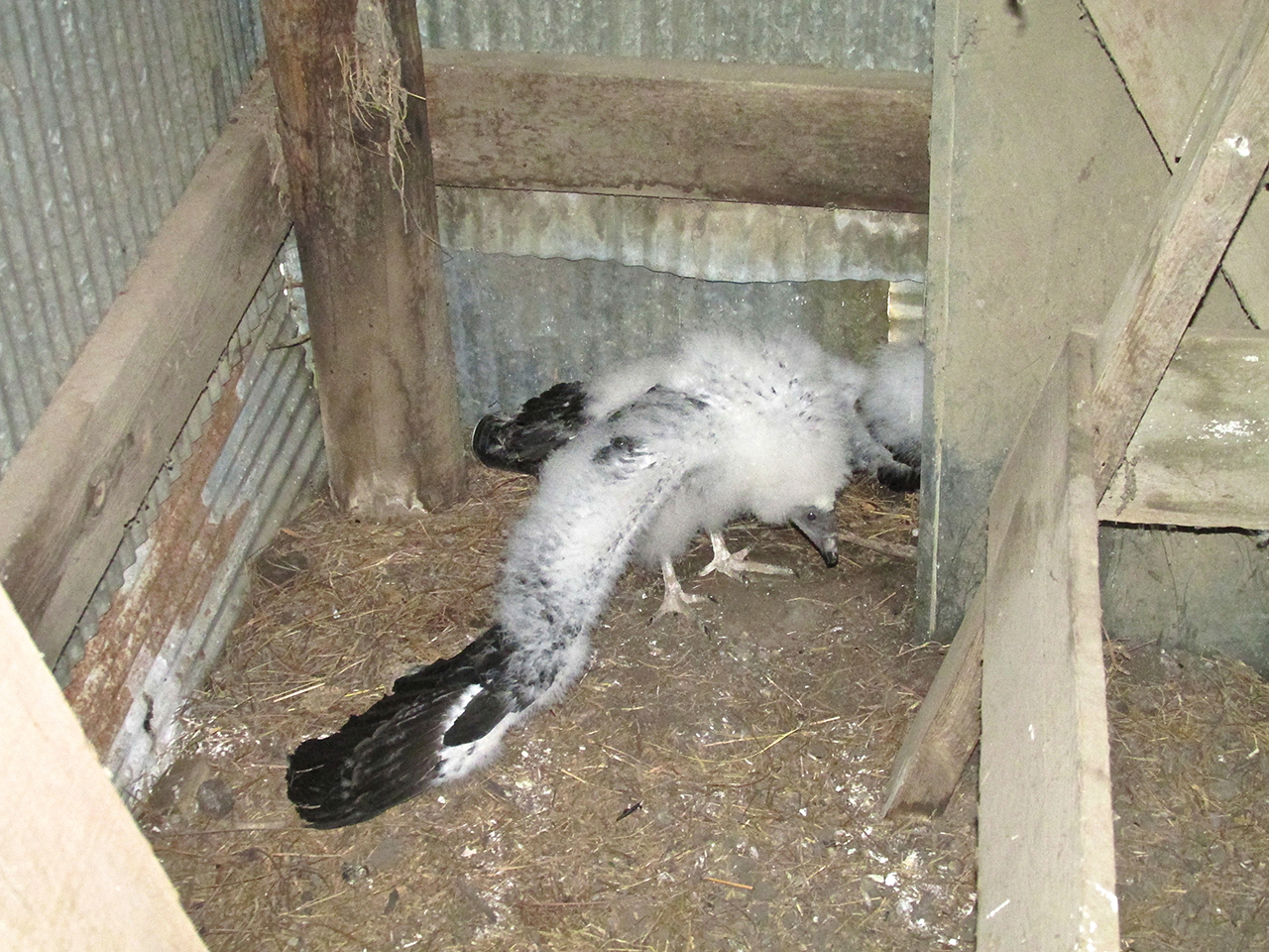
It only took about 30 seconds to grab these pix. During that time the brothers hissed continually at us while the one flapped his wing, slapping the ground.
Return To Town
After seeing the Turkey Vultures, Harry said he had some business to do and would drop me off at the restaurant. He said if he could make it he would shoot out to the airfield to see my plane before I took off.
Lunchtime Wrap Up
As I walked in, Charley and some buddies were finishing their meals. Charley introduced me to his friends who were taking a break from working the harvest. I sat down and drank a lemonade and we talked about matters farming and aviation.

Michael Old, Charlie Davis, Keith Karmann and Kevin Day
Airport Bound
Charlie announced had to get back to work so if I wanted a ride back to the airport we had to get going. We excused ourselves from the crew and I wished them well. But before leaving, I wanted to meet the secret to the success of this going concern. We headed back into the kitchen to meet Mrs. Davis and Son Lance.
As in any popular restaurant during mealtime, action in the kitchen was intense. In my 30th year in the advertising biz, I am particularly attentive to the verities of different businesses. After waiting for the appropriate moment I was able to get “Shelly” and Lance to stop for a microsecond to pose for a photo before they got right back to business. And business is good.

Lance and Michelle Davis – “The Feed Bunk” co-owners and Cooking Staff
A Few More Sights
On the way to the gas station Charley listed – off the top of his head – a number of notable sights around town to learn if I had already seen them. Quite a few I had not, so we made a quick tour of them on the way to the airport.
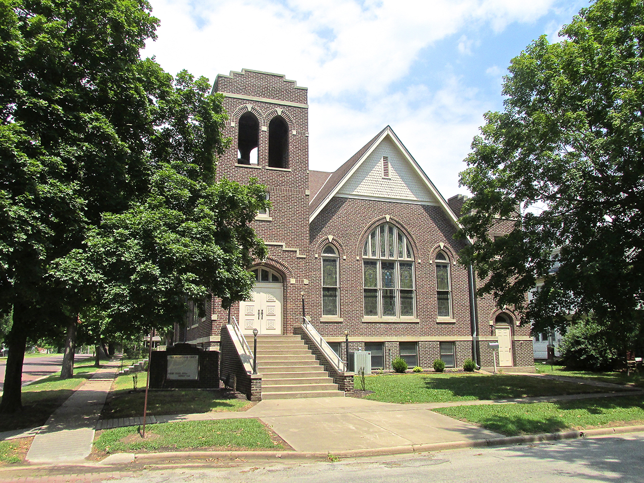
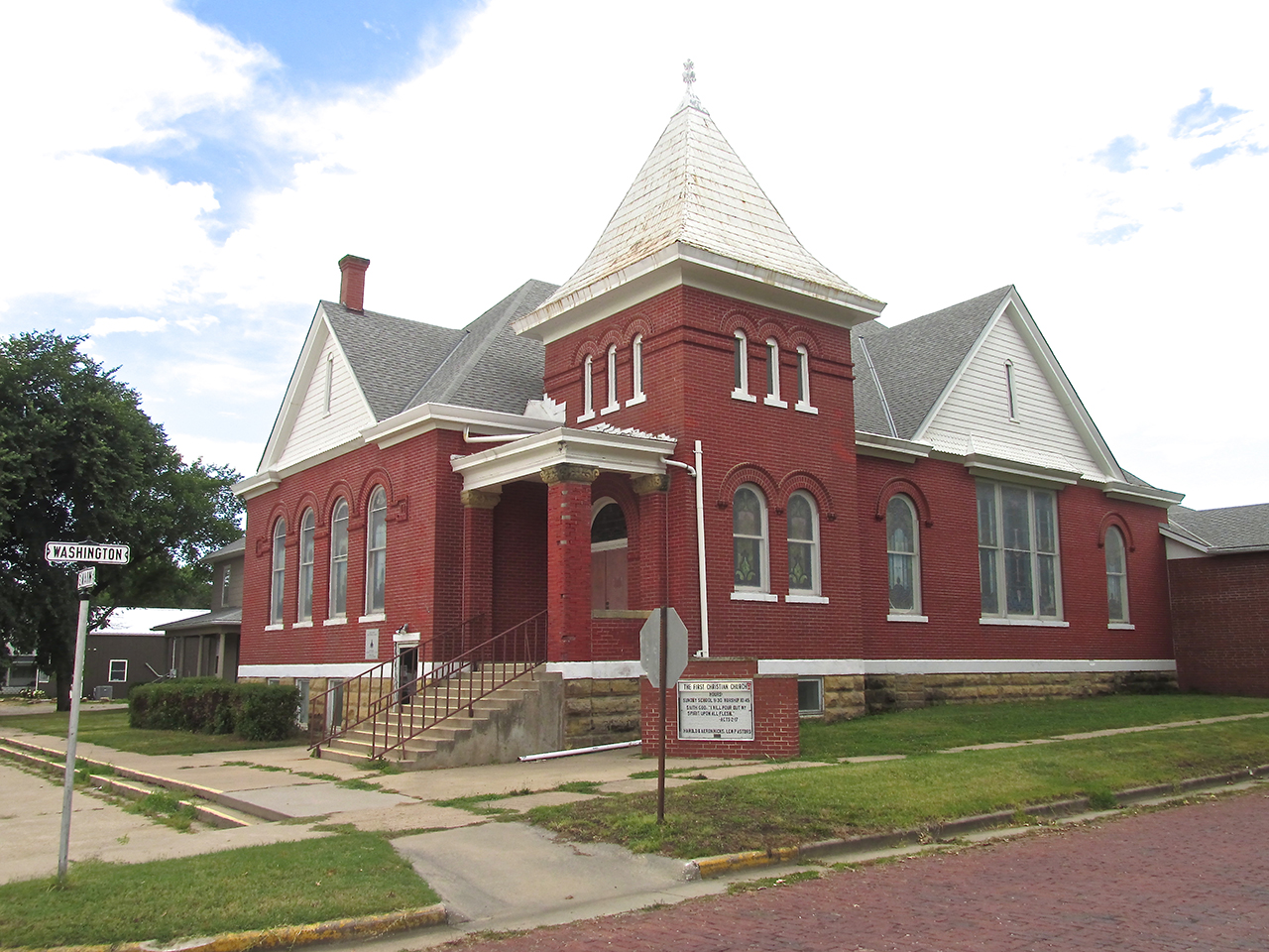
The First Presbyterian Church
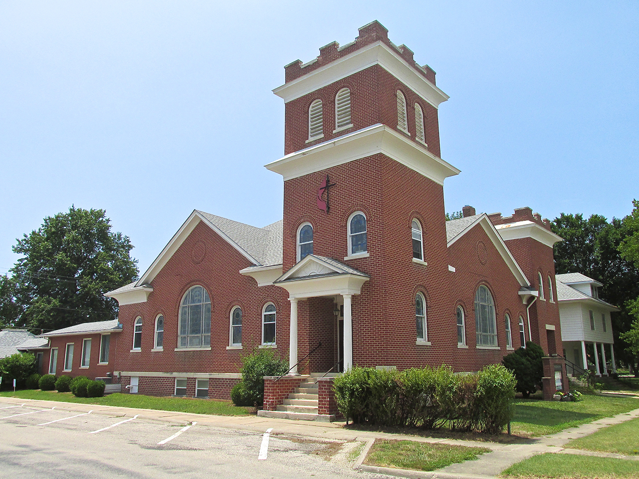
The Methodist Church
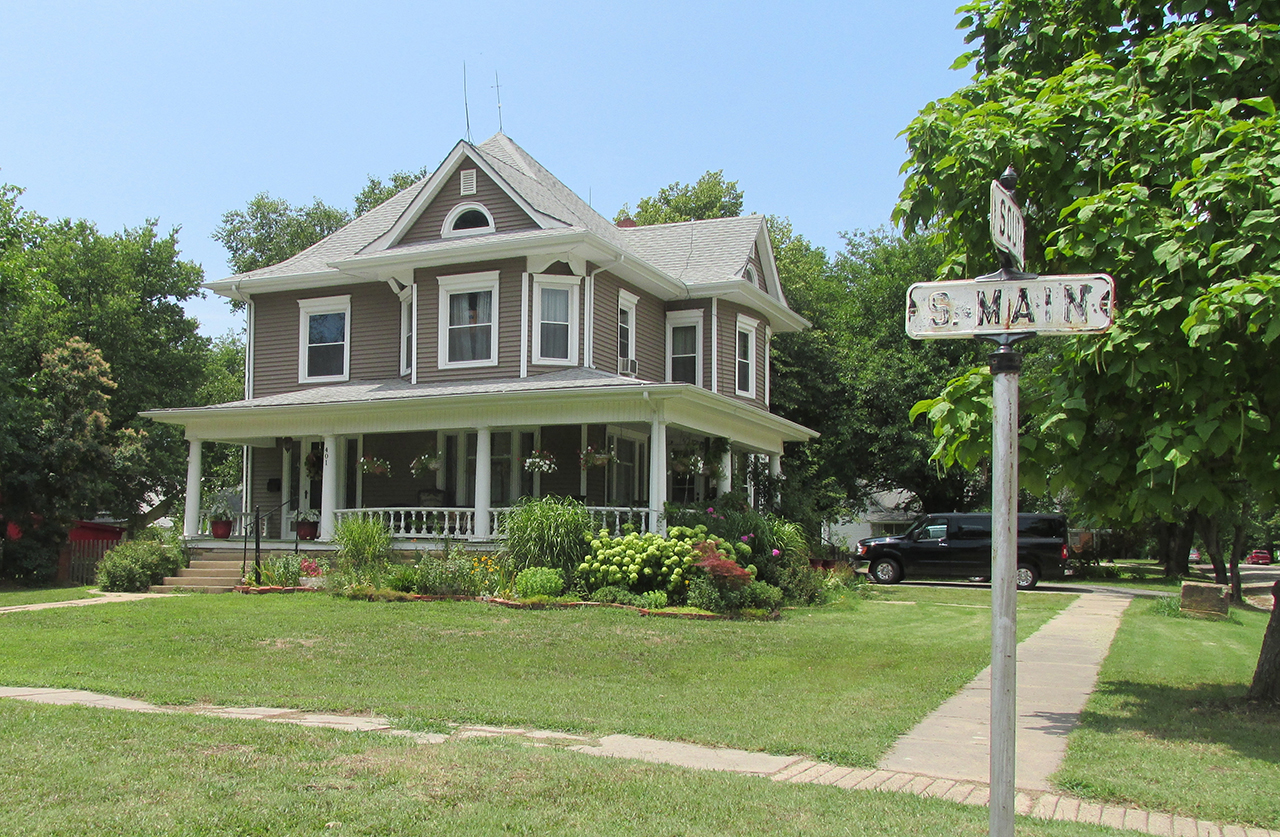
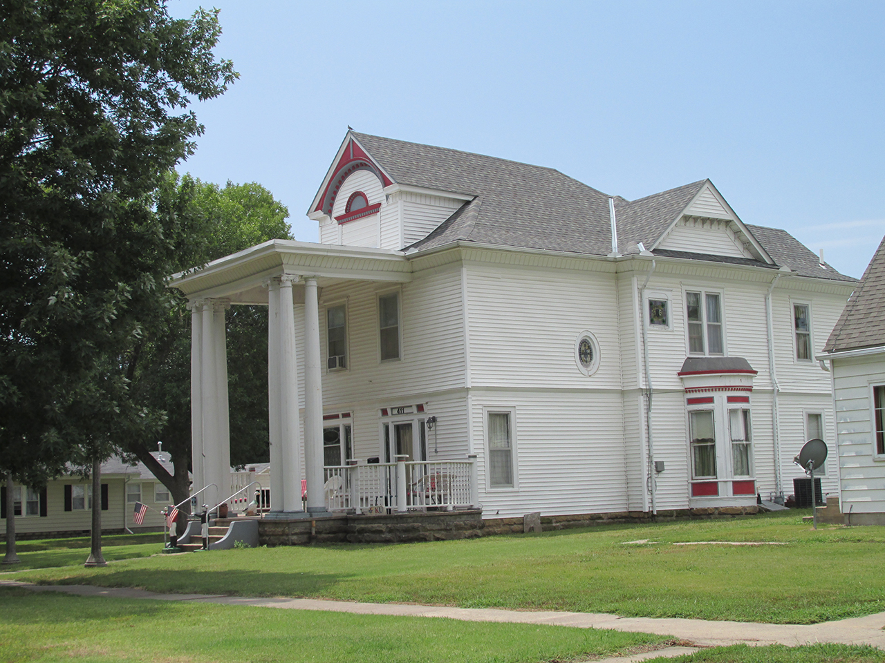
A Nicely Restored Victorian Home
Greek Columns
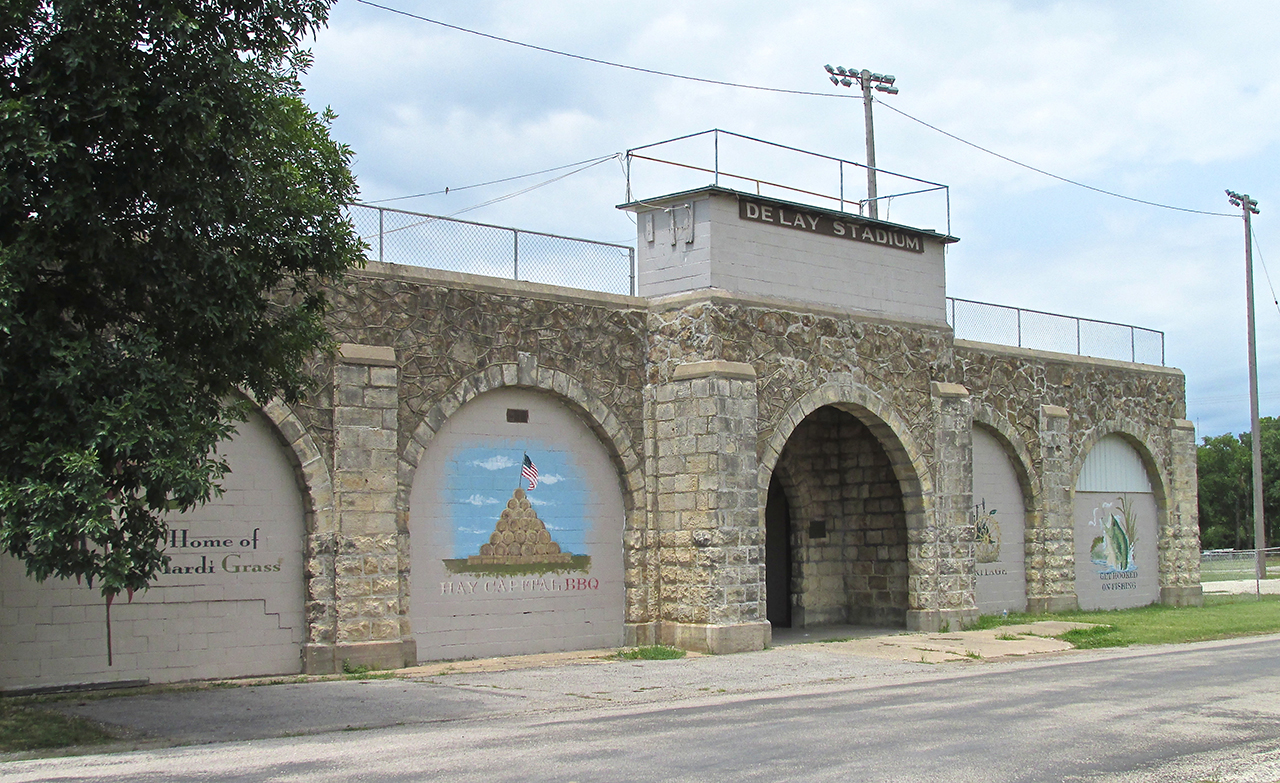
Delay Stadium – Among other events, The Hay Capital BBQ Contest is held here each year.
I leaned out of Charley’s truck window to snap this.
Farewell
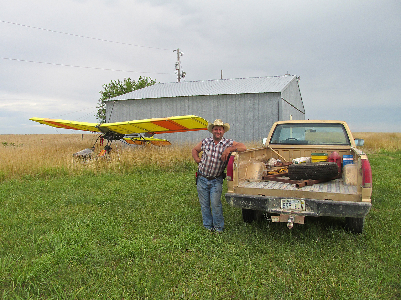
Upon arrival at the airport I got right to work. After about 10 minutes of digging around in the tall grass I retrieved the tie down stakes and straps and reinstalled them neatly into my backpack. Moments later Harry arrived. Because he is a pilot I walked him around the plane to show him particulars to this design. He said it looked similar to one another fellow in the area had a while back.

Finally The Sun Was Out
The More The Merrier
While Harry and I discussed fine points of aviation design, neighbor Ron McCormick and his Grandson Eli came across the field on a 4-wheeler with “Dog” bounding beside them. They had seen some action and wanted a closer look.
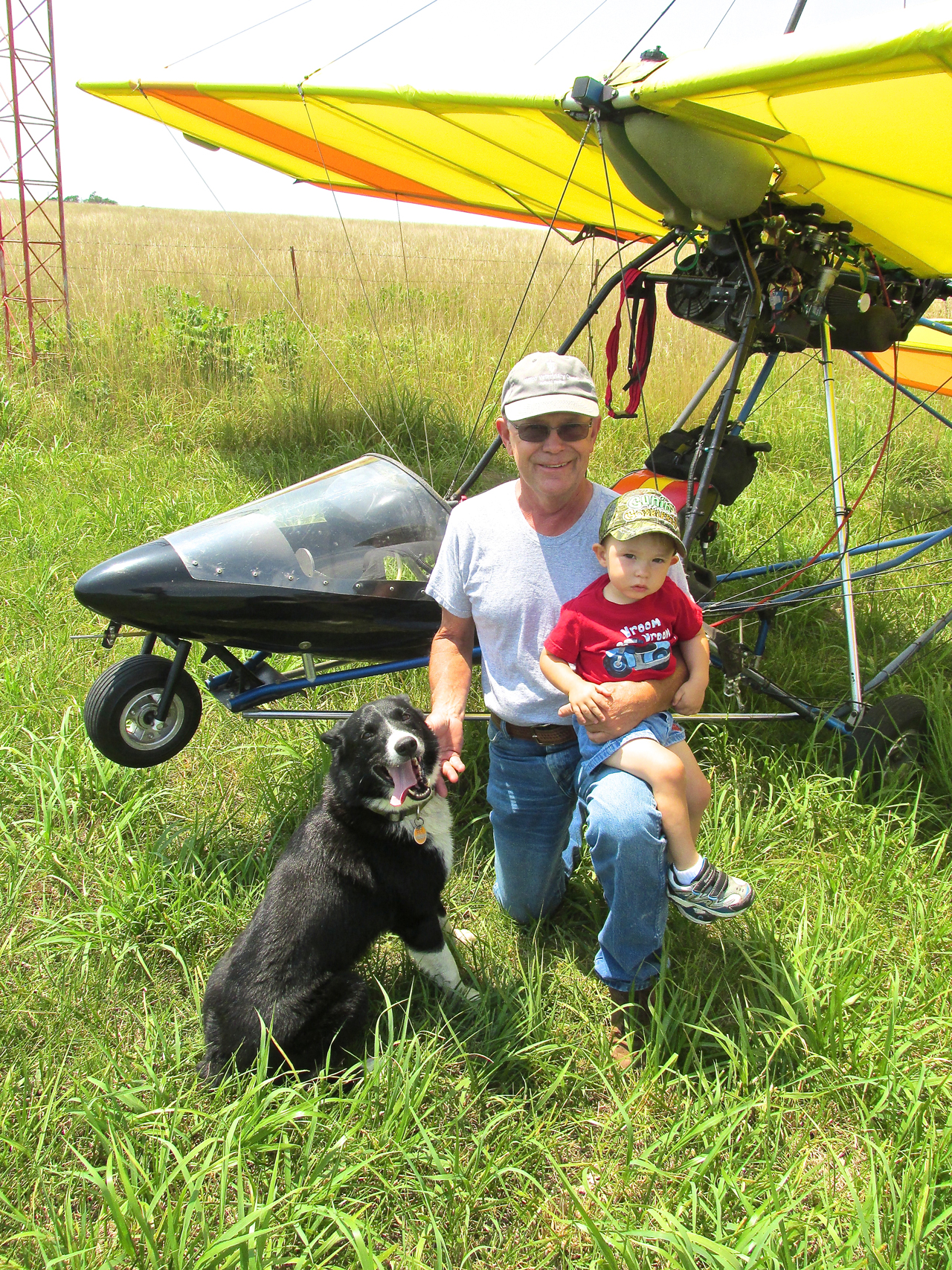
Ron McCormick, Grandson Eli and “Dog”
Egress Routine
Earlier in the day I had told Harry how quickly the Quicksilver becomes airborne and that it could perform a neat, high angle quick climb to about 100′. I announced to everyone present I would demonstrate these two exceptional MXL performance traits on take off. Then, I would circle to get some pictures of them below after which I would leave the area.
I thanked Charley for his fine hospitality and Harry for showing me The Fuzzy Flying Duo. The Rotax started with one pull. I let it warm up for 2 minutes while I strapped in, started the GPS and checked the controls. I taxied about 10 feet to position directly into the mild wind and took off. The aircraft performed as advertised but my photos of the guys below were sub par, unfortunately not good enough to include in this story. I waved goodbye and set a course for Selby Aerodrome.
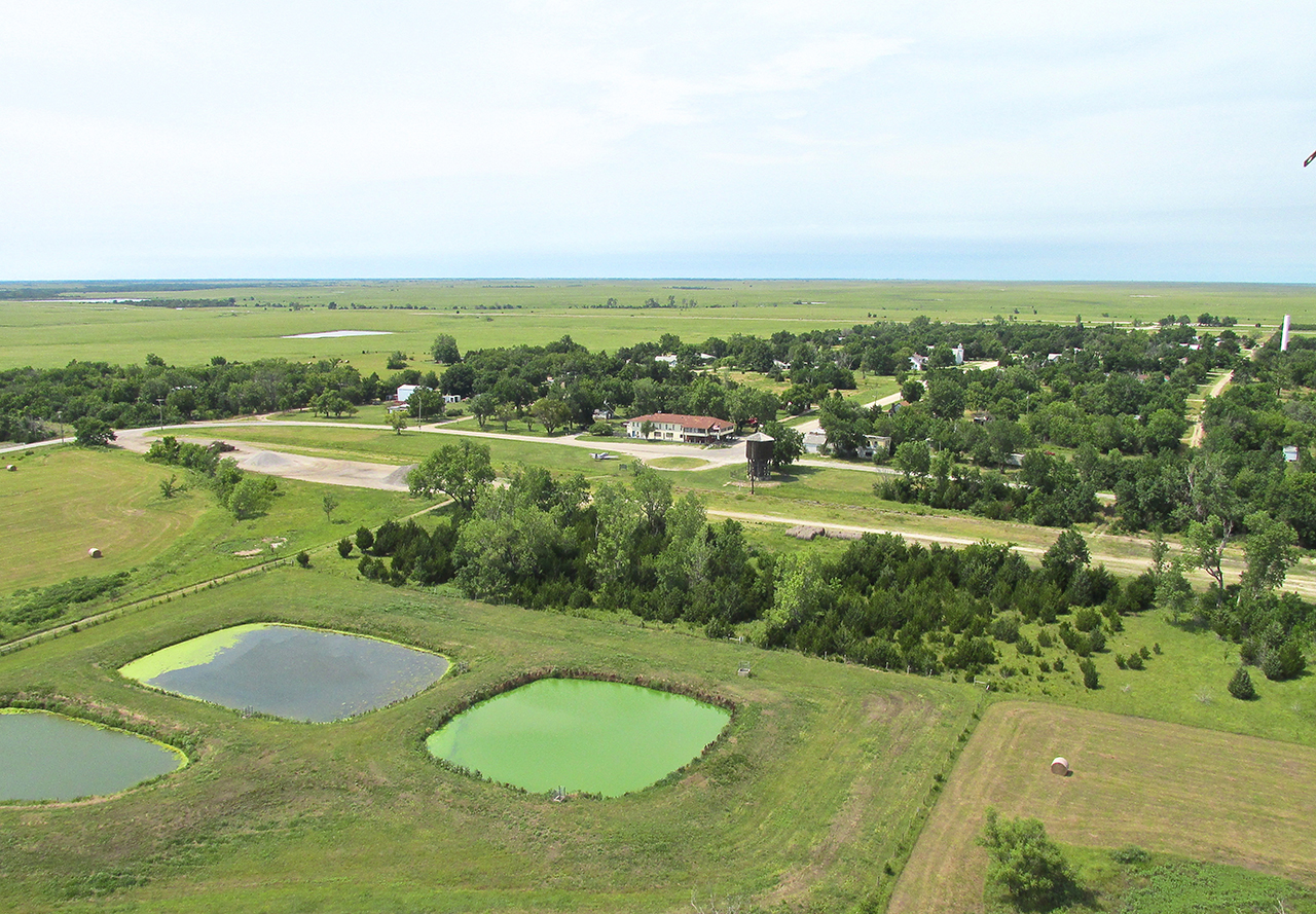
After takeoff I turned around for a moment to grab this telephoto shot of Yates Center with the Reservoir in the fore.
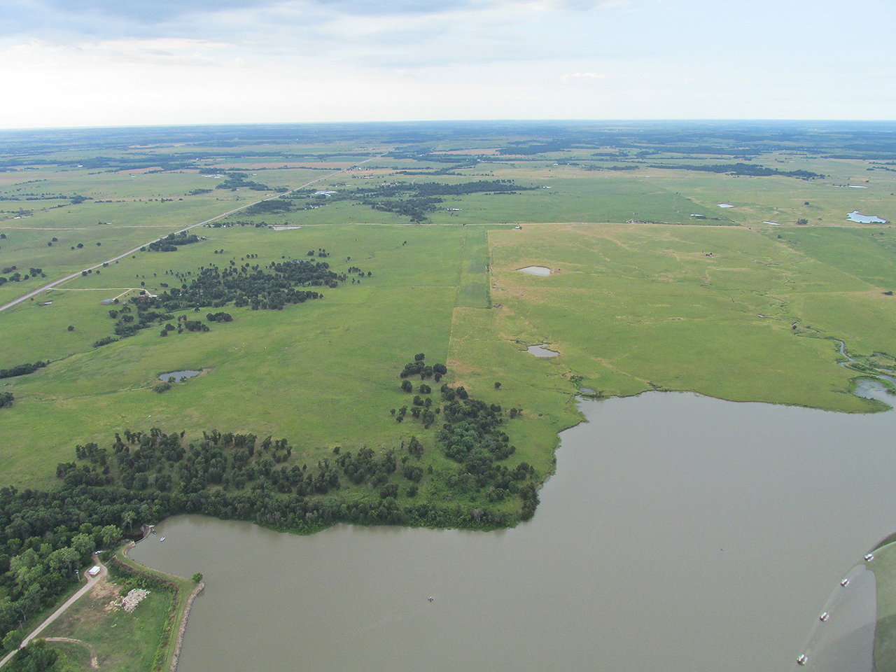
4 miles Southwest of Yates Center is this park.

Lake Fegan is a few miles farther.
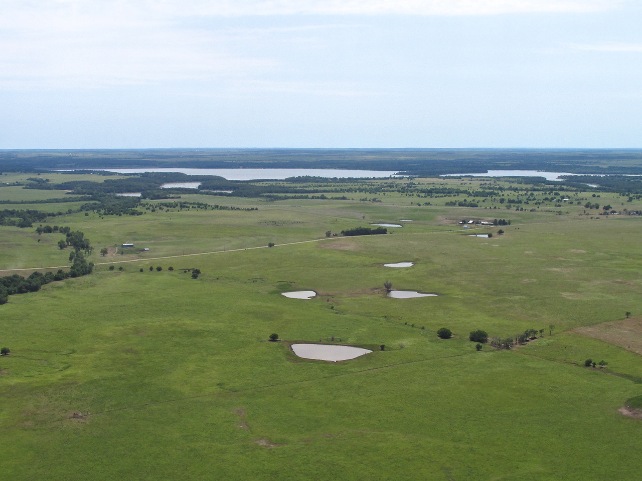
Lakes South of Toronto, Kansas
Slightly Different Track Yields Different Sights
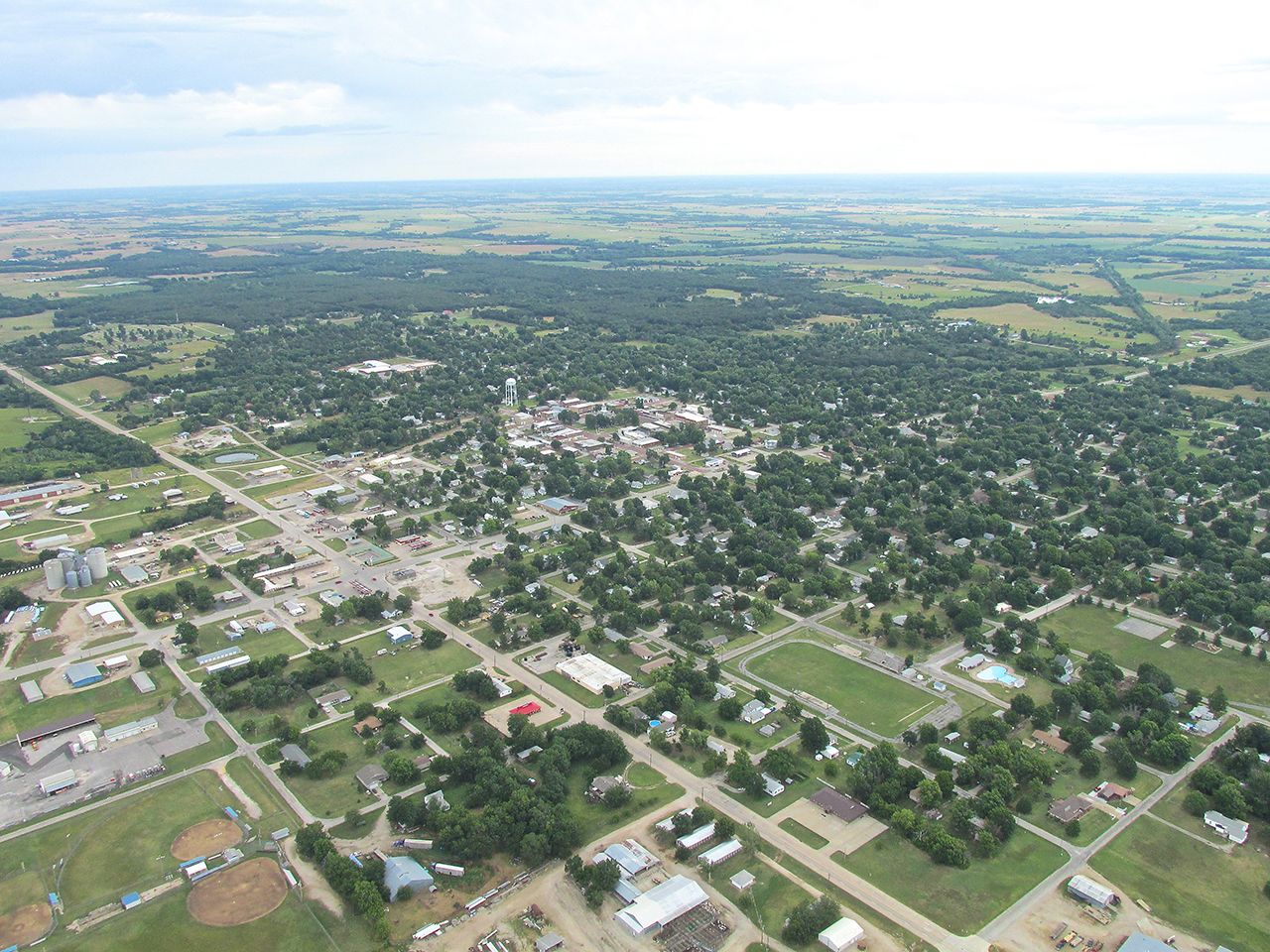
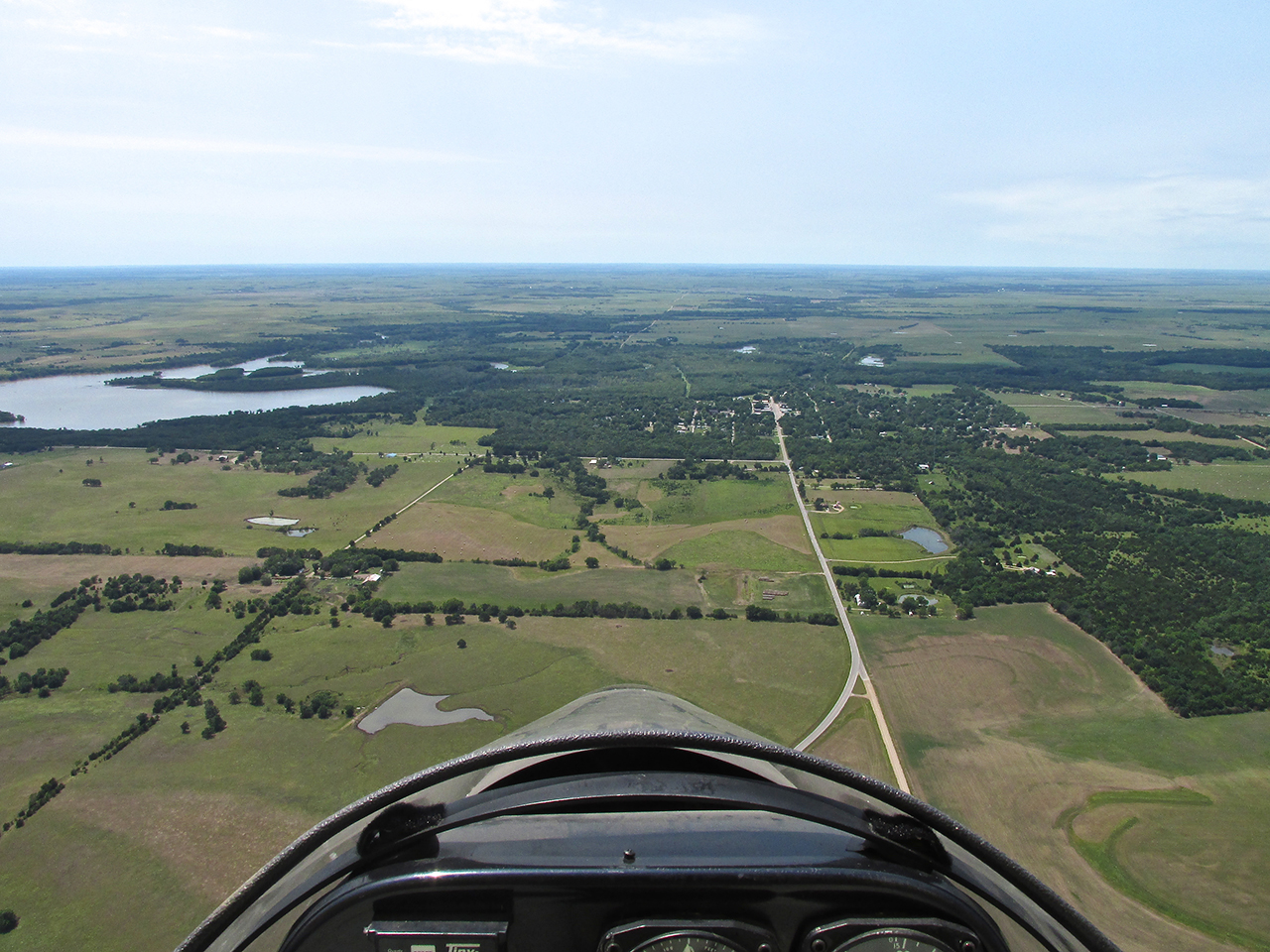
Earlier in the morning I passed low to the North of this area and didn’t see any of it. Toronto, Kansas is a new name to me. I think I’ll fly there some time. That is the Verdigris River passing it to the West.
Toronto, Kansas
Toronto’s Main Street From 1,100′ AGL Looking West
Toronto From 1,100′ AGL looking West Northwest
After leaving the Toronto and Verdigris River area I broke out into the open plains again.
Interesting rock patterns adorn these bluffs below.
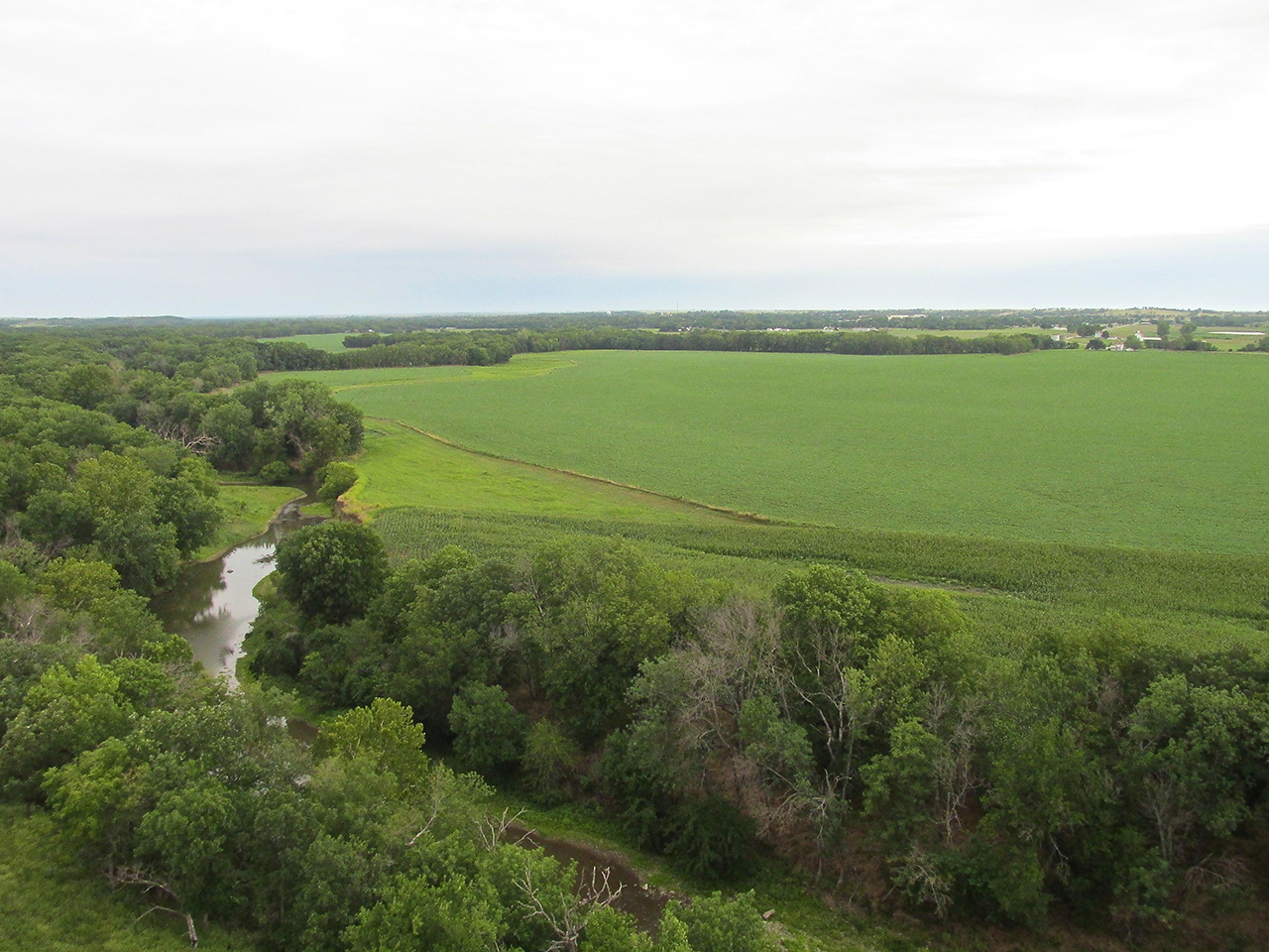
Flying low, this creek caught me by surprise. I snapped this shot under my right wing.
Plains Trig

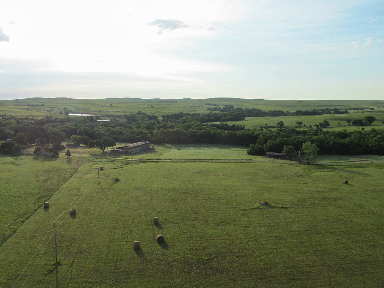
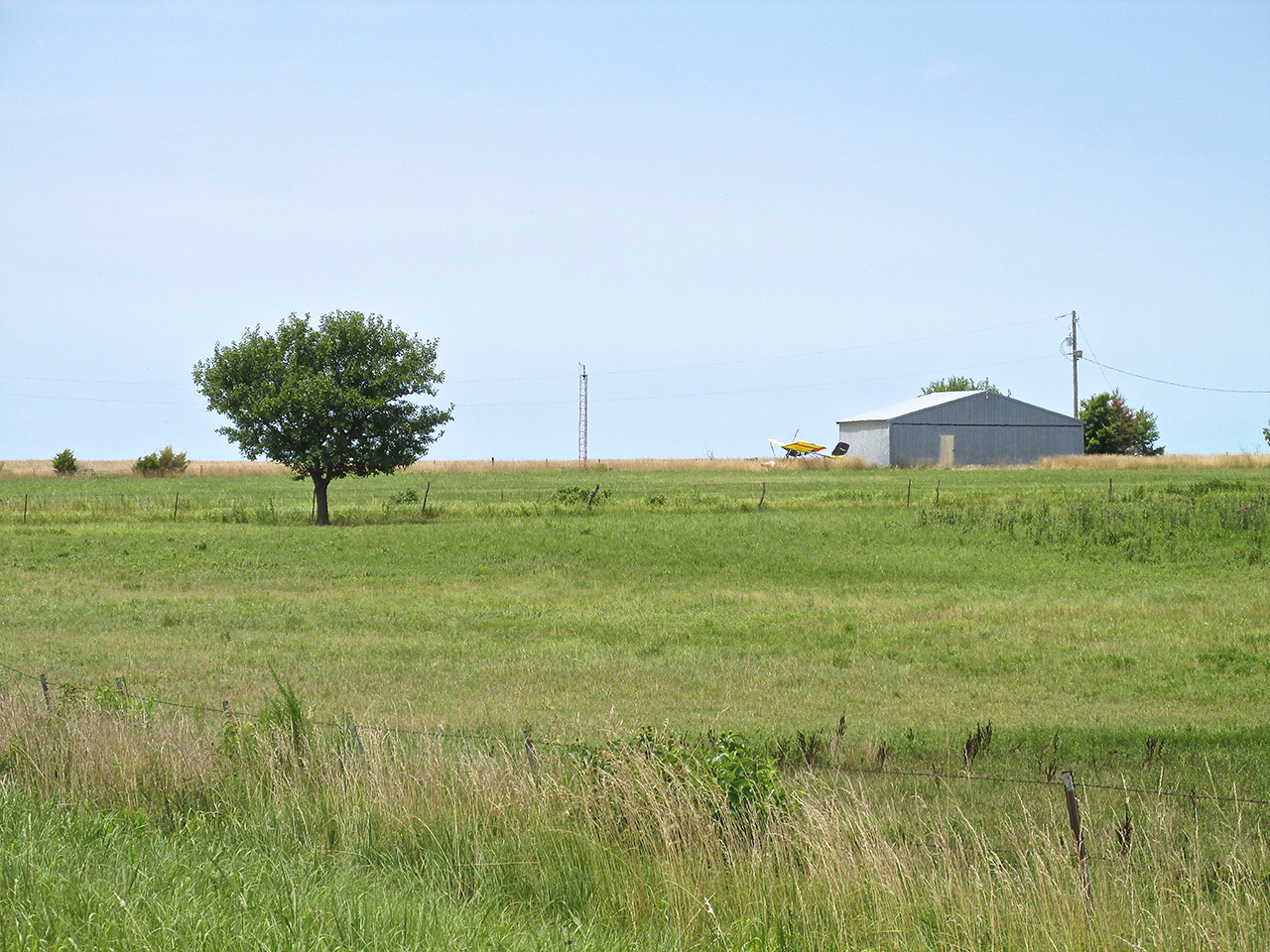
I took a picture of this farm on the way to Yates Center in the morning but like this angle better.
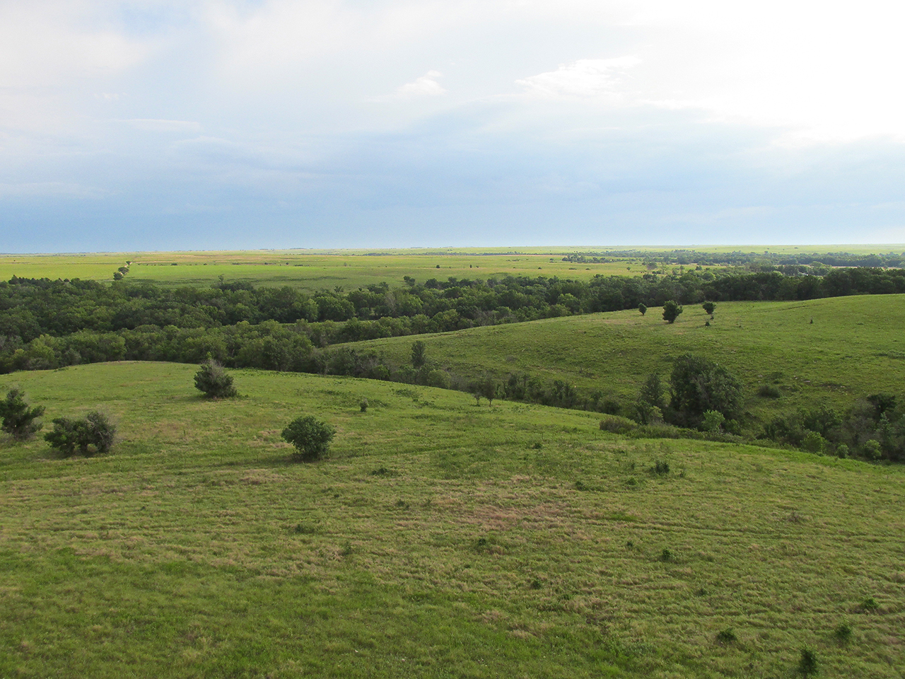
Before arriving at Beaumont I had to climb over these buttes.
I decided not to land at Beaumont but grabbed this picture instead. Note the Mooney parked in front of the restaurant / hotel.
About a mile West of Beaumont I spied this relatively small dry gulch.
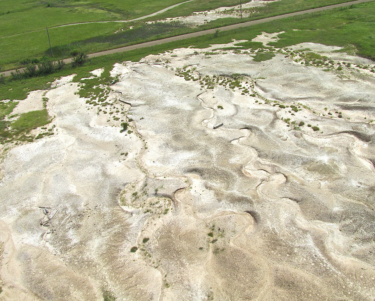

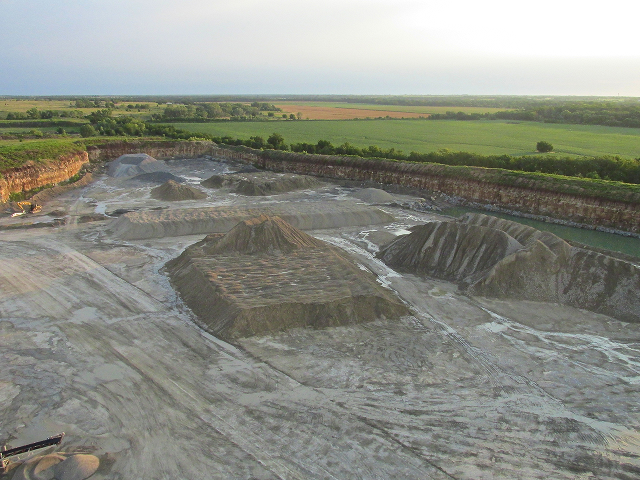
The quarry is a bit drier now. Seen from 600′ AGL looking Northwest.

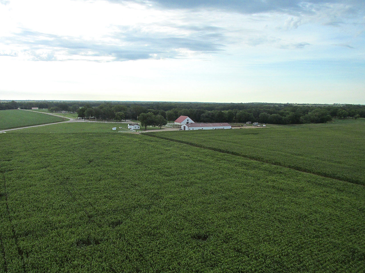
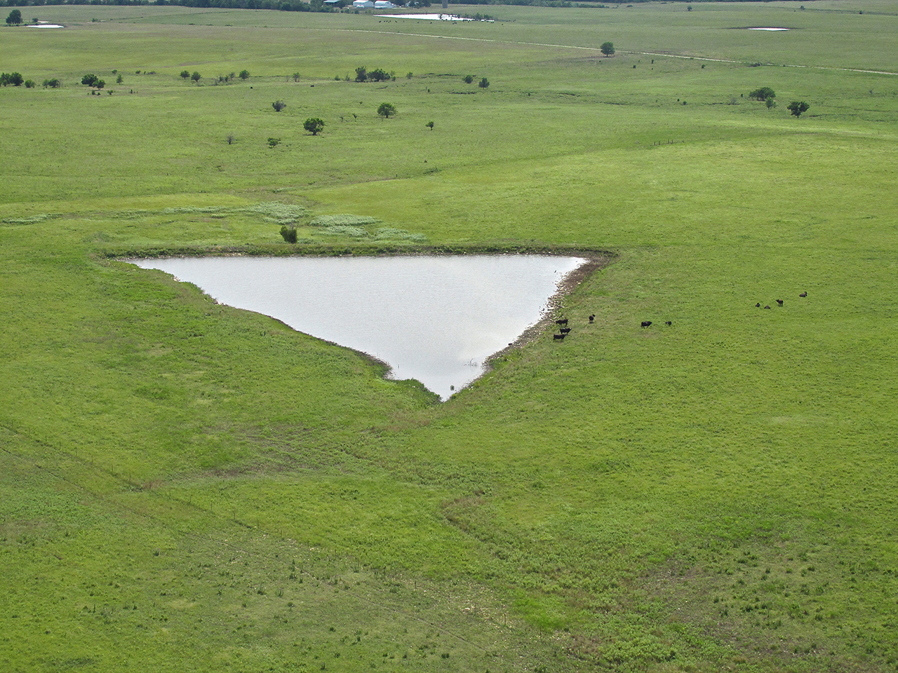
I was admiring this property complete with stables, pasture and lake.

My path took me directly over Butler County Airpark. My friend Chuck Gantzer lives there with his Pietenpol Airplane in the large Quonset style hangar home near the left end of the runway.
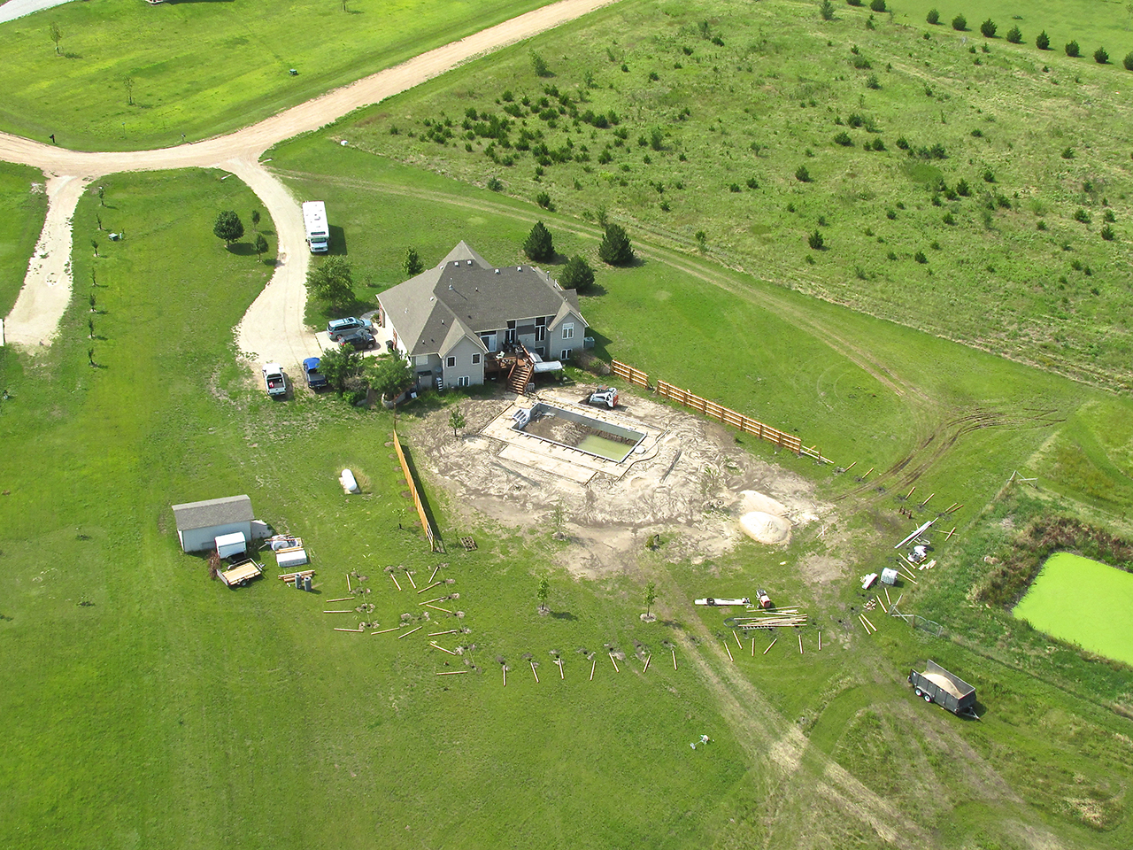
East of Derby, a new swimming pool and fence.
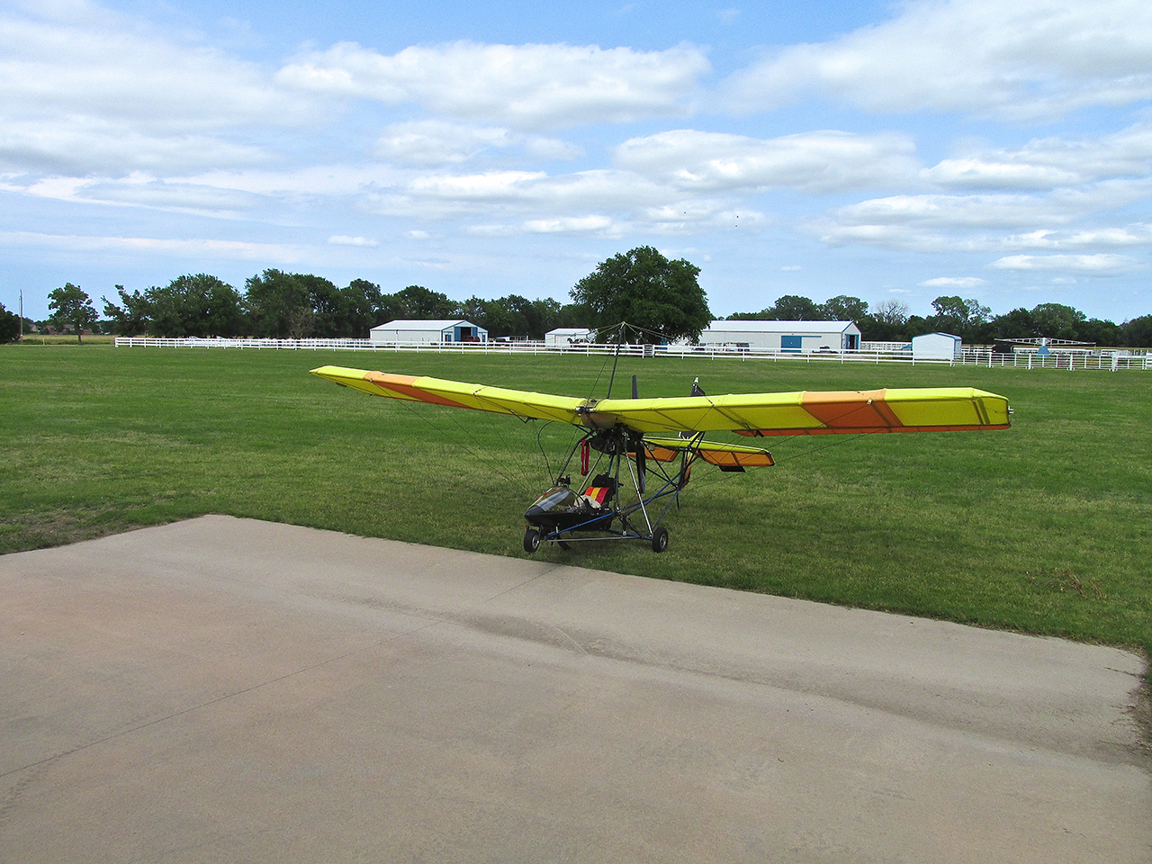
Back At Selby Aerodrome
Simple Ending
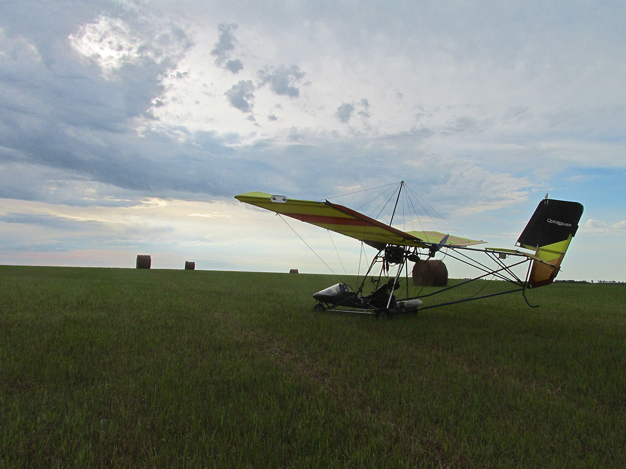
I try to close my stories with a unique photo angle or scene. This time, though, the story ends simply with proof that I returned to base with the same equipment I left with.
That you can see.
What you can’t see, is the gladness of heart I carry by being blessed again to experience The Heartland of America from the unique vantage point my gossamer chariot allows and from meeting The People Who Live There. No photo can reveal it, but the sentiment is as solid and valuable as gold.
See you next time!
Blue Skies & Tailwinds!™
The Sky Surfer – Brian FitzGerald – Wichita