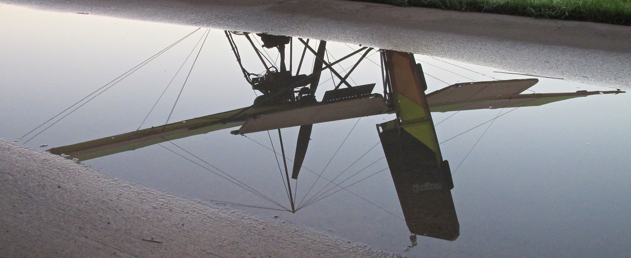
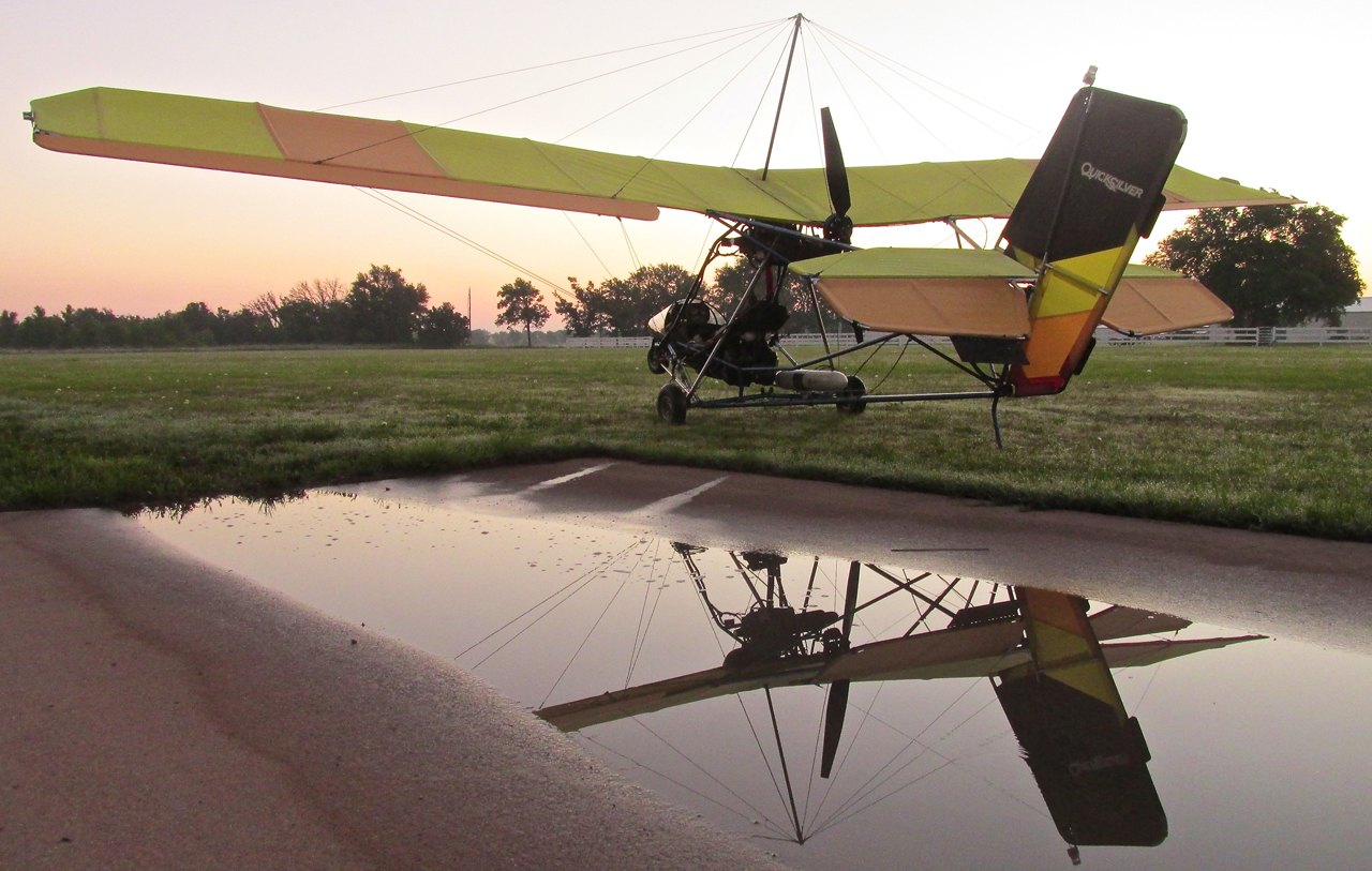
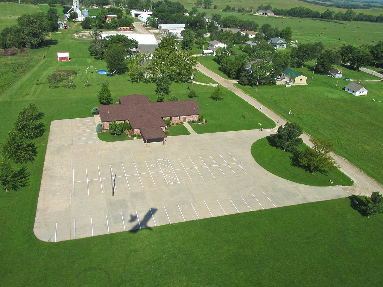
In Saturday’s Pre-Dawn light, The Sky Surfer’s MXL reflected at the bottom of the hangar ramp at Selby Aerodrome.
Drought No More
After 3 years of drought, Kansas has been treated to an enormous rainfall. This Summer of 2013 has brought more rain in a shorter time than I can remember in the 33 years I have lived here. For the week prior to the Burlington Flight it had rained every night. Around Tuesday, though, I predicted to My Wife that Saturday would be a good day for flying – it was.
Flight Plan
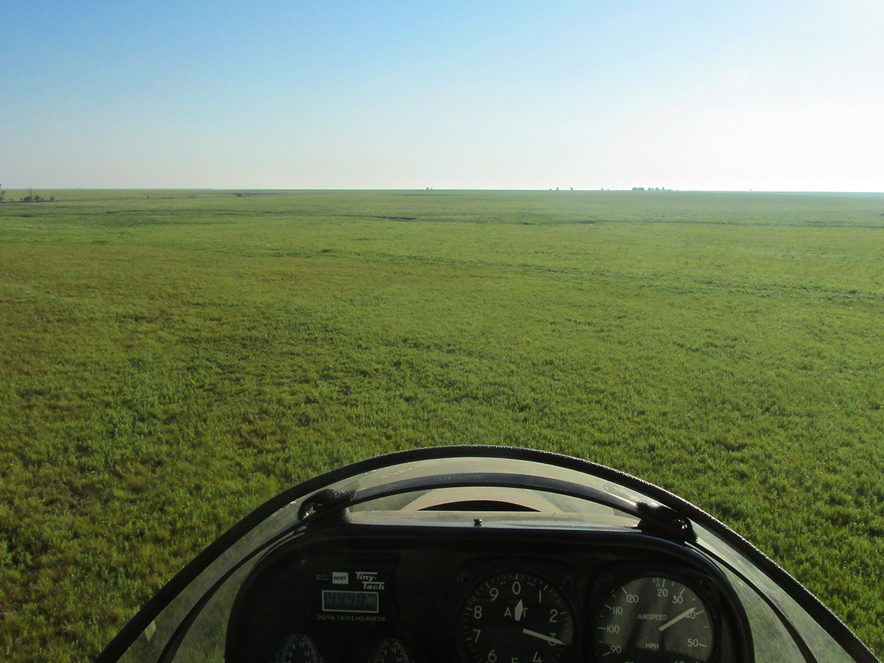
As is my GOP (General Operating Principle), I waited until Friday to pick my destination. The weather report that day predicted a Northeast wind of 9 mph for Saturday Morning. I checked my Destination Map for an interesting Northeasterly Destination. Because the morning headwind would be relatively low I decided to “stretch” a little with a flight of over 100 miles – Coffey County Airport / Burlington, Kansas.
A Sign?
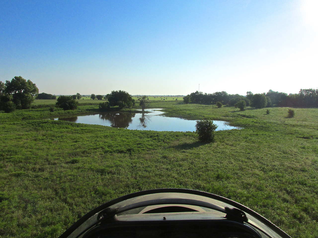
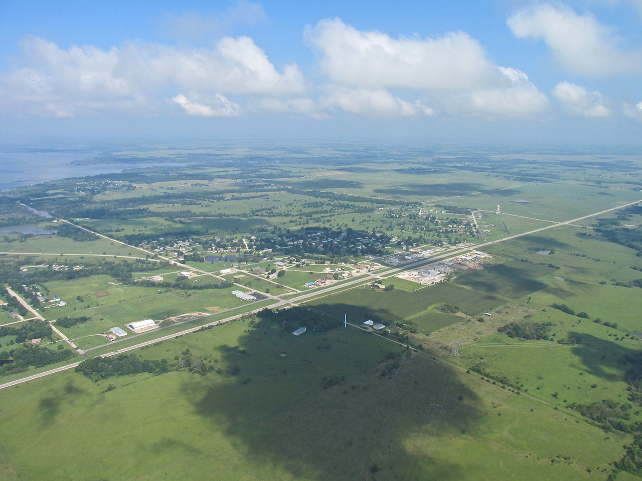
I had fueled up and pre-flighted the airplane Friday evening. Saturday before dawn, I rolled the Quicksilver out, hopping over the drainage area shown above. Besides being an excellent Businessman, Bill Selby displayed good knowledge and execution when building his hangars and airstrip. He planned the airfield well. He had it “crown” graded so it never has standing water on it. Water from rain or snow drains off the field immediately to the East and West. Then in front of the hangar, he designed the ramp to accomodate the drainage. The only challenge is to roll the plane across this drainage area without getting your feet wet. It’s not hard to do.
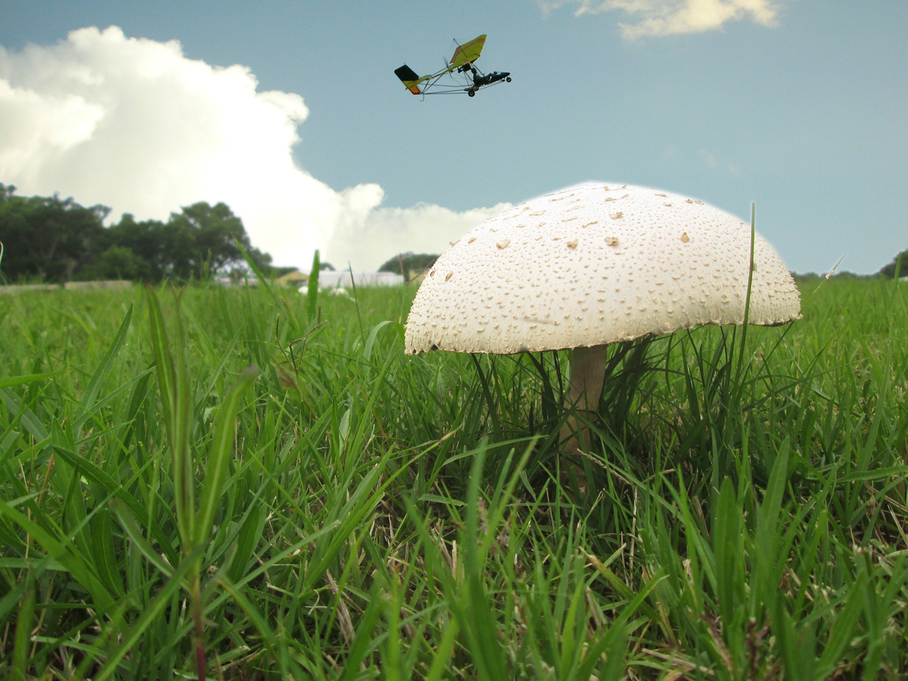
After getting the plane across the moat, checking the field for obstacles or deer, I noticed at the South end of the runway a low grouping of “white things” about 150 yards away. Being of curious bent, I jogged over to investigate before takeoff.
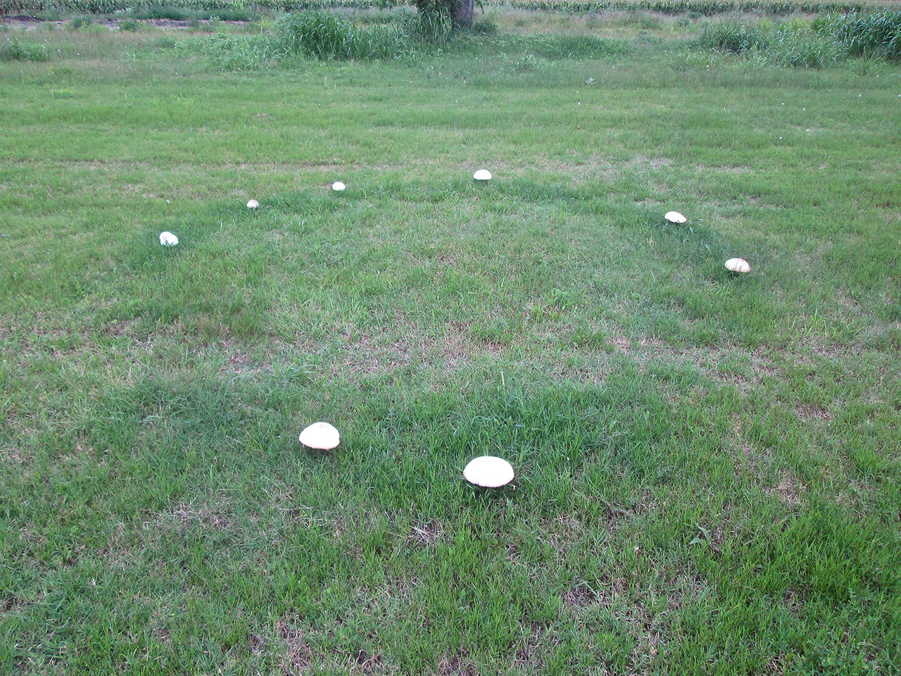
A Toadstool Ring – aka -Fairy Circle, Elf Circle, Elf Ring or Pixie Ring or Sorcerers’ Ring
Ronds de Sorciers (“sorcerers’ rings”)
It wasn’t a perfectly closed circle but definitely was what I know as “a Toadstool Ring”. I had never seen one before except in pictures. They figure large in European mythology but I put no stock in that sort of thing. On the other hand… As we shall see later in the story, there does seem to have been a connection that day…
99 – 100% Humidity

Above is the equation for determining the “humidity” of the atmosphere. One forecast said 99% and the other said the Humidity at Dawn would be 100%. Reading the Definition of Relative Humidity makes my head hurt but if you want to learn more about it you can follow the link.
From a human standpoint humidity is quite obvious. People feel high humidity very readily. For an airplane, it has various ramifications, mostly of reduced aerodynamic performance and the potential for “carburator ice”. I won’t go into the details but, suffice to say, Carb Ice can make your engine stop. I have never been affected by it flying my Ultralight but I know guys who have and were required to perform an unscheduled landing. If I was going to ever experience carb ice, that morning would be the day. I determined to be on the alert for it.
After takeoff the amount of water suspended in the air was obvious to see but hard to photograph because of the rising sun interacting with this highly reflective air mass. I tried six times to get a good rendition of it. The only shot that was successful was the one you see below. It captures well what I saw that morning.
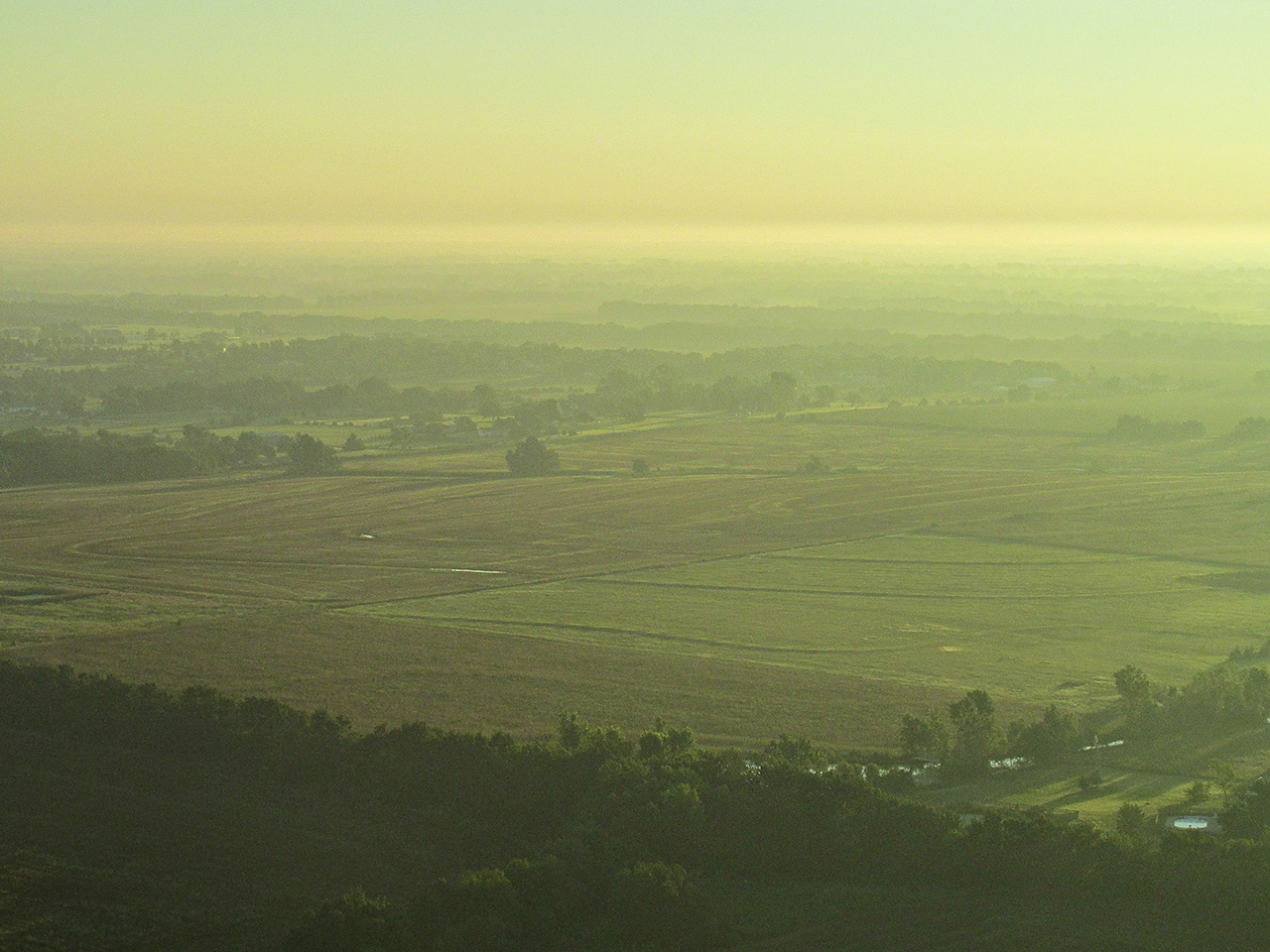
100% Humidity
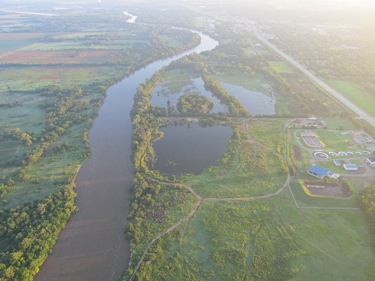
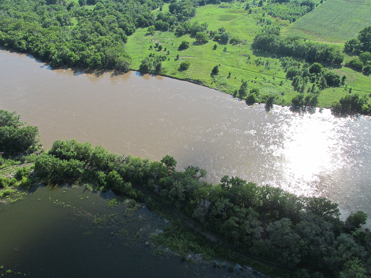
The Arkansas River just West of Derby, Kansas. Usually you can walk on most of that riverbed. Lately it is up to the banks.
I passed Cook Airfield to the South and took this shot out the back window.
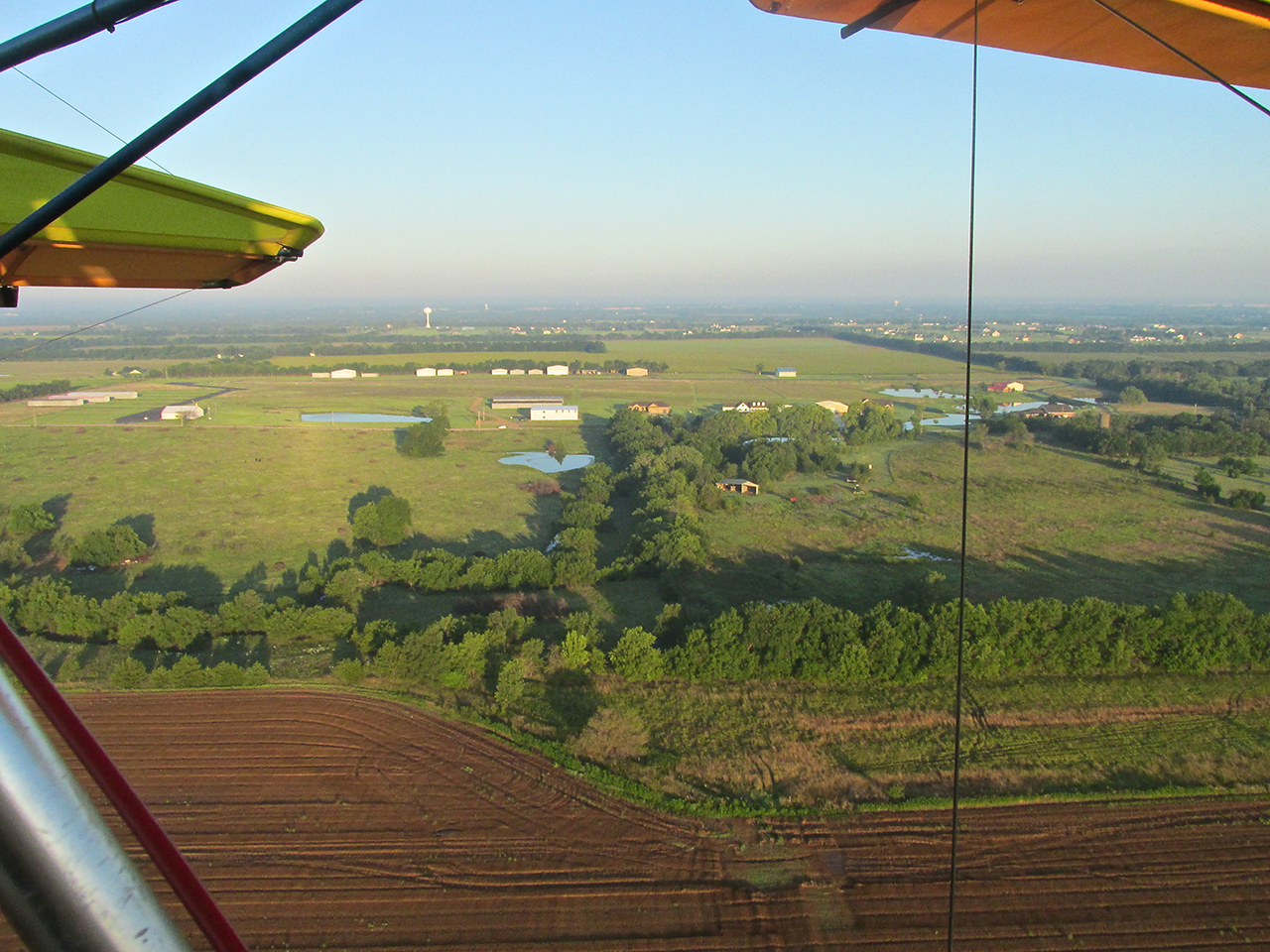
A short while farther Augusta, Kansas showed up under my left wing. Here the countryside begins to thin out.

Just as I cross Highway 77 I saw a former client of mine – PK Industrial.
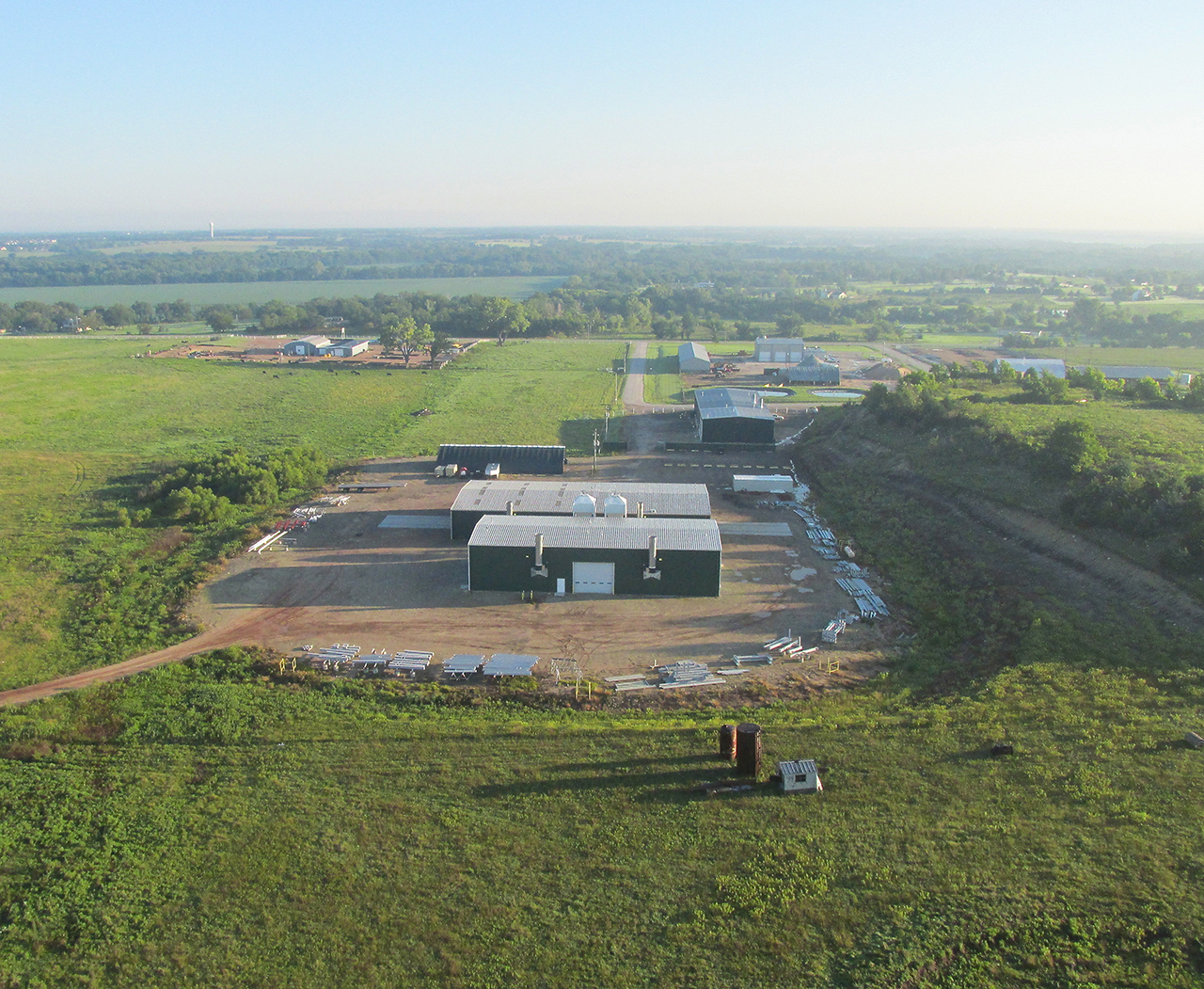
This is where they do off-site industrial painting and fireproofing. One of the many presentations I produced for them is HERE.
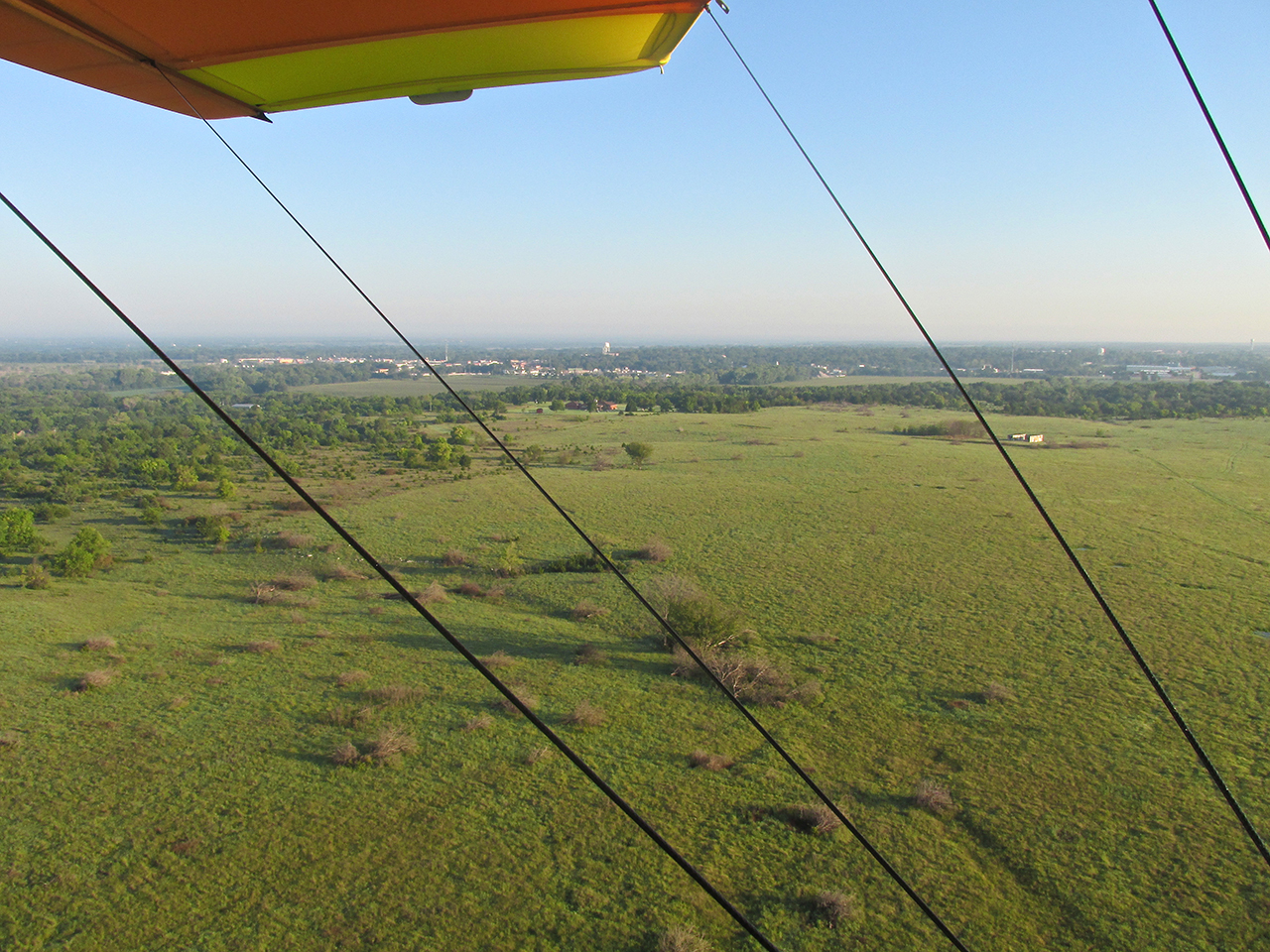
Finally, about 3 miles East of Augusta, I broke out into open prairie and farm land. To stay out of the headwind I dropped down to 6′ AGL and shot this “GlennView”.
Over grazing land, another “GlennView” from 5′ AGL looking Northeast.
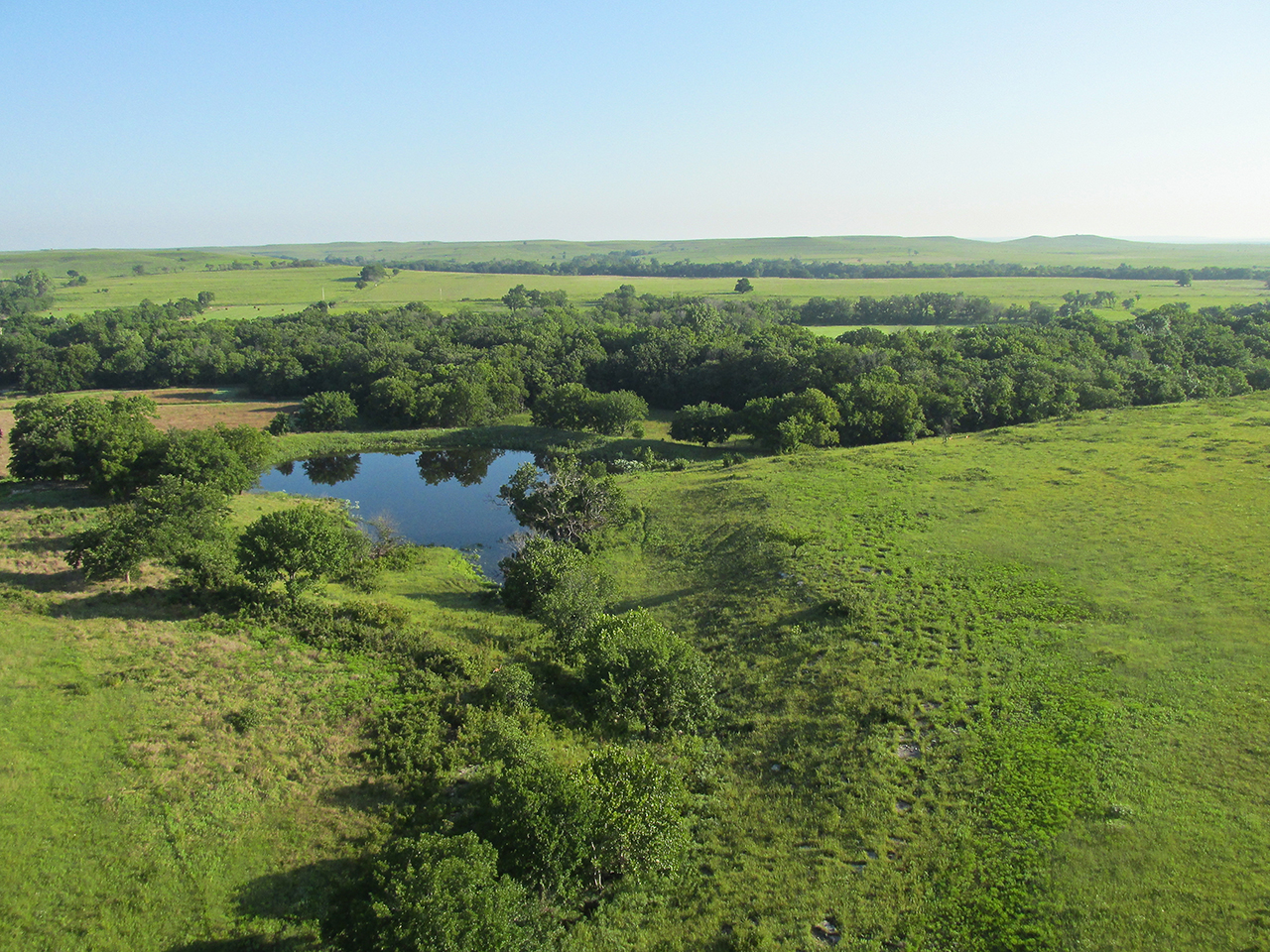
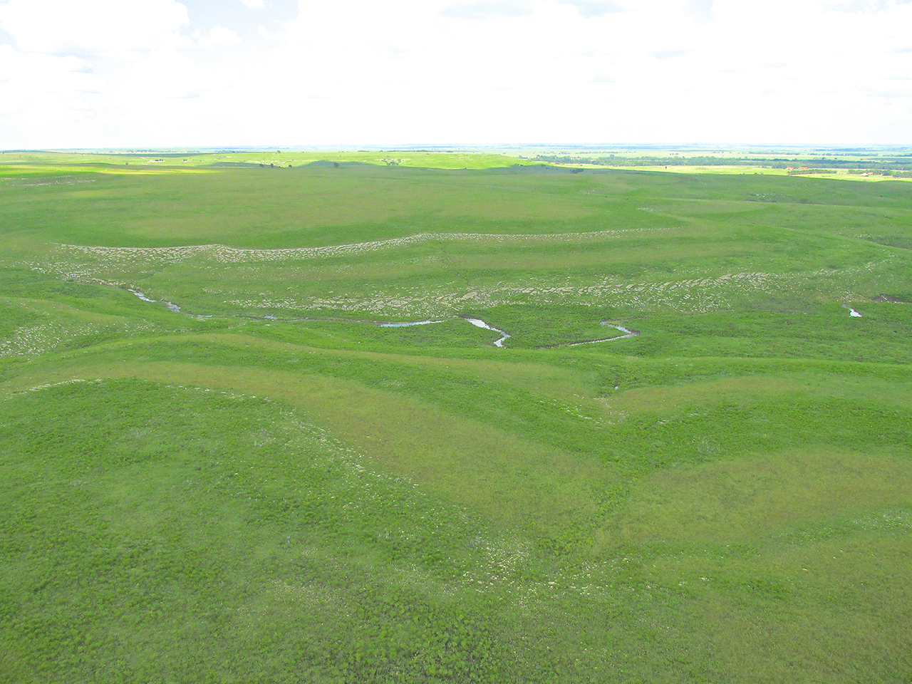
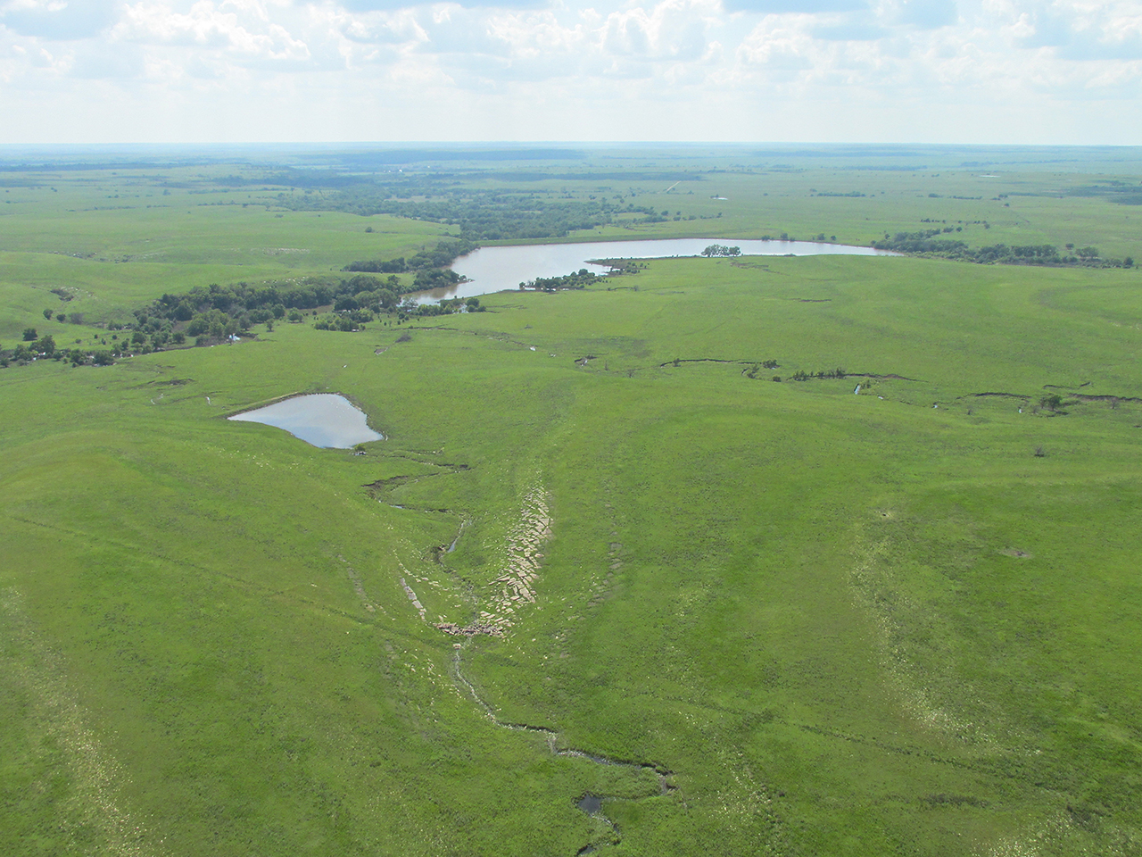
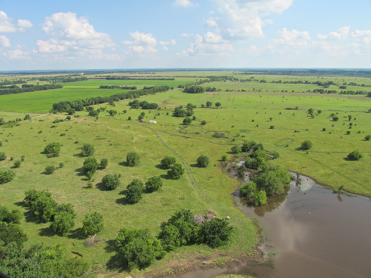
Super Saturated
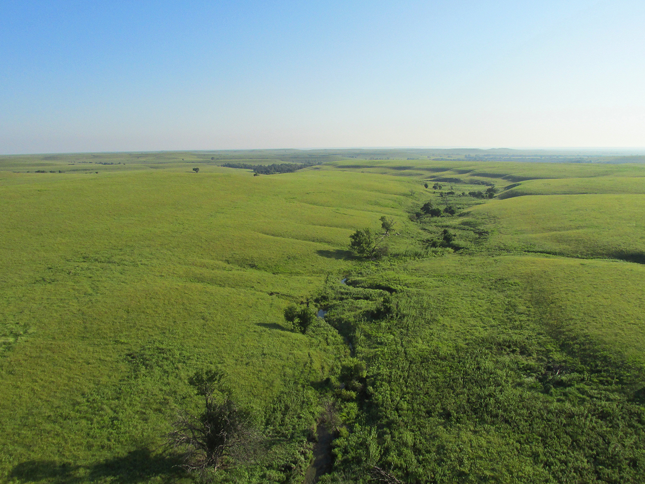
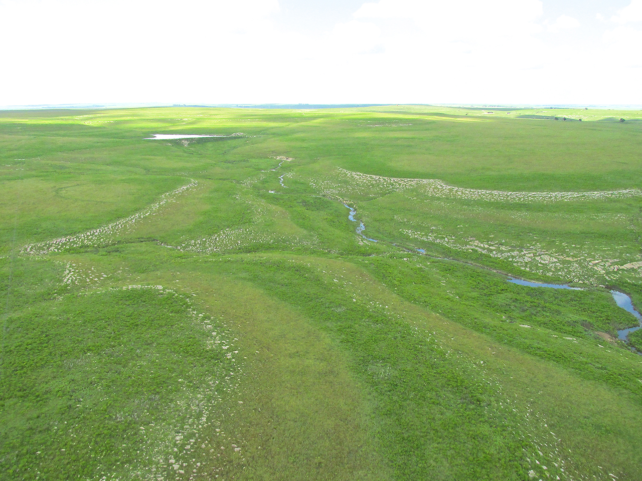
The photo below, besides providing a glimpse of the majestic view surrounding me, also will serve as an illustration of the “100% Humidity” sub theme of this story. While “flat” in one sense, this area of the great plains is actually a continuous carpet of rolling hills draining their rainfall into thousands of small creeks. In the center of this photo is one of these creeks. What you don’t see and what I had never witnessed before out in this landscape was the standing water everywhere beneath me. From the tops of the hills to where they emptied into the creeks, all the ground was under standing water I estimate to have been about an inch thick. It looked like an Irish Bog.

“Off by its lonesome”, I saw this old stone building.
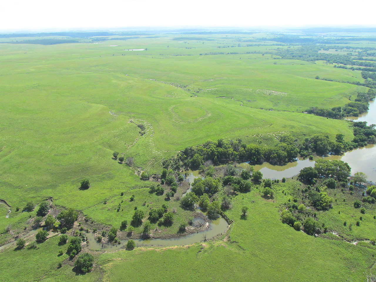
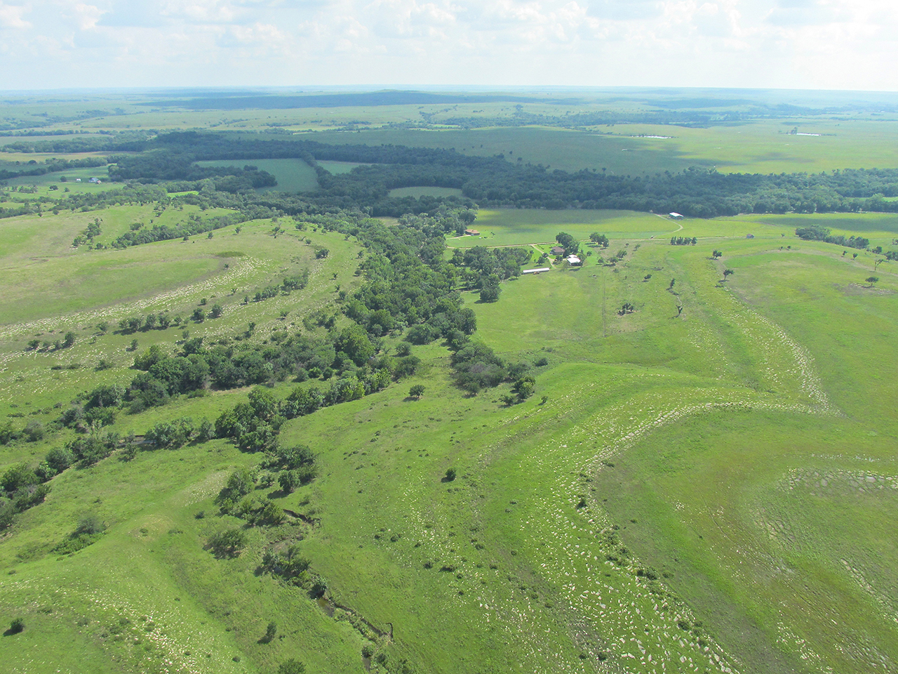
The contouring of these rolling hills fascinates me.
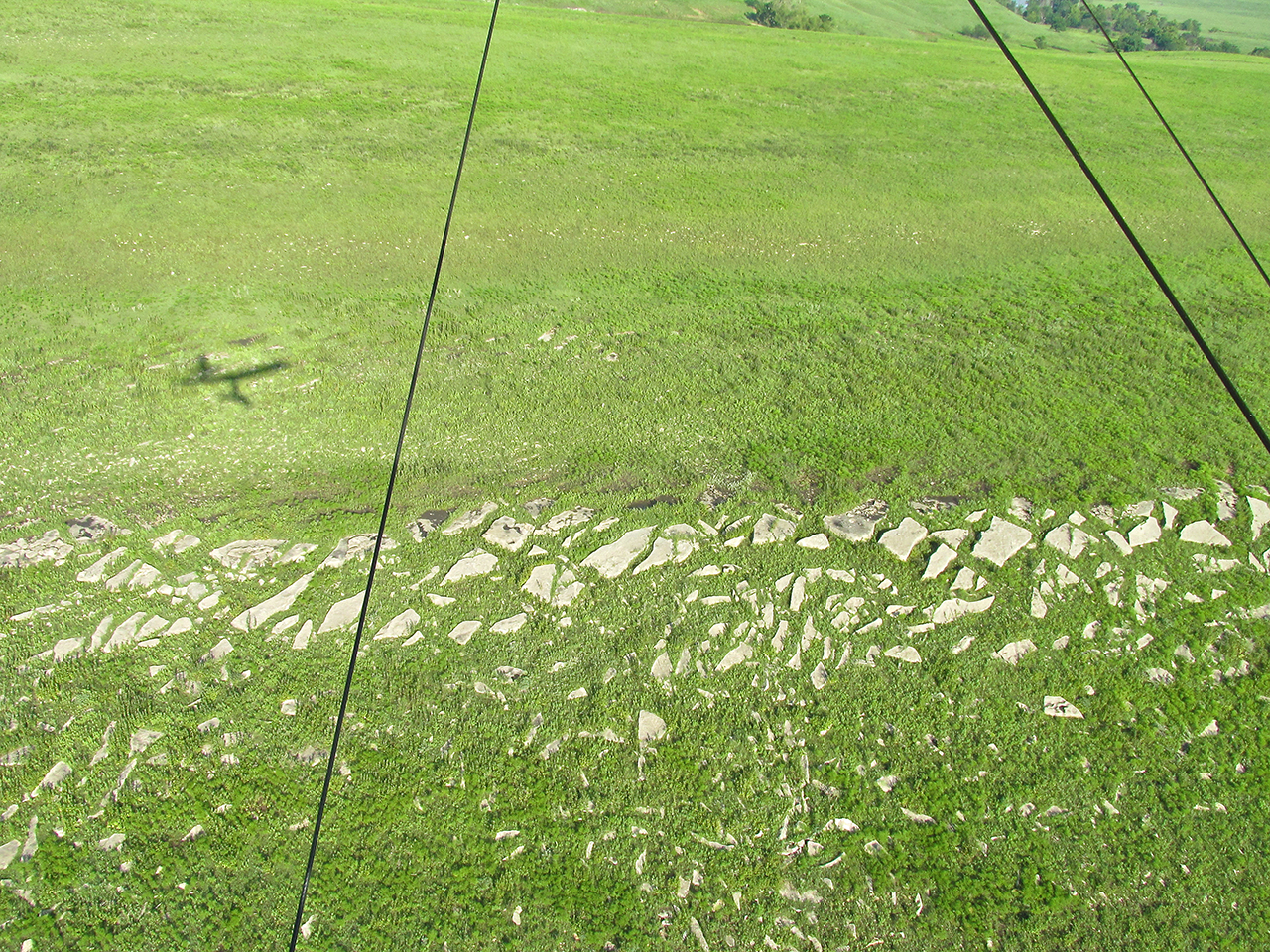
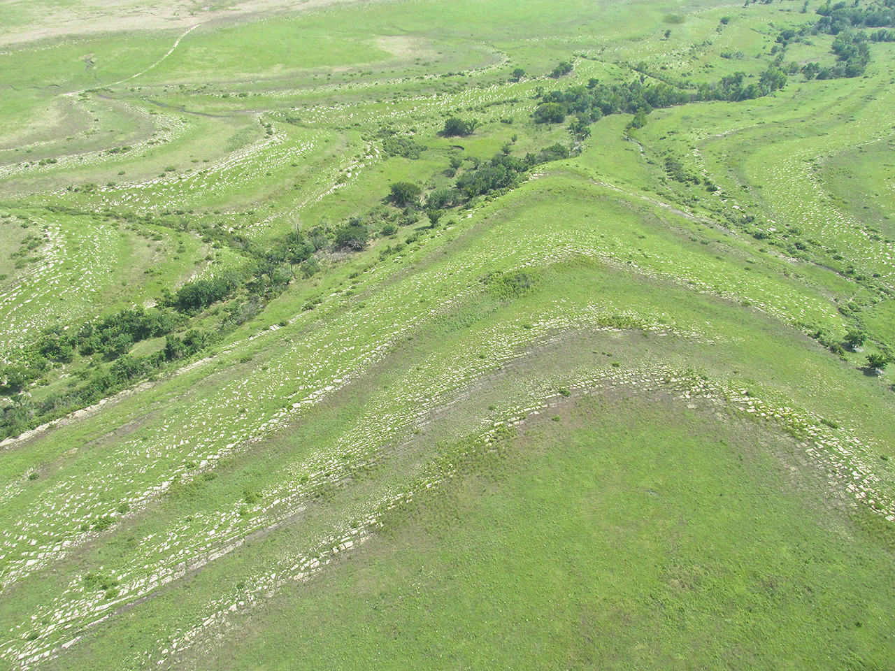
Here, flat pieces of stone adorn the break point of this gently sloping hill.
Recon
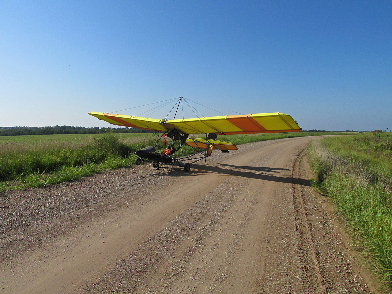
I had flown for about two and a half hours and decided to land and stretch the legs. Normally I would land on a cut hay field or on a “4 wheeler” trail but as I reported earlier all the land was like a big sponge that morning. I didn’t want to de-plane and slog around in that stuff. Additionally it would make takeoff much more difficult. I saw a nice flat country road. There was no pickup traffic who’s travel I would be blocking so I put the MXL down.
After fooling around taking pictures and looking at the map I decided it was time to continue. During this time I had not taken my earplugs out so I did not hear the approach of the pickup that pulled up behind my plane.
Mark Haas and The Sky Surfer
A Flint Hills Rancher
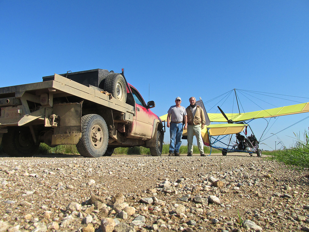
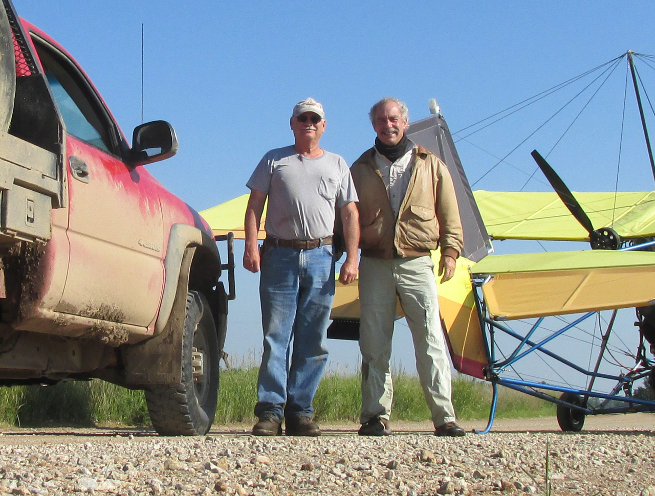
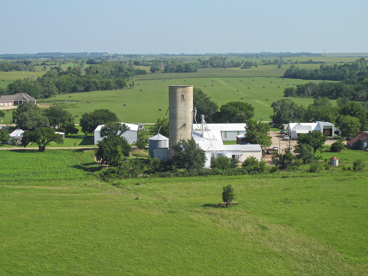
I was getting everything in order to start the motor and leave. From the position I was at in front of the plane I suddenly saw the tires and front of a pickup and somebody’s feet getting out of the cab. I pulled the earplugs out as I worked my way under the wing to introduce myself. It was Mark Haas. Mark had seen a bright, yellow object from a ways off and came over to investigate. Upon seeing it was an air machine he assumed I was having engine trouble and was prepared to help. I thanked him for his concern but explained my mission and that I was just making a stop on the way to Burlington. For about 15 minutes we talked about a number of things while standing out in the calm morning air. He pointed to some of his cattle on a hill about a mile Southeast of our position and said they own land to the Southwest also. I told him I had just passed over that area and how fine it looked from the air. He said it was but that there was an encroaching species of plant threatening to greatly diminish the quality of gazing there and throughout Kansas called Sericea Lespedeza. Not native to the area, it was pushing out the native grass the cattle thrive on.
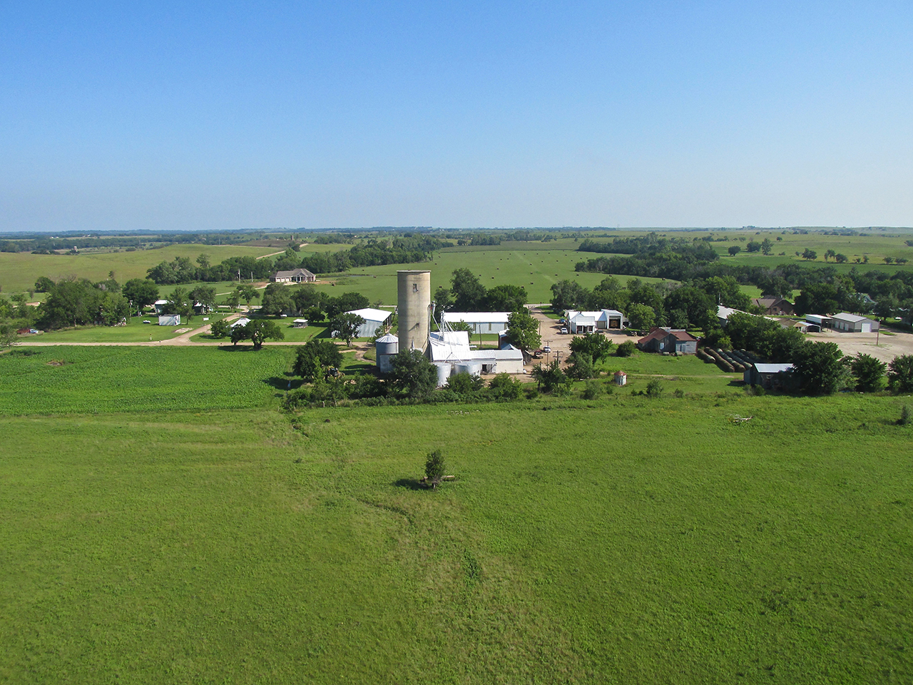
We also talked about his unique concrete silo. An author had been by recently to take pictures of it for a book she is looking to publish. I told him I would shoot some aerials of it.
Closer
Like most folks out on the range, Mark works Saturday and had to get back to it. I also needed to be on my way so we parted after I gathered his telephone number and email address. Just before I started the motor I noticed another truck pull up. I could hear Mark tell them I was getting ready to take off and they should watch. I waved and then got the motor turning. Then before strapping in, I shot the photo below.
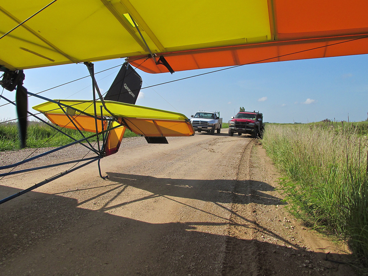
After takeoff, I circled the trucks and headed over to Lamont to get some photos of the concrete silo and town.
Lamont, Kansas from 100′ AGL looking North
The little girls on bikes were waving at me. I returned the wave and resumed my heading for Burlington, Kansas.
Short Leg
By the time I landed and met Mark Haas, I had flown about 2.5 hours. I had another 16 miles to Burlington – 20 miles to the Coffey County Airport which is North of town. The entire morning I flew into a gentle headwind that was allowing between 30 and 35 mph ground speed at my 38 mph “best fuel consumption airspeed”. As I approached Burlington, though, I climbed to 1,000′ AGL and my ground speed dropped to about 28 mph.
Next are aerial images of Burlington, Kansas and environs surrounding.

The John Redmond Reservoir – Northwest of Burlington
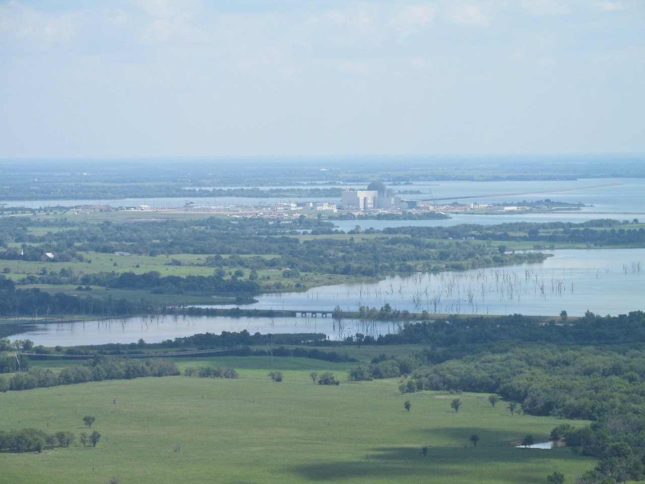
There’s Silos And Then There’s SILOS
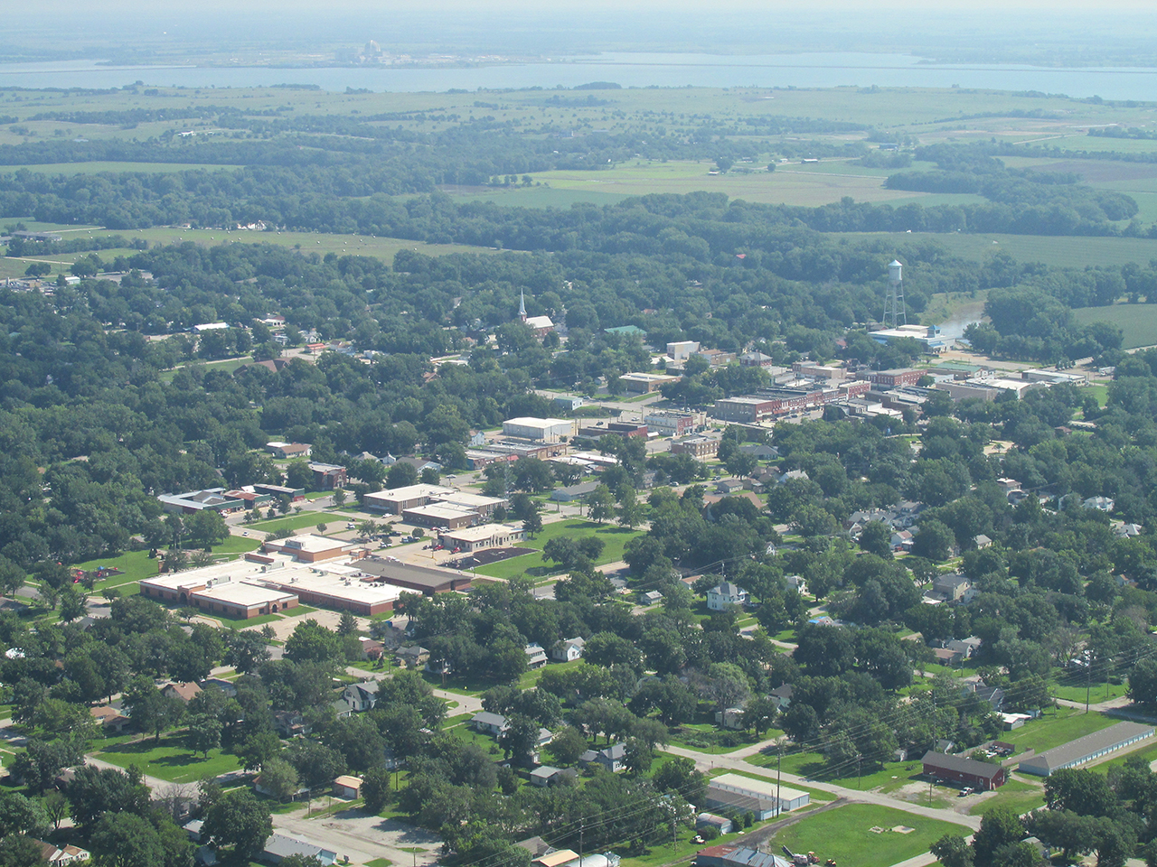
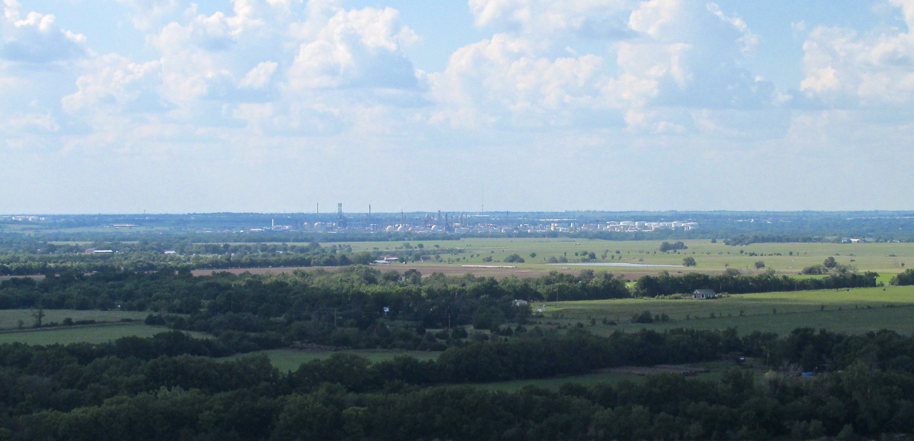
Even though I was looking forward to seeing The Wolf Creek Nuclear Electric Generating Plant, it caught me by surprise. As I approached the Burlington area from the Southwest I flew at about 75′ AGL until about 2 miles out. From that low level out here in “The Flatlands”, generally the highest point of a town will be the grain elevators it might have. That is what you notice first. For quite a way before actually seeing buildings, I picked up Burlington’s “grain elevator” (at least that’s what I thought). I could see a series of buildings with a “silo” and assumed it was a grain elevator in town. As I began my ascent about 2 miles Southwest of town it became obvious this was wrong. I was seeing the Wolf Creek installation rising above the prairie 4.5 miles past Burlington. Wolf Creek is a much larger installation than I had imagined.
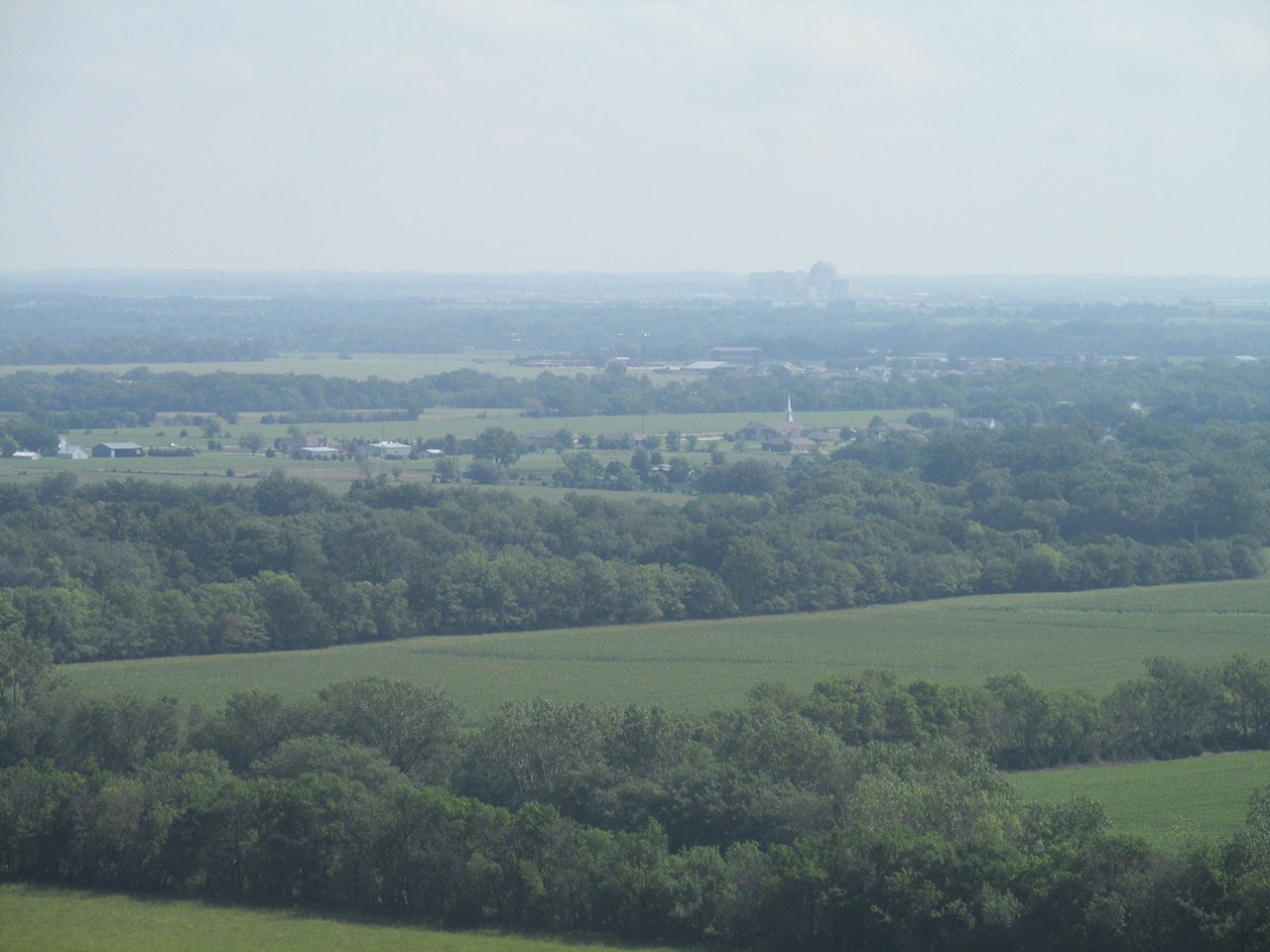
The Moment It Became Obvious

Burlington, Kansas from 1,000′ AGL looking Northeast
Telephoto: Downtown Burlington with Wolf Creek in the distance from 1,000′ AGL looking Northeast
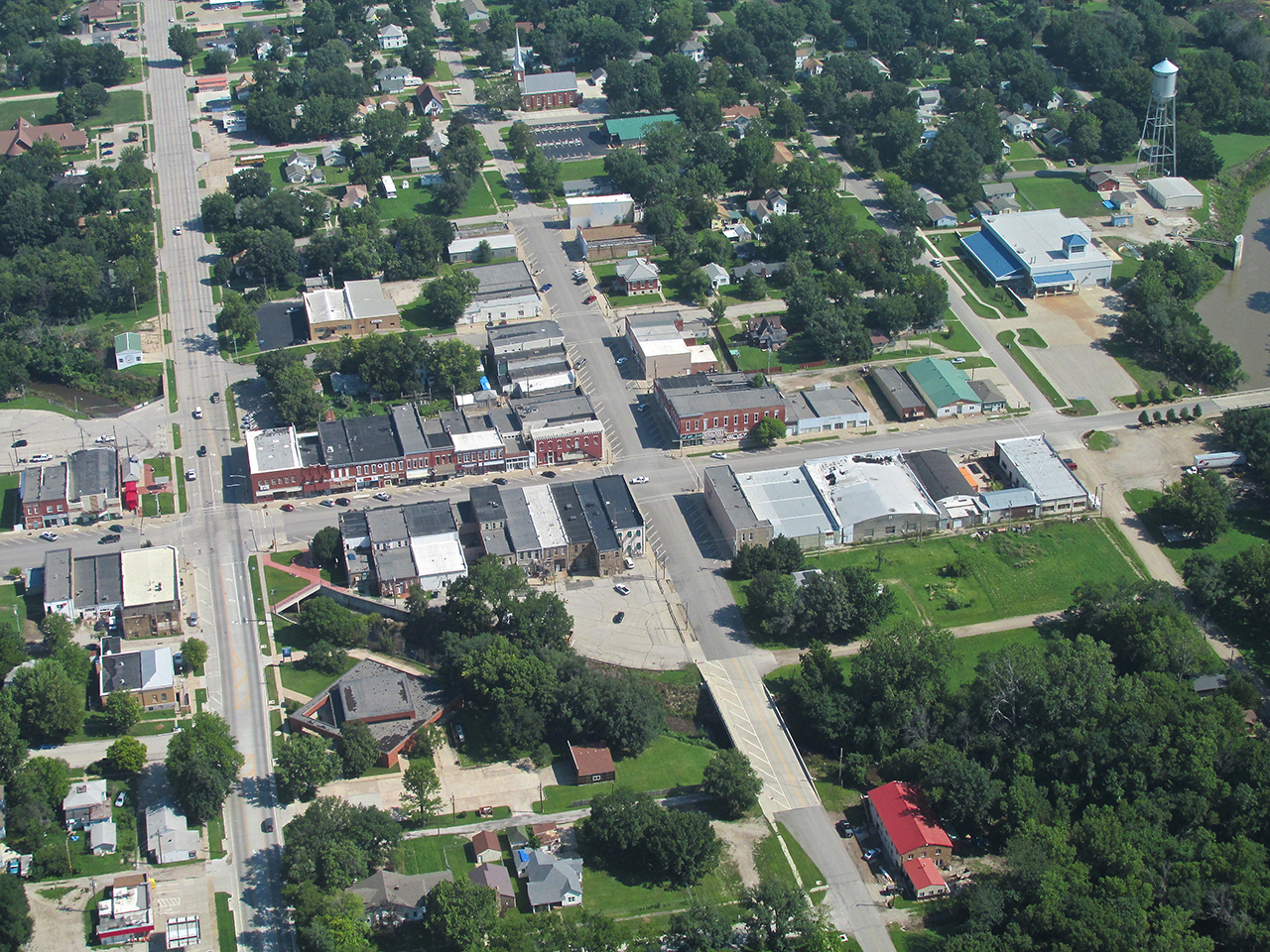
Neosho Street where I will be showing a number of pictures later in the report – from 1,100′ AGL looking North Northeast.
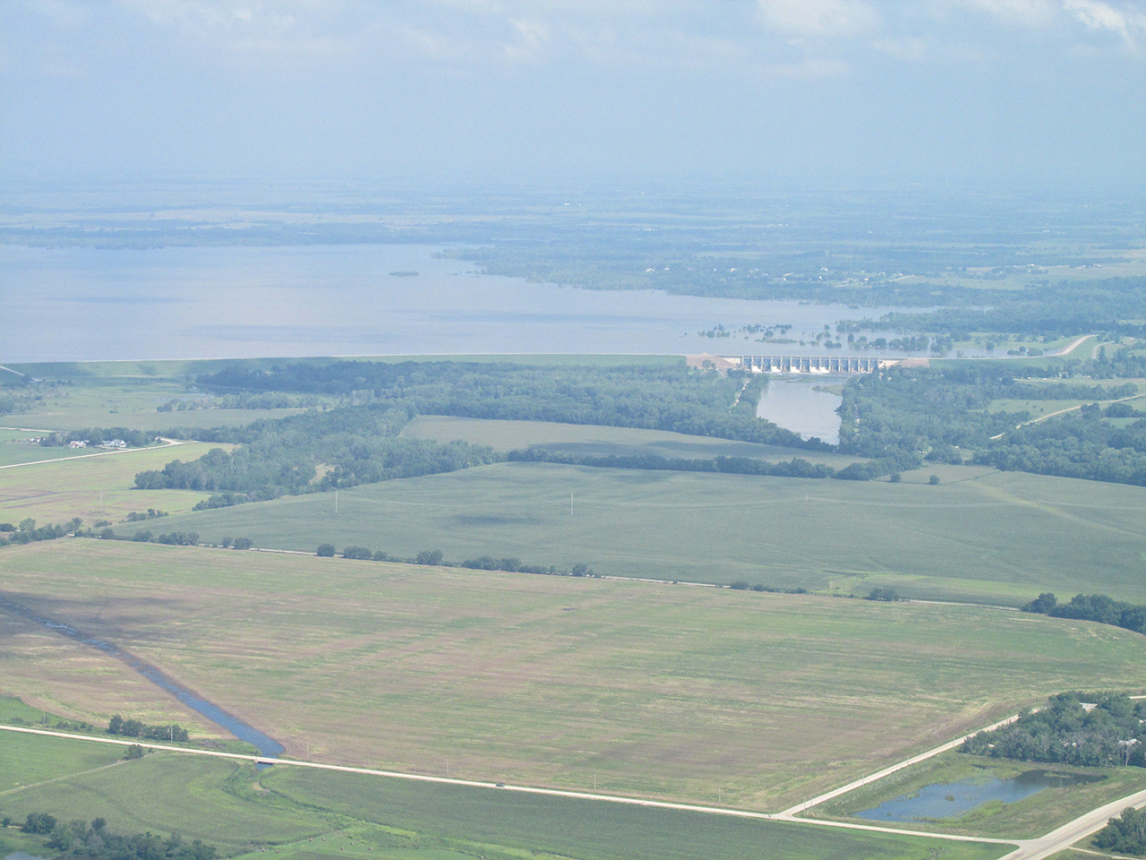
The John Redmond Dam. After flying around the South end of town I headed North to the airport. Later in the story as I leave the airport I will fly over the dam and show it from above.
No Loitering
Because of confused state of our Federal Government with regard to Terrorism, prior to flying to Burlington I made inquiries as to the “authorities’ feelings” regarding aerial photography of Wolf Creek. I use the word feelings purposely because since the muslim attack on The World Trade Centers in 2001, I have seen little evidence emanating from Washington indicating a logical, consistent, sensible, cohesive, effective policy to deal with this threat. I half expected to find it illegal to take pictures of this gargantuan facility but that was not to be the case. All I was told was that “the authorities” did not like airplanes “loitering” around the site.
I figured that was just fine because I had no intention of getting close to it. Even so, I wondered if my cruise speed of 38 mph (ground speed even slower into the headwind) might be perceived as “loitering”. So be it. I pressed on.
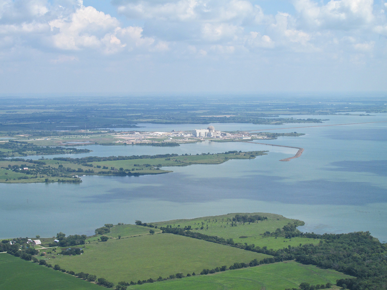
Wolf Creek on the other side of its cooling water lake from 1,500′ AGL looking Northeast.

Telephoto – Same Position
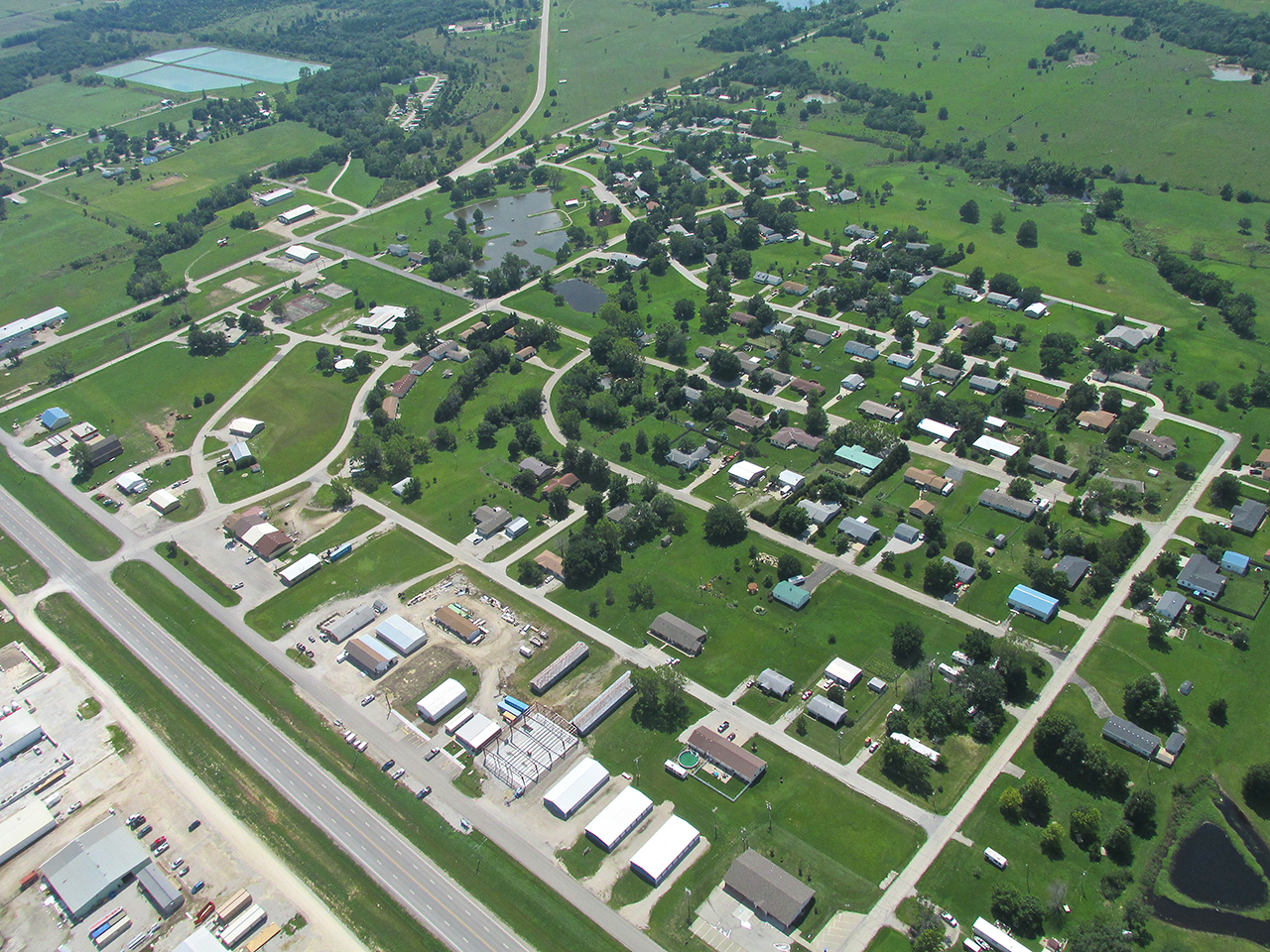
New Strawn
When researching this flight I discovered there was a Strawn before there was a New Strawn. Simply put, “Old Strawn” is out in the middle of The John Redmond Reservoir. They moved everything.
New Strawn from 1,500′ AGL Looking Northwest
Near Cloud Base
Usually I fly far beneath the clouds but this Saturday their base was 200′ over my head. VFR (Visual Flight Rules) dictate flying clear of clouds and that’s what I did. Just Northeast of New Strawn is Coffey County Airport. I entered the pattern and landed.
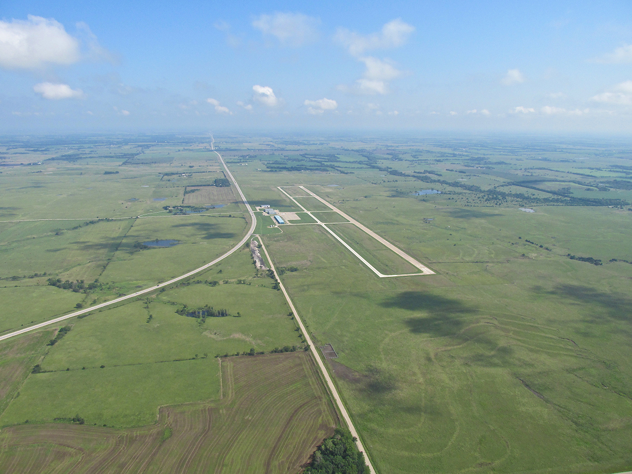
Coffee County Airport from 1,500′ AGL looking North

In the pattern – downwind leg
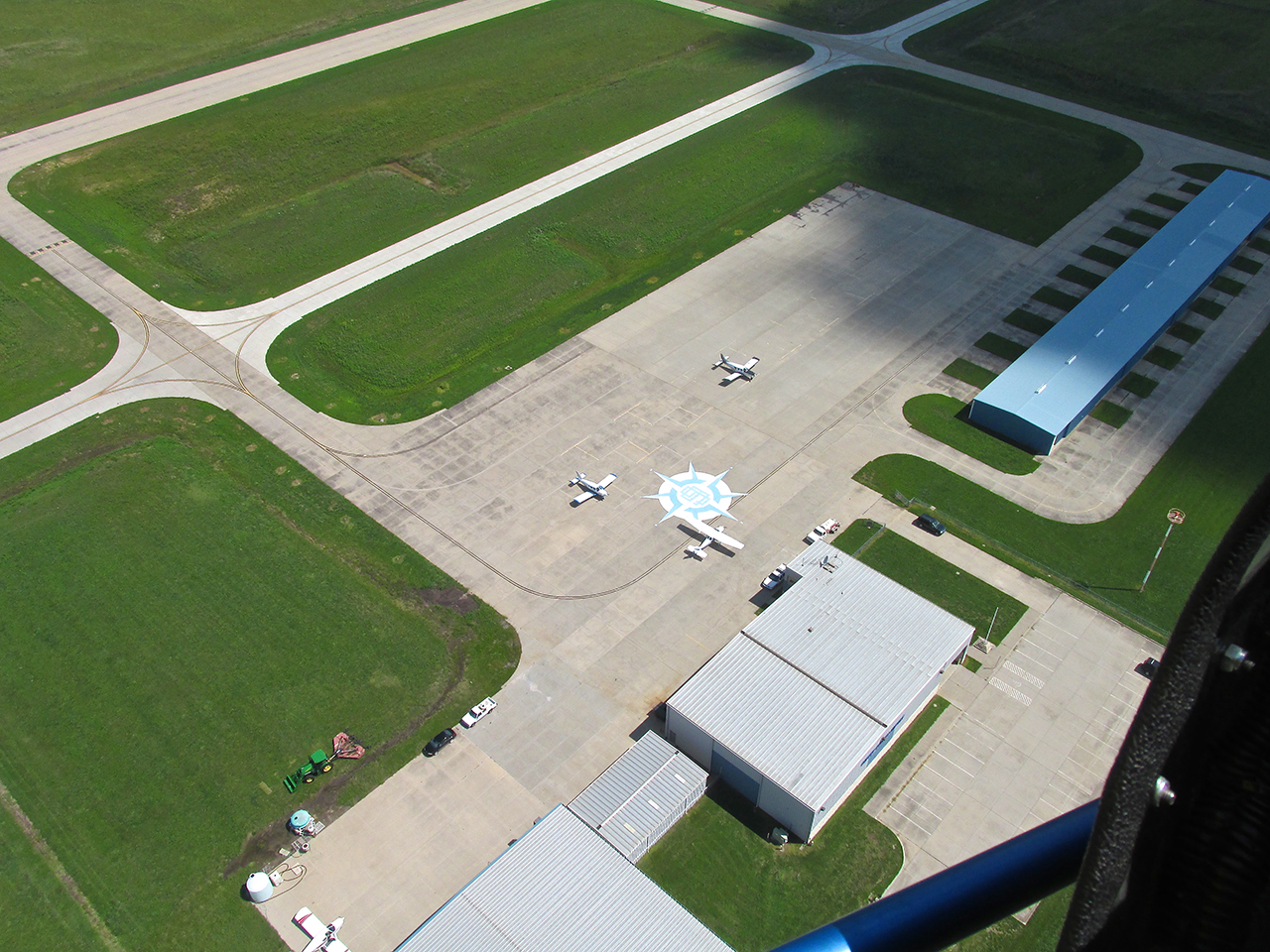
The Compass Rose is a nice touch!
Just after exiting the active runway looking West from 30″ AGL.
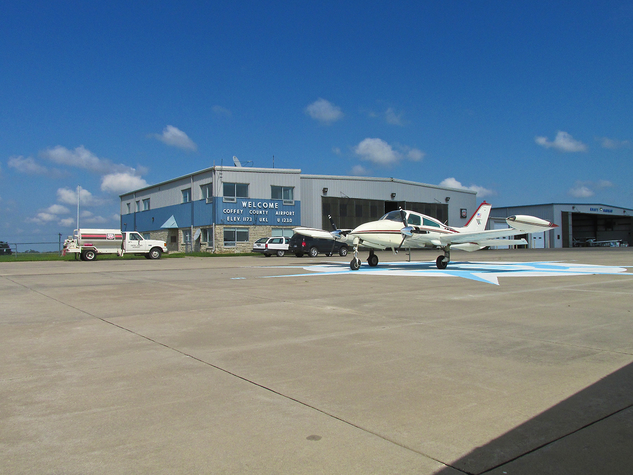
Man, with a little more prep work this could be their promo photo. How about that Cessna Sky King plane? Nice!
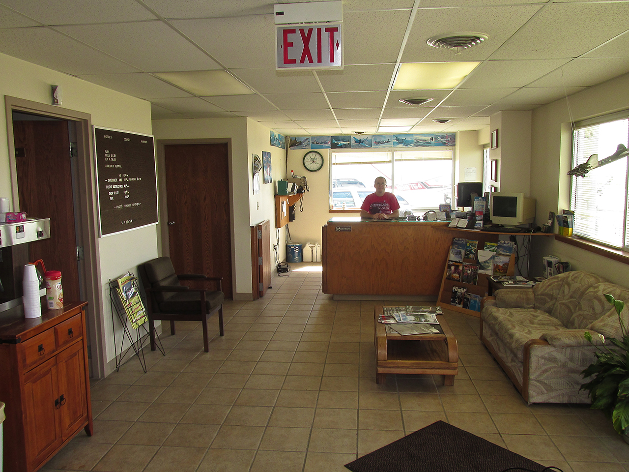
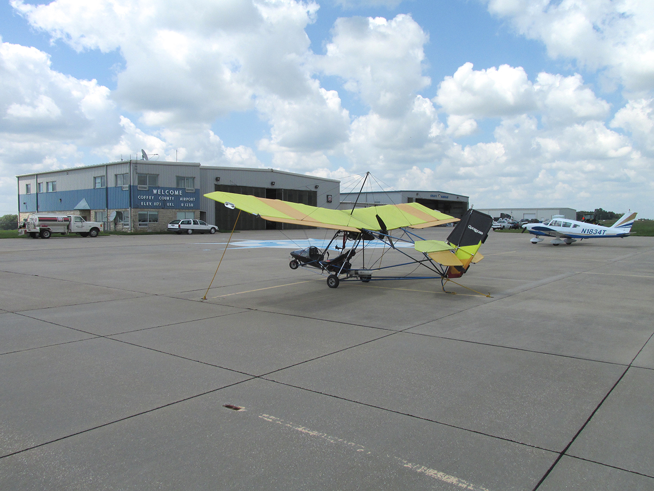
After tying the Quicksilver down I entered the airport office.
Always Helpful
I can say with 100% Surety, every small airport I have visited in my Surfing Safaris has been staffed by friendly, helpful people. Coffey County Airport was no exception. When I explained to Justin Langley what I was doing he immediately pulled out and gave me a well-written Coffee County Magazine filled with maps and good photography. As I explained the various things I look for, he grabbed a highlighter and showed me on the maps where possibilities might be found.
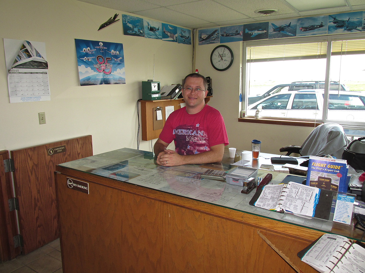
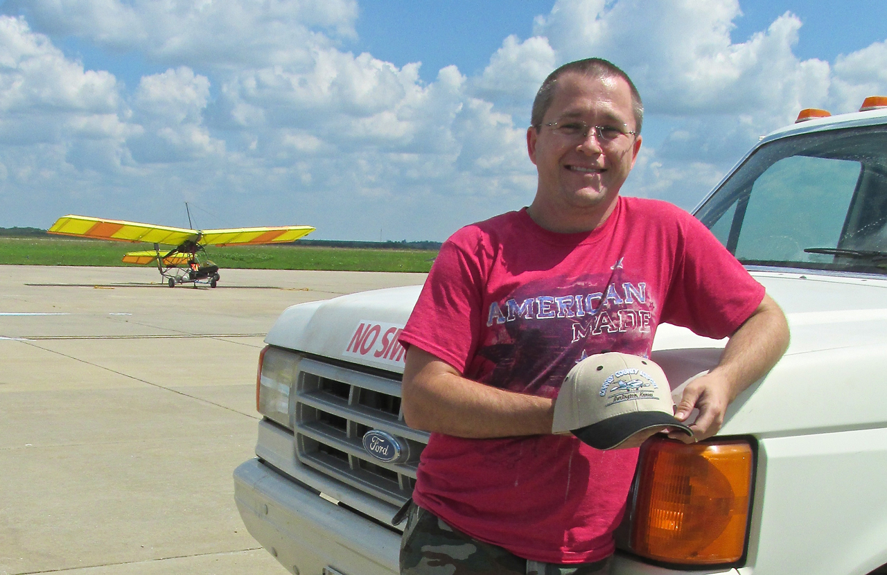
“American Made” Justin Langley formerly of Mississippi. The white Olds station wagon he loaned me is outside the window.
Gotta Be Reasonable
In other stories I have told how much I like walking into town from the airport. But sometimes even I have to be reasonable. I was thankful for the loan of the Olds. It is 7.5 miles down Highway 75 from the Airport to Burlington. The highway put me right in the center of town. I parked in one of those angled parking spaces and set out on foot.
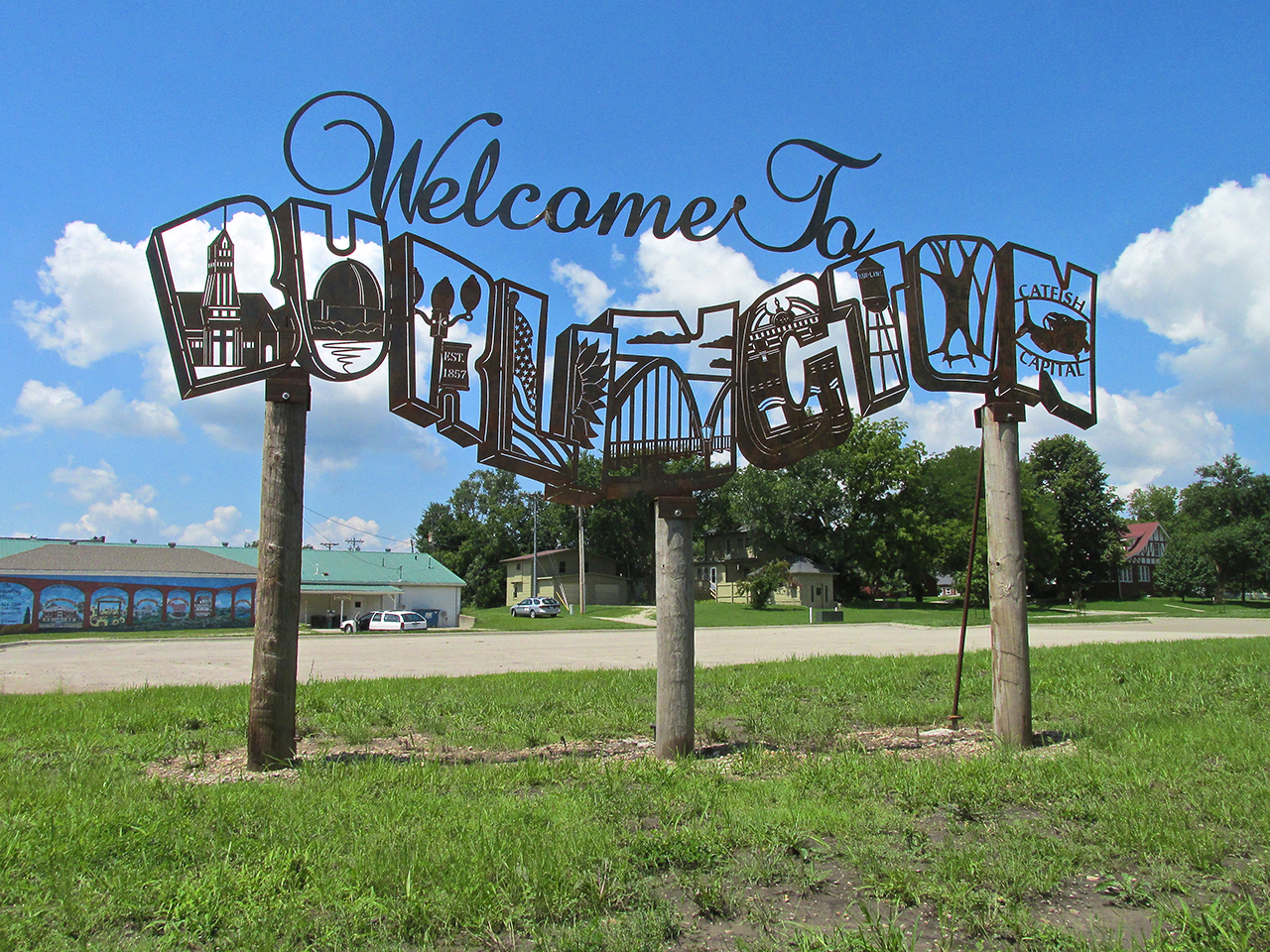
Upon crossing the Neosho River, I was greeted into the East Side of town by this creatively designed, steel Welcome Sign. Among other things, from it I learned this is The World Catfish Capital.

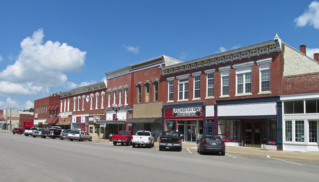
2nd and Neosho Streets looking West
Set The Tone
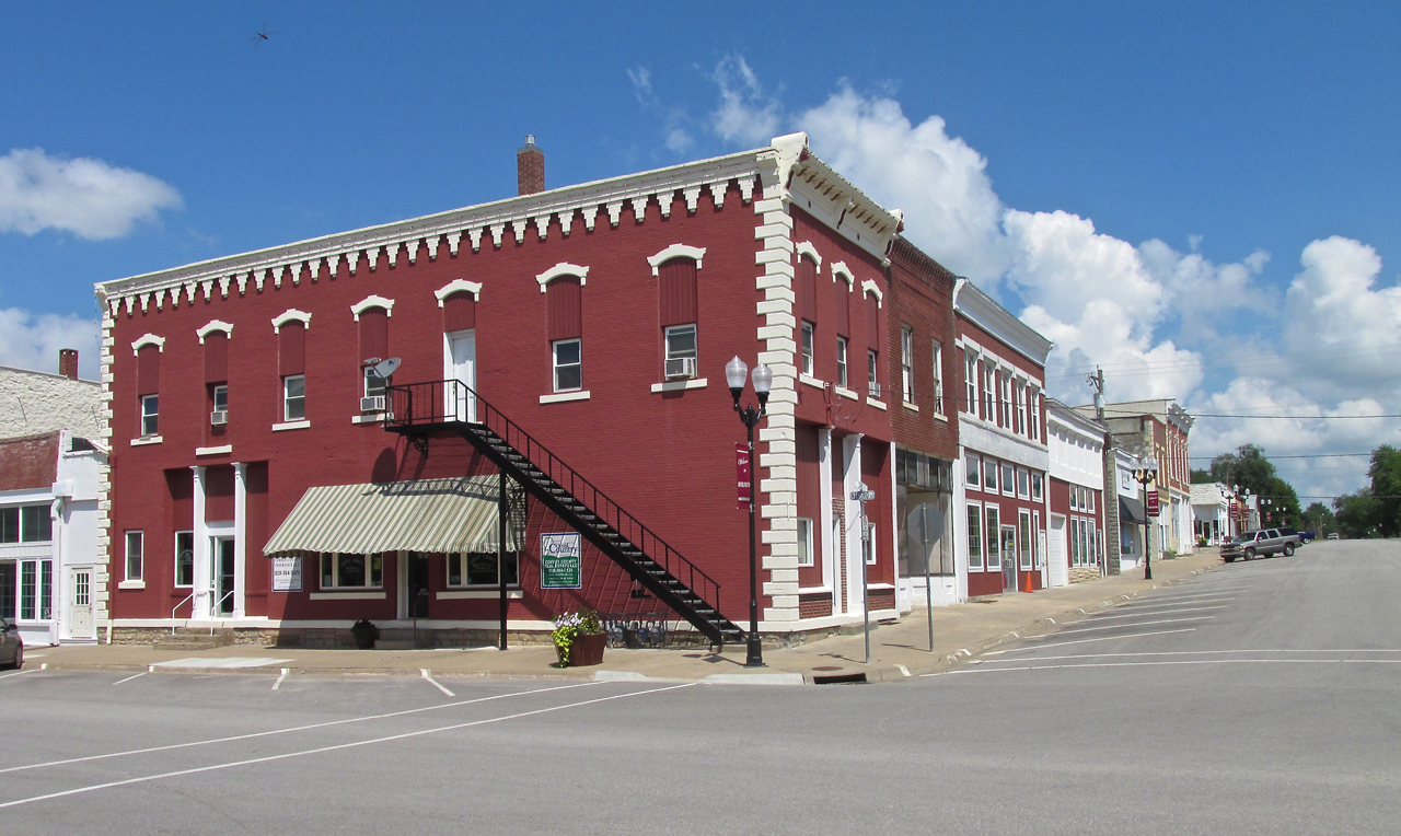
The first photo I will show you is meant to set the tone of many of the interesting buildings and architecture to be seen in Burlington.
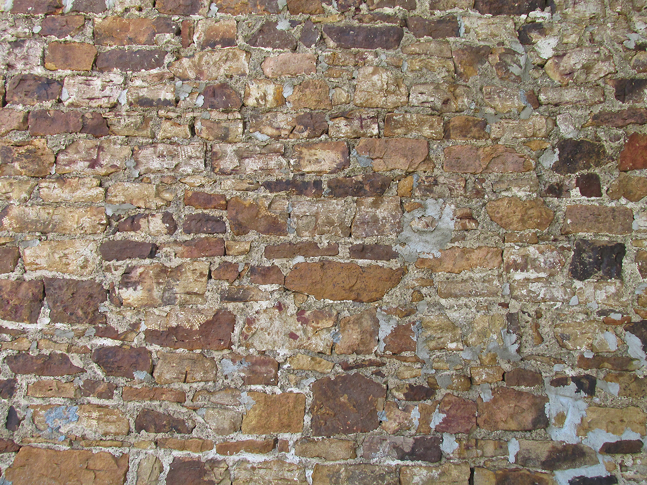
It impresses me no end how a mason can take all these disparate pieces of brick and stone and fashion a wall such as this. This is ART.

The entire wall from the inset above. This building is on Neosho Street.
Character
I finally realized one of the big draws for me with these small towns – Character! Most buildings of today are completely “functional”. Any artistic value they may “require” is generally installed as an “art object” sitting out front. I think it is far more aesthetically pleasing to “write the art into the design” than to force the issue by planting a statue, sculpture or water work out front of the many bland steel, concrete and glass boxes our civilization has taken to building. The builders who designed and built these edifices would never dream of foisting them on the public without incorporating some sense of style into their facades. They would call buildings without faces warehouses – which is what they are…
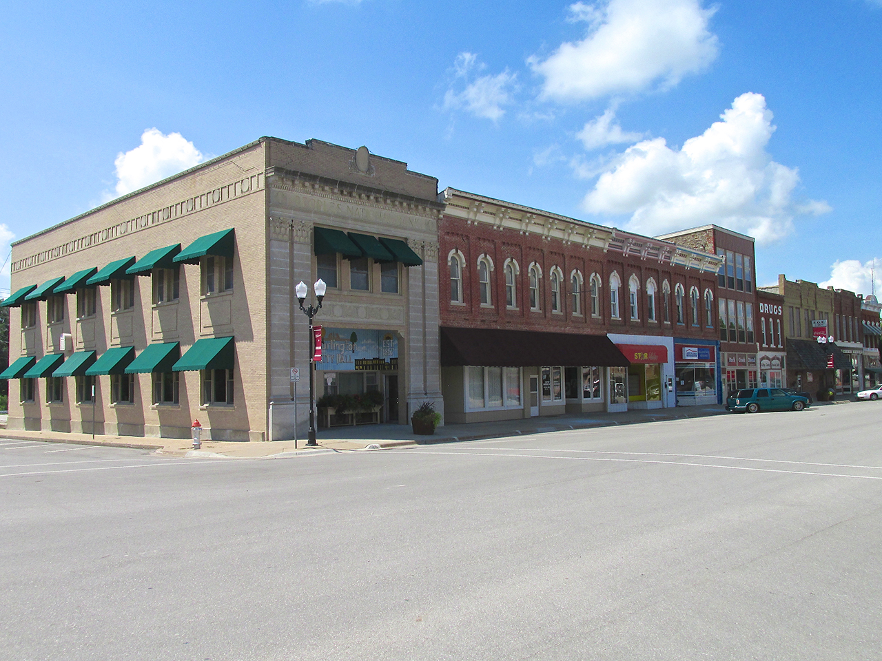
The North Side of Neosho near 4th Street
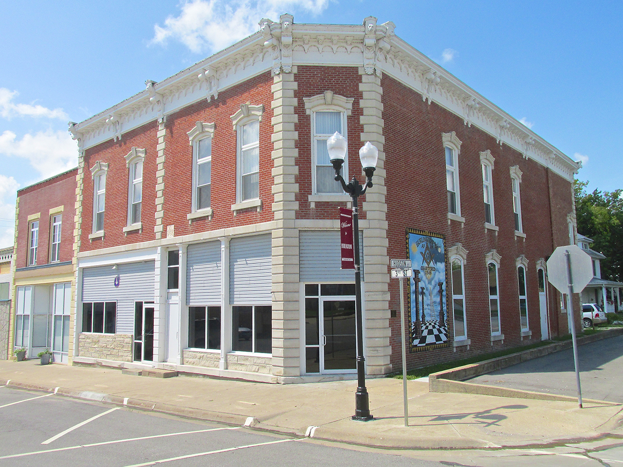
This fine structure of stone and brick at the corner of Neosho and 3rd used to be Peoples National Bank.

Now it is the Burlington City Hall
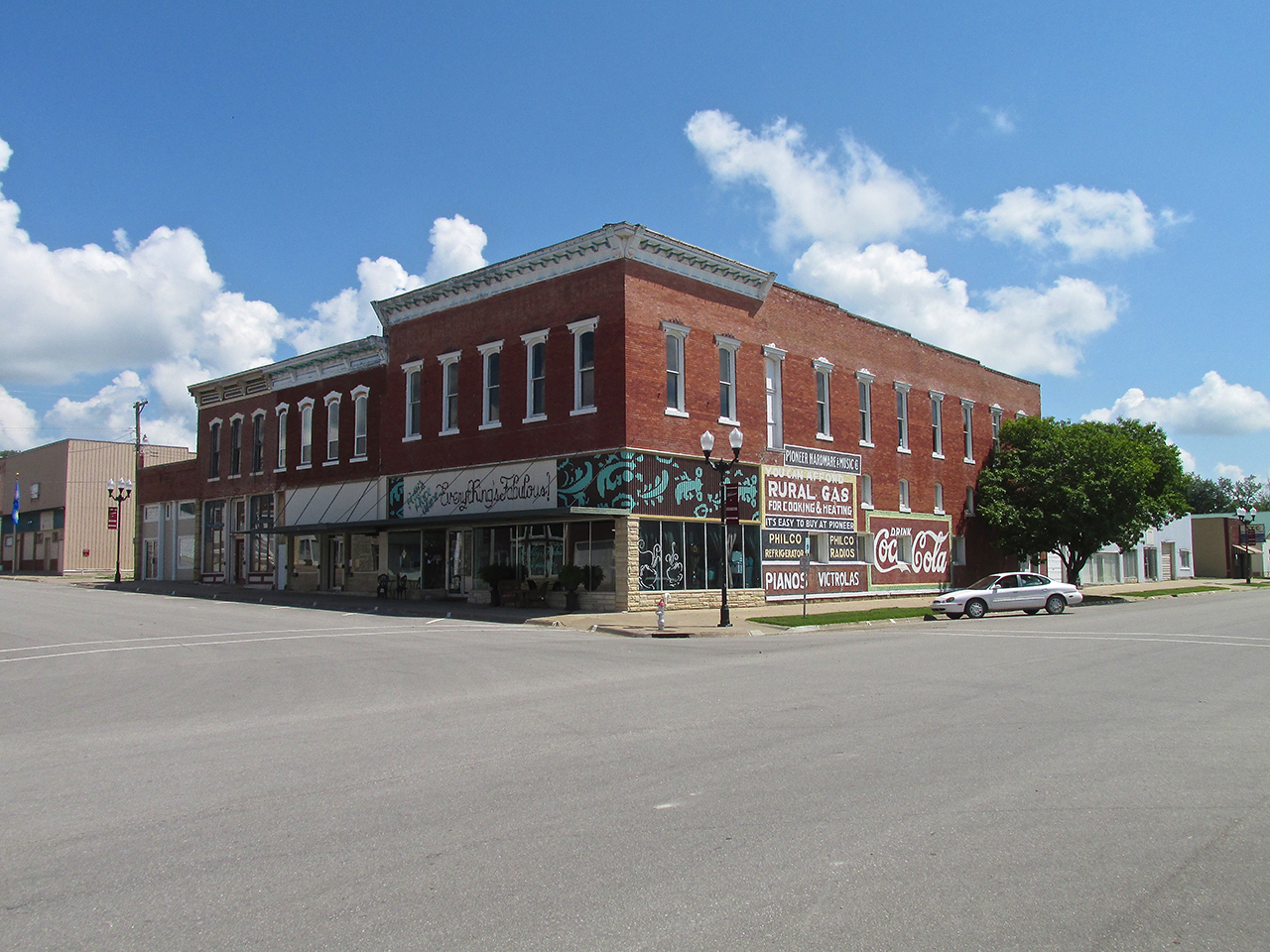
After shooting this I noticed a Dragonfly in the upper left of the frame. A Dragonfly???

I shot this elegant facade to include the classic lamp post. One of the many which decorate the town, all with the herald “Welcome to Burlington”.
A Better Way
Andrew Carnegie amassed a staggeringly large fortune by developing America, near the end of the 1800’s, into the world’s largest steel producer. Rather than sit on this wealth he embarked on a huge program of philanthropy. Free Public Libraries were a major goal of his and he had them built in towns across the nation.
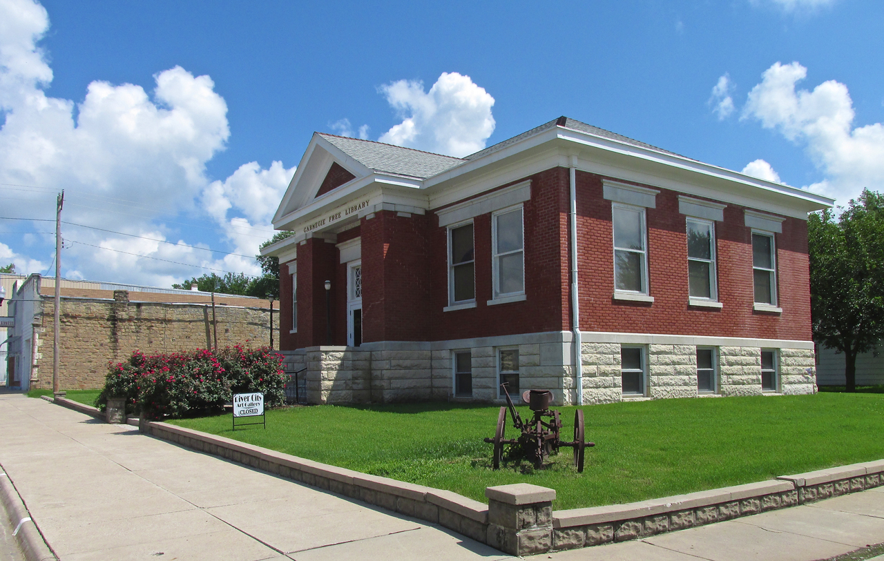
I shot this so you could see the old Carnegie Library and also the stone wall of the building next to it.
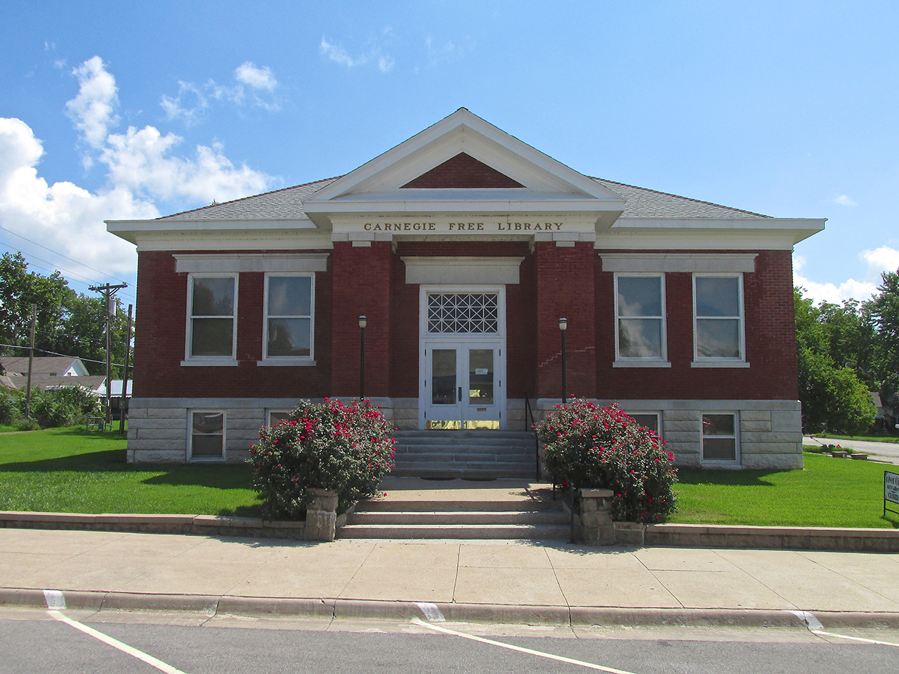
This is now River City Art Gallery.
Many of the small towns have impressive Brick and Stone Mason Buildings like this one.
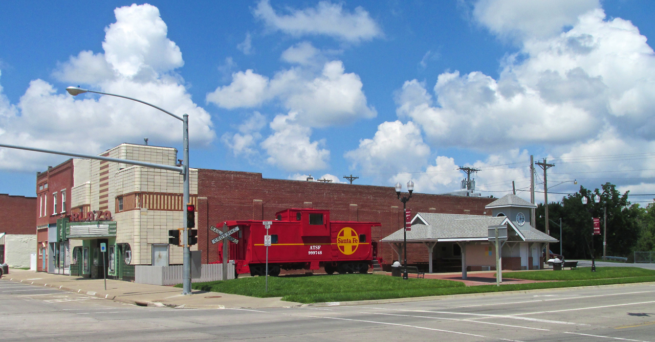
A nice Atchison, Topeka & Santa Fe Caboose and Railway Station Display on the Northwest Corner of Neosho and Hwy 75.
Mural Artistry
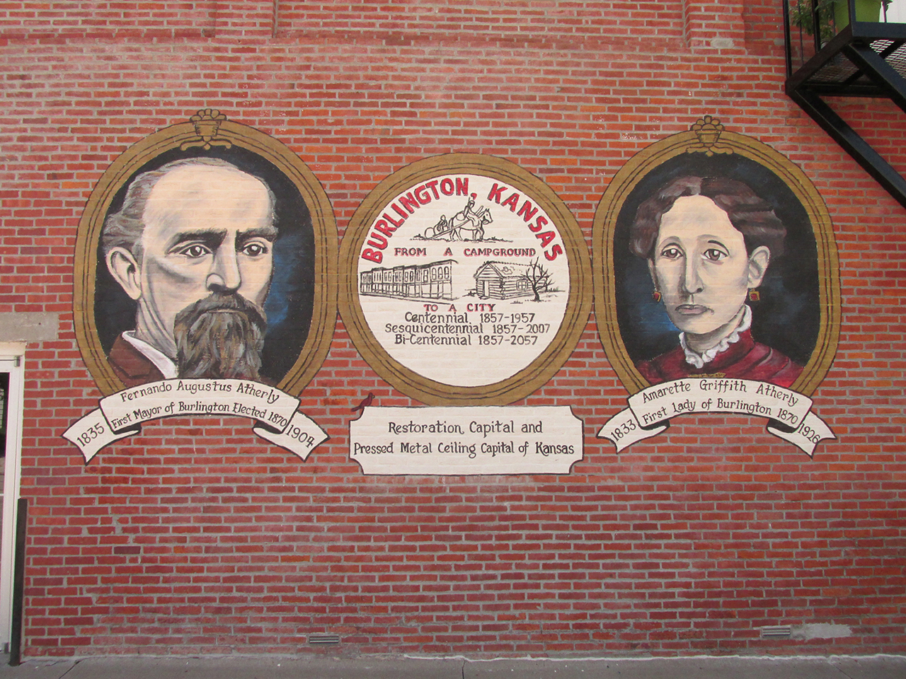
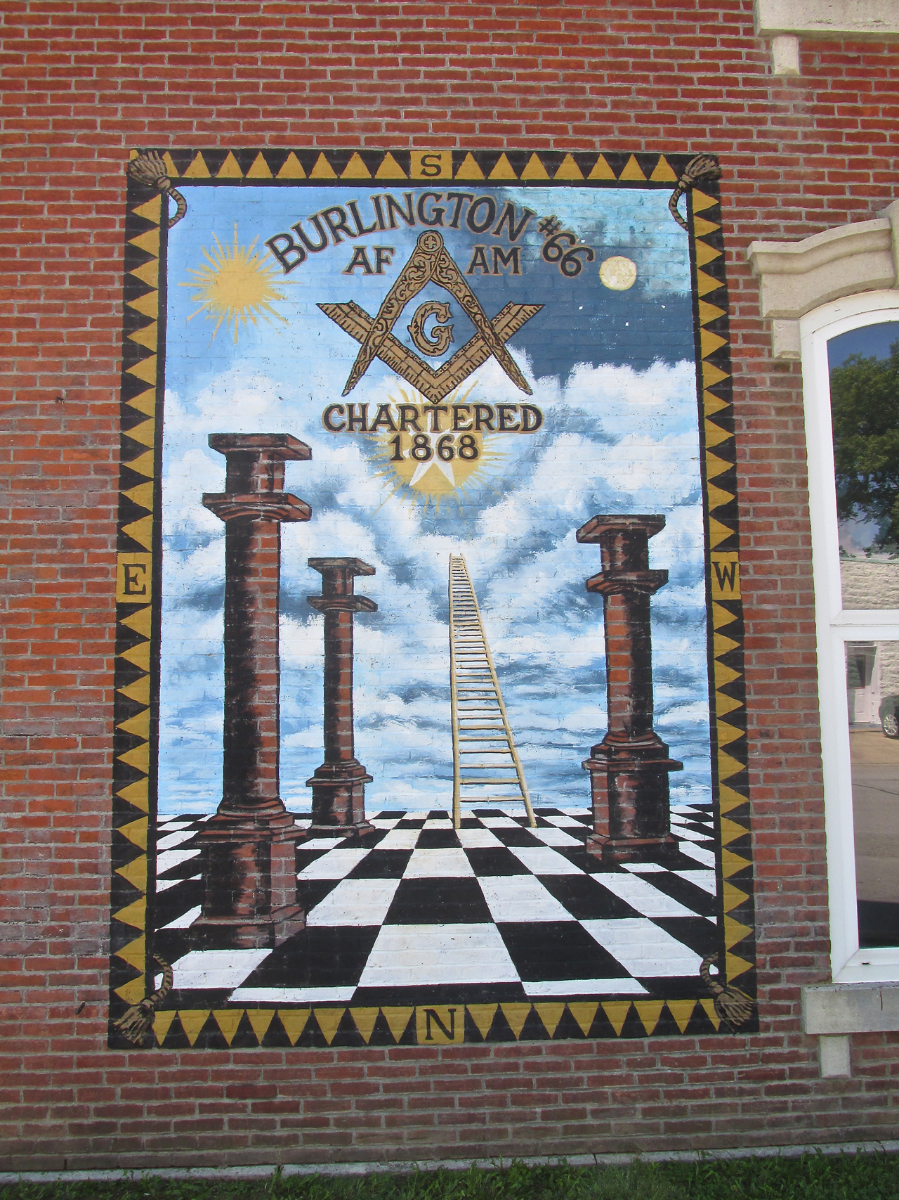
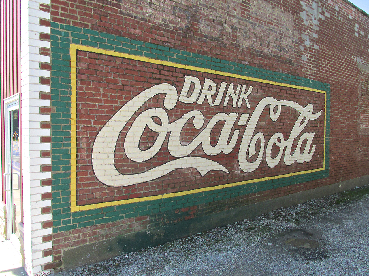
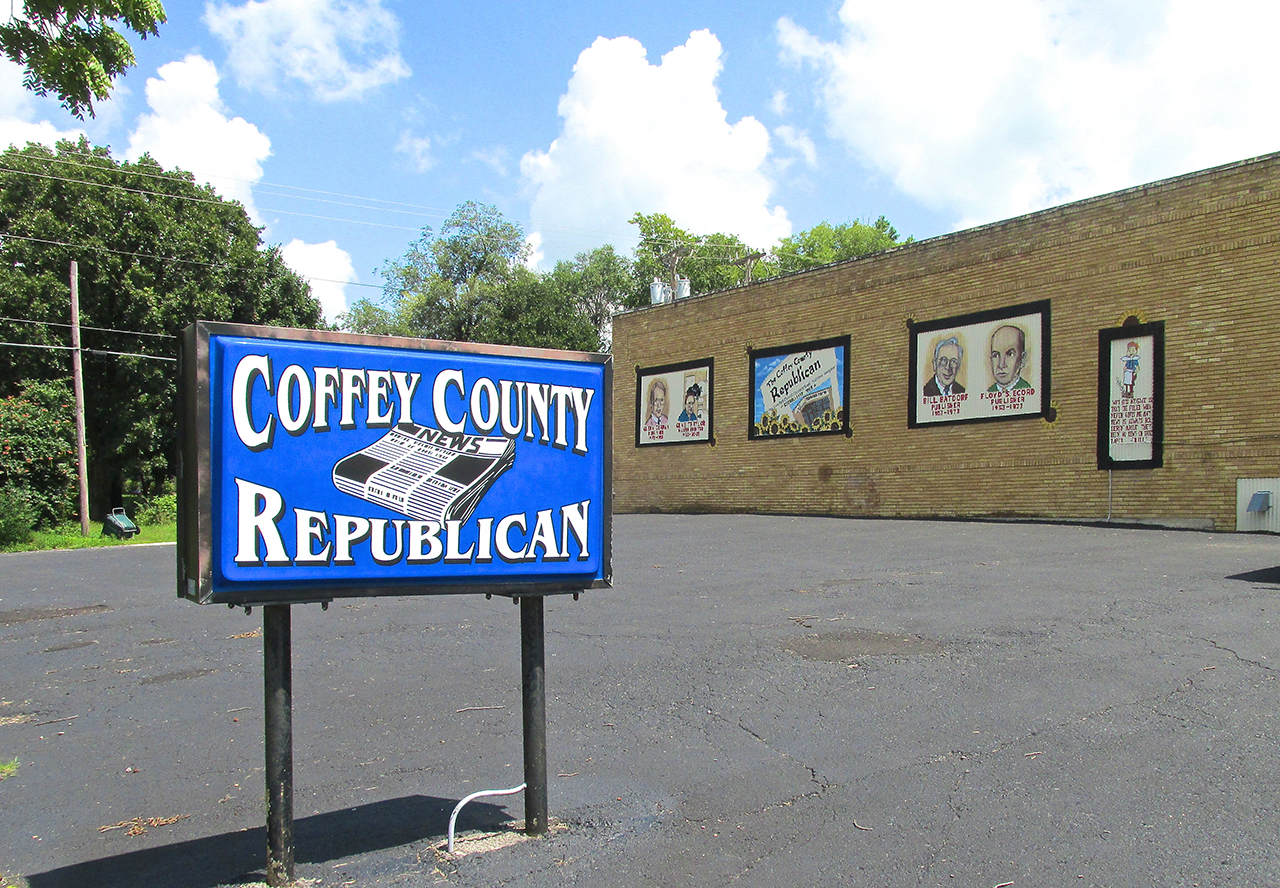
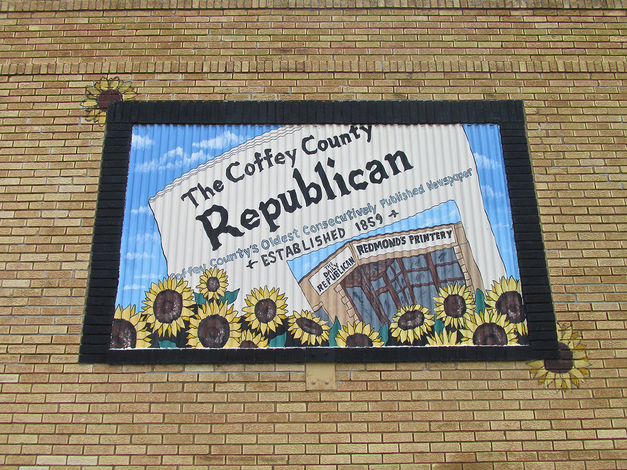
While walking about Neosho Street I happened to see the Mail Man. I hurried over to talk to him. Few people in any town know as much about the neighborhood as the Mail Man. While he didn’t want his picture taken because he was on the job, he was very helpful and gave me a good number of things to seek out. One tip he gave me was to look all over town for the murals of Local Artist Jim Stukey. I know I didn’t find them all but I was able to photograph a number and will display them next. I think they are an delightful embellishment to the considerable charm of Burlington.
Indoors, Too
Although Burlington has a number of chain, fast food restaurants, I always seek out the local spots for breakfast or lunch. Stepping through the front door of “Across The Borders”, I perceived what I believe to be the stamp of Jim Stukey once again.
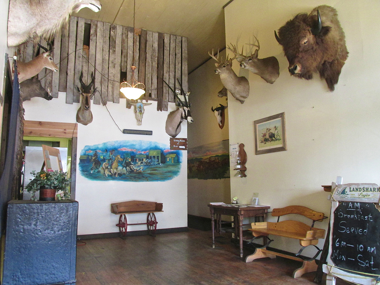
“Across The Borders” Entry
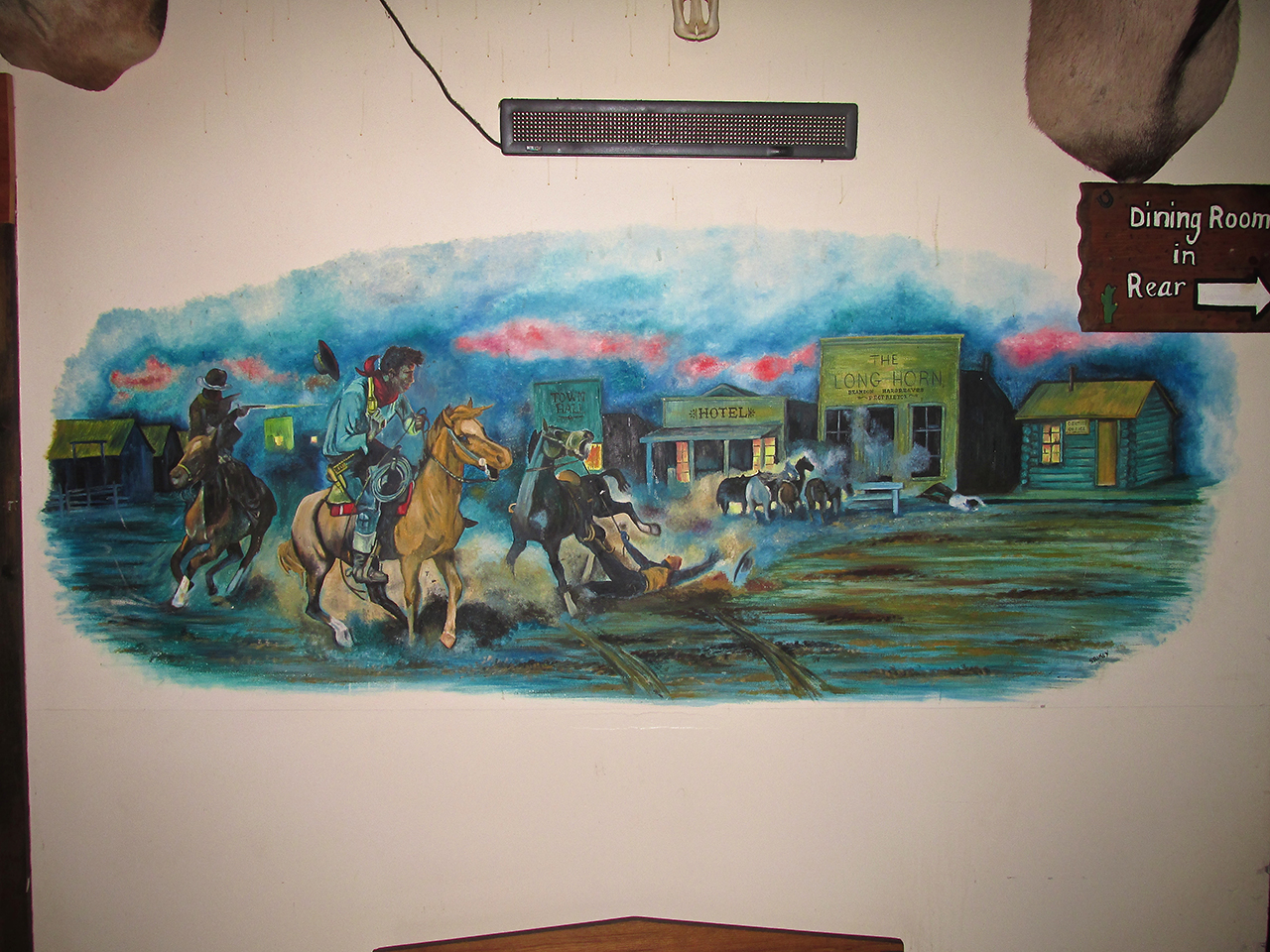

A really nice piece, chock full of history, this is the best I could do to photograph it as it is in a narrow hallway.
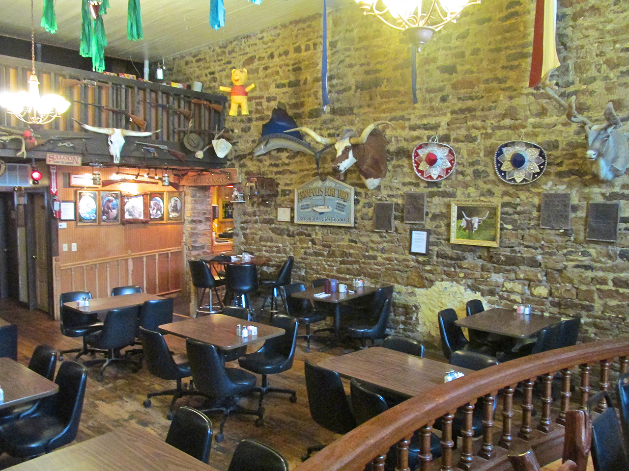
I was seated just before rush hour. “Across The Border” has a very interesting ambience and the food was delicious.

When you go to Burlington, make sure to stop at “The Border”. I neglected to take a photo of the entrance but it is easy to find on Neosho Street just across the street East of the BNSF Caboose.
Gadget The Wizard
After eating lunch I set out to explore the East Side of town off the “main drag” of Neosho. After noticing the mural on the side of The Coffee County Republican I have already shown you, I continued East on Hudson Street toward the water utility building. That’s when I was greeted by Mojo. He wasn’t so much threatening me as he was beckoning to his Master of my approach. Master responded verbally by affirming to the dog he had received the message and then told Mojo to return to his side where he was working. I continued to approach and introduced myself.
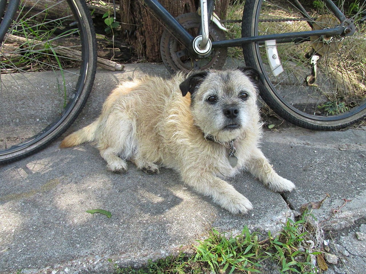
Mojo the Dog
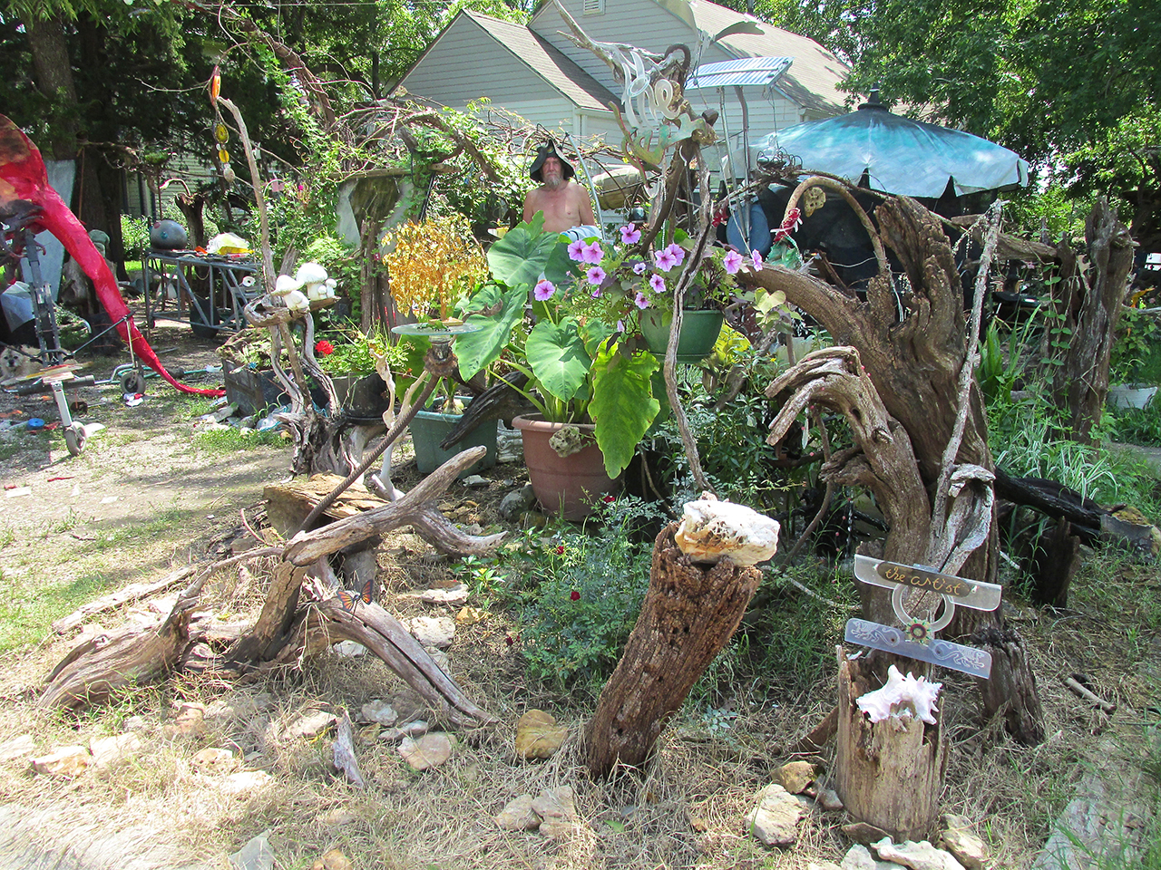
An Integrated Vision
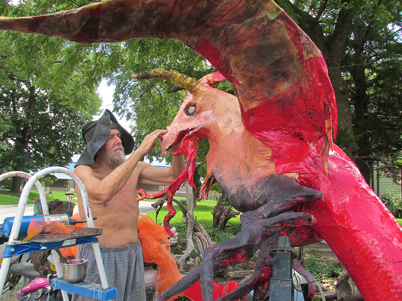
Gadget the Wizard intently crafting The Weir Dragon
Gadget the Wizard
I followed Mojo the Dog to the side of the gentleman seen above who was working intently on the dragon you see until I finally interrupted to introduce myself. Almost as if coming out of a dream, he looked over at me, smiled and replied that he was Gadget… Gadget the Wizard. He made a gesture as if to shake my hand while at the same time indicating we should forego that formality his hands being covered with glue. Intrigued by this name, as is my bent, I began an inquiry into his endeavors.
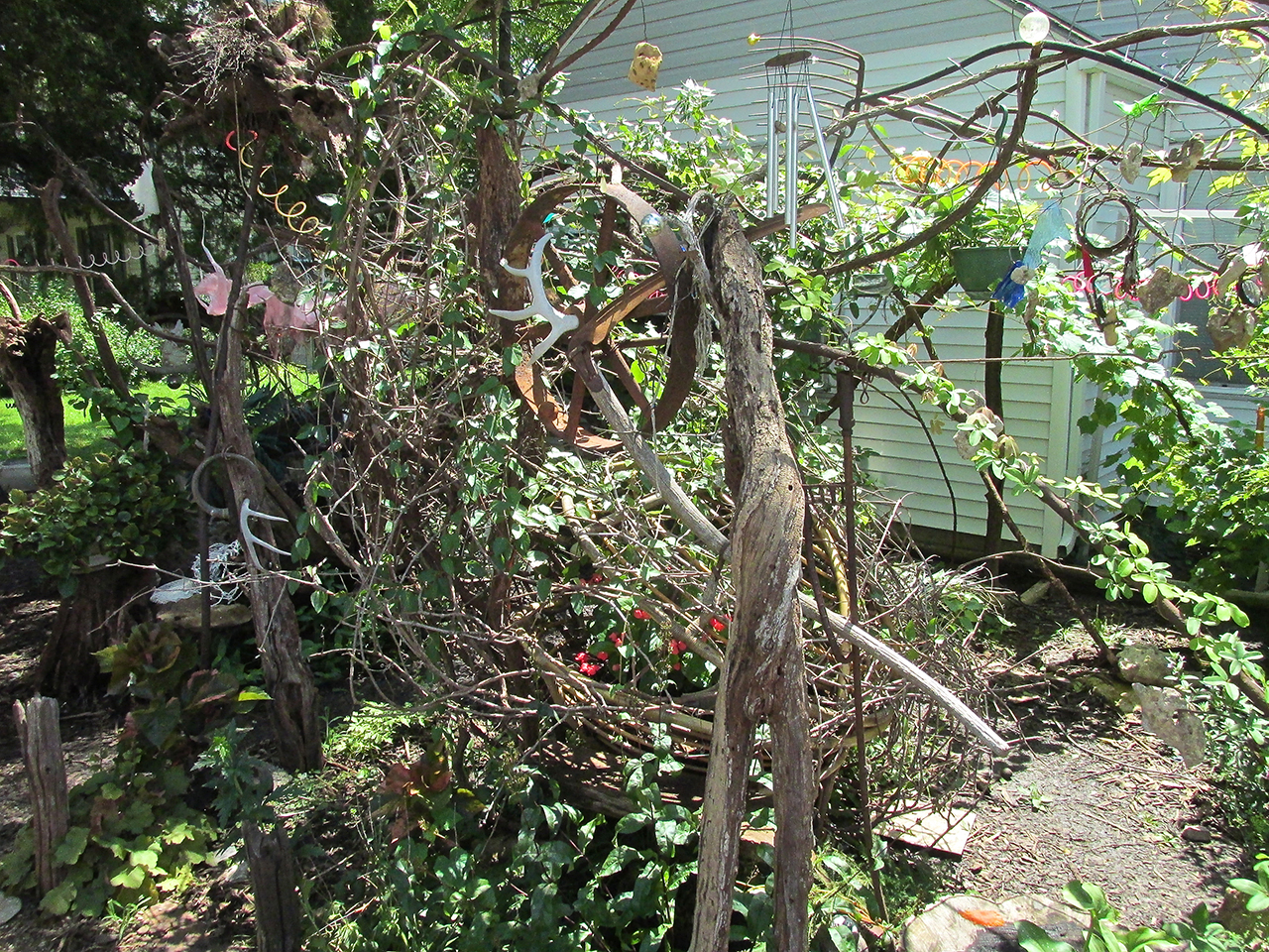
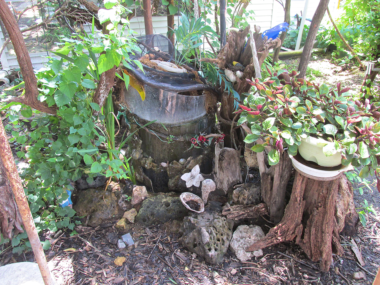
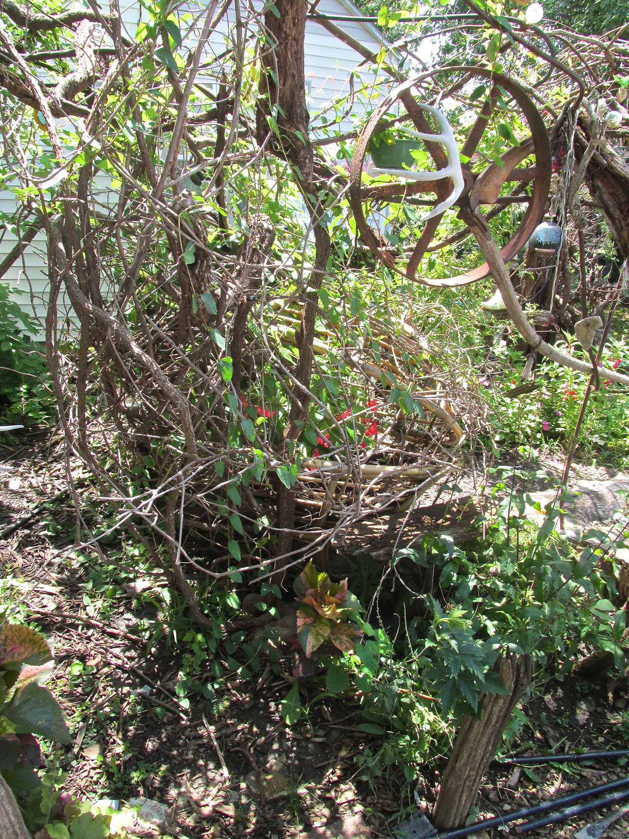
I learned that Gadget is involved in many activities and that his place is called Weir Grotto. Having been an Industrial Process Engineer, Farmer, Industrial Troubleshooter and now an Artist of Integrated Components, Gadget and I discussed a wide range of topics over the next half hour as he showed me around. First, I had to learn what a “weir” is. Basically, one use is as an obstruction constructed to alter the flow of a river. But, in Gadget’s Weir Grotto, the Weir Dragon “pre-determines the flow of time by its playfulness”. This The Dragon does in conjunction with a variety of characters arranged throughout The Grotto. Many of the materials used in this presentation were found in the Neosho River a block away from Weir Grotto. In addition, Gadget employs a computer to show video projections on a back screen and to trigger lights and motorized objects positioned across the yard. He uses the newest version (two versions newer than I use) of Adobe Creative Cloud Software to produce 3D graphics for his videos. He also has an interesting website in its formational stage.
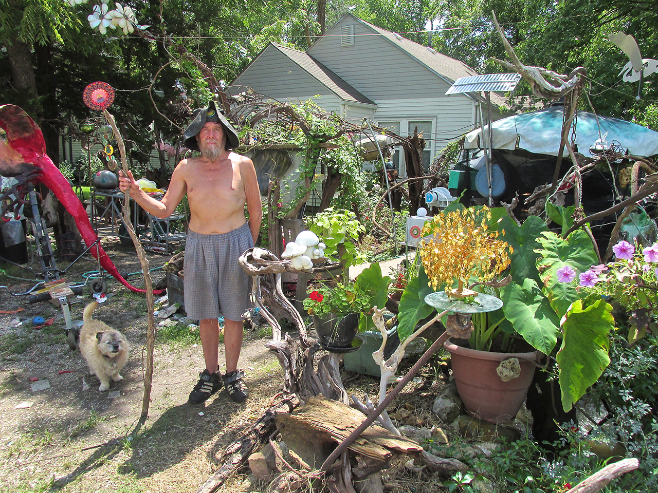
I prevailed upon Gadget the Wizard to pause from his work for a moment to pose with Mojo and Weir Grotto.

A functioning Stone and Gem Cutter.
Elements Of Weir Grotto
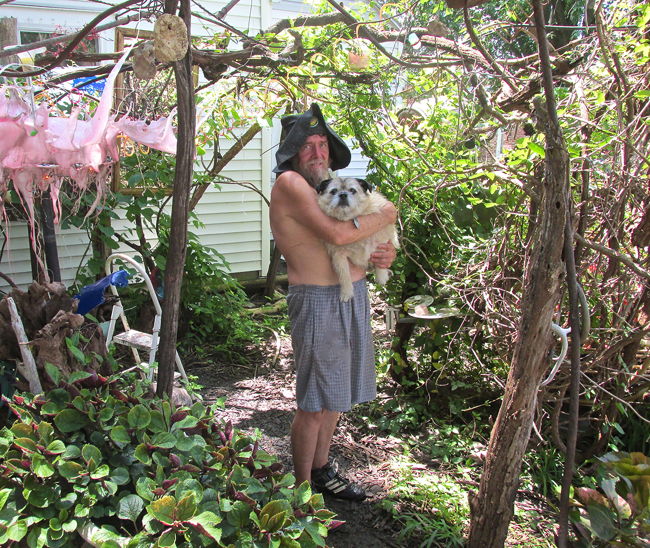
I asked Gadget if he wouldn’t mind picking up Mojo for a picture of the two in an arbor of The Grotto. The Wizard was happy to oblige.
The Sky Surfer & The Wizard
After a very interesting time discussing matters of Space and Time, Computers, The Internet and Gadget’s “Vision in Progress”, I had to beg off. I really would have liked to stay longer but it was already after 2 pm and I still had to return to the airport, fuel up and fly home.
I can relate to Gadget the Wizard and I like him a lot. He has a Vision and is doing what he can to make it “real” and understandable to others. This is not a task easily approached or accomplished but when you have “A Vision”, you have no choice but to try.
We had already said our goodbye but as I walked away I saw one more shot and asked Gadget to break away from his work on The Weir Dragon again for this last photo.
Weir Grotto and Gadget the Wizard
One Of The Oldest
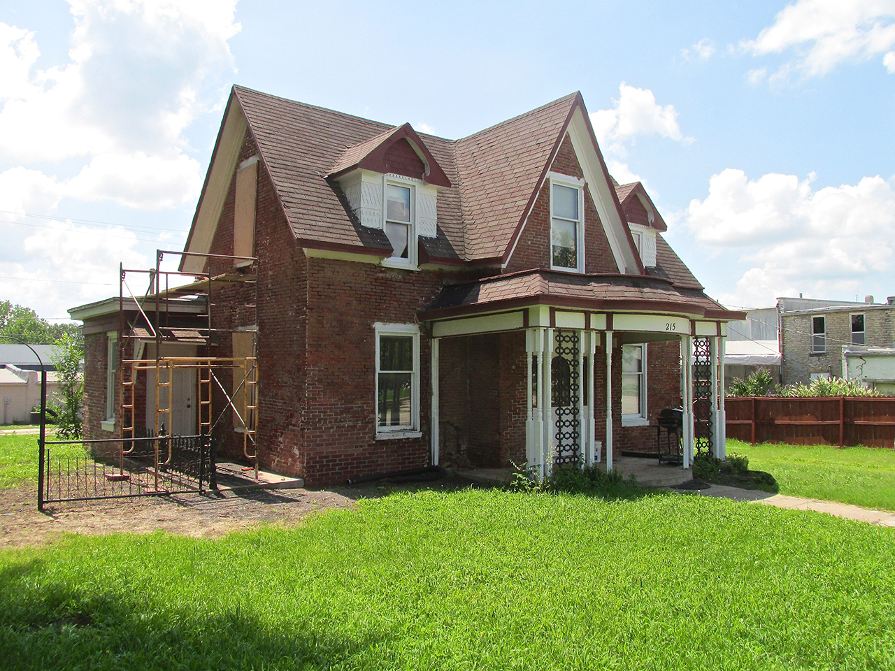
I hadn’t walked 10 yards when I called out to Gadget once again. Earlier when my approach was announced by Mojo, I walked by this house without even noticing it. As it is right next to Weir Grotto, I figured The Wizard would know something about it. He did.
Under renovation, it is one of the earliest homes built in Burlington. Because of a murder committed in it years ago combined with a bizarre turning of the wheels of justice, some consider it haunted. Here is what I was told…
One night after a party, former residents of this house were quite inebriated and had a testy argument on their way home. As they pulled up in the driveway the wife stormed out of the car, went into the house and slammed the door. The husband stayed in the car and either decided to sleep in it or passed out from excessive alcohol intake. The next morning when he entered the house he found his wife dead. He was charged with murder. In the trial he claimed a burglar had entered the house and killed his wife. The jury did not accept this story and condemned him as guilty. Later, though, in Nebraska a man was arrested on burglary charges and admitted to the Burlington murder. Tools found on his person were identified as stolen from the Burlington House.
People who believe in ghosts say that the couple was not really that mad at each other and the wife’s ghost is still upset that her husband was accused of her murder.
Why haunting the house for decades would remedy a miscarriage of justice that was subsequently rectified is beyond me. To get the answer to that conundrum you will have to consult people who waste time on such supernatural claptrap. Whoops! I guess I just did that…
Excelsior Mill
On the way back to the airport I stopped at a very special building called the Excelsior Mill. At one time it was a water driven mill and then for quite a spell was empty. Now it is being refurbished. Plans are to make it a Bed ‘n Breakfast hotel. I didn’t want to interrupt the guy working on it so I took these pictures from about 100 yards West. I also found some excellent pictures on the web of this mill taken by Pennsylvanian Jim Miller a couple of decades ago. You can find them HERE.
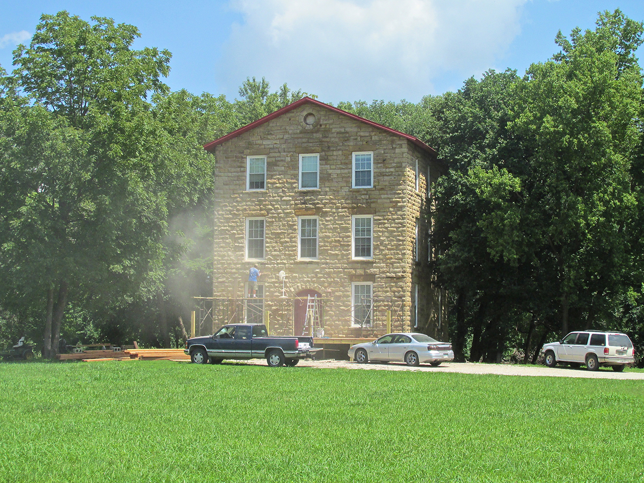
Excelsior Mill
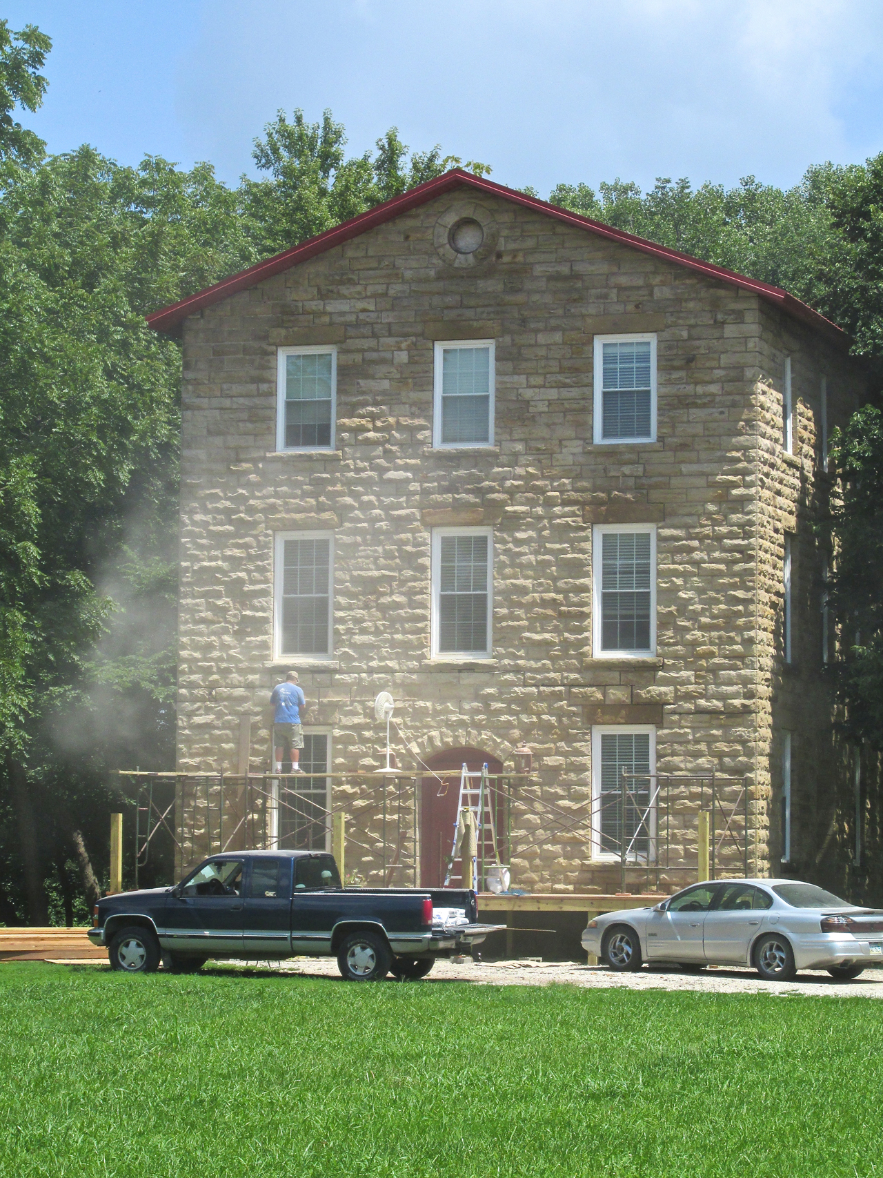
What a fine stone building.
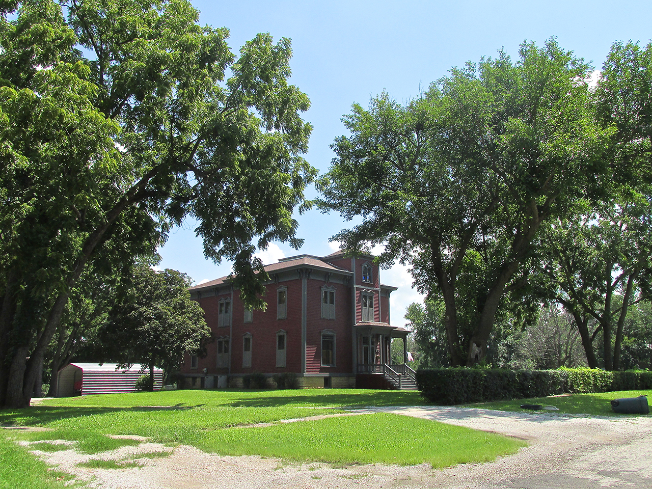
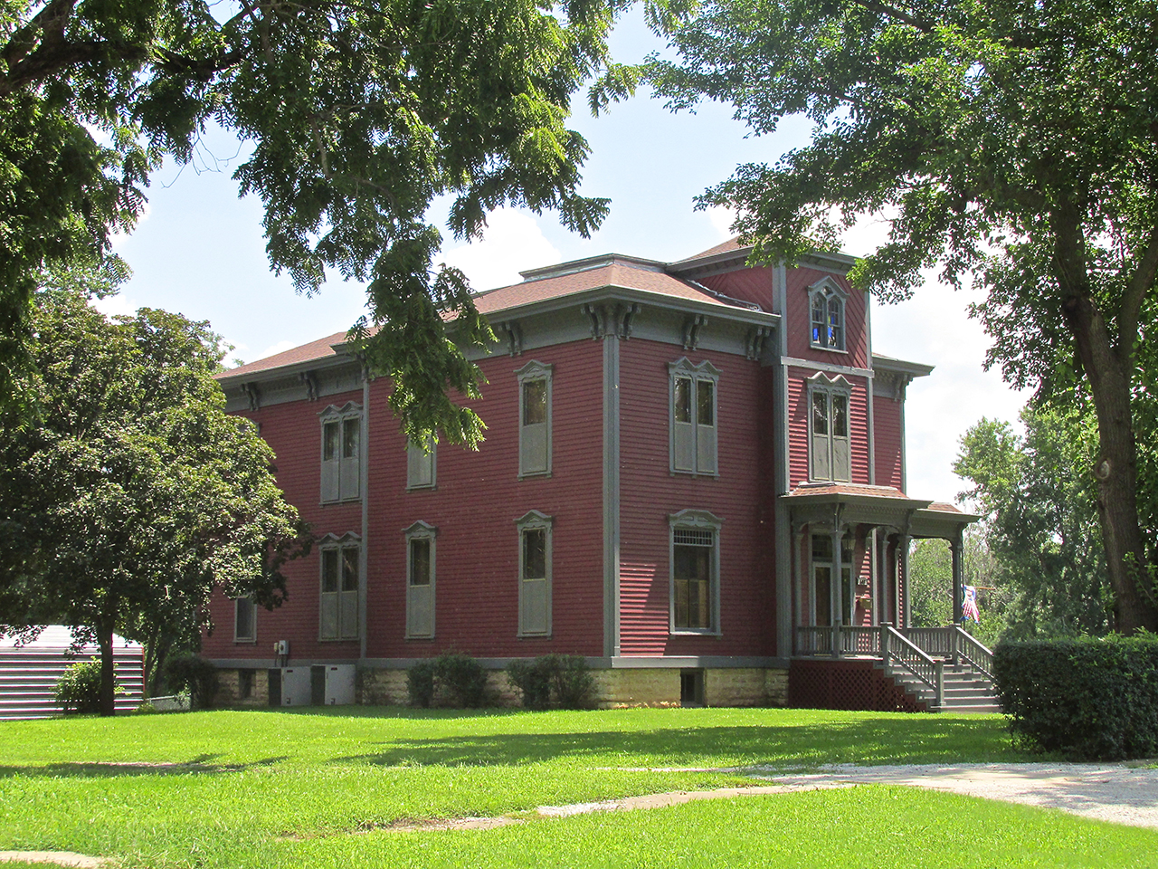
Passing through the neighborhood near The Mill I spied this attractive Victorian Home.
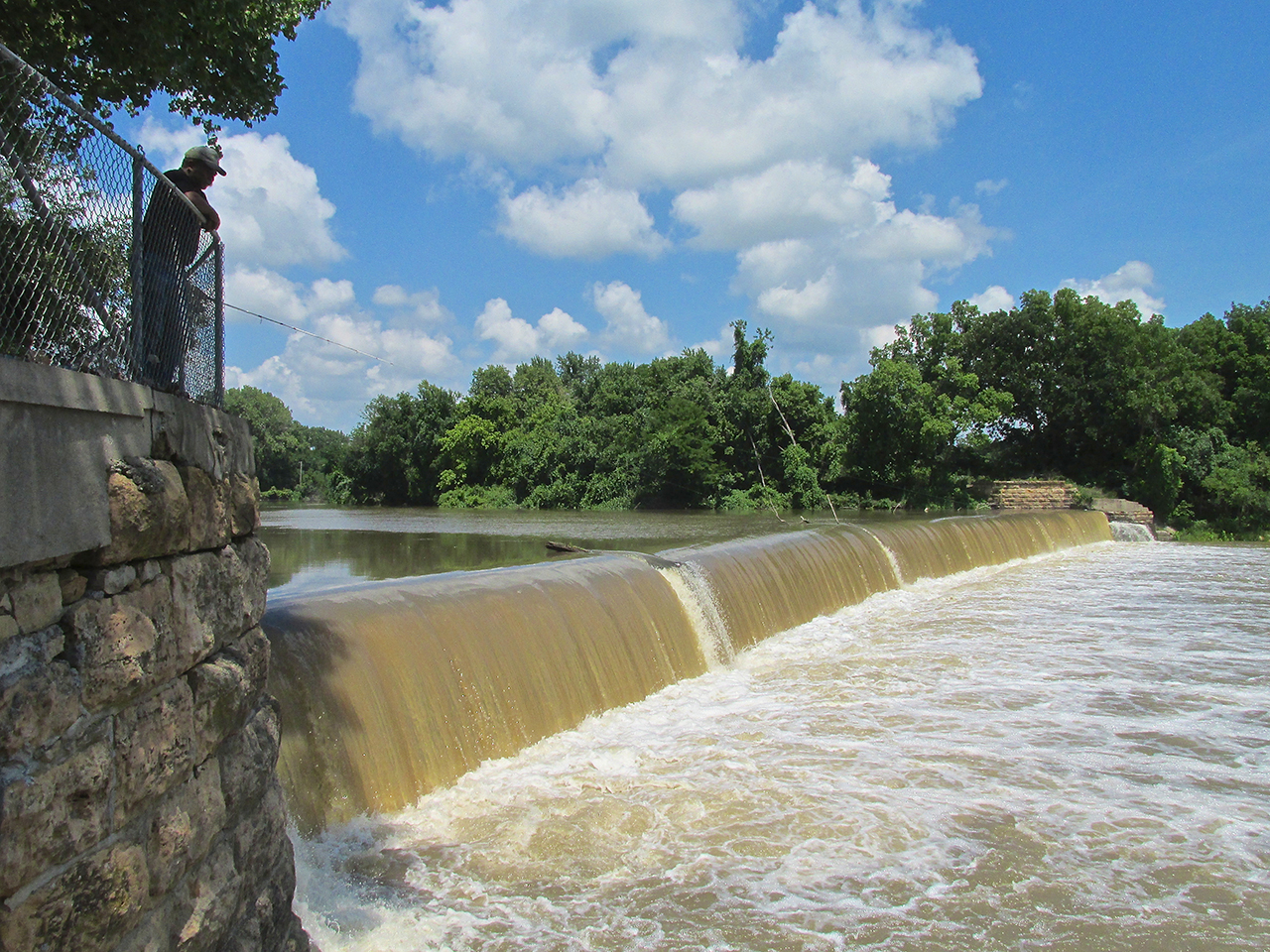
City Dam
My last stop on the way to the airport was the city dam found at the end of Cross Street. I looked on The Web at other pictures taken at this spot and the water is far lower than you see below. By the way, one of the pictures’ caption discribes it as a “weir” rather than a dam. From what Gadget told me, I also consider this a weir rather than a dam. I suspect this is one of the places that contributes to Burlington’s Catfish Championship status.
Back At KUKL
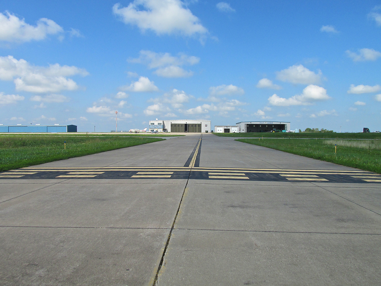
Before fueling up I took this picture to show the MXL, the terminal building and the courtesy car.
Surprise Gift
After fueling up the plane, Justin Langley surprised me with a Coffee County Airport hat. I love this thing! It fits great. I have a collection of about 30 baseball caps and am not exaggerating to say this is the finest of the bunch. This hat is embroidered front and back – not stamped – and the head band is plush. Like the town of Burlington, this airport has class.
Heading Back To Base
After takeoff, the general lighting of the area was much better than when I had arrived in the morning so I took a few more pictures of Wolf Creek and New Strawn.

5 miles Northwest of Wolf Creek Generating Facility from 1,500′ AGL
New Strawn from 1,200′ AGL looking Southwest – Highway 75 at bottom
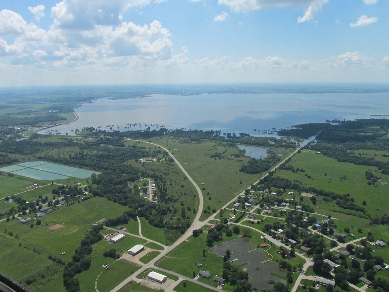
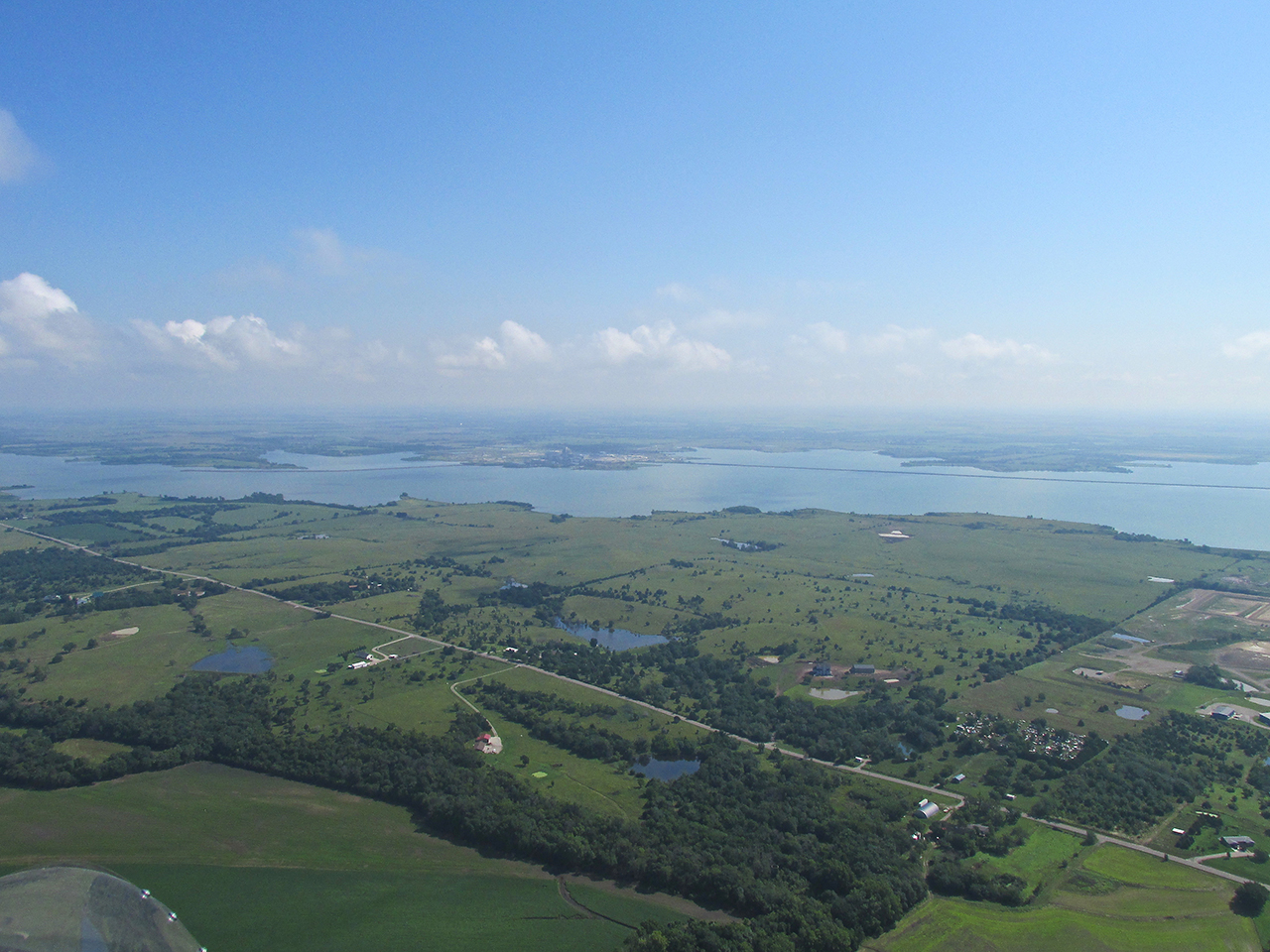
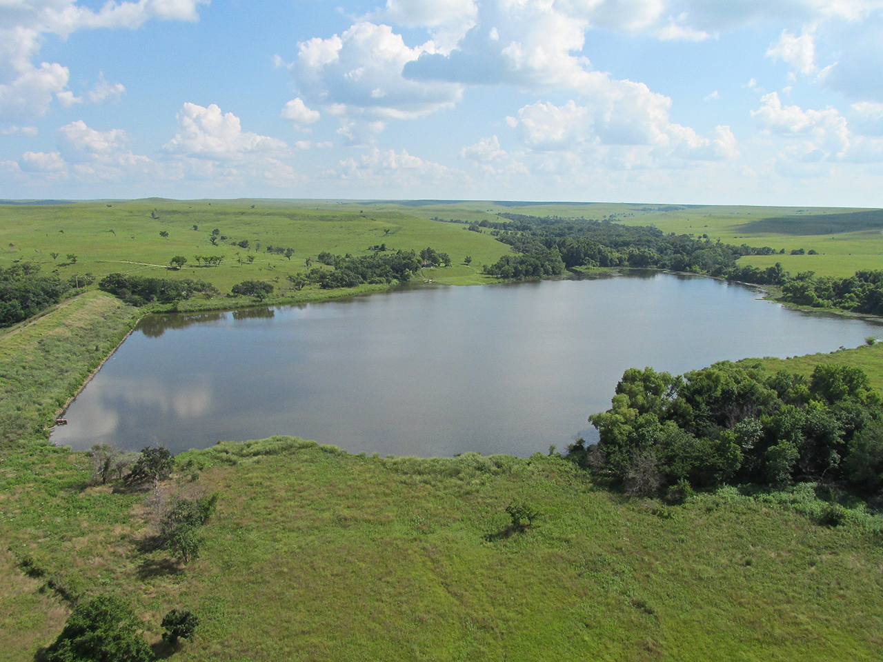
The John Redmond Reservoir from 1,200′ AGL looking Southwest
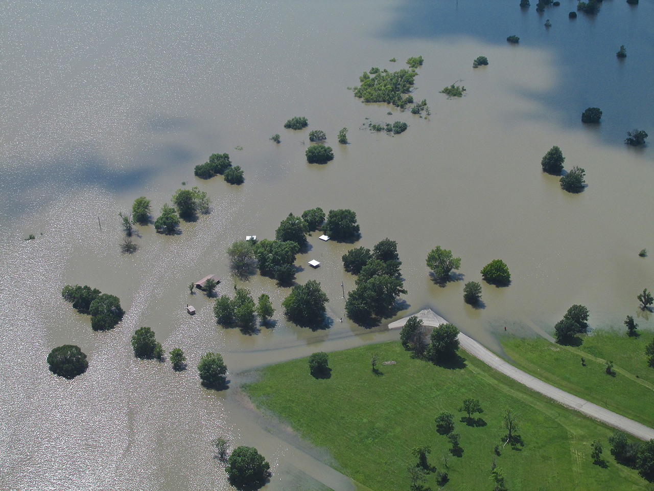
Another indication of the exceptional rain we have had this Summer.
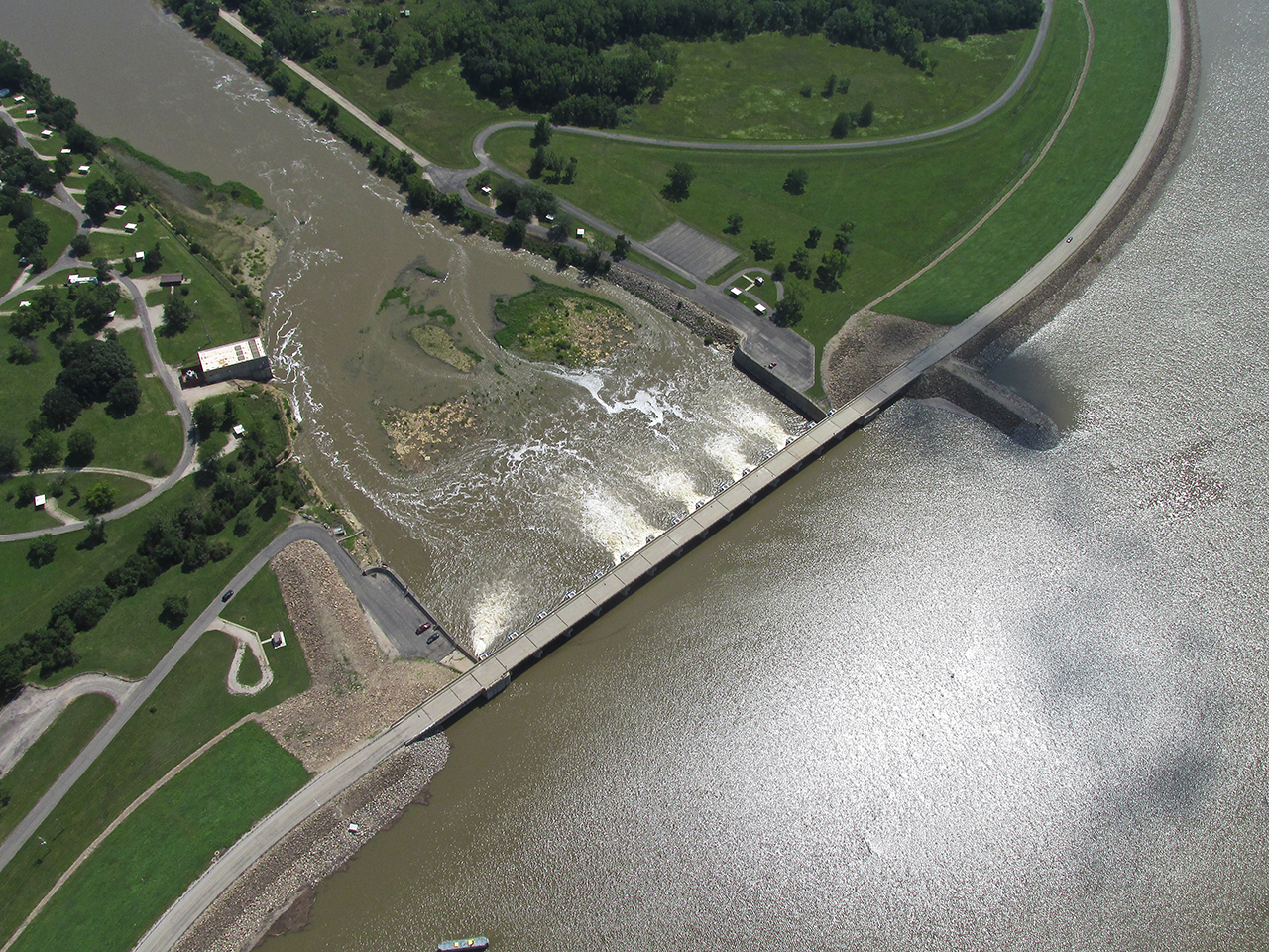
The John Redmond Dam

The Flint Hills and Beyond! A Glennview photo taken just after passing over the John Redmond dam.
Testing Altitudes
Even though I was getting a good tailwind bump (9 mph) at 1,200′ AGL, I prefer the view down lower. I descended in order to see if I would maintain that tailwind support at 200′ AGL. It was still there.
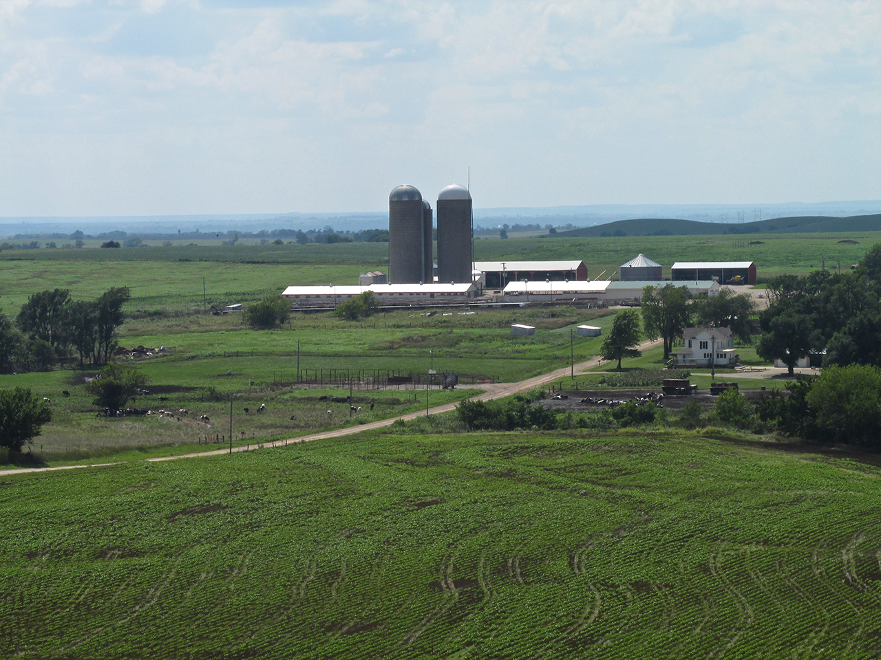
Directly in my path was a picturesque dairy farm. Before detouring around it to the South, I shot a few telephotos of it. The one below was the best.
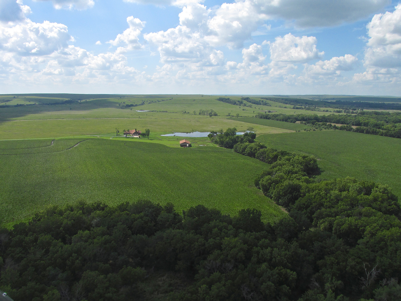
Soon the landscape opened up and plateaus appeared.
Contour Crazy
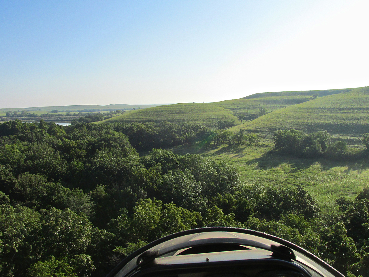
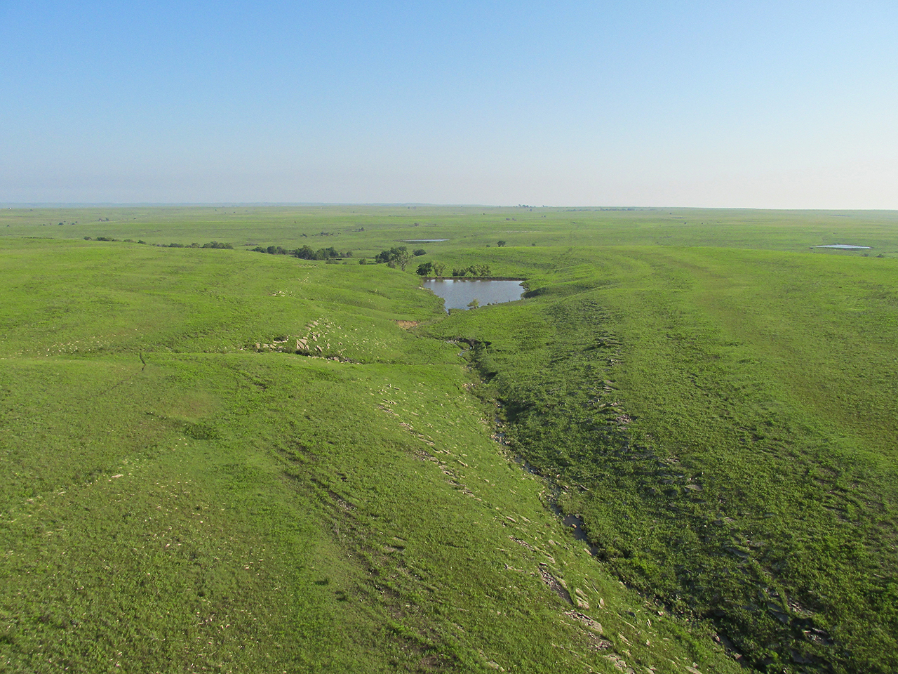
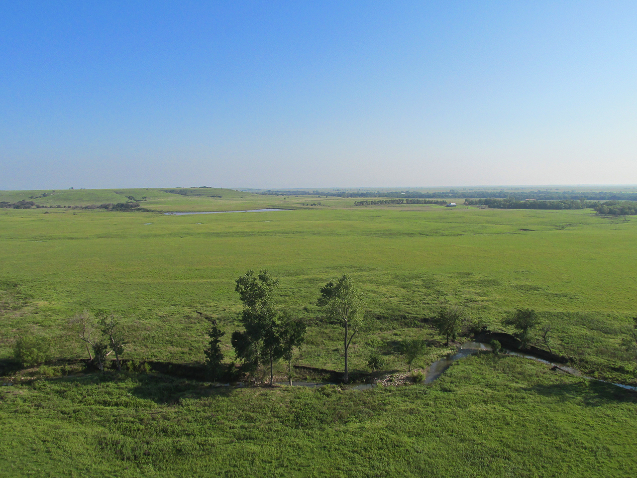
On the trip to Burlington I showed a couple of examples of the contouring I like so much out here. Now on the way home, I saw many more interesting contour scenes, probably because I was flying another hundred feet higher. Here is a series of contour pix.
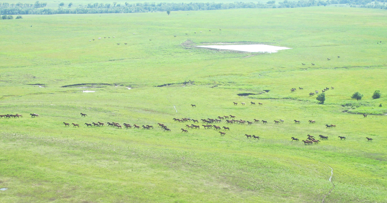
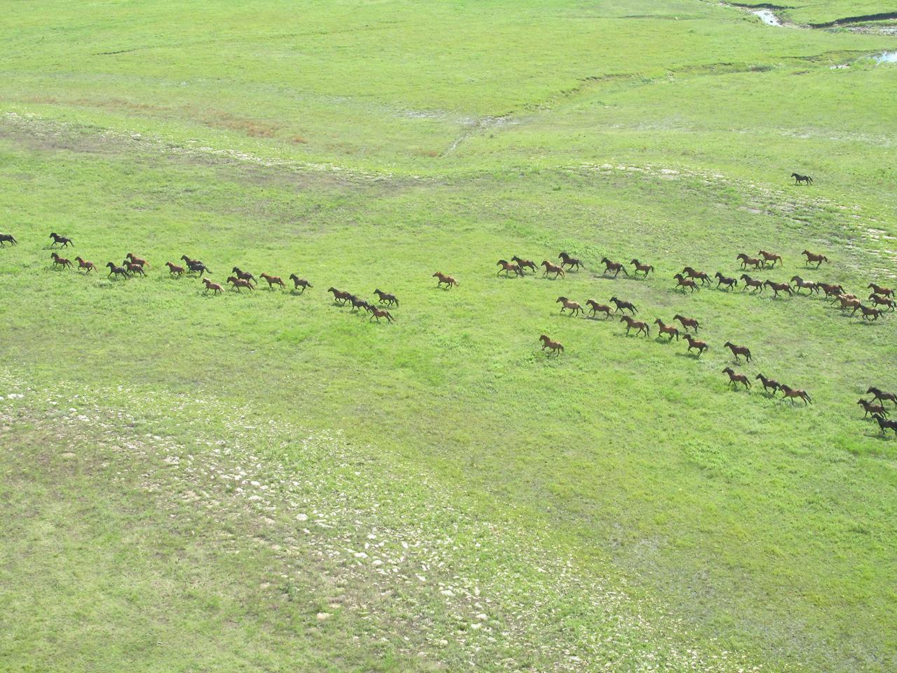
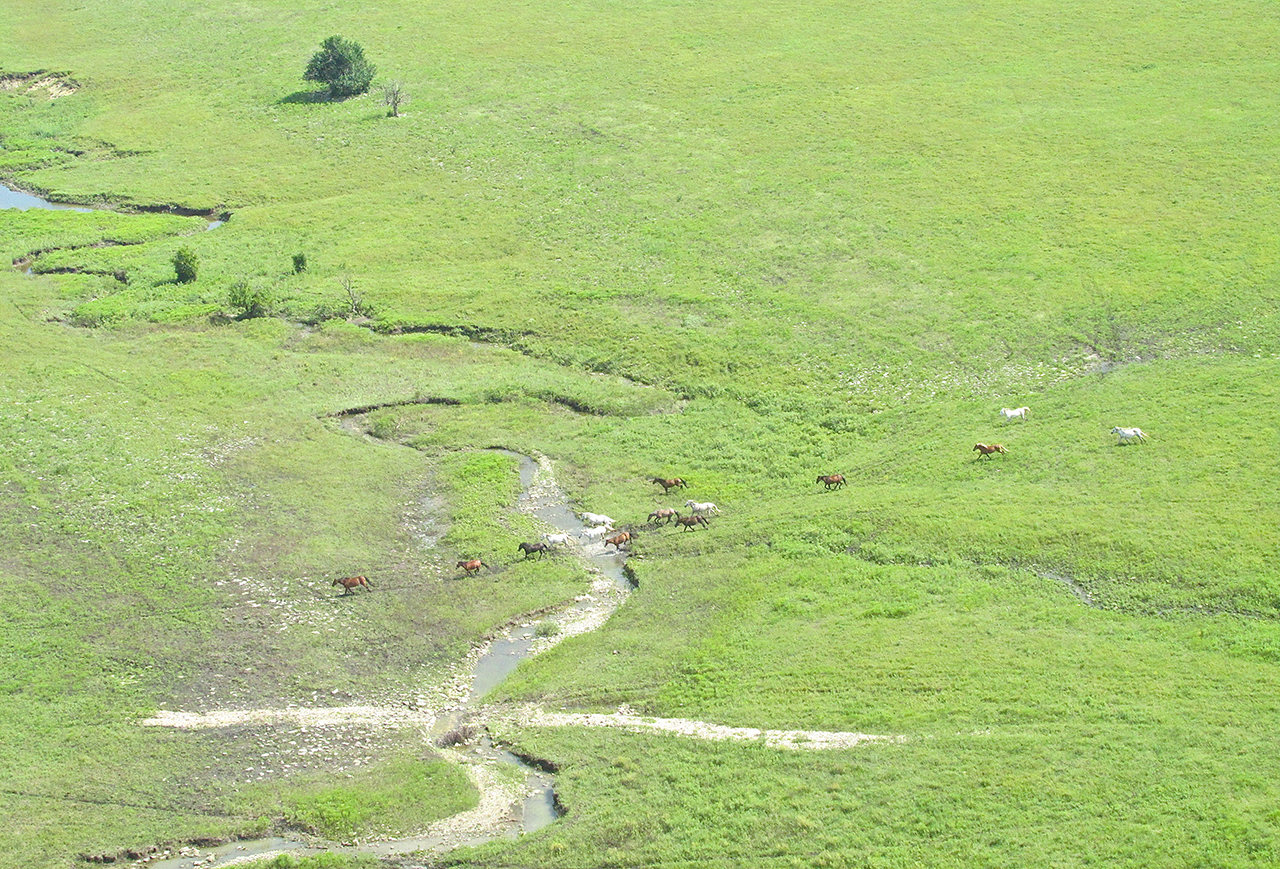
Mustang Alley
After the interesting contour territory, I saw in the distance the familiar sight of wild horses in motion. I have never seen Mustangs saunter. They are always at a medium trot like they have to be somewhere and never seem to notice me at all.
A Solitary Idyll
Only the telltale signs of rural electrification betrayed the presence of a lone habitation nestled in this center of seclusion.
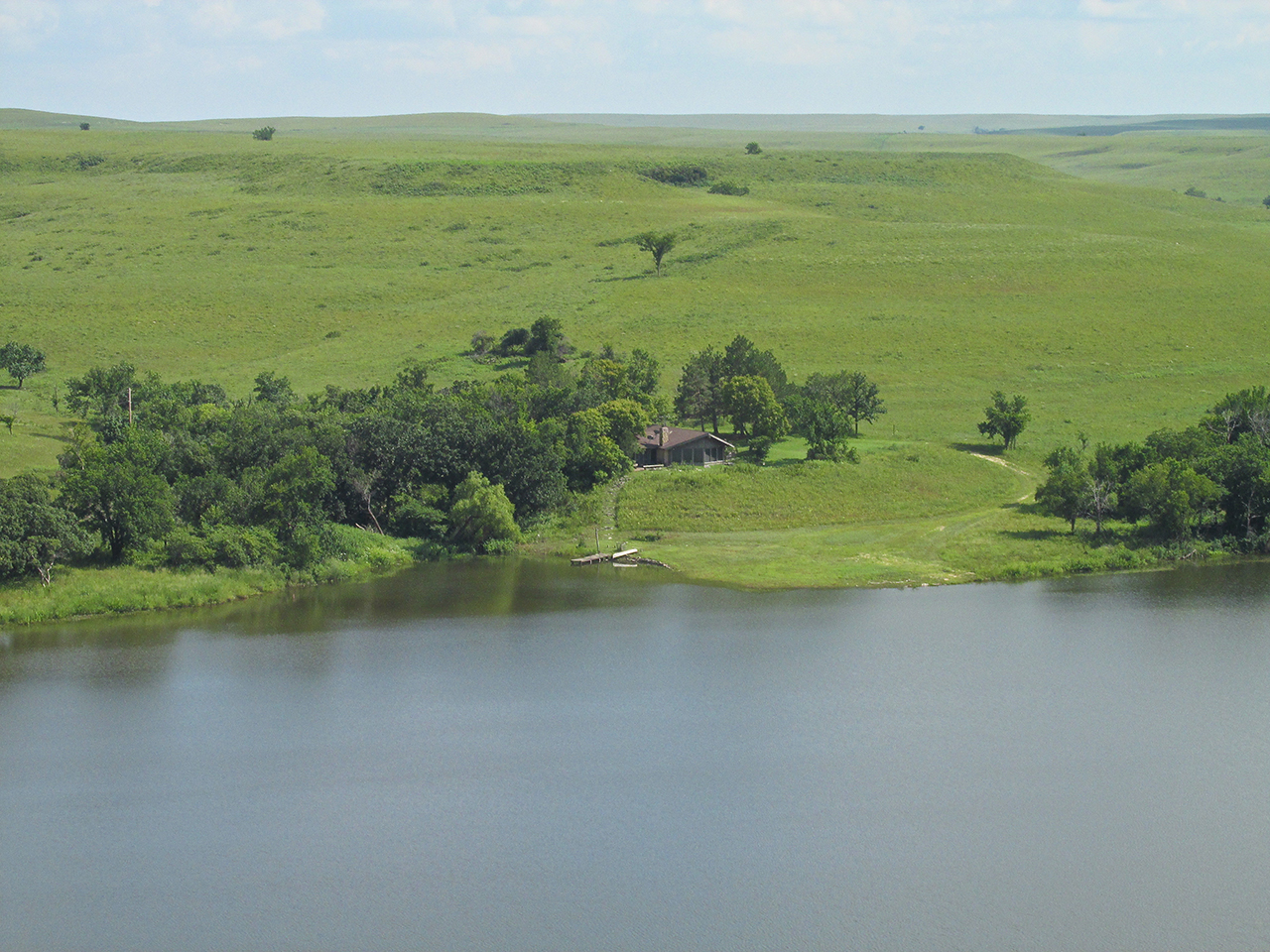
In case you missed it in the first shot…

Meandering at less than 4500 RPM, this gentle rise would require an increase in power.
The breaking cloud cover now permitting the sun to illuminate this newly mown hay field.
4 Wheelin’ On A Nice Day
Just left of my path, I saw some folks out running their 4 Wheelers on a track they had laid out. Since they were waving to me, I staged a minor air show. I flew past their position and then entered a left banking dive to their South, momentarily leveling off just above the grass. Then I powered up, climbing at a sharp angle back up to about 150′ AGL. It was basically a big circle but everybody liked it and waved enthusiastically as I left the area.
4 Wheeler Enthusiasts and Track
The Holly Frontier Refinery
A few years ago I shot video in this refinery. It was very interesting. One thing that surprised me was how loud it is around the process units. Ear protection required.
The Refinery at El Dorado, Kansas about 5 miles away from 300′ AGL looking Northwest
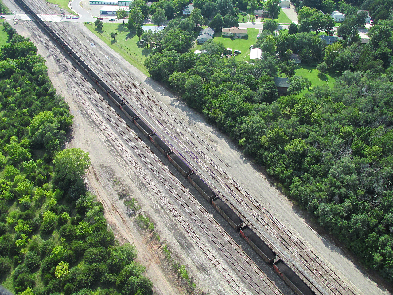
On the East side of Augusta, Kansas I spotted this long coal train. Isn’t that the name of a famous sax player?

Augusta, Kansas where Hwy 54 cuts through – seen from 600′ AGL looking West.
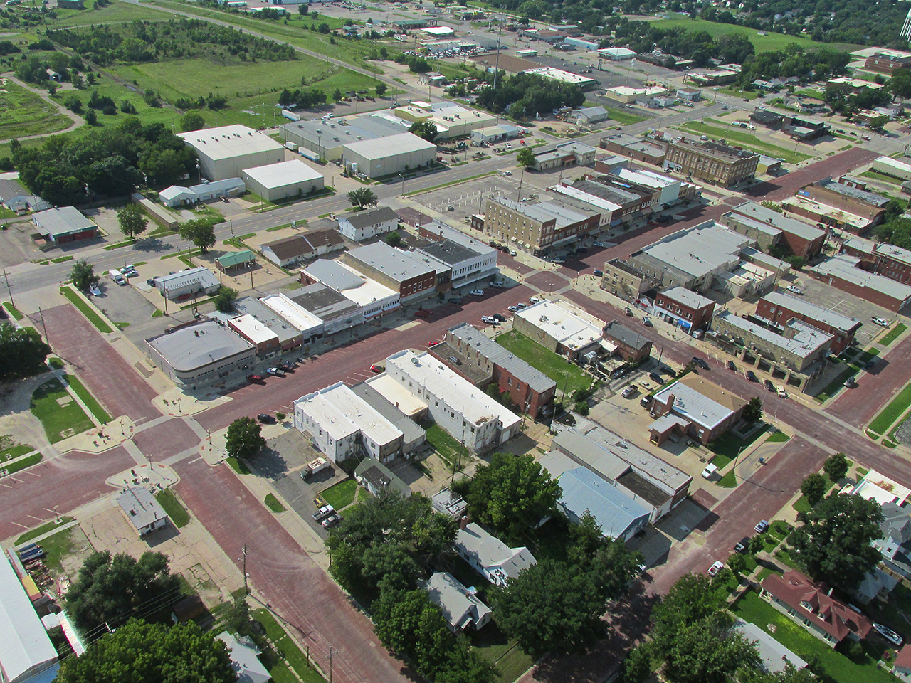
Downtown Augusta with its brick surfaced streets. I shot a music video “Augusta Musta” here during their annual car show. It is in my movie “Decade of Thunder“.
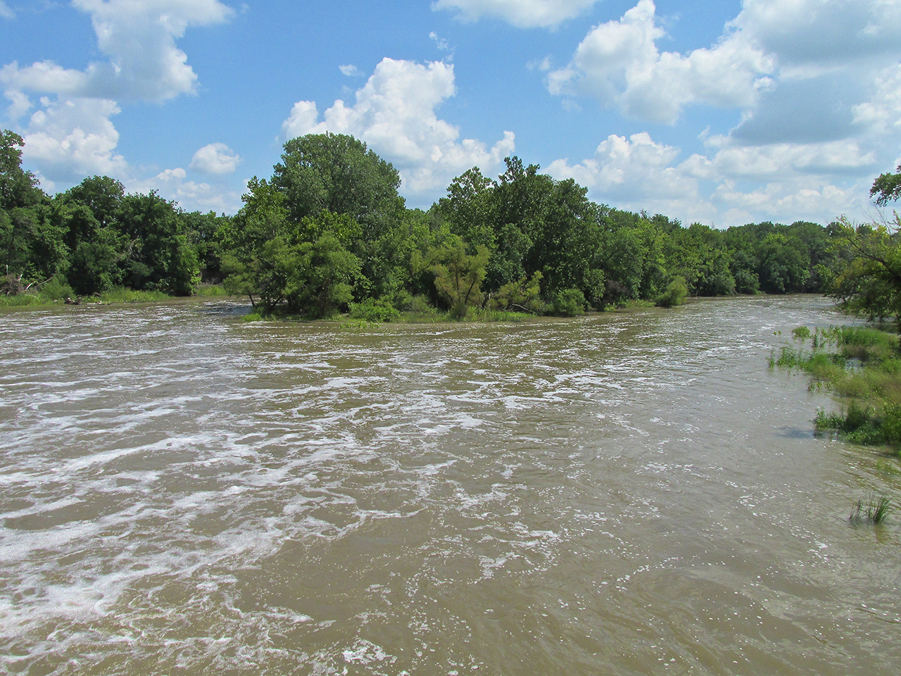
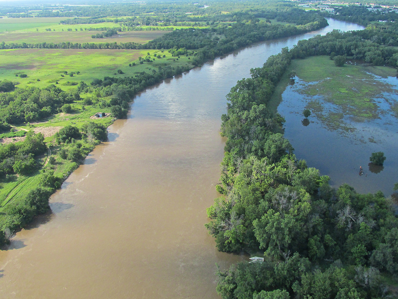
High Water Mark
In the early morning mist of my outward bound leg, I included a shot of the Arkansas River that was frankly sub par. On my return to Selby Field, the light was more favorable so I took a few more. I have not seen the river this high in many, many moons. I am impressed with our water engineers’ ability to keep it from overflowing the banks because it is right on the edge.

The Arkansas River at the Southwest corner of Derby, Kansas from 400′ AGL looking Southwest.
Same Location – Looking North
6 Hours of Airtime Later – On Final Approach To Selby Aerodrome
Grand Murals, A Nuclear Power Plant, Wild Mustangs, Great Mexican Food, a Wizard, A Dragon, A Ghost Tale, A New Hat…
An Ultralight Fun Flight always guarantees adventure and new discoveries. Burlington, Kansas was yet another high point in The Sky Surfer’s Endless Summer.
Let’s see what the next flight brings!
Blue Skies & Tailwinds!™
Brian FitzGerald – The Sky Surfer