It Was A Windy Day
Just as a fisherman or farmer or golfer is constantly aware of the weather, The Sky Surfer monitors it constantly during The Fun Flying Season. Most of the week prior to the 2013 National BiPlane Fly-In Weekend in Junction City, Kansas was not optimal for Ultralight Flying. With lots of rain and winds averaging at 15mph gusting as high as 46mph, it wasn’t good for pretty much anything but staying inside… Here in Kansas, though, weather conditions change rapidly and that’s what happened. Without warning on Friday, 31 May, the winds dropped to nil and the sky cleared. The front was passing. This can mean “severe clear” for a few days – or maybe not. Regardless, I saw it as a good omen and prepared for my Longest Ultralight Cross Country Flight to date – 112 miles out and 112 miles back!
I have shot video at The BiPlane Fly-In for its First and Second year since it was established at Freeman Field (Parts of this music video were shot there). It is a great event and I had set my mind to fly there myself this year (2013).
Upon arriving at Selby Aerodrome before sunrise that Saturday, the atmospheric conditions had deteriorated from the Waikiki-like Friday. The air was marginal but The Sky Surfer would still try…
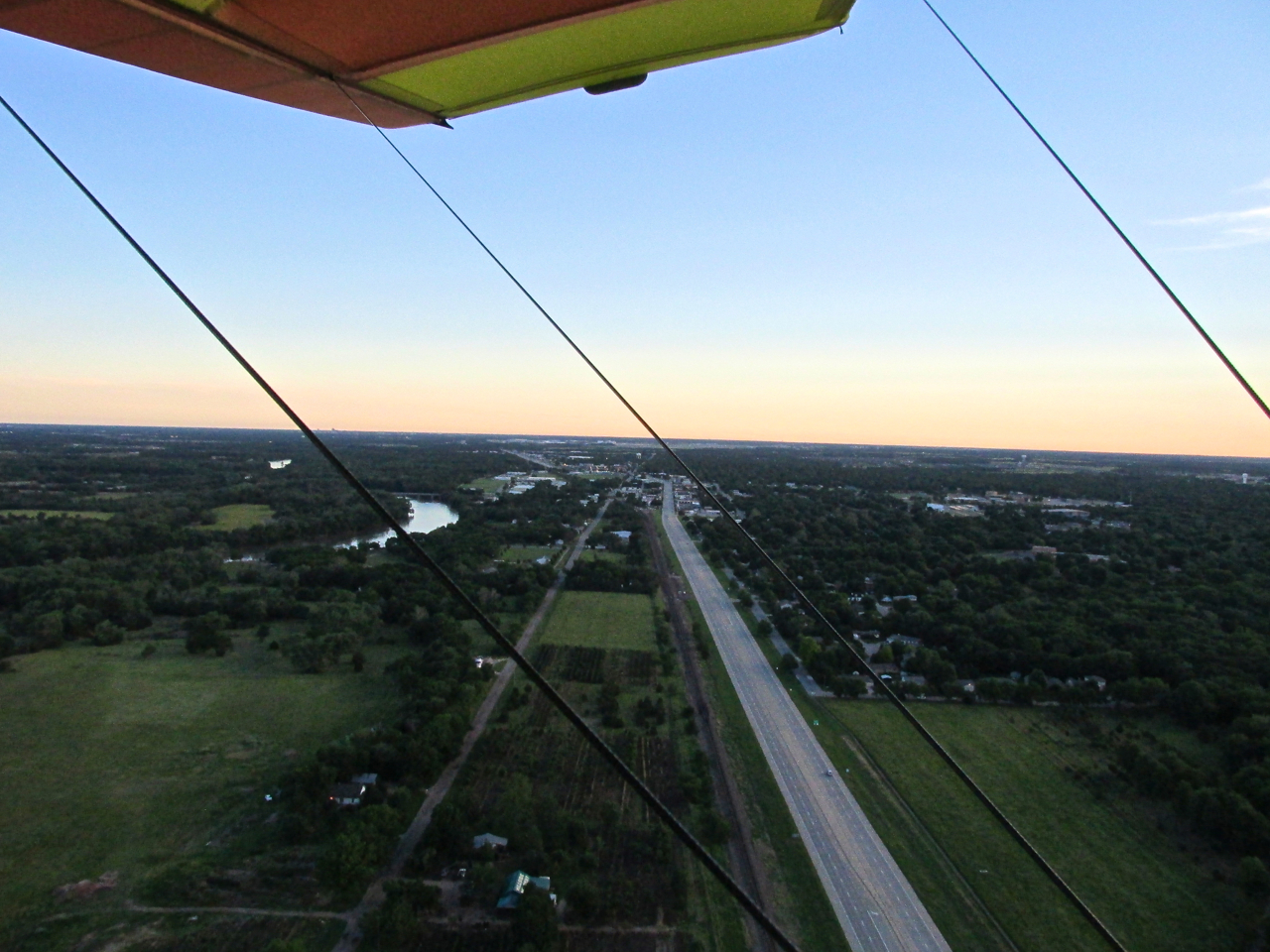
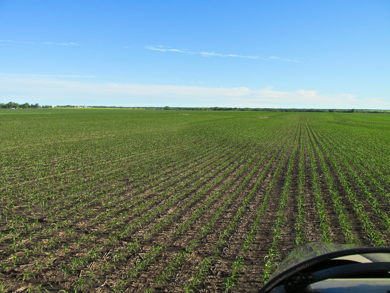
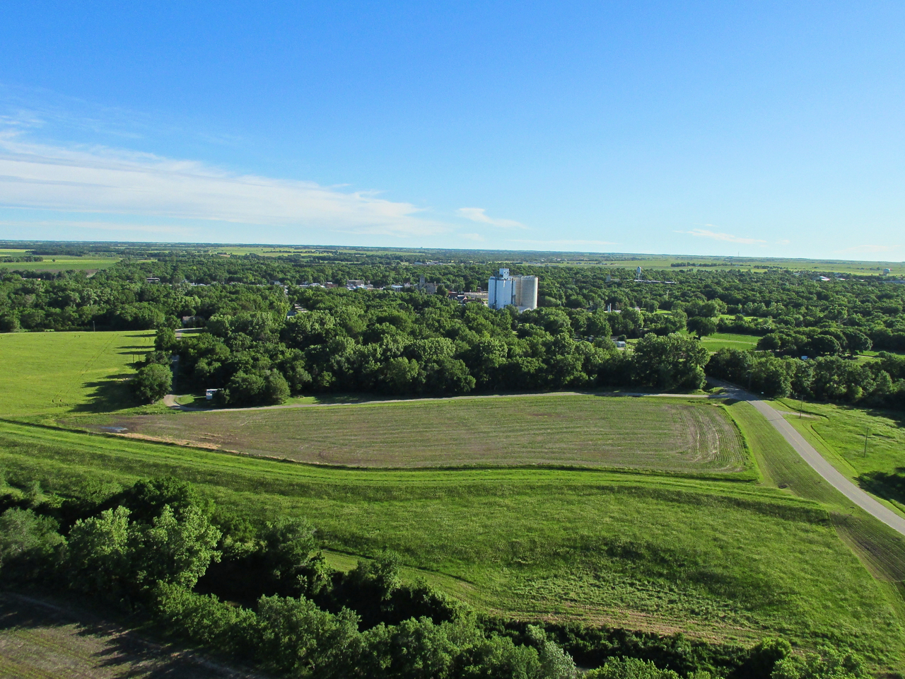
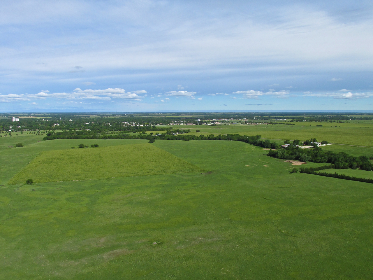
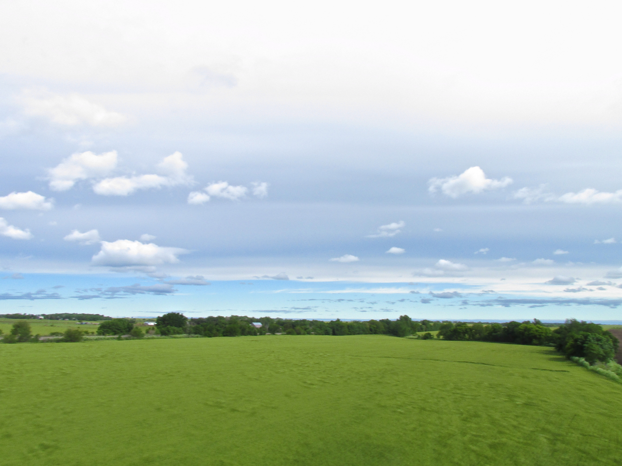
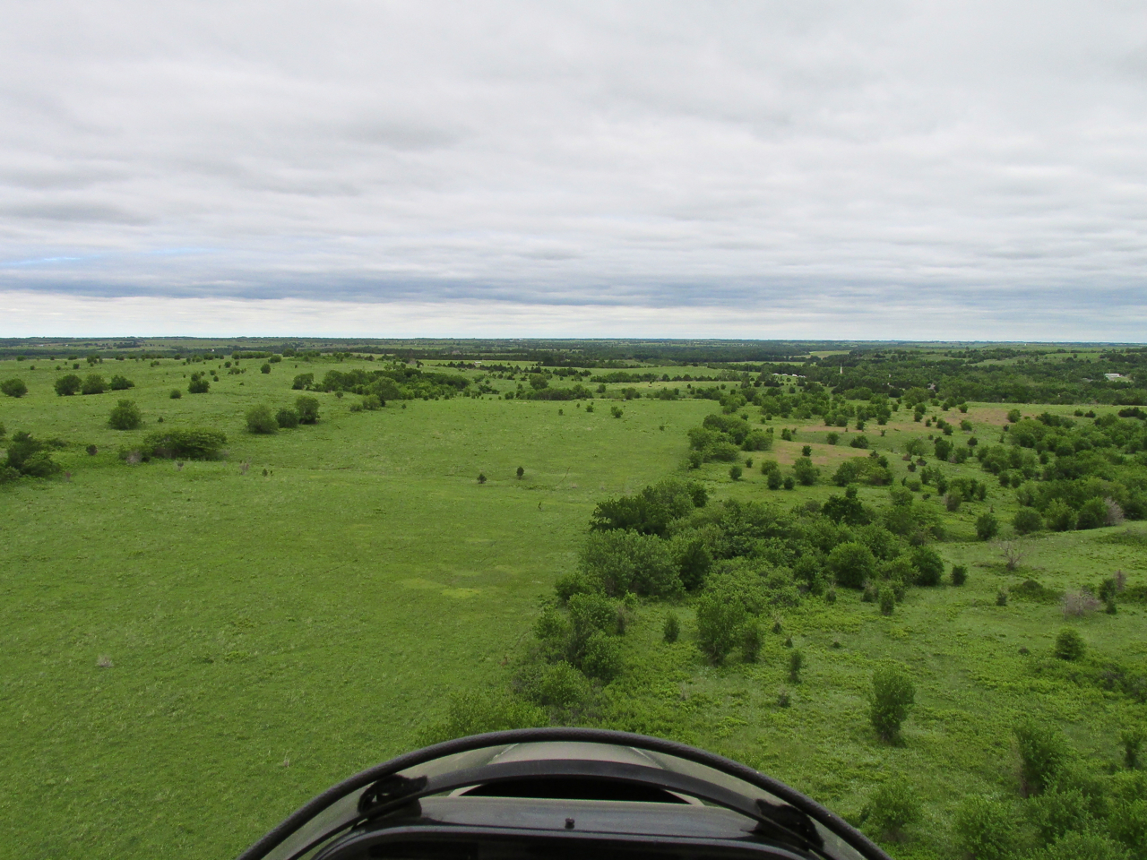
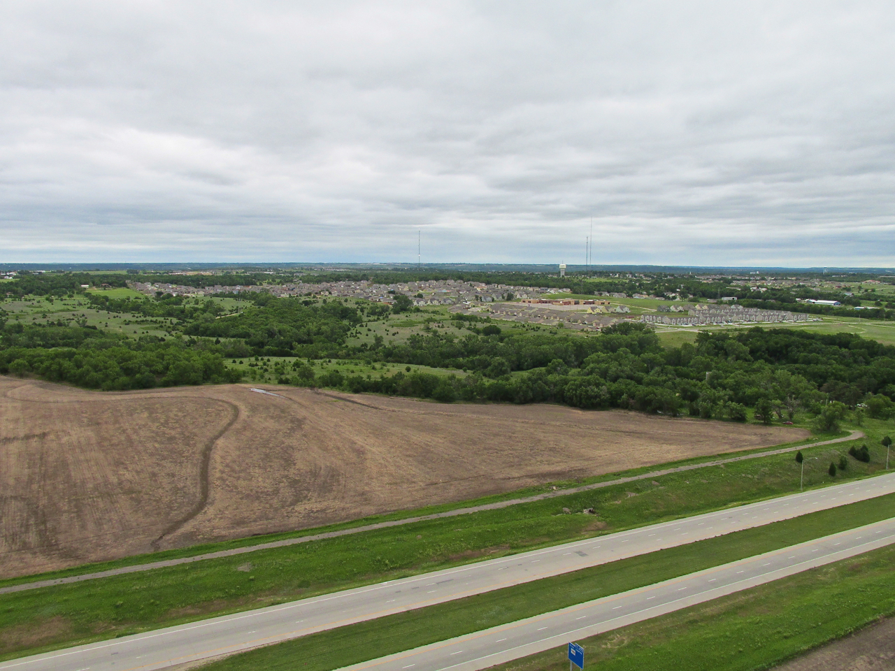
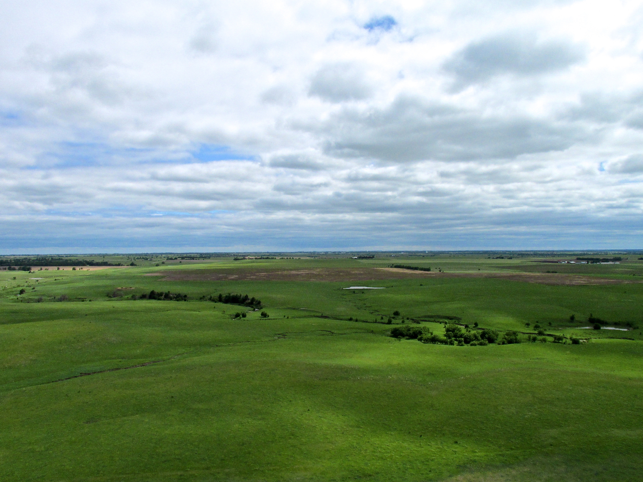
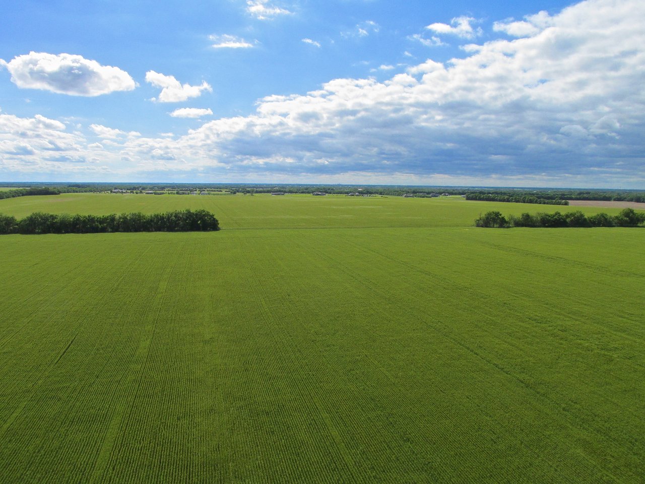
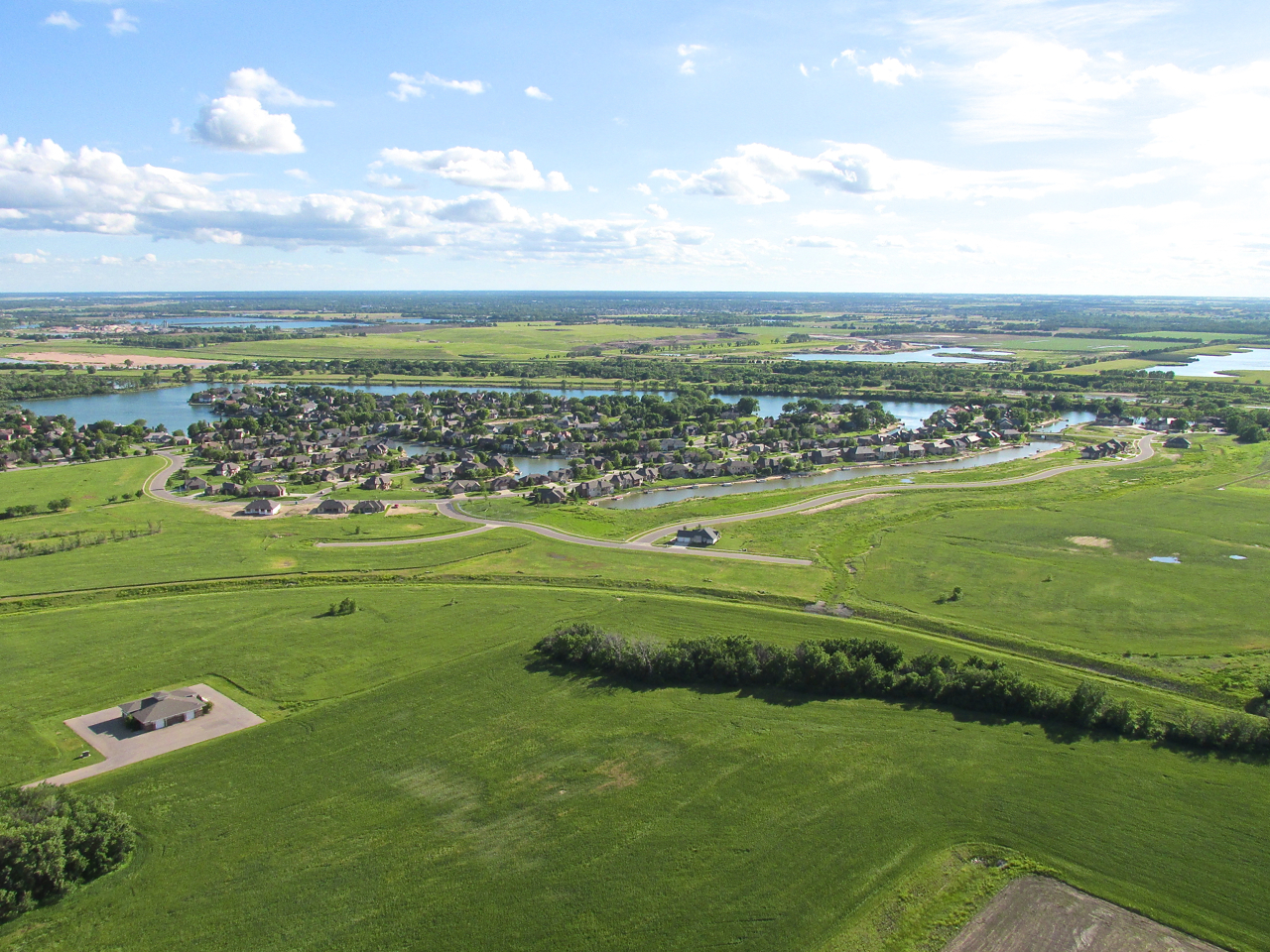
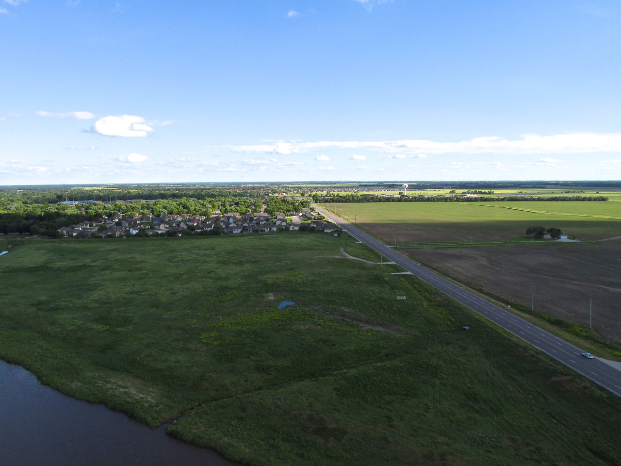
The scene under my left wing as I departed at 6:30am for Junction City, Kansas. The highway is K-15, which separates Derby, Kansas from the Ninnescah River at this point. This is looking due North from 800′ AGL (Above Ground Level).
Wind Consistent
The whole day the wind was out of the North Northwest. Before Sunrise Saturday morning, its velocity was 10 to 12mph. I wanted to get as far North as I could while the wind stayed relatively slow because it usually gets stronger as the day progresses. My plan was to stop at Marion, Kansas if the headwind was retarding my travel North too much. There I could re-fuel, take stock of the situation and decide to continue or turn back.
Detour
Junction City is North Northeast of Selby Aerodrome. Ultralights are not allowed to fly over “congested areas”. While this FAA (Federal Aviation Administration) definition is somewhat vague, for sure it means do not fly over a city the size of Wichita. For that reason, even though “the crow’s path” to Junction City would have taken me right over Wichita, I had to deviate from “the crow’s path” around the city to the East.

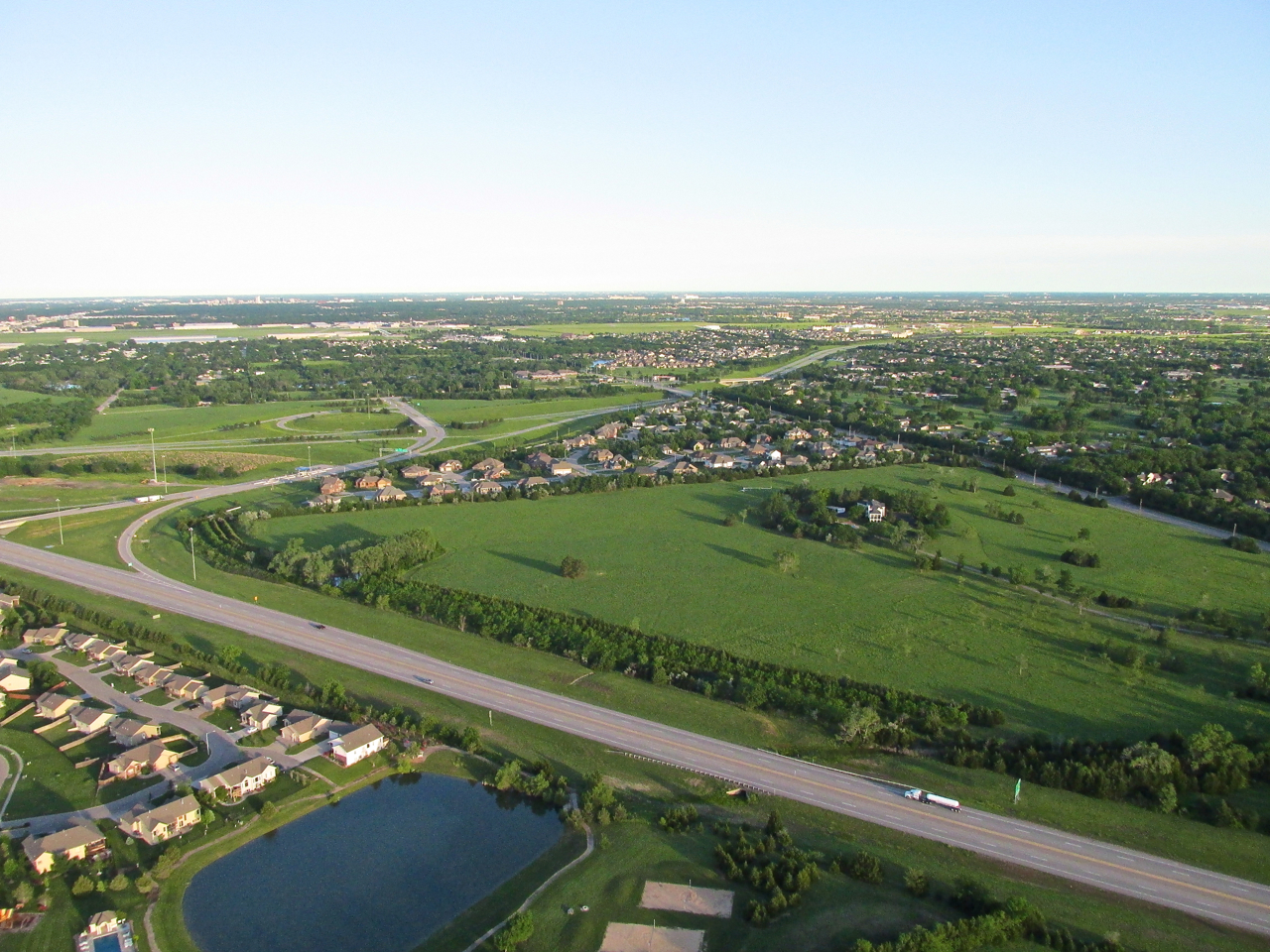
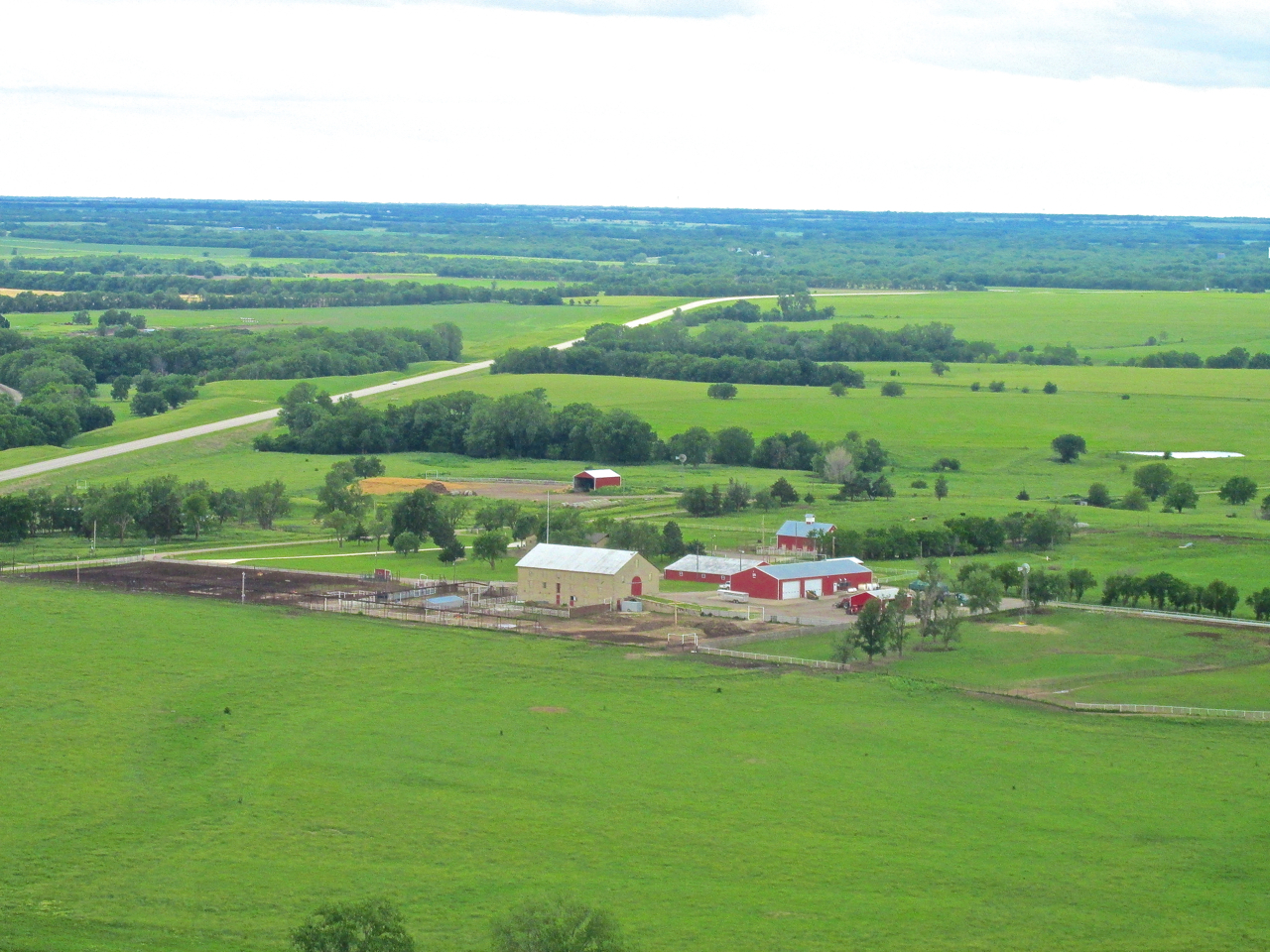
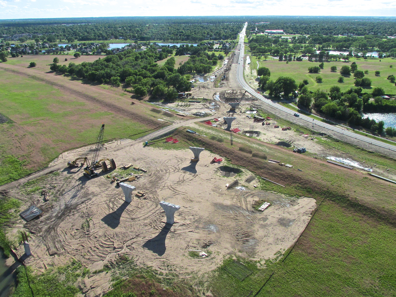
On the Southeast side of Derby, Kansas this building is going up. I think it will be a Wal Mart. I am over a wheat field. This was shot at 400′ AGL (Above Ground Level) looking North Northwest.
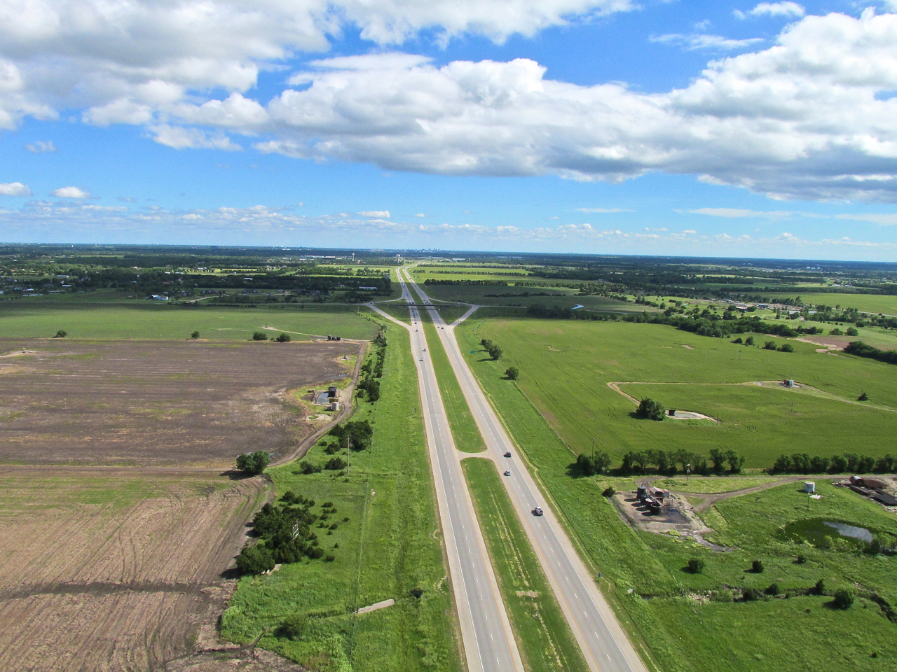
Preparing to cross Kellogg Avenue/Hwy 50 on the East Side of Wichita. In the distance you can see Beech Factory Airfield. This was shot from 1,000′ AGL looking West. My groundspeed was only 22 mph.
Druthers
About the time I took the picture shown above I was wishing I had called TRACON before launch. TRACON is the Radar Approach Control for Mid Continent Airport. I could have asked permission to fly up The Big Ditch which is a shortcut North from Selby (More about TRACON and The Big Ditch later in the report). I “druther” flown up The Big Ditch. I would have been able to fly much lower under the headwind plus it is a shorter distance to cross the city.
The headwind at 700′ to 1,000′ was about 20 mph. That is quite significant to a plane with a top speed “straight and level” of only 60 with the throttle “fire-walled”, water/alcohol injection up full, manifold pressure maxed, drop tanks away. OK… I’m not fooling you. I don’t really have all that stuff, but regardless, the headwind had me slowed to a crawl.
The East Side of Wichita is continually growing, so in addition to having to fly much higher, I have to “thread the needle” to avoid flying over people’s houses. I was not happy with myself for not using The Ditch Shortcut but as you will see later in the report, I made up for it in the afternoon.
The Key
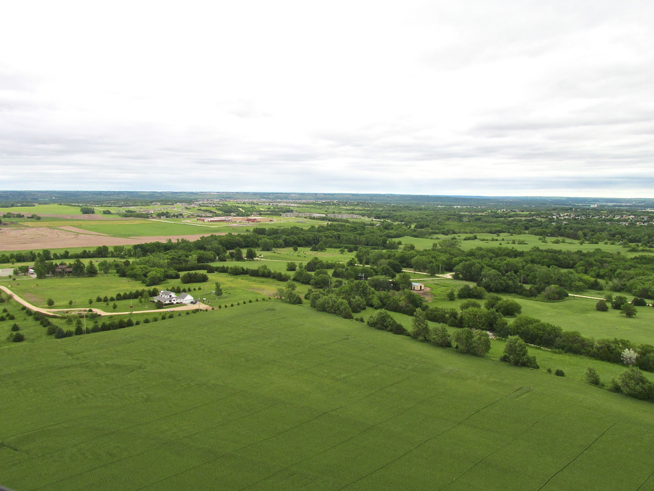
As I never get tired of explaining, the key to my Ultralight Cross-Country Adventures is to fly low into headwinds so as to take advantage of the “boundary layer” of relatively slower air closer to the surface. After finally emerging from the relatively congested area of East Wichita and Andover, I broke out into the beautiful fields you see in the next series of shots. There I was able to descend to (Ultralight) Flight Level 75. Immediately my ground speed bumped to 40 mph. Smokin’!
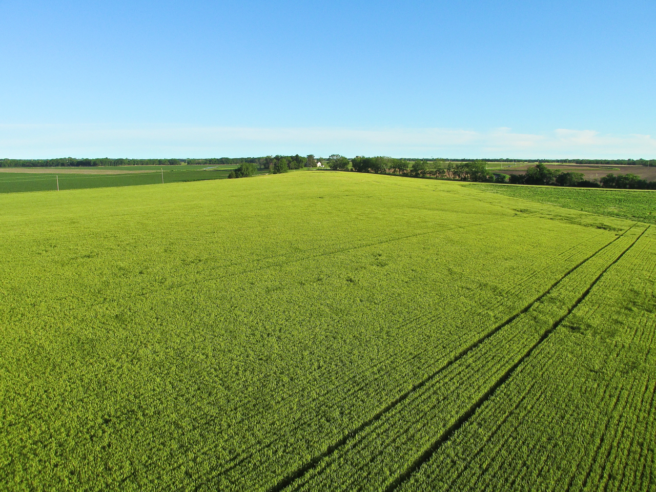
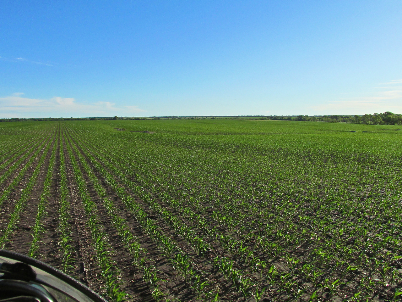
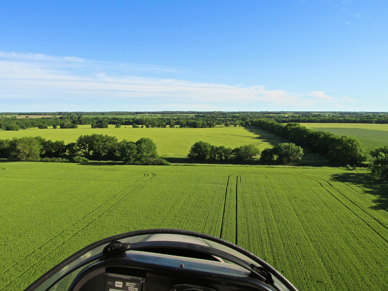
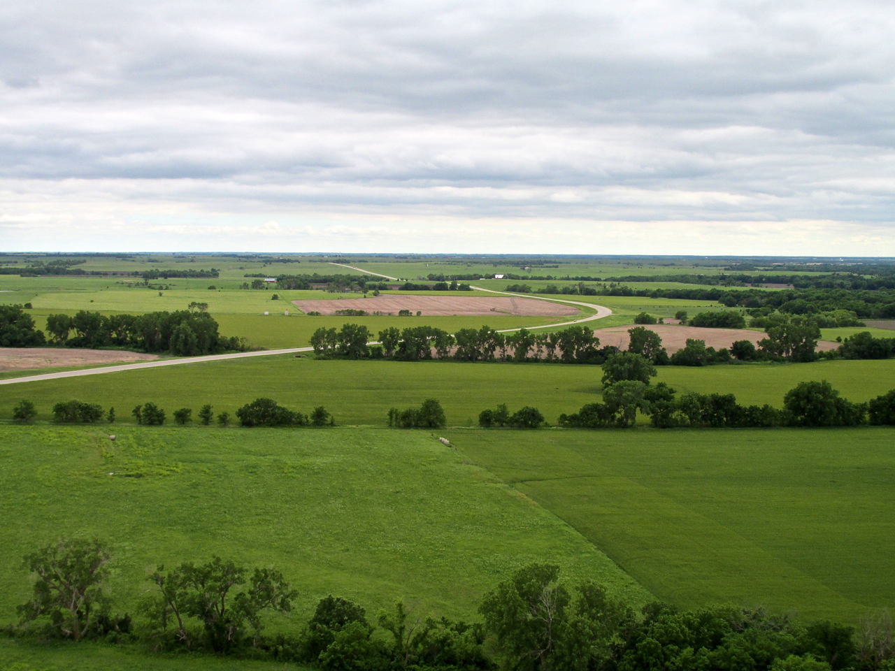
Here is some fine wheat. Notice the clear skies – a hint of clouds on the horizon.


I think this is Whitewater, Kansas.
The sky was clear; the panorama beautiful. Note the small settlement ahead.
I took a few pictures of this. I threw the rest away because this one was the best. It looks to me like they left an historic old stone building in the middle of all the new construction. I like that.
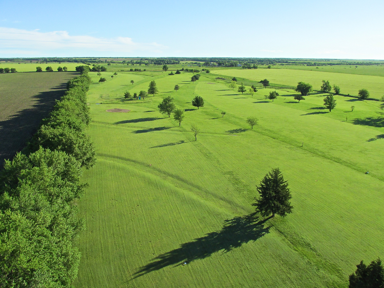
Suddenly out of nowhere I encounter this well-kept Golf Course. With no town around it must be privately owned. Hey! Farmers like golf, too!
Note the “rivulets” above and left of my shadow on the surface of the wheat. They represent the wind that was increasing in velocity from the Northwest – a quartering headwind.
Marion, Kansas On The Horizon
Time To Land
Even though I had been flying “nap of the earth”, the quartering headwind was still fairly strong at the surface. I had about one gallon of fuel left in the tank. I had chosen Marion, Kansas as the decision point for re-fueling if necessary whether I continued to Freeman Field OR returned to Selby Aerodrome. Even though the turbulence made it “both hands on the wheel” flying, I decided after re-fueling I would “press on” to Junction City.
Luxurious Wheat At Marion’s Southern Doorstep
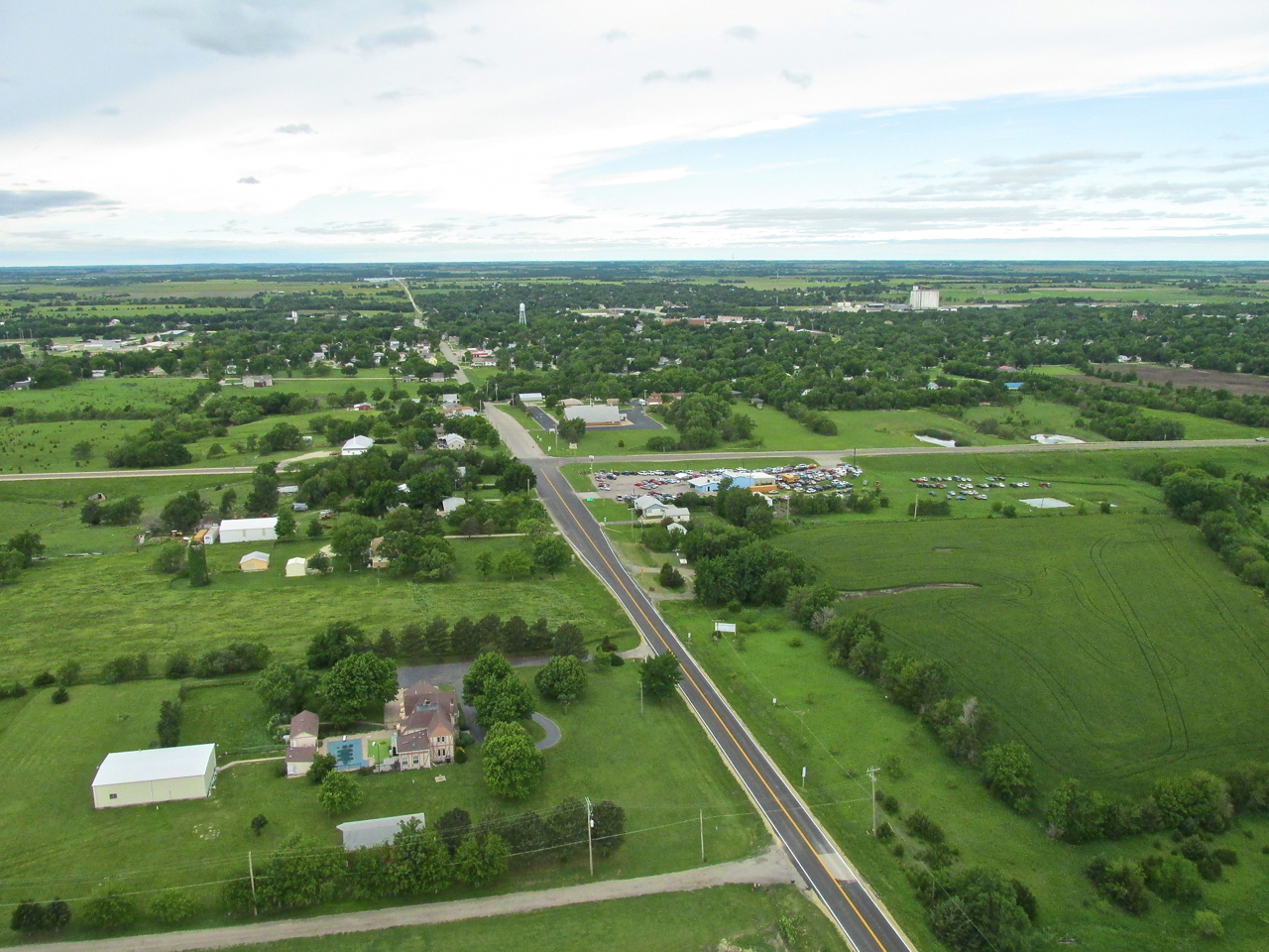
Marion, Kansas from 400′ AGL looking West Northwest.
Take A Look-See
I had set my GPS for Marion and it did well by pointing me directly downtown. Marion Municipal Airport is 2 miles Southeast of town. I climbed to visually acquire the airport and to enter its traffic pattern at a more proper altitude.
Marion, Kansas from 600′ AGL looking West.
After climbing and turning East, Marion Municipal became obvious. It looked just like the satellite photo on Google Earth. This was taken at 900′ AGL looking East.
Maybe An Anchor?
As I approached the field the wind was 20+mph with gusts to 29 mph. I have a lot of flight time in my Quicksilver. I have flown it in winds of this nature many times. The airframe is solid. The controls are plenty adequate to meet the conditions – while airborne. The challenge is being on the ground in windy conditions. Because an Ultralight is so “light”, the moment the pilot gets out of the seat, the gross weight of the machine decreases by about 40%. In the conditions described above, this will at least cause the craft to spontaneously roll across the ground – at worst, the wind can lift up a wing – at very worst, it can turn it over.
Wind Shadows
When landing in the conditions described I have found it useful to employ “wind shadows”. The picture below is a perfect example of “wind shadowing”. At the top of the pole in the picture you are actually looking right through the airfield wind sock. It is standing straight out. That gives you an idea of the wind velocity and direction. Because you see the position of the airplane without yours truly in it, you know the plane is in a wind shadow. Being thus shielded from the force of the wind, I could walk away from The Air Machine.
Fueling Procedure
At unattended airports such as Marion Muni, IF they have fuel at all, the procedure is generally to call the Mayor, City Manager or Police Department. Someone will come out to the field and unlock the gas pump and take your money. A few places have automated the process and have credit card swipes at the pump. Marion’s gas is padlocked. My wind contingency plan would be to implore whatever person was to come to the field to hold the tail of the MXL down while I poured a measured amount of two stroke oil followed by four gallons of gas into the tank. Even better would be if said person had a five gallon gas can so I could mix the oil and gas in it so as to leave the Quicksilver in the wind shadow and fuel it up in place.
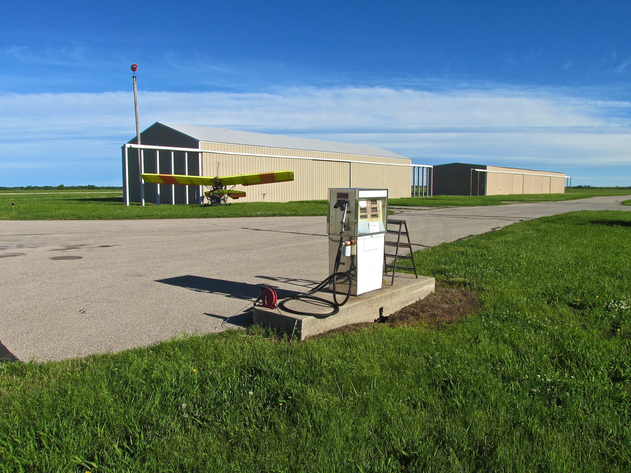
Check the Wind Sock. It was very windy at the pump.
Providence
Over the last few years I have been doing my best to resurrect into common use a term that was once commonplace. The word is Providence. The adjective derived from it is “providential”. Providential are events which are “heaven-sent”, “divinely intervened”, “in God’s will” – “a manifestation of divine care or direction” – that sort of thing. Providence is opposed to“luck”.
After pulling the plane into the Wind Shadow, the instant I reached for my cell phone to make the call to the Marion City Manager, a Ford Pickup Truck entered the airfield property from the two lane highway. As the folks in the cab approached I saw a familiar face behind the wheel. It turned out to be Dick McClinden and his wife Patty. I had met Dick a couple of years earlier at Kingman’s Clyde Cessna Airfield (The Story is HERE). He works for Eagle Sky Patrol and flies his Cessna Cardinal to check pipelines. Not only did Dick have the key to the gas pump but he could also take the money for the gas AND had a five gallon can for mixing gas and oil. To top it all off, he backed his pickup right to a spot perfect for me to stand on the tailgate to pour the gas in. Some call all that luck – To me it was Clearly Providential.
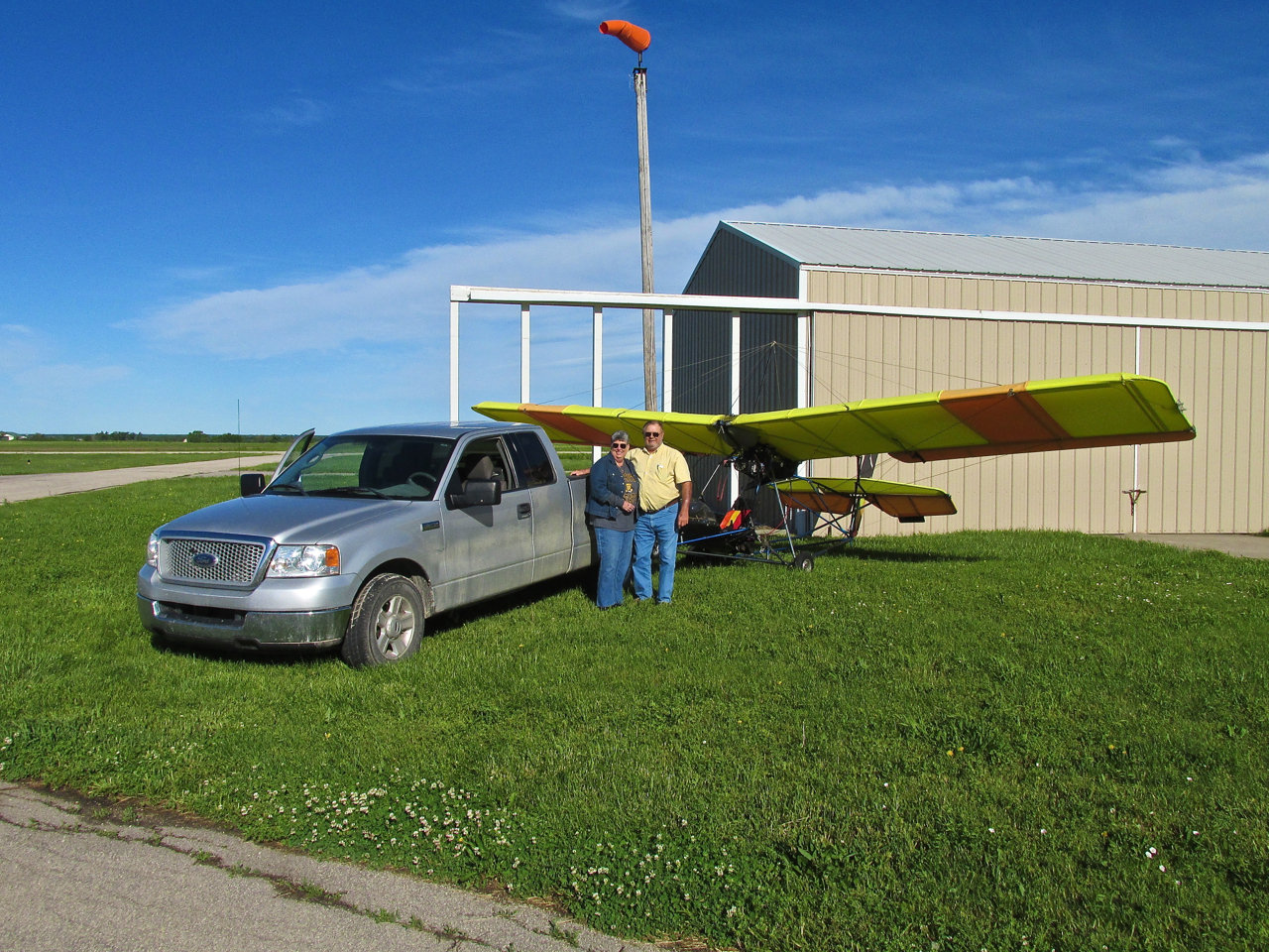

Dick and Patty were heading to a rehearsal for Symphony in the Flint Hills when they saw my plane next to the hangar.
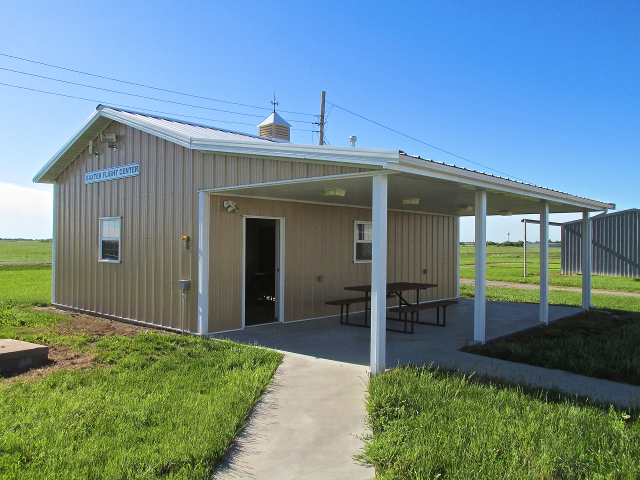
New – Baxter Flight Center
After fueling up the plane, Dick opened the door to The Baxter Flight Center and we went inside to conduct business out of the wind. The look and feel of the place indicated it was brand new. Dick told me it was, and represented a significant donation by Pearl Baxter in her husband George’s memory. They had been members of The Flying Farmers for many years and after George died, Pearl wanted to do something for the aviation community she and George loved.
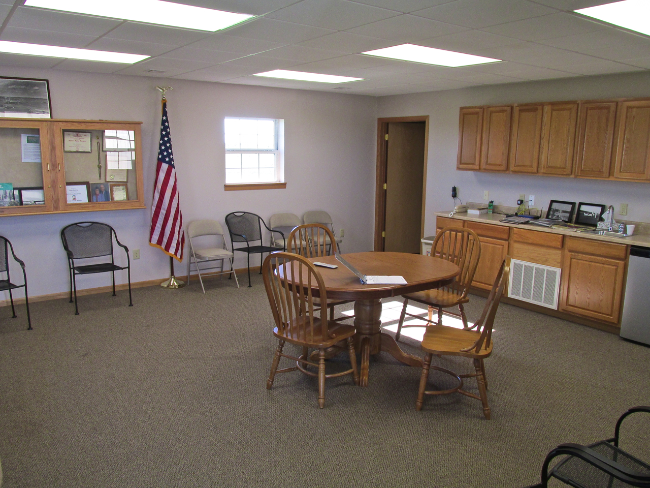

Artifacts have begun to arrive and will be organized within this display case soon.
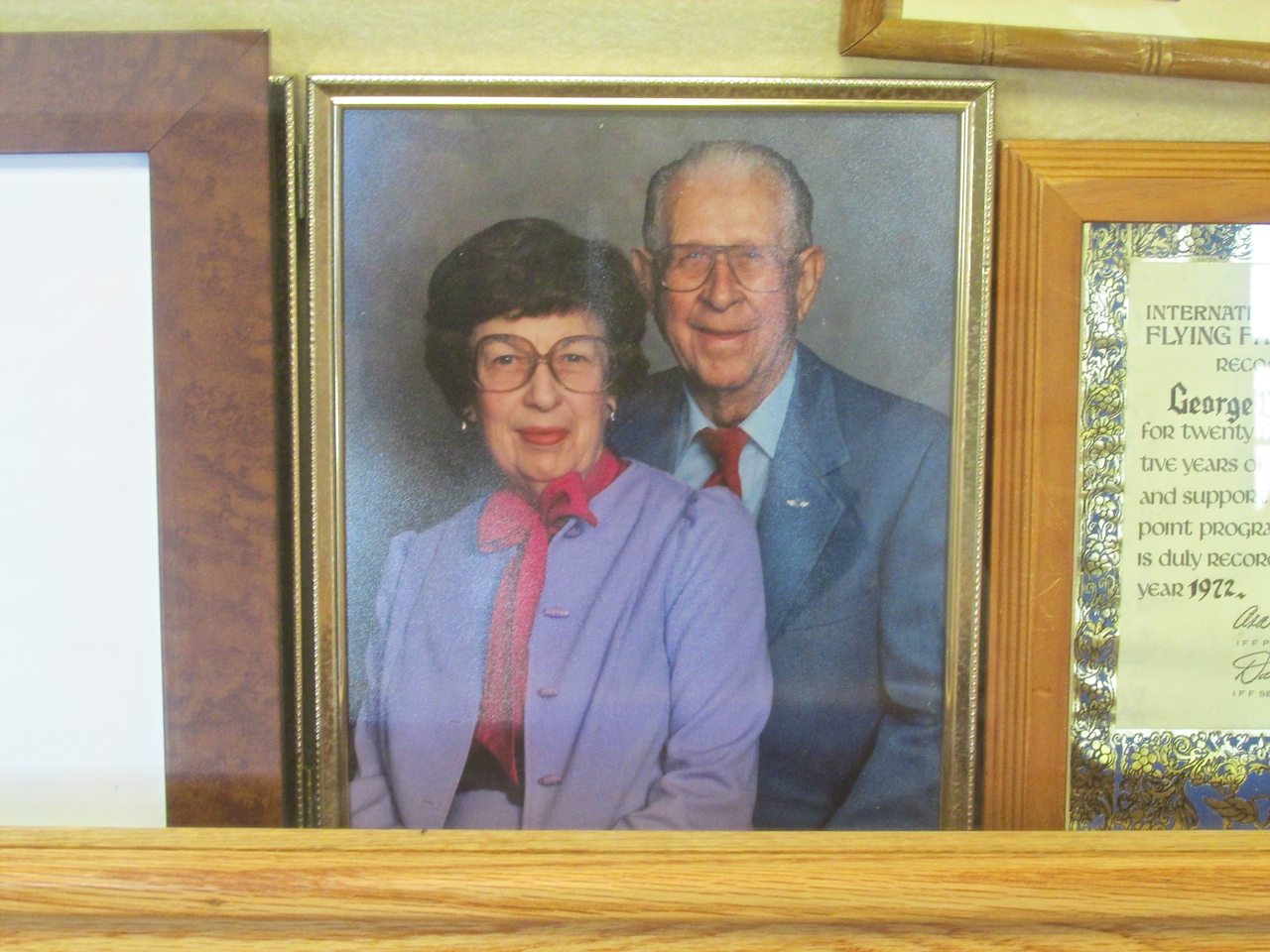
George and Pearl Baxter
‘Til We Meet Again
We all had places to be, so I thanked Dick and Patty for their kindness and courtesy, fired up the bird and headed North.
Just after liftoff I took another picture of Marion, Kansas. This from 100′ AGL looking West. Note the change in cloud cover.
Right after taking the picture of Marion, I kicked the tail right to shoot around it and get this departure shot of the Marion Municipal Runway.
Lincolnville, Kansas
My path took me along a railroad track. Soon I saw a town next to it. It was Lincolnville. I stayed over the tracks and took these two pictures. Lincolnville had no one outside for The Sky Surfer to wave to…
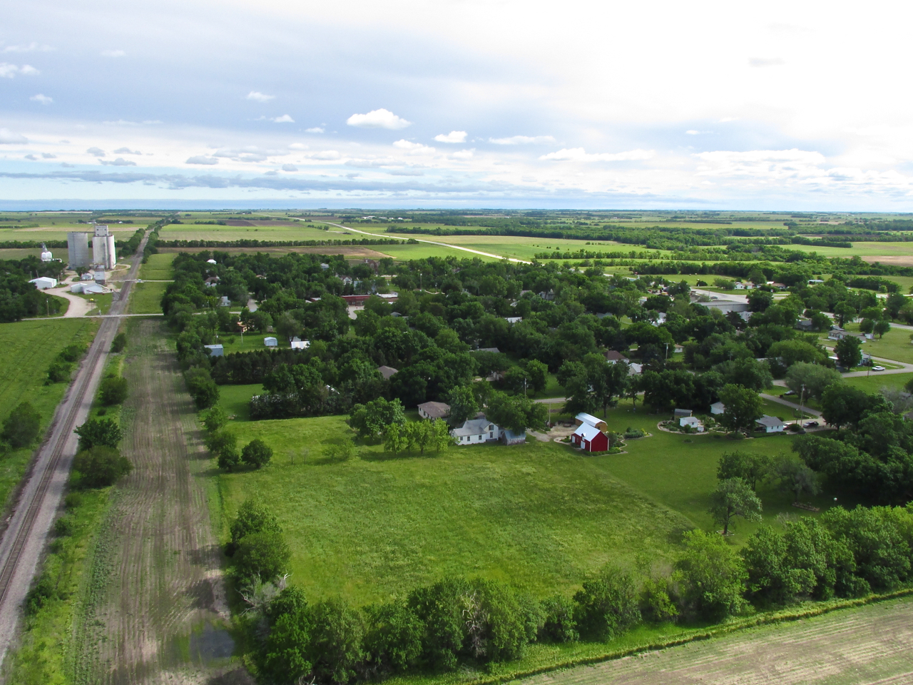
Ten Miles North of Marion along the railroad track lies Lincolnville, Kansas.
Downtown Lincolnville
Sky Changes
On occassion I have seen the attractive atmospheric effect I attempted to capture in the photo below. The upper cloud layer provides a dark background to the bright, white cumulous clouds in the fore. The photo does not give complete justice to this scene but still sufficient to give you the idea. Note the wind on the surface of the wheat. It was fairly turbulent at this time but not choppy – Made to Order for The Sky Surfer. In spite of this quartering headwind, I was getting 35 to 40 mph ground speed. Perfect!
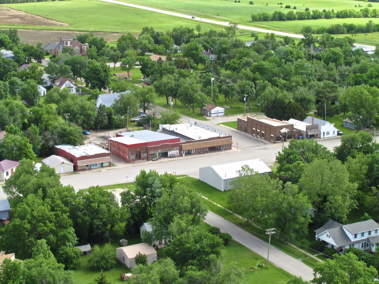
Herington, Kansas
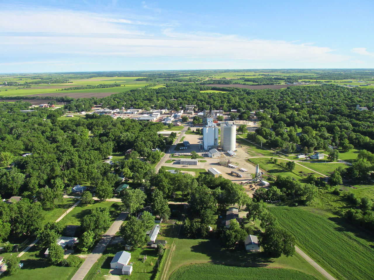
For a number of years I had an advertising client in Manhattan, Kansas for whom I produced and placed TV and Radio commercials. Over that time I can’t count how many times I drove up and down Highway 77 which you can see cutting left to right in the photo below. For me, Herington, Kansas was a marker on the road. I knew once I passed through it how soon I would be in Manhattan. From the road, Herrington appeared to be just a gas station and convenience store on “77”. Now finally seeing it from the air, I can tell it is a good-sized, small town. It has an airport 5 miles East of town and is on my Future Fun Flights List. As soon as I get a chance to fly over there, you’ll be the first to know.
Herington, Kansas from 200′ AGL looking West.
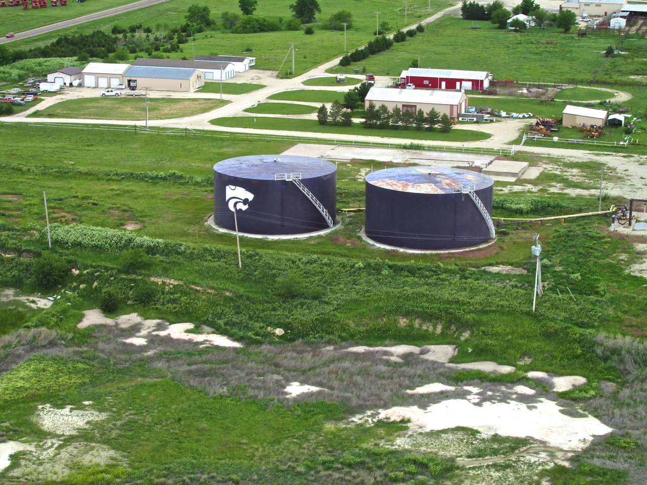
The famous and omnipresent Willie The PowerCat – The logo of Kansas State University. The whole campus, alumni, their children, pets, cars and golf clubs are painted Purple.
The Ever-Changing Flint Hills
Continuing North over The Flint Hills, Wheat Country gave way to Cattle Country yet again.
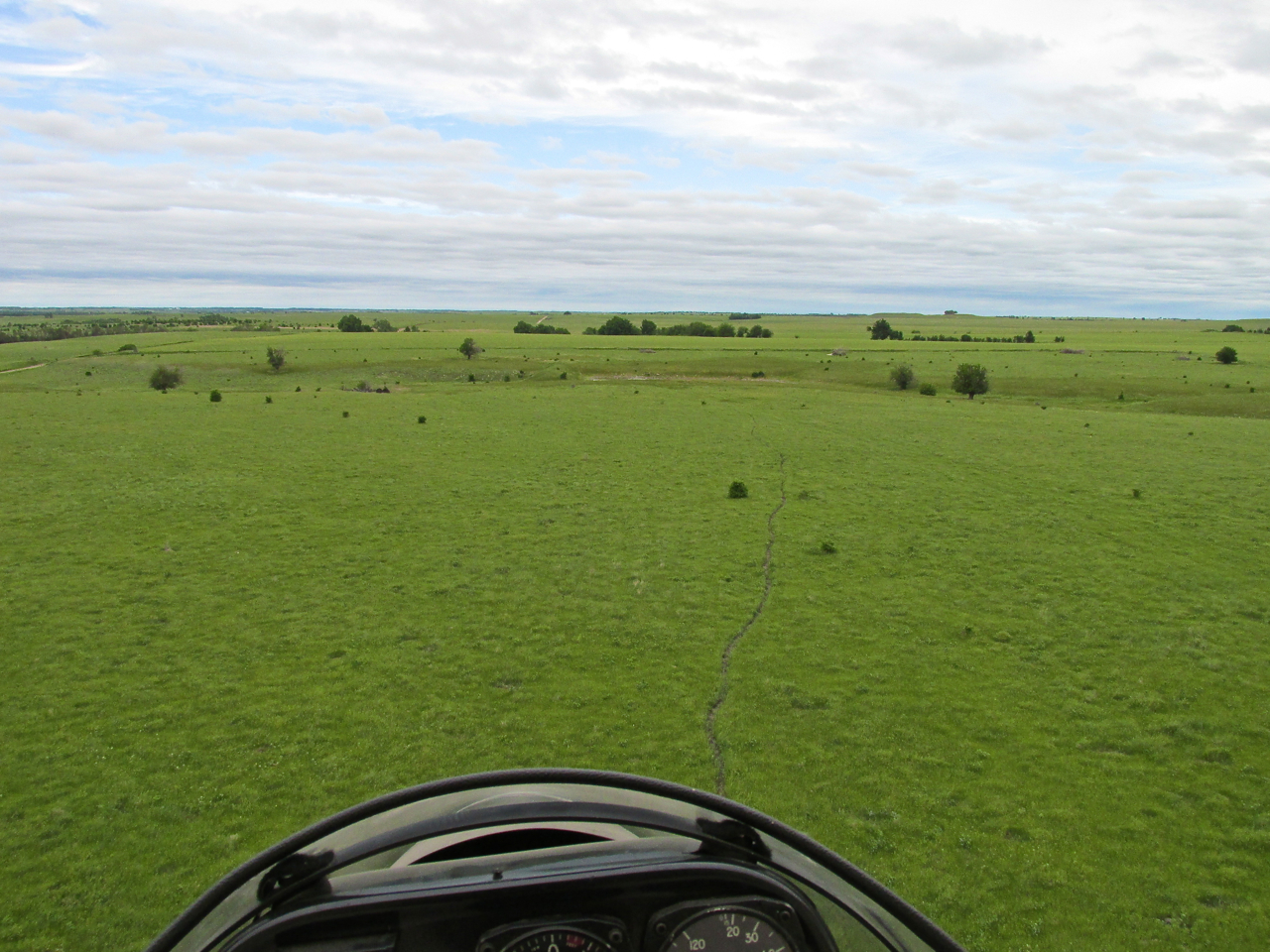

Note: In the preceding 3 picture series, the sky has gone from mostly cloudy to complete overcast. In addition, the wind became more gusty and the temperature dropped.
A Christian Summer Camp
Suddenly, right in my path, I saw a Camp. I swung West in order to give proper space between me and them. I did not see a sign naming it. Even while writing this report I could not find it on Google Earth or any of the other tools on The Web. So, if anyone knows what this is, please let me know and I will add its name to the report.
Junction City In Sight!
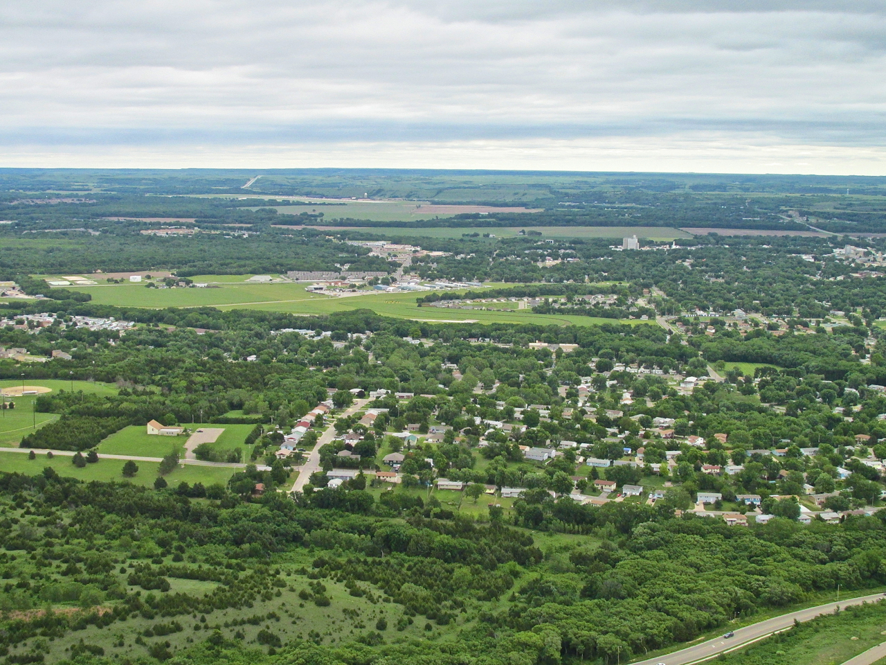
Before taking the picture below I knew I was approaching Junction City because I could see the two towers from a good distance off. Flying very low to avoid headwinds, it is often surprising how close you can get to a town and not see it. The picture below does not reflect this phenomenon because it was taken while gaining altitude to cross the wooded band and the river. Doing that allowed me to see the buildings at the feet of the two towers.
Crossing 1-70 Looking North NorthEast At Junction City
While approaching Freeman Field, I took this picture of the Northwest part of Junction City. I was climbing to pattern altitude.
Looking North Northeast from the same position, we see Milford Lake in the distance.
Approach Plan
Freeman Field is an “uncontrolled airport”. To any non-pilots reading this, that does not mean “wild free-for-all”. It means there is no tower. There are still “controls”. The general concept is called “See and Avoid“. Pilots follow defined methods and patterns for entering the airspace of an airport. If you want to learn about it, HERE is an excellent explanation provided by the FAA.
After taking this, I could not take any more pictures because I was swinging my head all around looking for traffic. Entering a traffic pattern is a time for total concentration on the task at hand.
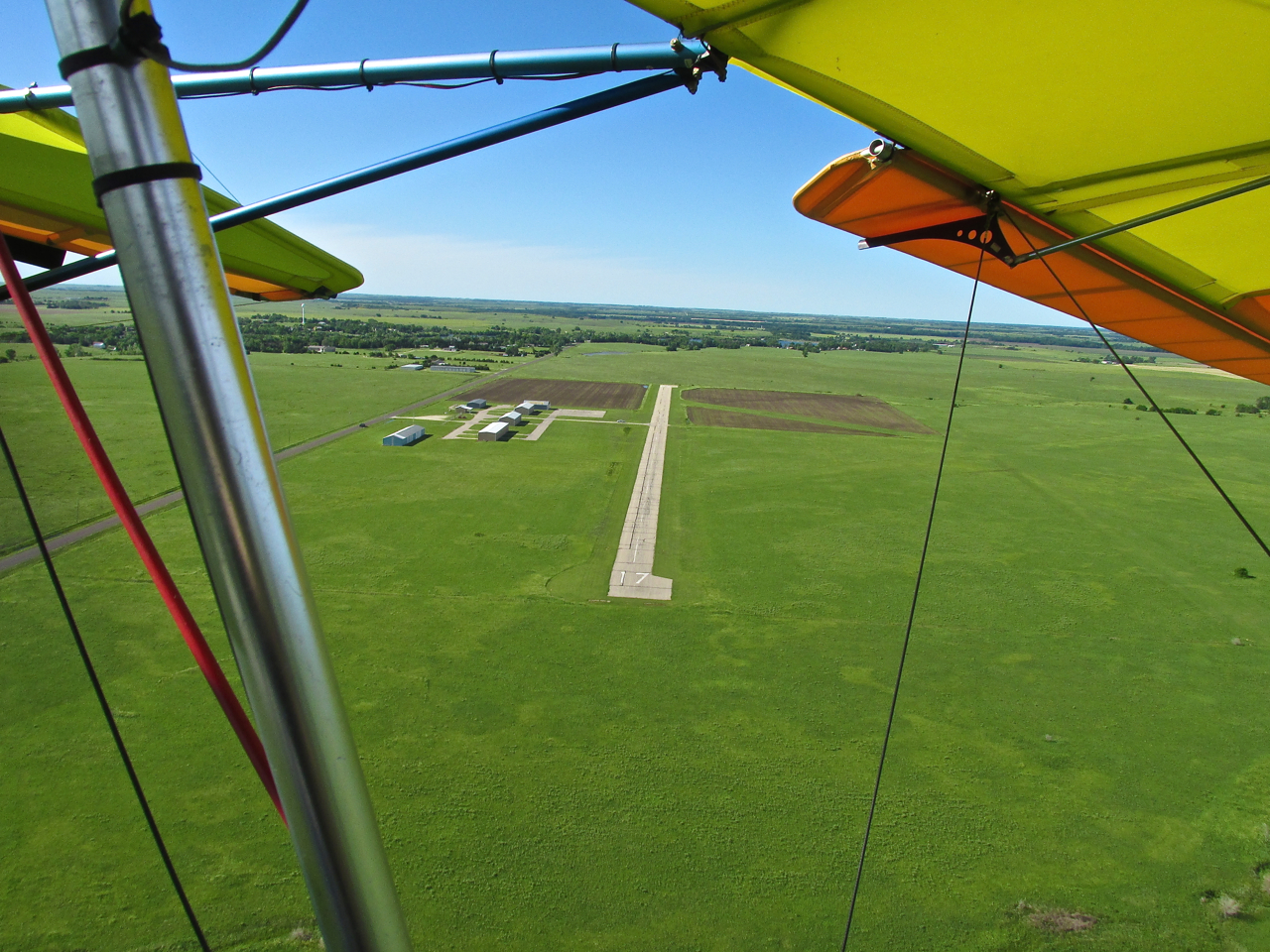
Freeman Field Directly Ahead. In the distance, Marshall Army Airfield can be seen.
The National BiPlane Fly-In 2013
The National BiPlane Fly-In is presented by EAA (Experimental Aircraft Association) Chapter 1364. They do a top notch job. It was the first time in my Fun Flying Career a “Follow Me” vehicle escorted me to a tie down. Particularly interesting was that the driver of my “Follow Me” was Kent Foster. Kent owns a 1937 Fairchild 24 Classic Airplane and is one of the pilot/airplane owners featured in my latest installment of “That They Might Fly Again” (I would insert a link to the web page here but it is not finished yet). It was fairly windy on the surface of Freeman Field so I asked Kent if he could direct me to some tie downs. He did and for the next 3 hours I only once moved farther than 10 feet from my plane.
One reason I stayed close to the plane was because of the wind. Even though securely tied down, the wind would randomly gust and the MXL would respond by starting to fly in its moorings. I needed to be there in case it broke loose.
The main reason I stayed around the plane, though, was to answer questions from interested Fly-In Attendees. Most people had never seen an air machine so small and light. They were very curious. The Sky Surfer was in his element. He loves talking about Aviation, Ultralights, and the Quicksilver MXL. The three Junction Citians shown below were the only folks I thought to take a picture of. But, there were many others I was happy to spend time with discussing The Sport.

Shirley Lee, Becky Lay and Christopher Coy were three of the folks interested in aviation and my Quicksilver.
Ed and Charlotte Doyle
I was also happy to finally meet Ed and Charlotte Doyle. Ed and Charlotte are active members of The Flint Hill Flyers. They were instrumental in leading me to Kent Foster. A real bonus of our meeting that Saturday was to learn that they had recently acquired the Meyers OTW they are standing with below. We had been discussing that possibility for a couple of years on the phone and by email and now it had come to pass.
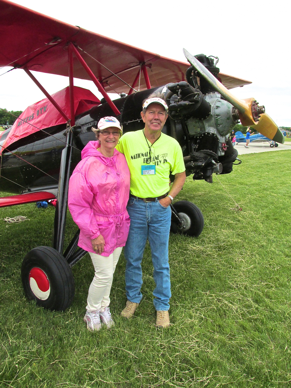
Ed and Charlotte Doyle with their Meyers OTW.
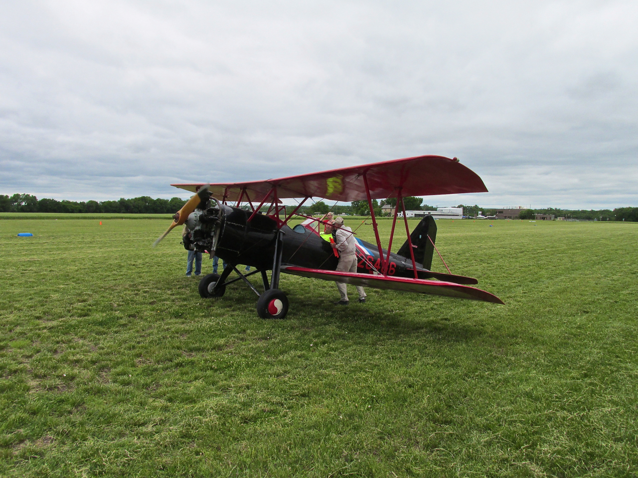
N26466 sports a Kinner R5 Motor
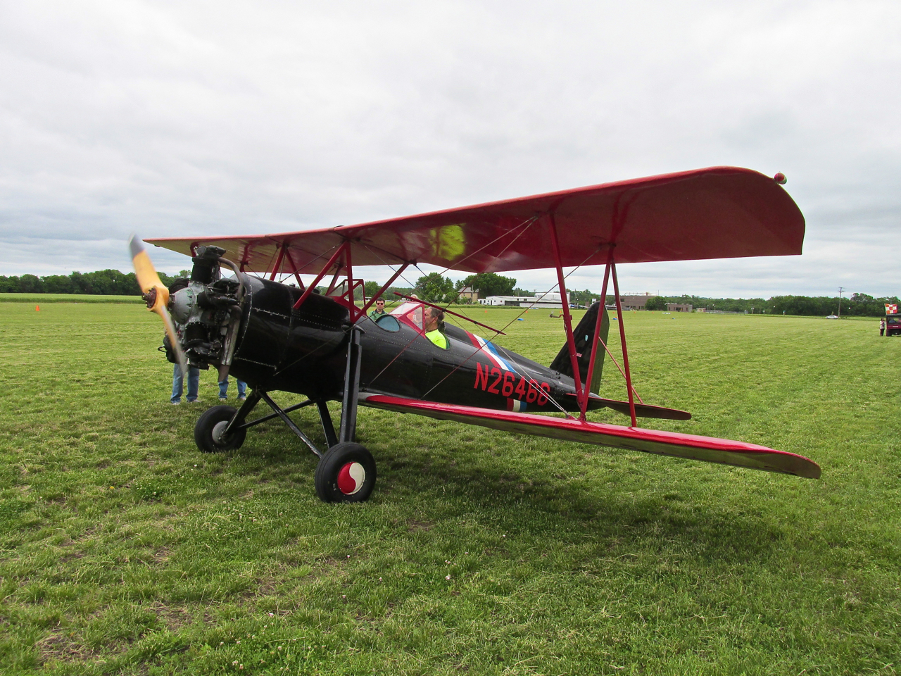
Because of its 5 cylinder design, the Kinner has a very distinctive sound.
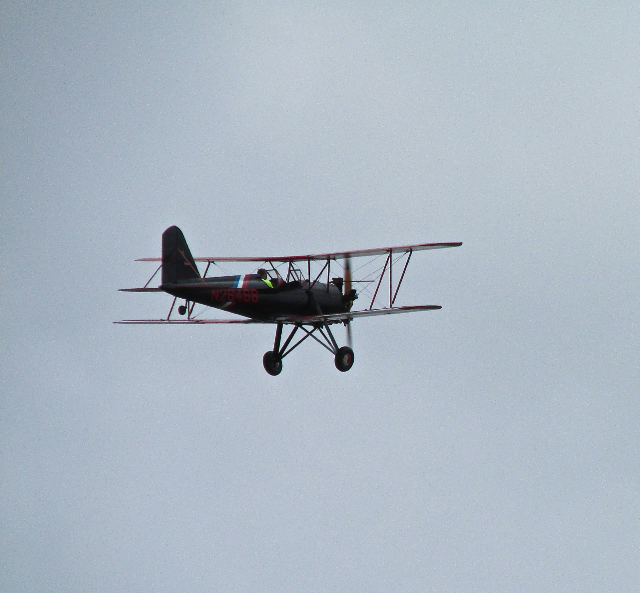
Ed took it up for a number of circuits around the field. It flies quite well and looks great in the air.
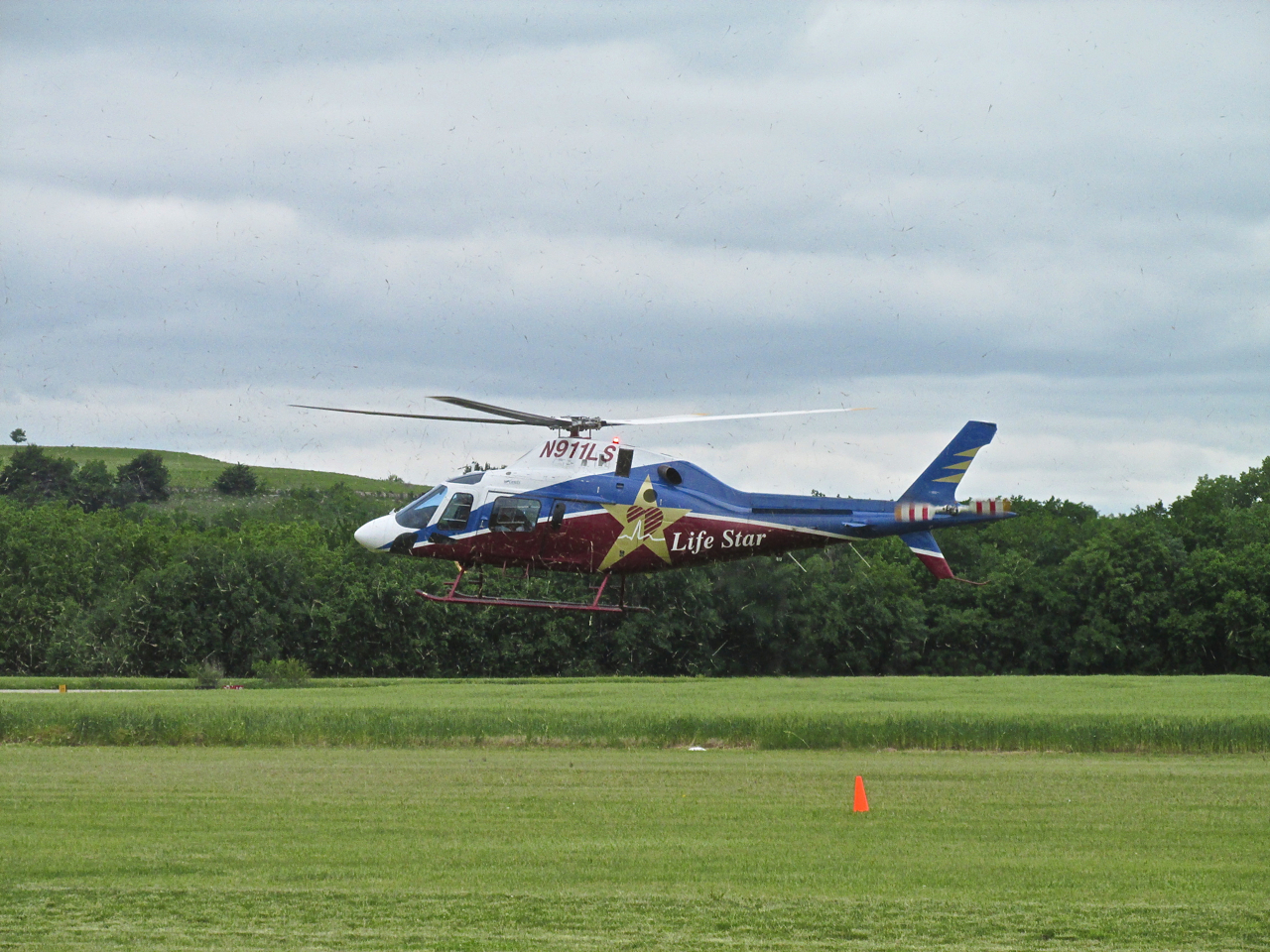
This Agusta AW119 MKII is owned by Topeka Air Ambulance and is stationed at Freeman Field. Check out all the grass it blows into the air while hovering! A jumbo Weed Eater.
Real Fliers
It was great to see Jeff Edwards at The BiPlane Fly-In with his Great Lakes. Jeff and his girlfriend Jennifer Jarvis flew out from Florida to be at the Fly-In. I met Jeff a couple of years ago at either (or both?) The Blakesburg Fly-In or The Waco Fly-In at Creve Coeur, Missouri. Jeff’s “day job” is flying airliners.
Jeff, Jennifer and The Great Lakes
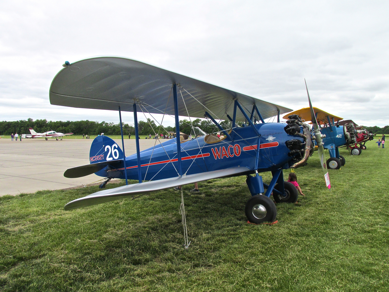
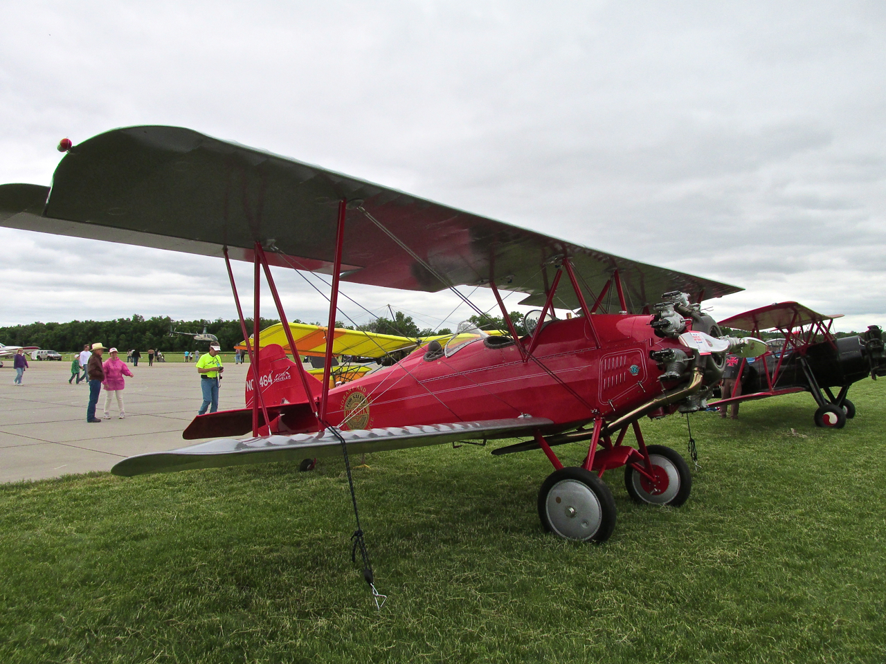
A Few Of The Other BiPlanes That Were There


A 1941 UPF-7 Waco From Daytona Beach, Florida
A Waco ASO From Colorado
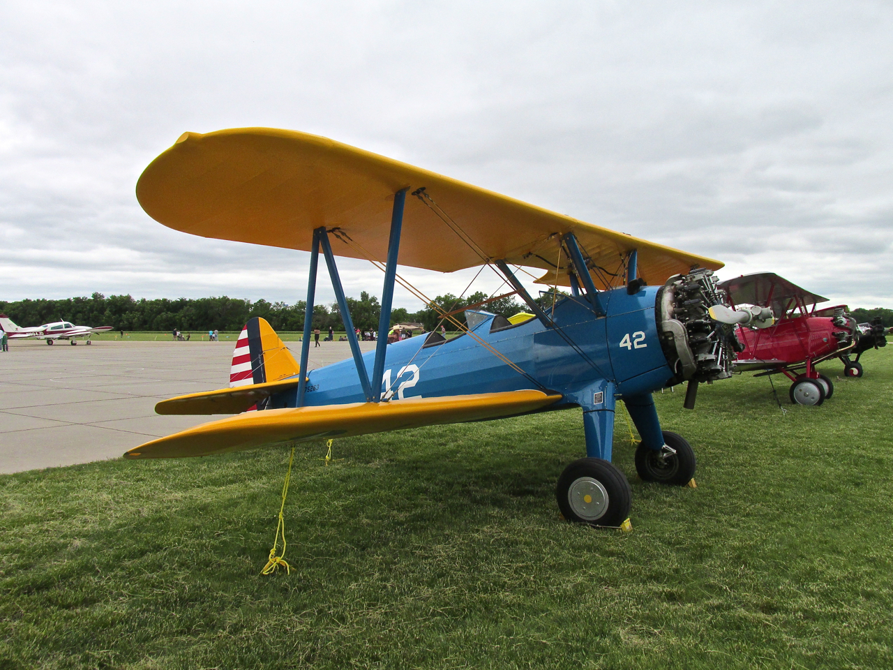
A 1942 Stearman From Salina, Kansas
Dr. Larry Boehme
I was very happy to see Dr. Larry Boehme and his lovely wife Janice at the Fly-In. They are both active members of The Flint Hills Flyers. The Good Doctor was the first interviewee for my “That They Might Fly Again” series. At the time they owned a beautifully restored 1943 Stinson Reliant which he describes in great detail in the documentary. They have since sold it but I am sure they will be flying another Classic before too long.
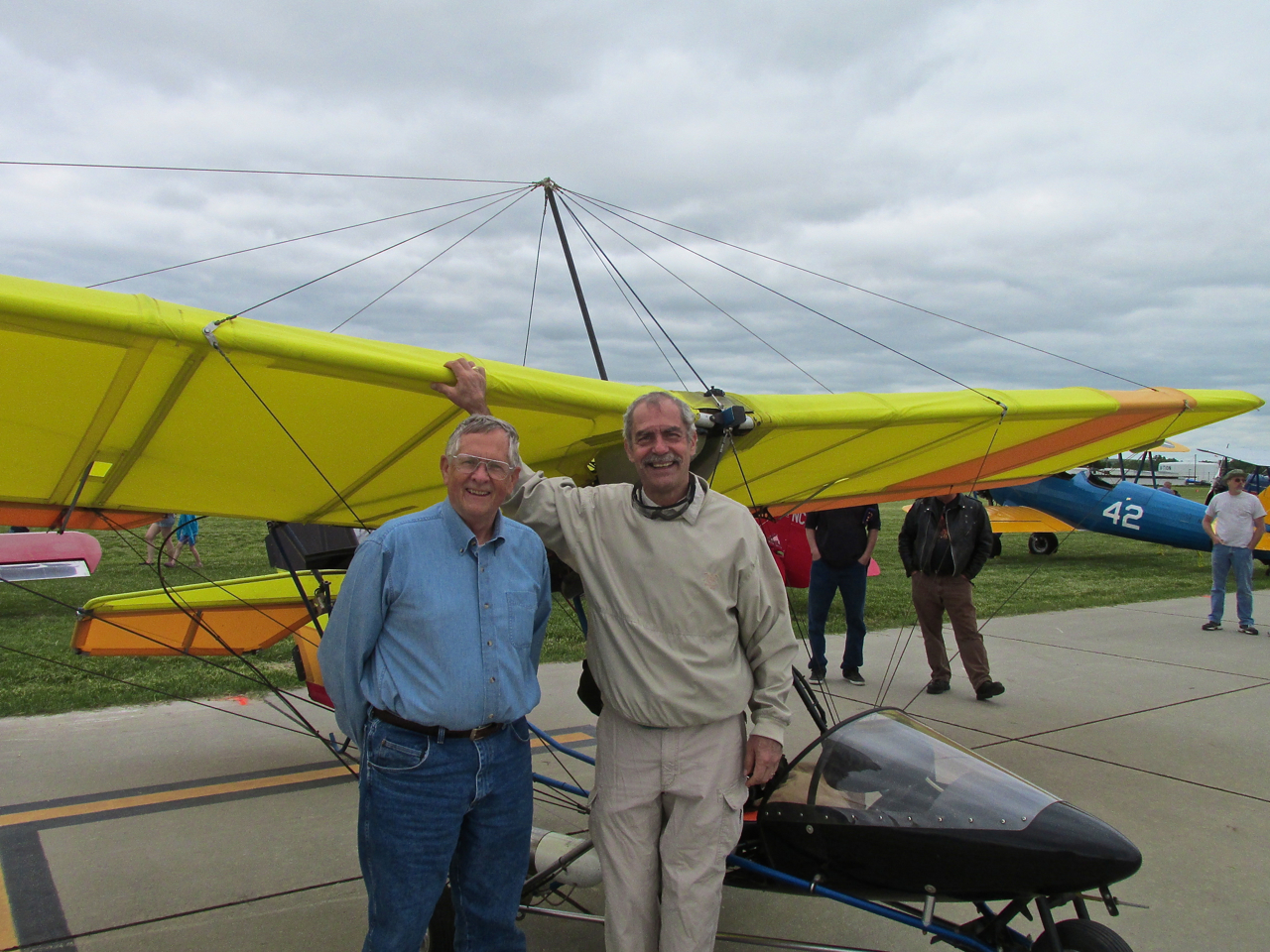
Dr. Larry Boehme and Brian FitzGerald (Check out that “Frankenstinian” ridge/groove on my forehead. Could it be I’m wearing my goggles a little too tight?)
Tailwind Wanes
Soon after we took the picture above I flew into action. Dr. Boehme informed me that someone had just told him the current weather report. Word was that my North Northwest Tailwind was moving over to the West. This was not the worst news one can hear but after flying into a headwind all morning to get to the Fly-In, I was hankering to “ride the wave” back home.
A Hero’s Exit
I was intending to leave in the next hour or so anyway but the news of the wind shift provided the motivation to get in gear. I refueled, preflighted, released the tie downs and turned the plane tail-into-the-wind with Larry’s assistance. This activity drew a small crowd for the Pièce de résistance: The Starting of the Motor. One thing Hollywood has taught the general public about aviation is that “airplane engines are hard to start” (Jimmy Stewart in “Flight of the Phoenix“). Frankly, many of them are quirky and require an exceptionally detailed sequence of actions to “light the fire”. There are also “hot starts” and “cold starts” to consider. Regardless of the motor being used, it is of great importance when measuring the stature of any aviator that he be able to start whatever it is – AT WILL.
I prefer a pull start rather than an electric one on my Rotax due to its lighter weight and reduced complexity. The goal when firing up a two stroke Rotax is a “One Pull Start”. Doing this guarantees “I’m Impressed” nods from any pilot within a hundred yards. A Two Pull Start can still elicit the same response. If it goes to Three Pulls your peers have begun averting their eyes – looking uncomfortable. Six or Seven pulls and even non-pilot onlookers look concerned, in their minds questioning the validity of the power plant and/or the operator. Well… That’s pretty much what happened… At Eight Pulls I felt charisma draining from my body like Superman must feel when inadvertently landing in a field of Kryptonite. I was so filled with dread at the possibility of a NON START I went into brain lock for what seemed an eternity… Finally I ran out of breath. This forced me to calm down and assess the situation. After all, people say a mark of insanity is doing the same thing over and over expecting a different result…
Always Re-Learning The Same Things
It is a known “failure mode” to preflight an airplane while distracted. That dictum occurred to me. I pulled myself together and went into “high theater” mode. Stepping back from the plane for effect, I nodding to onlookers in a confident manner so as to convey the idea that the previous exercise session had been a normal “warm up”. With my demeanor I attempted to convey: “Not To Worry, Folks…” “Everything Is Under Control”. All the while my mind raced. I back-tracked through the starting procedure to see if I had missed anything. Of course you understand, the Rotax 503 DCDI is not a Werner Von Braun Rocket Motor. The only think simpler is a rubber band. Only two things will make it not start:
1] No Gas – The tank was full – I checked the fuel valve and it was on.
OR
2] No Spark – Nice going, Brian…
I had forgotten to turn the Ignition Switches on. With a casual swipe of my hand (as if to brush a bit of dust from the area around the switches) I flipped the ignition switches on. Squaring my shoulders and nodding to myself and the crowd, I indicated with body language that my examination of the engine had proved “everything was in order”. I pulled the rope one more time. The Rotax exploded into life. A sense of relief spread through the crowd. People began nodding their heads to one another as my credibility quotient slowly inched up in their minds. Knowing I had a good thing going, I strapped into the seat and reached up to flip the strobe light switches on (that always looks like “real pilot” action). Finally, with a galant “thumbs up” to a grinning Larry Boehme (he wasn’t fooled for a minute), I taxied to the active. During that short roll to the runway, my mind was desperate that I not have forgotten anything that would require me to taxi back. My “Hero’s Exit” had taken a beating and was on the verge of collapse…

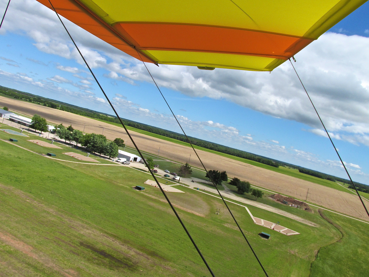
After demonstrating the short field takeoff capability of the MXL, I loitered for a second to get this shot of the field and then “caught the wave” heading South.
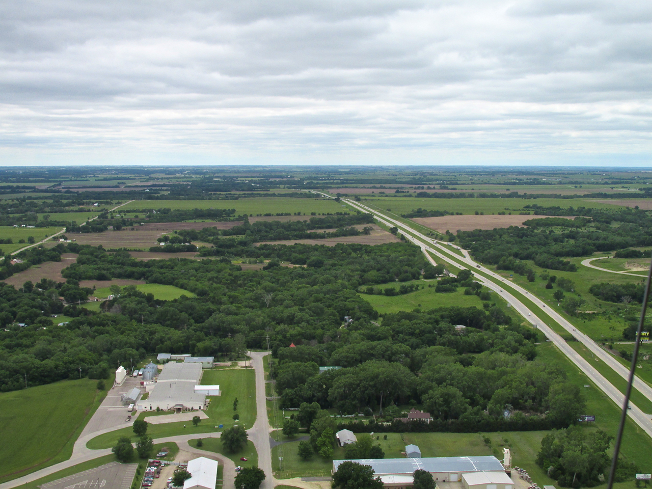
Junction City sits mostly on the North side of I-70. This was shot from 1,000 feet AGL just South of I-70 looking West. Not too far down the road is a huge wind generator field.
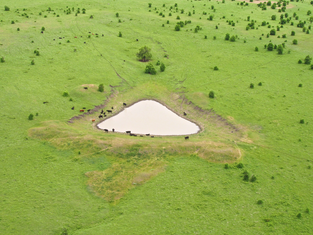
Back in Cattle Country, I see this interesting cow pond of triangular shape. Not one bovine noticed me pass by.
I flew for about an hour when I noticed the sun peeking through the cloud cover. The air was cool enough that I could feel the warmth of the sun when it contacted my face, hands, windbreaker and pants.
Most roads in this region are so perfectly oriented North-South-East-West, you would think the map was painted on the earth. Because Highway 77 made the rare curve here, its interesting sweep caught my attention.
My airspeed was only 38 mph but I was moving about 65 mph across the ground. It was particularly turbulent. I saw this stone building with a new roof. I love old stone buildings so I grabbed for the camera and shot this as I passed by. I am at about 80′ AGL looking West.
Bypassing Marion This Time
On the way South, even though the tailwind was “quartering” from the Southwest, I was getting a great fuel saving and ground-speed-increasing boost from it. As I approached Marion I determined I would have enough fuel to go all the way home. Slipping over the ground at 65 to 70 mph suddenly the “Big M” shown below appeared in front of me. I grabbed the camera and swung around in my seat to capture what you see below. It was like shooting out the back window of a car. You can see the top of my tire at the bottom of the frame.
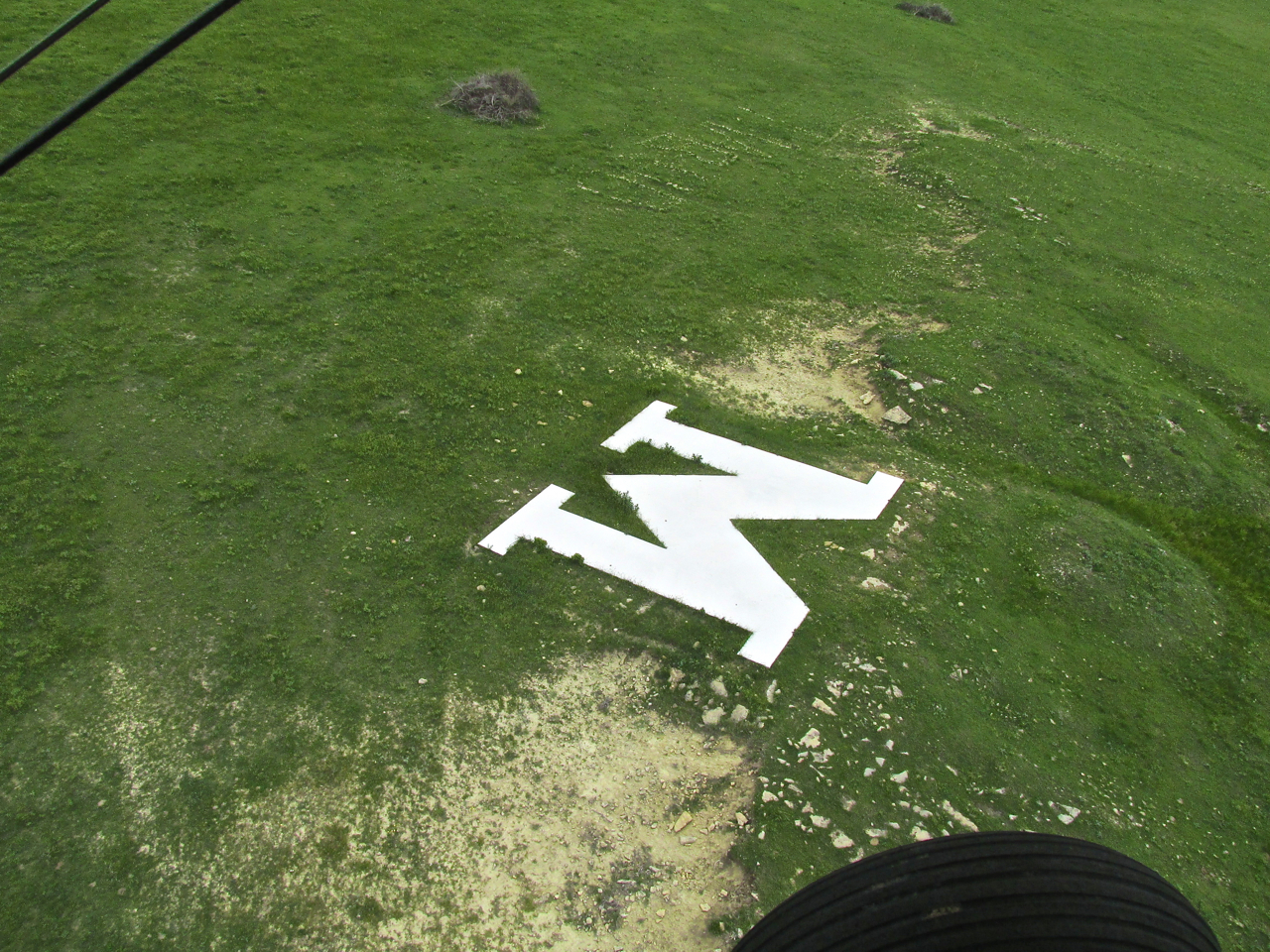
The Marion Warriors?
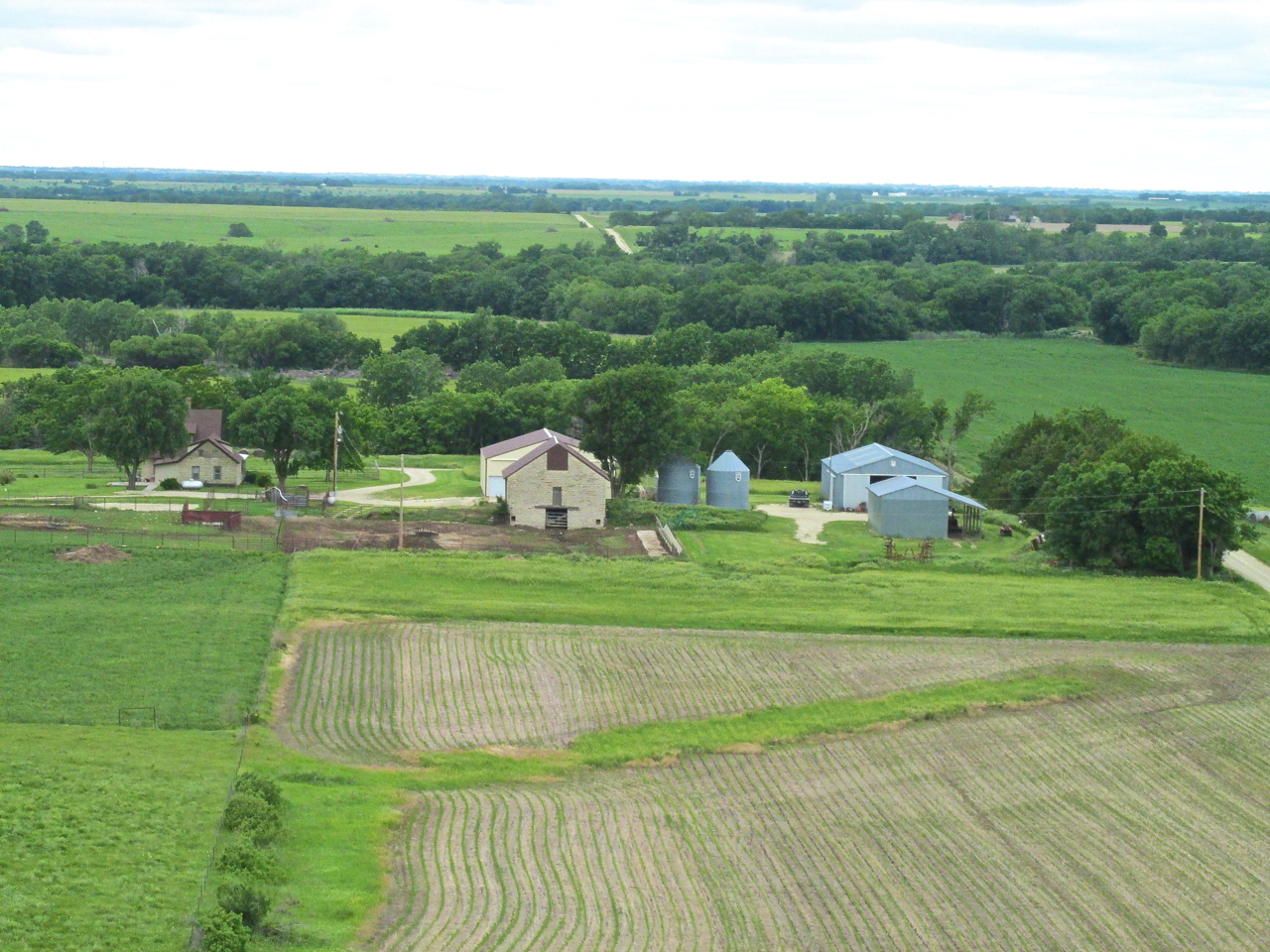
Even though I had to use the telephoto and the sun was glaring into the lens, I wanted to get this scene. This homestead has a lot of what I find attractive for a farm or ranch. The red barns would have been sufficient but the large stone building pushed it over the top. I am at 150′ AGL looking West.
I’m pretty sure this is Elbing, Kansas. I was at 75′ AGL shooting Northwest.
Sequential Object Lesson
The next three shots are a sequence. I want you to see how things continuously reveal themselves when approached at low altitude. It is a lesson in “mental acuity” more than anything.
The first picture was taken to show the sky finally breaking open. The sun brought welcome warmth to what little I can call a cockpit. I was basically taking a “landscape photo”. While composing it, I noticed the series of little “blockhouses” evenly spaced out across the ground. At that moment I decided they were some type of livestock pens. I banked right (West) in order not to buzz these “livestock pens” and disturb the denizens.

Beautiful Sky – Little “Block Houses”
Recognition Begins To Dawn…
Just as I shot the next picture (below), the place is suddenly looking familiar. I think I have been there before but can’t place it…
Oh! Now I Remember!
It’s The Ark Valley Shooting Club!
In the 1990’s I was a founding member of The Kansas Second Amendment Society. We formed The Society to stand up for our Constitutional Rights against a concerted attack by a Wichita Mayor who has since completely disappeared from political life (Amen). I was the Secretary of the organization at that time. One of our “consciousness- and money-raising activities” was a sponsored trap shoot at this range. Mostly I shoot pistols at indoor ranges or out in the country so the one time I have been to this Skeet and Trap range was that event. It never occurred to me to look for it.
Fortunately, because it was so windy there were no shooters out on the range. If anyone HAD been out, I am pretty sure they would have stopped when they saw the Nutcase in the Ultralight lollygagging downrange. Regardless, I won’t make that mistake again!
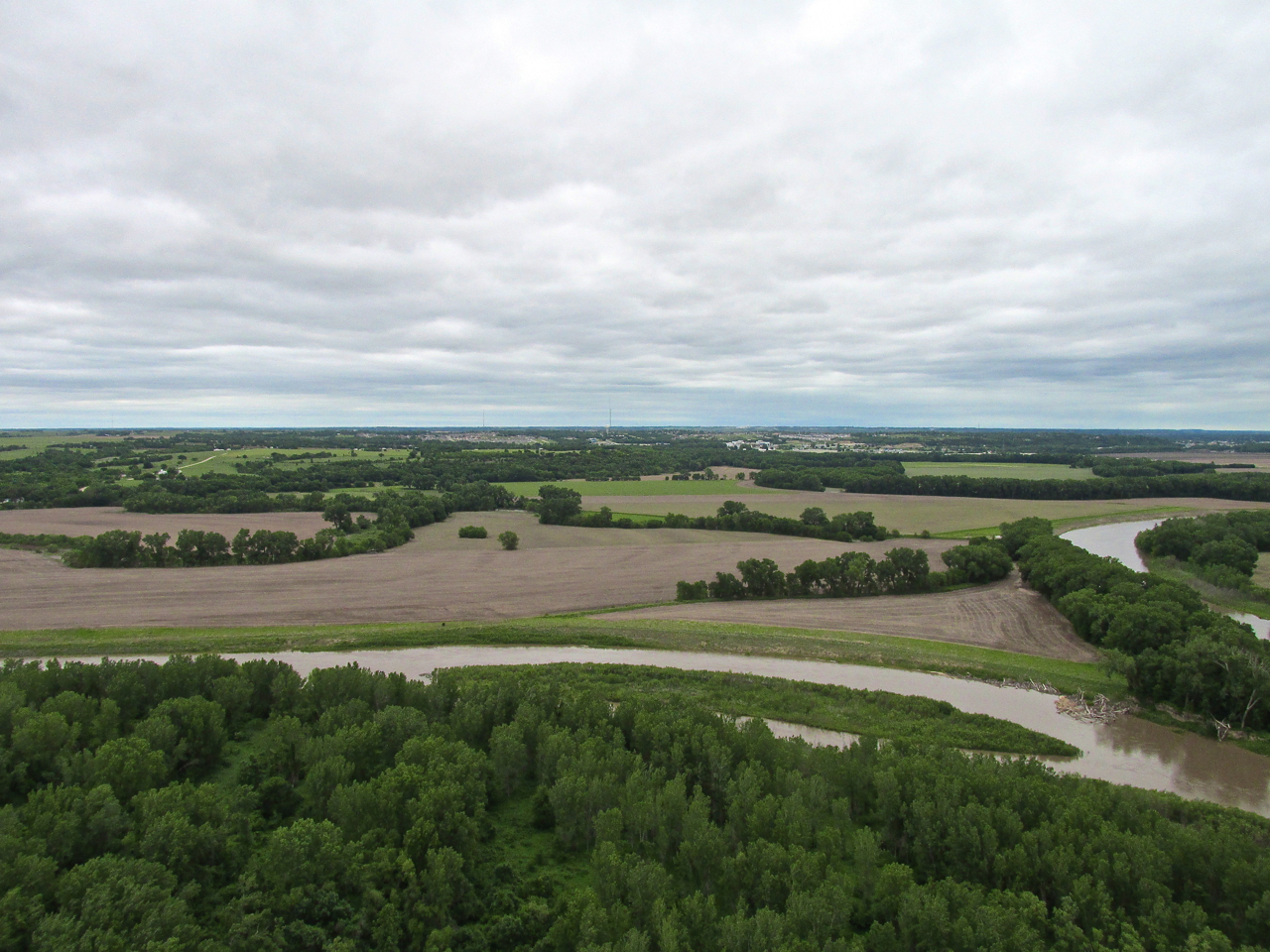
In my previous article about Caldwell, Kansas, I rightfully extolled the virtues of their incredibly bountiful wheat crop. So as to give credit to other parts of the state, I shot this scene of the new wheat on the East side of I-135 about 12 miles Northeast of Valley Center, Kansas. Nice, huh?
Moler’s Home?
Solo flight in the Quicksilver gives me plenty of time to think. While floating over The Flint Hills on this return leg I changed my plan and decided I would drop in to High Point to see if Doug and Sabrina Moler were back from their Alaskan Cruise. I have featured a number of reports on their Famous Fly-Ins. They had been gone the previous two weeks and were to return some time that weekend. After taking a break there, I decided I would take The Big Ditch Route through Wichita to return to Selby Aerodrome.
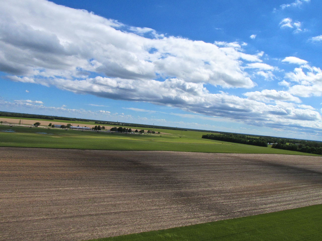
Looking South from 1,000′ AGL crossing I-135. This is my favorite sky – Deep Blue With Cumulus.
Something New
I have flown this general area many times and never seen this so I think it is new. At least it’s new to me… I looked it up in the phone book. This is the Jeeps Cycle Club of Valley Center. Quite an “off-roading” complex.
Captain Doug Moler
I finally landed at High Point, an aviation community North of Wichita with homes backing up to a grass landing strip. Doug and Sabrina had returned from their cruise only 30 minutes before I arrived. Since I had to get home and they needed to unpack, I didn’t stay around very long. I did go next door with Doug to check out Jimmy Wiebe’s Cassutt Racer. He was checking it over after making some repairs. It is one of these little race planes that you “wear”. Quite a machine.
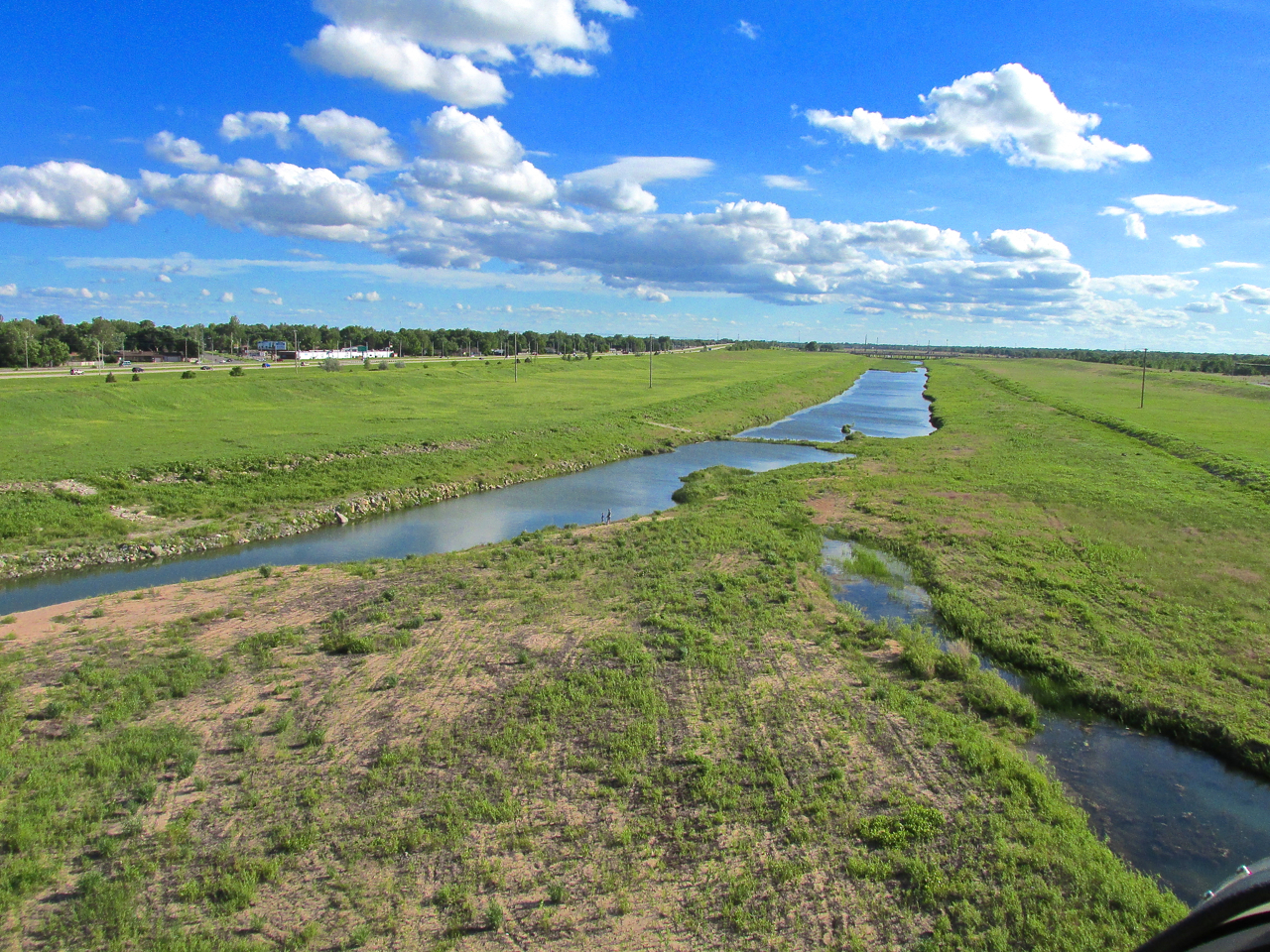
The Big Ditch Route
Before, I have explained that the FAA Rules prohibit Ultralights from flying over “congested areas”. Frankly, even if there wasn’t a rule against it, I would have no interest in flying my two cycle engine powered Ultralight over any city. Thus far my Rotax has been completely dependable, BUT, if it stopped running, it would be the challenge of a lifetime to land in a city. Most of the time I circle around the city to the West when traveling to High Point. Sometimes I go up The Big Ditch which is the flood control project that has tamed the Arkansas River on its path through town.
TRACON (Terminal Radar Approach Control Facilities)
The Big Ditch travels most of its length in proximity to Mid Continent Airport. At the North end its path crosses the North end of an active runway. The FAA Controllers at TRACON are very obliging if you call them on the phone and ask to travel down The Ditch. They just tell you to stay under 200′ AGL and call back when you land. How cool is that?
Airline Pilot Navigation
For no particular reason I can surmise, most of the time I have flown The Big Ditch, I have gone South-to-North. Then when I return to home home base, I circumnavigate Mid Continent to the West instead of traveling back down The Ditch. Today I wanted to go North-to-South down The Ditch. I called TRACON for permission and then asked Captain Doug Moler how to find the entry point for The Big Ditch on the North side.
Moler has flown professionally all his adult life and retired as a Full Captain from Continental Airlines a few years ago. He stopped counting his flight time when it hit 35 thousand hours. I figure he is “The Man” to give me pinpoint navigation advice for finding the North End of The Big Ditch without crossing an airliner’s path and causing an “incident”. “No Problem” says Doug, “Just head down to the Wal-Mart and then head South”. Really? That’s All He Gives Me? Hmmm… Apparently that’s the way they navigate Boeing 747’s. Okey doke…

Captain Doug Moler and the Quicksilver – Jim Wiebe with his Cassutt in the background.
Airborne Again
After receiving the professional, precision departure and approach briefing from Captain Doug, I lept into the air with high confidence I would find the entry to The Big Ditch without being run over by a jumbo jet. Sure enough… Within minutes I located the The Big Ditch Inbound Marker.
Wal Mart Below – Ditch Must Be Ahead
Nice Digs
Right after the Wal Mart and just before the entry to The Big Ditch I sighted off my Port Bow a high profile, Wichita living area called The Moorings. It is featured in the next two shots.

Before making the entry to The Big Ditch Corridor, I snapped this shot just because the bridges, river and sand pits looked neat together. Simple as that.
Wichita’s Big Ditch Flood Control Project
Basically The Big Ditch project amounts to forcing the Arkansas River to maintain its track through the West Side of Wichita by the use of levees and occasional spillways. People fish down here and sometimes you see deer although hunting is not allowed. Before the advent of The Ditch, flooding of this part of town was a fairly common occurrence.

The Big Ditch
In The Groove
Under orders of TRACON to stay below 200′ AGL, I drop down into the channel. Ahead I see a Father and Son fishing on the bank of the river this fine day. I wave as I pass them and they wave back. From the tracks in the foreground, you can tell this place gets heavy 4-wheeler action.
Fishing And Four Wheelers
New Bridge
For some time I have heard talk of a new bridge being built by Wichita on this side of town. Since I don’t drive over here very often it has not been something I paid much attention to. Flying low up The Ditch, I saw very large cranes ahead. My lightning-fast mind finally realized this must be the bridge project. I decided to climb to get over them in case work was going on. The next two shots show the progress of the some-day-to-be-christened “13th Street Bridge“.
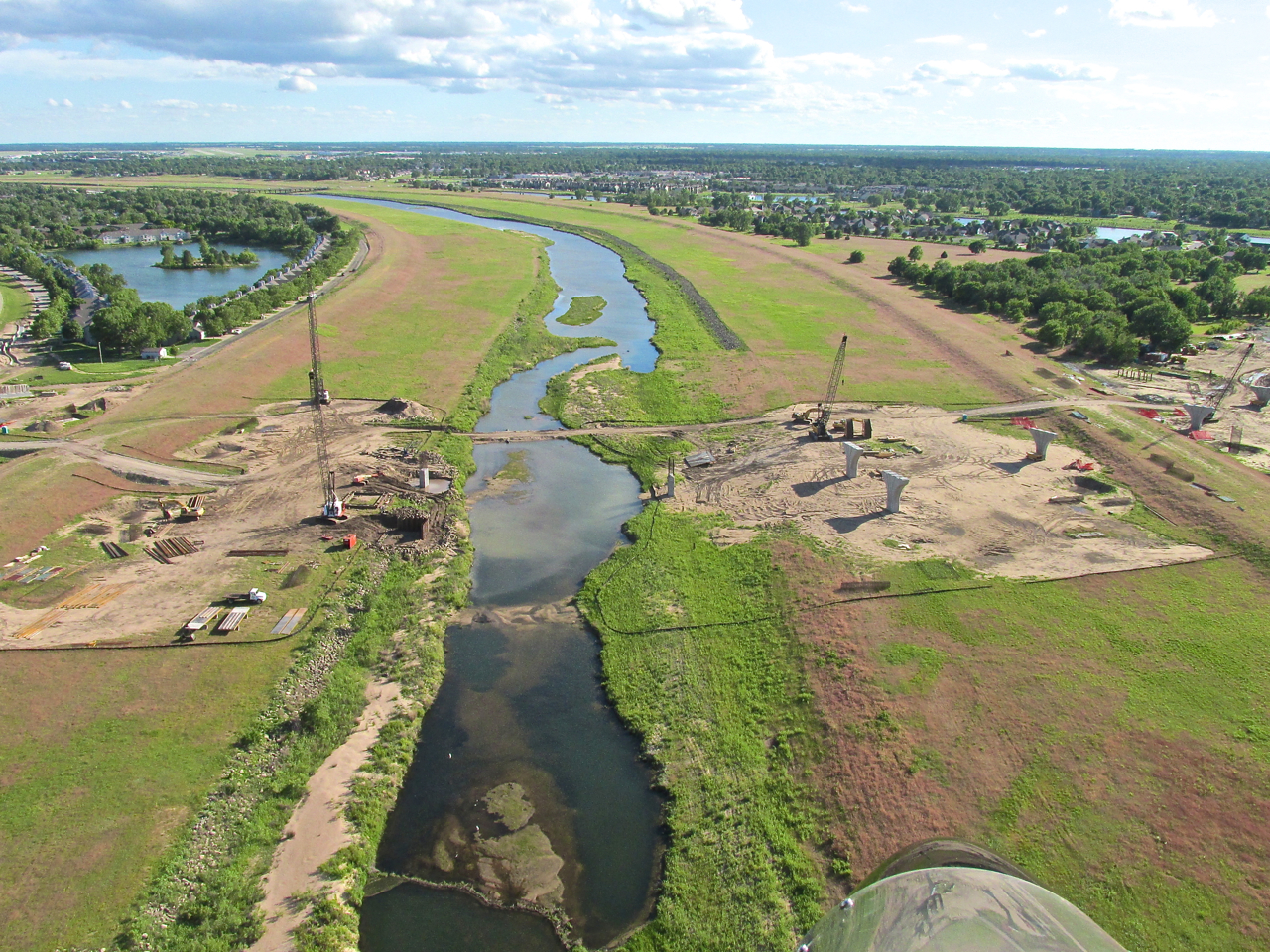
Construction work below. Toward the left on the horizon you can see the twin, parallel, main runways of Mid Continent Airport. These are the runways I am vectoring beneath.
After climbing to avoid them, I discover Bridge Workers don’t work on Saturday in Wichita.

I am about 150′ ARL (Above River Level) looking Southwest. This is the lesser used East Runway of Mid Continent. I had to climb a bit so I wouldn’t buzz the cars crossing the Maple Street Bridge seen in the foreground.

Just before crossing Kellogg/Hwy 50 I snapped this shot looking East. In the foreground is Town West Square. On the horizon to the left you can see the Wichita Downtown Skyline. My shadow is just this side of I-235.

Moments later, through my right wing flying wires, we see one of Cessna Aircraft’s main facilities. It is on the Southeast quadrant of Mid Continent Airport property bounded on the South by K-42 Highway. This was taken from 75′ ARL looking Northwest
Egressing The Ditch. This is a shot that needs a Panoramic lens. Because I didn’t have that, I “split the difference”. This is what I am trying to show. To the left is the North part of Haysville, Kansas and to the right is a large cornfield that I used for shooting a segment of a music video titled “Lil Prop / Big Prop”. We are looking South from about 150′ ARL.
From the same position as the previous shot, I swiveled my camera mount Northeast to take this picture. In the distance, beyond the homes is Spirit Aero Systems and then McConnell AFB.
A Different Perspective
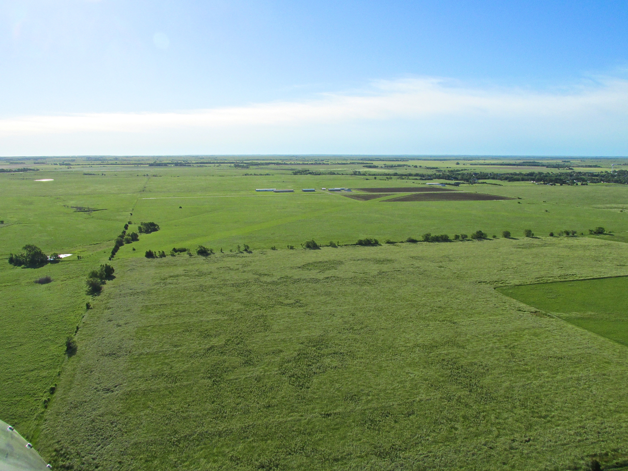
This was the first time I have approached Selby Aerodrome from the South on a trip. It took some concentration to locate the airfield. When I did, I saw a familiar sight. Hangar mate Don Forse was performing a run-up in his Titan Tornado in preparation to launch to the North.
80% Of Photography Is Just Being There
The “photo composition wheels” are always turning in The Sky Surfer’s head. He hoped that on approach a good position would manifest itself for a decent picture of Don taking off from The Aerodrome in his Titan.
Yes!
As I slid into the downwind leg of the pattern and decided on a wide shot, Don broke ground and I pulled the trigger. A fine ending to a great adventure that yielded a total round trip airtime of 6 hours!

Don Forse and his Titan Tornado lift off for parts unknown.
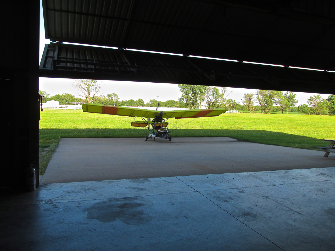
The rising hangar door reveals the MXL – ready to rest in the stable after dancing the skies for the better part of a day.
The 2013 Bi-Plane Fly-In
So ends my journey to The National Bi-Plane Fly-In 2013. It was my Longest Ultralight Journey to date – 112 miles each direction. The Flying Season is now in full swing.
Stay tuned! You’ll be the first to know where serendipity next leads The Sky Surfer on Safari.
Blue Skies & Tailwinds!™
Brian FitzGerald – Wichita
Sounds like another interesting flight. It appeared that there were not many airplanes there. Weather must have made an impact on attendance. Marion, KS has been a stop for me twice, once unplanned (I had a loss of rpms coming home from 3jc in 2010 and was headed for the Marion, but landed just east of the airport on U.S. 77 about 1.5 miles short), and a second time in 2011. The second time I was fighting a strong headwind (making only about 40 mph over the ground) and needed fuel to complete the trip to El Dorado safely. Made the airport the second time. In both instances Dick McClinden helped me out. In 2010 he found temporary hangar space for the Fisher (it was slightly damaged and the wings had to be taken off for trucking home), and the second he came out and unlocked the fuel pump for me. A very congenial person and super helpful.
Wish I could have made it to the fly-in. Maybe next year.
Don
Dear Don,
I hate when the fan stops turning. What kind of motor are you using? Over the years I have had at least 6 landings due to power loss. Some are better than others.
Next time I go to Marion will be to tour the town. I will leave the plane at Marion International and walk. I would like to see what it looks like and get some pix.
I flew to the Strother Field Fly-In two Saturdays ago. I went to the Benton Fly-In this morning but did not fly. I was at the hangar until 9:30pm last night making a repair on my plane. It was pretty dark when I finished my job and closed up the hangar. I thought it prudent to not get up at dawn and head to Benton because of this. A major repair calls for extra inspection after the fact. Also, it was very windy. The wind wasn’t a deal breaker in and of itself but the two issues combined decided me to drive rather than fly. There was a good turn out and I saw some buddies.
I am going to combine the two events into one post.
Blue Skies & Tailwinds!™
Brian